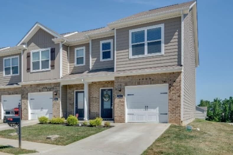
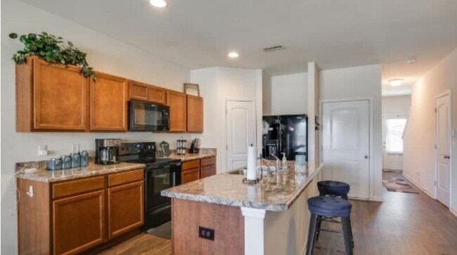
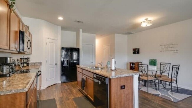
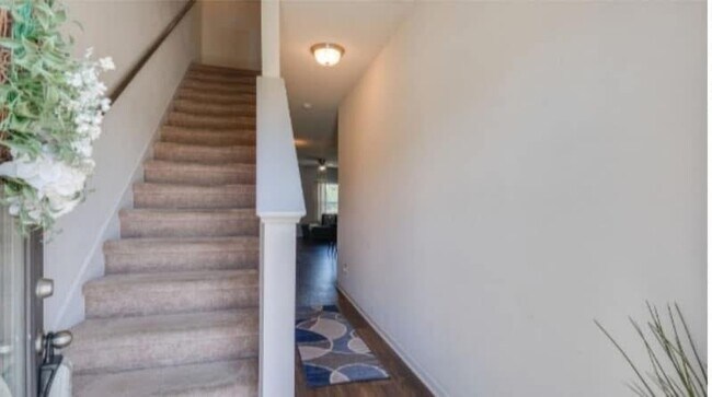
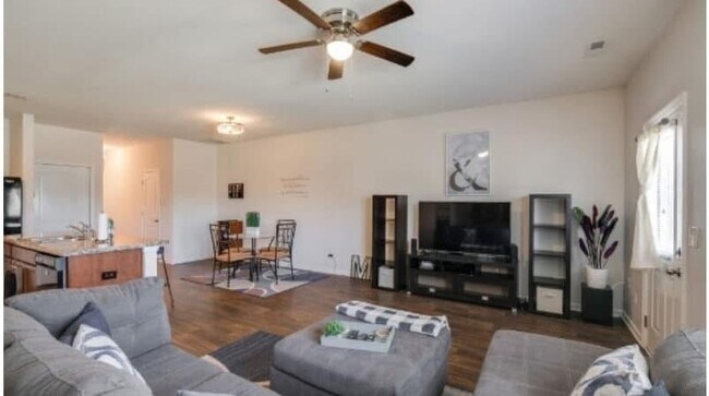
$2,200 Total Monthly Price

313 Nixon Way

,

La Vergne, TN 37086

Share Listing
Favorites
  • Bedrooms

    3

  • Bathrooms

    2.5

  • Square Feet

    1,650 sq ft

  • Available

    Available Jul 3

313 Nixon Way
Share Listing
Favorites

Contact

  • Contact
| Edit

Under 30 minutes

Commute Time is calculated at rush hour.
Neighborhood

Off the shores of Percy Priest Lake, Smyrna/ La Vergne is an area in Rutherford County convenient to Nashville, which is located 20 miles north. Interstate 24 and Highway 41 run through the neighborhood, providing easy access to the big city and beyond. The Smyrna/La Vergne area itself is known as a hub for industry as it’s home to printing plants and Lightning Source’s headquarters. Family-friendly fun is provided by community parks, including ones with lakefront views like Poole Knobs Recreation Area and Hurricane Creek Recreation Area. Shopping and dining options can be found within and right outside of the neighborhood thanks to plazas filled with all the essentials. The rest of Smyrna/La Vergne is made up of residential areas with a variety of apartments, houses, and townhouses for rent.

Learn more about living in Smyrna/La Vergne 
Education
Colleges & Universities Distance
Drive: 25 min 15.5 mi
Drive: 28 min 20.1 mi
Drive: 30 min 20.8 mi
Drive: 32 min 21.7 mi
313 Nixon Way is within 25 minutes or 15.5 miles from Trevecca Nazarene University. It is also near Lipscomb University and Belmont University.
Transportation

313 Nixon Way is near Nashville International, located 11.3 miles or 19 minutes away.

Commuter Rail Distance
Drive: 24 min 14.7 mi
Drive: 28 min 17.1 mi
Drive: 33 min 17.9 mi
Drive: 28 min 18.5 mi
Drive: 40 min 25.2 mi
Airports Distance
Airports Distance
Nashville International
Drive: 19 min 11.3 mi
Getting Around
Somewhat Walkable
Walkability
30 / 100
Minimal Public Transit
Transit
0 / 100
Moderately Drivable
Drivability
70 / 100
Fairly Bikeable
Bikeability
40 / 100

Scores provided by

What do Walkability, Transit, Drivability, and Bikeability mean? Walkability measures the walking distance to day-to-day needs. Transit measures access to public transportation. Drivability measures congestion, parking availability, and access to major roads. Bikeability measures the suitability for cycling. How It Works
-
Soundscore
- / 100

Traffic

-

Airport

-

Businesses

-

Scores provided by

HowLoud What is a Sound Score Rating? A Sound Score Rating aggregates noise caused by vehicle traffic, airplane traffic and local sources. How It Works
Points of Interest

Time and distance from 313 Nixon Way.

Shopping Centers Distance
Drive: 7 min 2.1 mi
Drive: 7 min 2.2 mi
Drive: 6 min 2.4 mi
313 Nixon Way has 3 shopping centers within 2.4 miles, which is about a 6-minute drive. The miles and minutes will be for the farthest away property.
Parks and Recreation Distance
Long Hunter State Park
Drive: 20 min 9.6 mi
Hamilton Creek Trails
Drive: 18 min 9.8 mi
313 Nixon Way has 2 parks within 9.8 miles, including Long Hunter State Park, and Hamilton Creek Trails.
Hospitals Distance
Hospitals Distance
Drive: 15 min 6.0 mi
313 Nixon Way is 6.0 miles and a 15 minute drive from TriStar Stonecrest Medical Center.
Military Bases Distance
Drive: 78 min 60.8 mi
Drive: 90 min 66.3 mi
Drive: 106 min 75.7 mi
313 Nixon Way has 3 military bases within 75.7 miles, the nearest is Arnold Air Force Base Tullahoma which is 60.8 miles away and a 78 minute drive.