
Venue Residences
3688 Overland Ave,
Los Angeles, CA 90034
$3,550 - $4,795
1-2 Beds
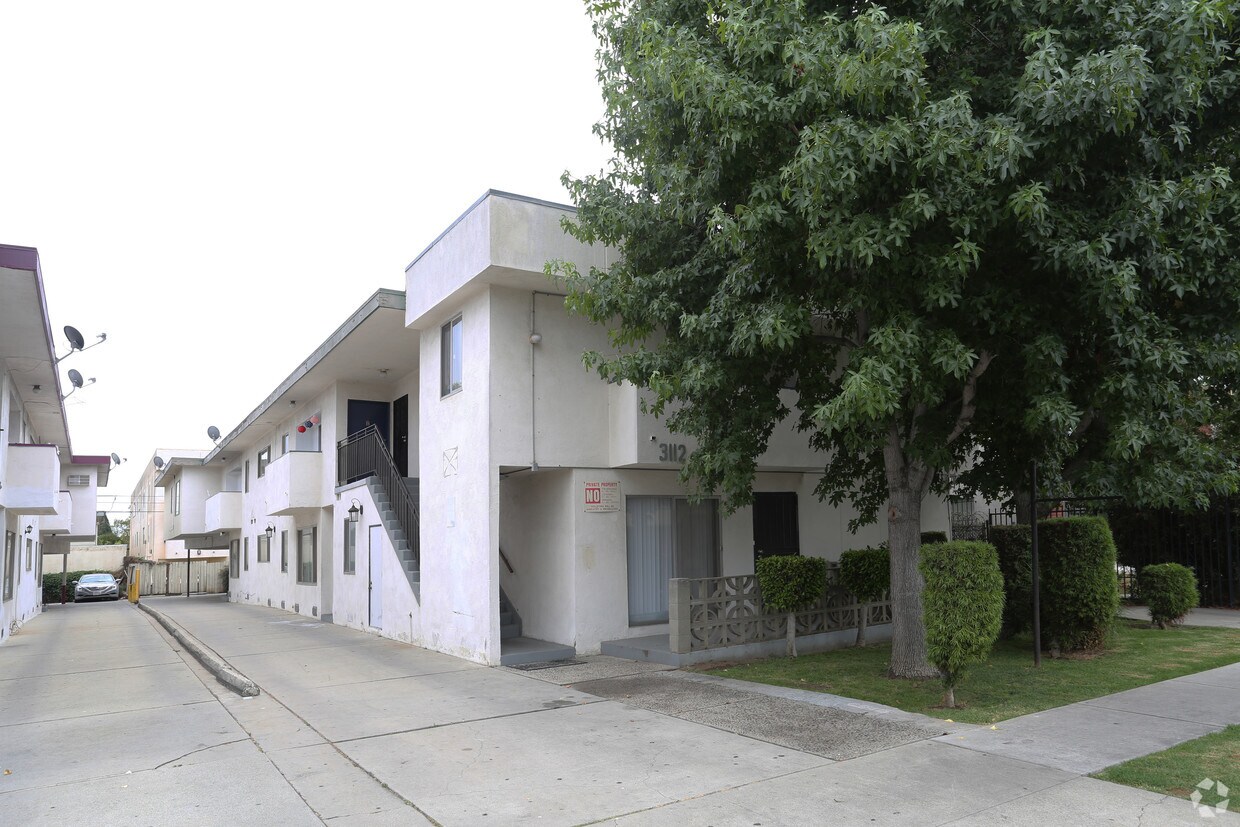

Experience Los Angeles living at 3112 S Canfield Ave. You'll find this community in the Cheviot Hills area of Los Angeles. The leasing staff is available to help you find the best floor plan for your lifestyle. Select from 1 to 3 bedroom apartments, then call for current pricing. Stop by the leasing office to check the current floor plan availability.
3112 S Canfield Ave is an apartment community located in Los Angeles County and the 90034 ZIP Code. This area is served by the Los Angeles Unified Rocp School District attendance zone.
Cheviot Hills is a tranquil and upscale community on the west side of Los Angeles. With a low population density, mature trees and picturesque streets, the Cheviot Hills area ensures residents are feel somewhat secluded from the hustle and bustle of the busy city around them.
Even though it feels private and isolated, Cheviot Hills' location ensures that residents can easily access all that L.A. has to offer. The high-rise office buildings and high-end shopping of Century City sits just to the neighborhood's north, along with the Twentieth Century Fox movie studio. Beverly Hills, Culver City and West L.A. are all blocks away, and the area has convenient access to downtown L.A. and Santa Monica as well.
Learn more about living in Cheviot HillsCompare neighborhood and city base rent averages by bedroom.
| Cheviot Hills | Los Angeles, CA | |
|---|---|---|
| Studio | $1,752 | $1,712 |
| 1 Bedroom | $2,102 | $2,178 |
| 2 Bedrooms | $2,642 | $3,017 |
| 3 Bedrooms | $3,041 | $4,255 |
| Colleges & Universities | Distance | ||
|---|---|---|---|
| Colleges & Universities | Distance | ||
| Drive: | 8 min | 2.7 mi | |
| Drive: | 9 min | 5.1 mi | |
| Drive: | 8 min | 5.1 mi | |
| Drive: | 9 min | 5.4 mi |


Transportation options available in Los Angeles include Culver City, located 0.6 mile from 3112 S Canfield Ave. 3112 S Canfield Ave is near Los Angeles International, located 7.9 miles or 16 minutes away, and Bob Hope, located 16.4 miles or 31 minutes away.
| Transit / Subway | Distance | ||
|---|---|---|---|
| Transit / Subway | Distance | ||
|
|
Walk: | 11 min | 0.6 mi |
|
|
Walk: | 14 min | 0.7 mi |
|
|
Drive: | 3 min | 1.5 mi |
|
|
Drive: | 5 min | 2.5 mi |
|
|
Drive: | 5 min | 2.8 mi |
| Commuter Rail | Distance | ||
|---|---|---|---|
| Commuter Rail | Distance | ||
|
|
Drive: | 16 min | 10.6 mi |
|
|
Drive: | 18 min | 10.8 mi |
|
|
Drive: | 22 min | 14.0 mi |
|
|
Drive: | 27 min | 14.3 mi |
|
|
Drive: | 29 min | 15.3 mi |
| Airports | Distance | ||
|---|---|---|---|
| Airports | Distance | ||
|
Los Angeles International
|
Drive: | 16 min | 7.9 mi |
|
Bob Hope
|
Drive: | 31 min | 16.4 mi |
Scores provided by
Traffic
-Airport
-Businesses
-Scores provided by
HowLoud What is a Sound Score Rating? A Sound Score Rating aggregates noise caused by vehicle traffic, airplane traffic and local sources. How It WorksTime and distance from 3112 S Canfield Ave.
| Shopping Centers | Distance | ||
|---|---|---|---|
| Shopping Centers | Distance | ||
| Walk: | 9 min | 0.5 mi | |
| Walk: | 11 min | 0.6 mi | |
| Walk: | 12 min | 0.7 mi |
| Parks and Recreation | Distance | ||
|---|---|---|---|
| Parks and Recreation | Distance | ||
|
Kenneth Hahn State Recreation Area
|
Drive: | 10 min | 3.6 mi |
|
Ballona Creek Trail - Ballona Wetlands Ecological Reserve Access
|
Drive: | 8 min | 3.9 mi |
|
La Brea Tar Pits
|
Drive: | 8 min | 4.3 mi |
|
Zimmer Children's Museum
|
Drive: | 8 min | 4.4 mi |
|
Mathias Botanical Garden
|
Drive: | 10 min | 5.8 mi |
| Hospitals | Distance | ||
|---|---|---|---|
| Hospitals | Distance | ||
| Drive: | 3 min | 1.6 mi | |
| Drive: | 7 min | 3.6 mi | |
| Drive: | 7 min | 3.7 mi |
| Military Bases | Distance | ||
|---|---|---|---|
| Military Bases | Distance | ||
| Drive: | 17 min | 10.5 mi |
Pets Allowed In Unit Washer & Dryer Maintenance on site Heat Controlled Access Elevator
What Are Walk Score®, Transit Score®, and Bike Score® Ratings?
Walk Score® measures the walkability of any address. Transit Score® measures access to public transit. Bike Score® measures the bikeability of any address.
What is a Sound Score Rating?
A Sound Score Rating aggregates noise caused by vehicle traffic, airplane traffic and local sources.

3112 S Canfield Ave
Los Angeles, CA 90034


