
$1,800 / Month
31 Central St Unit 1
Wellesley, MA 02482
2 Weeks Ago
Favorites
31 Central St Unit 1

Favorites
Check Back Soon for Upcoming Availability
| Beds | Baths | Average SF |
|---|---|---|
| 1 Bedroom 1 Bedroom 1 Br | 1 Bath 1 Bath 1 Ba | — |
Fees and Policies
The fees below are based on community-supplied data and may exclude additional fees and utilities.
- Parking
-
Street--Assigned Parking
-
Other--Assigned Parking
Details
Lease Options
-
12 Months
About This Property
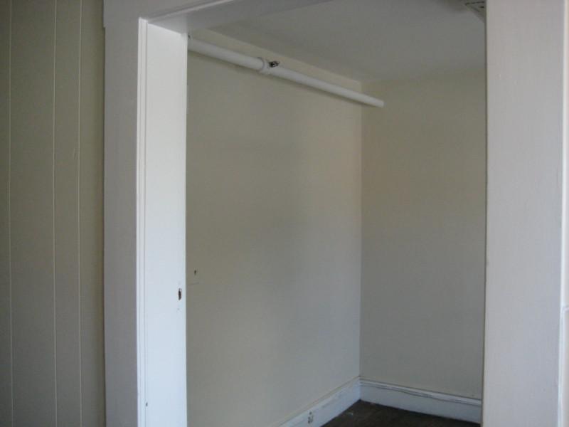
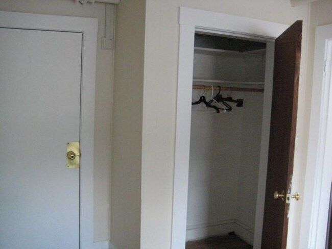
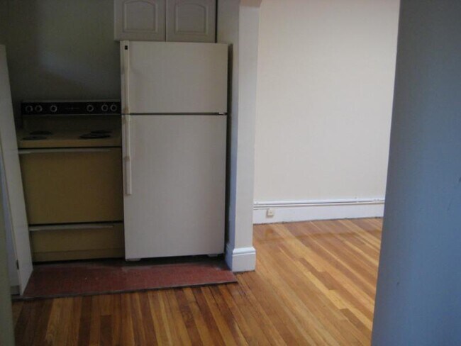
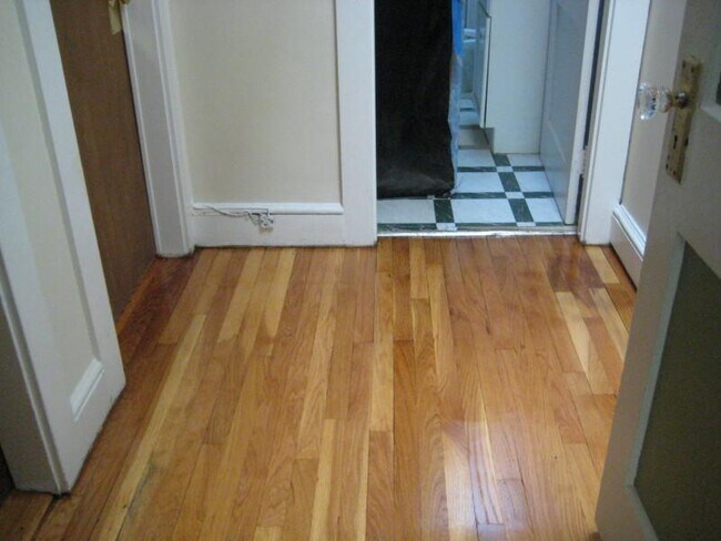
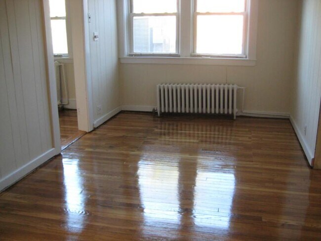
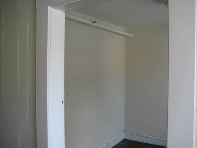
Perfect for work/live business owner or student. One bed apartment with office, refinished hardwood floors, walk-in closet and much more. Walk to Wellesley College, Starbucks, grocery store, CVS, and much more. Just a block from commuter rail. Easy access to all commuting routes. Lock in now! Only half month fee! javascript:void(0);
31 Central St is a condo located in Norfolk County and the 02482 ZIP Code. This area is served by the Wellesley attendance zone.
Condo Features
- Hardwood Floors
Location
Get Directions
Just west of Boston and East of Worcester sits Metro West, a region that houses a group of towns and cities with significant historical backgrounds. A total of 19 municipalities make up the core of this community, but other municipalities are considered to be a part of the Interstate 495/Metro West Corridor.
Learn more about living in Metro WestBelow are rent ranges for similar nearby apartments
| Beds | Average Size | Lowest | Typical | Premium |
|---|---|---|---|---|
| Studio Studio Studio | 503-505 Sq Ft | $1,400 | $2,385 | $7,196 |
| 1 Bed 1 Bed 1 Bed | 893-895 Sq Ft | $1,495 | $2,947 | $10,079 |
| 2 Beds 2 Beds 2 Beds | 1269-1271 Sq Ft | $1,900 | $3,730 | $17,058 |
| 3 Beds 3 Beds 3 Beds | 1578-1583 Sq Ft | $1,000 | $4,811 | $21,323 |
| 4 Beds 4 Beds 4 Beds | 3531 Sq Ft | $1,110 | $6,614 | $18,000 |
Amenities
- Hardwood Floors
Education
| Colleges & Universities | Distance | ||
|---|---|---|---|
| Colleges & Universities | Distance | ||
| Drive: | 4 min | 1.2 mi | |
| Drive: | 4 min | 1.8 mi | |
| Drive: | 14 min | 6.4 mi | |
| Drive: | 16 min | 8.6 mi |
31 Central St Unit 1 is within 4 minutes or 1.2 miles from Wellesley College. It is also near Babson College and Brandeis University.
Schools


Public Elementary School
Grades PK-5
699 Students
Nearby
Public Elementary School
Grades K-5
287 Students
Attendance Zone
Public Middle School
Grades 6-8
922 Students
Attendance Zone
Public High School
Grades 9-12
1,412 Students
Attendance Zone
Private Elementary & Middle School
Grades PK-8
185 Students
Nearby
Private Middle & High School
Grades 6-12
475 Students
Nearby
School data provided by
 The GreatSchools Rating helps parents compare schools within a state based on a variety of school quality indicators and provides a helpful picture of how effectively each school serves all of its students. Ratings are on a scale of 1 (below average) to 10 (above average) and can include test scores, college readiness, academic progress, advanced courses, equity, discipline and attendance data. We also advise parents to visit schools, consider other information on school performance and programs, and consider family needs as part of the school selection process.
View GreatSchools Rating Methodology
Data provided by GreatSchools.org © 2025. All rights reserved.
View GreatSchools Rating Methodology
Data provided by GreatSchools.org © 2025. All rights reserved.
Transportation options available in Wellesley include Woodland Station, located 3.9 miles from 31 Central St Unit 1. 31 Central St Unit 1 is near General Edward Lawrence Logan International, located 17.9 miles or 29 minutes away, and Worcester Regional, located 31.9 miles or 54 minutes away.
| Transit / Subway | Distance | ||
|---|---|---|---|
| Transit / Subway | Distance | ||
|
|
Drive: | 7 min | 3.9 mi |
|
|
Drive: | 8 min | 4.0 mi |
|
|
Drive: | 8 min | 4.6 mi |
|
|
Drive: | 10 min | 5.2 mi |
|
|
Drive: | 10 min | 5.4 mi |
| Commuter Rail | Distance | ||
|---|---|---|---|
| Commuter Rail | Distance | ||
|
|
Walk: | 6 min | 0.3 mi |
|
|
Drive: | 2 min | 1.4 mi |
|
|
Drive: | 6 min | 2.7 mi |
|
|
Drive: | 5 min | 3.0 mi |
|
|
Drive: | 8 min | 3.5 mi |
| Airports | Distance | ||
|---|---|---|---|
| Airports | Distance | ||
|
General Edward Lawrence Logan International
|
Drive: | 29 min | 17.9 mi |
|
Worcester Regional
|
Drive: | 54 min | 31.9 mi |
Time and distance from 31 Central St Unit 1.
| Shopping Centers | Distance | ||
|---|---|---|---|
| Shopping Centers | Distance | ||
| Walk: | 2 min | 0.0 mi | |
| Walk: | 10 min | 0.5 mi | |
| Walk: | 13 min | 0.7 mi |
31 Central St Unit 1 has 3 shopping centers within 0.7 mile, which is about a 13-minute drive. The miles and minutes will be for the farthest away property.
| Parks and Recreation | Distance | ||
|---|---|---|---|
| Parks and Recreation | Distance | ||
|
Whitin Observatory
|
Walk: | 9 min | 0.5 mi |
|
Wellesley College Botanic Gardens
|
Walk: | 13 min | 0.7 mi |
|
Weezie's Garden for Children
|
Drive: | 7 min | 2.5 mi |
|
Elm Bank Reservation
|
Drive: | 7 min | 2.5 mi |
|
Horticultural Society at Elm Bank
|
Drive: | 8 min | 2.7 mi |
31 Central St Unit 1 has 5 parks within 2.7 miles, including Whitin Observatory, Wellesley College Botanic Gardens, and Horticultural Society at Elm Bank.
| Hospitals | Distance | ||
|---|---|---|---|
| Hospitals | Distance | ||
| Drive: | 6 min | 3.7 mi | |
| Drive: | 6 min | 3.7 mi | |
| Drive: | 13 min | 6.9 mi |
31 Central St Unit 1 has 3 hospitals within 6.9 miles, the nearest is Newton - Wellesley Hospital which is 3.7 miles away and a 6 minute drive.
| Military Bases | Distance | ||
|---|---|---|---|
| Military Bases | Distance | ||
| Drive: | 7 min | 3.6 mi | |
| Drive: | 24 min | 13.8 mi |
31 Central St Unit 1 is 3.6 miles from US Military Reservation, and is convenient to other military bases, including Hanscom Air Force Base.
You May Also Like
Similar Rentals Nearby
-
-
-
1 / 17

-
1 / 21

-
1 / 17

-
1 / 19

-
1 / 21

-
1 / 21

-
1 / 16

-
1 / 16


What Are Walk Score®, Transit Score®, and Bike Score® Ratings?
Walk Score® measures the walkability of any address. Transit Score® measures access to public transit. Bike Score® measures the bikeability of any address.
What is a Sound Score Rating?
A Sound Score Rating aggregates noise caused by vehicle traffic, airplane traffic and local sources
31 Central St
Wellesley, MA 02482