


$800
Total Monthly Price
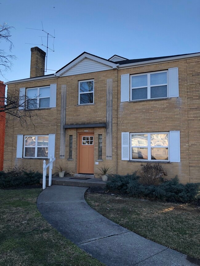
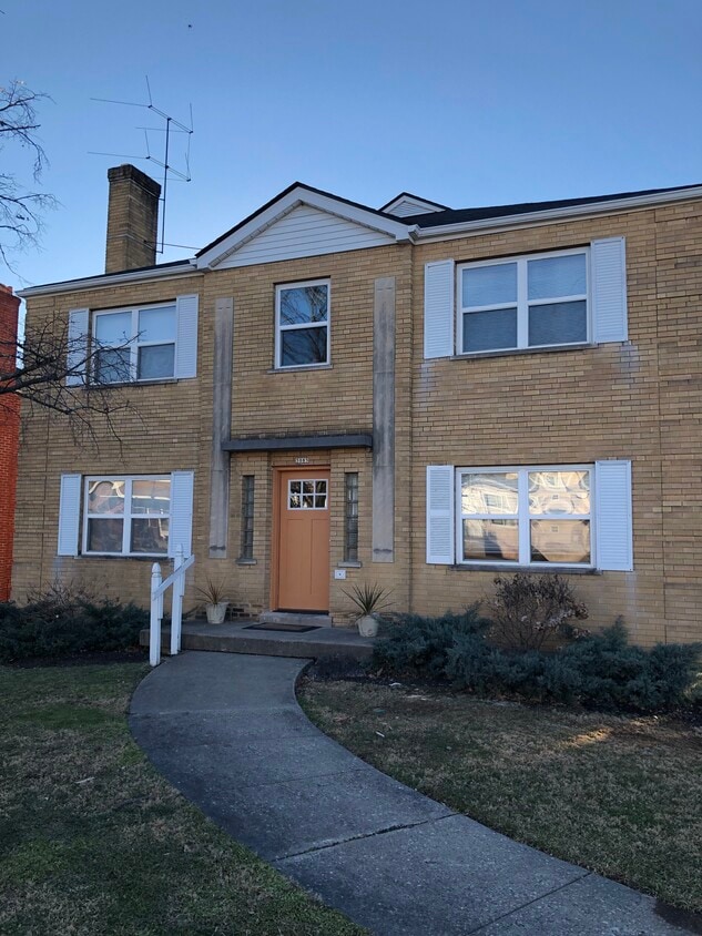
3085 Glenmore Ave
Cincinnati, OH 45238
Today
|
Edit
Favorites
513-993-4209
-
Bedrooms
1
-
Bathrooms
1
-
Square Feet
700 sq ft
-
Available
Available Now
3085 Glenmore Ave

Favorites
2 Available Units
#3
$800
Total Monthly Price
1 bed,
1 bath,
700 sq ft
12 Month Lease, $600 deposit,
Available Now
#1
$800
Total Monthly Price
1 bed,
1 bath,
700 sq ft
12 Month Lease, $600 deposit,
Available Now
* Price shown is base rent. Excludes user-selected optional fees and variable or usage-based fees and required charges due at or prior to move-in or at move-out.
Price, availability, fees, and any applicable rent special are subject to change without notice.
* Square footage definitions vary. Displayed square footage is approximate.
About 3085 Glenmore Ave Cincinnati, OH 45238
12 Month Lease,
$600 deposit,
Available Now
We are close to everything on the west side and on the bus line. Clean , well maintained quiet building. Single adults. No pets. No drugs including marijuana on property. Must have income and clean criminal record, credit check.
3085 Glenmore Ave is an apartment community located in Hamilton County and the 45238 ZIP Code.
* Price shown is total price based on community-supplied monthly required fees. Excludes user-selected optional fees and variable or usage-based fees and required charges due at or prior to move-in or at move-out. Price, availability, fees, and any applicable rent special are subject to change without notice.
* Square footage definitions vary. Displayed square footage is approximate.
Apartment Features
- Laundry Facilities
- Storage Space
Fees and Policies
The fees listed below are community-provided and may exclude utilities or add-ons. All payments are made directly to the property and are non-refundable unless otherwise specified.
- Parking
-
Surface Lot--
Details
Utilities Included
-
Water
-
Heat
-
Trash Removal
Property Information
-
4 units
Contact
- Listed by Brian Hunt
- Phone Number
- Contact
Location
Get Directions
Situated about five miles northwest of Downtown Cincinnati, Westwood is the largest neighborhood in the city. Residents flock to Westwood for its many affordable historic homes and modern apartments available for rent in addition to its close proximity to I-74, I-75, and all that Downtown Cincinnati has to offer.
While Westwood is a predominantly residential neighborhood, it is also home to a slew of convenient stores and restaurants. Shopping opportunities abound in Westwood, with plenty of national retailers in Western Hills Plaza and local shops in the growing Town Hall District. Numerous neighborhood parks provide ample space to enjoy the outdoors in town as well as the sprawling 1,400-acre Mount Airy Forest, which is partially located in Westwood.
Learn more about living in Westwood
Education
| Colleges & Universities | Distance | ||
|---|---|---|---|
| Colleges & Universities | Distance | ||
| Drive: | 9 min | 4.3 mi | |
| Drive: | 16 min | 6.5 mi | |
| Drive: | 14 min | 6.8 mi | |
| Drive: | 16 min | 7.2 mi |
3085 Glenmore Ave is within 9 minutes or 4.3 miles from College of Mount St. Joseph. It is also near Cincinnati State and University of Cincinnati.
Transportation options available in Cincinnati include Brewery District Station - Elm & Henry, located 5.8 miles from 3085 Glenmore Ave. 3085 Glenmore Ave is near Cincinnati/Northern Kentucky International, located 18.3 miles or 33 minutes away.
| Transit / Subway | Distance | ||
|---|---|---|---|
| Transit / Subway | Distance | ||
| Drive: | 14 min | 5.8 mi | |
| Drive: | 14 min | 6.0 mi | |
| Drive: | 14 min | 6.0 mi | |
| Drive: | 14 min | 6.1 mi | |
| Drive: | 15 min | 6.3 mi |
| Commuter Rail | Distance | ||
|---|---|---|---|
| Commuter Rail | Distance | ||
|
|
Drive: | 14 min | 6.0 mi |
| Airports | Distance | ||
|---|---|---|---|
| Airports | Distance | ||
|
Cincinnati/Northern Kentucky International
|
Drive: | 33 min | 18.3 mi |
Time and distance from 3085 Glenmore Ave.
| Shopping Centers | Distance | ||
|---|---|---|---|
| Shopping Centers | Distance | ||
| Walk: | 9 min | 0.5 mi | |
| Walk: | 12 min | 0.6 mi | |
| Walk: | 14 min | 0.7 mi |
3085 Glenmore Ave has 3 shopping centers within 0.7 mile, which is about a 14-minute walk. The miles and minutes will be for the farthest away property.
| Parks and Recreation | Distance | ||
|---|---|---|---|
| Parks and Recreation | Distance | ||
|
Imago Earth Center
|
Drive: | 11 min | 3.9 mi |
|
Mt. Airy Forest
|
Drive: | 9 min | 3.9 mi |
|
Embshoff Woods
|
Drive: | 13 min | 4.5 mi |
|
Wilson Commons
|
Drive: | 13 min | 4.6 mi |
|
Buttercup Valley
|
Drive: | 13 min | 5.5 mi |
3085 Glenmore Ave has 5 parks within 5.5 miles, including Imago Earth Center, Mt. Airy Forest, and Embshoff Woods.
| Hospitals | Distance | ||
|---|---|---|---|
| Hospitals | Distance | ||
| Drive: | 10 min | 4.0 mi | |
| Drive: | 13 min | 6.0 mi | |
| Drive: | 17 min | 6.8 mi |
3085 Glenmore Ave has 3 hospitals within 6.8 miles, the nearest is Mercy Health - West Hospital which is 4.0 miles away and a 10 minute drive.
| Military Bases | Distance | ||
|---|---|---|---|
| Military Bases | Distance | ||
| Drive: | 76 min | 56.3 mi | |
| Drive: | 81 min | 61.3 mi | |
| Drive: | 97 min | 70.5 mi |
3085 Glenmore Ave has 3 military bases within 70.5 miles, the nearest is Gentile Air Force Station which is 56.3 miles away and a 76 minute drive.
Amenities
- Laundry Facilities
- Storage Space
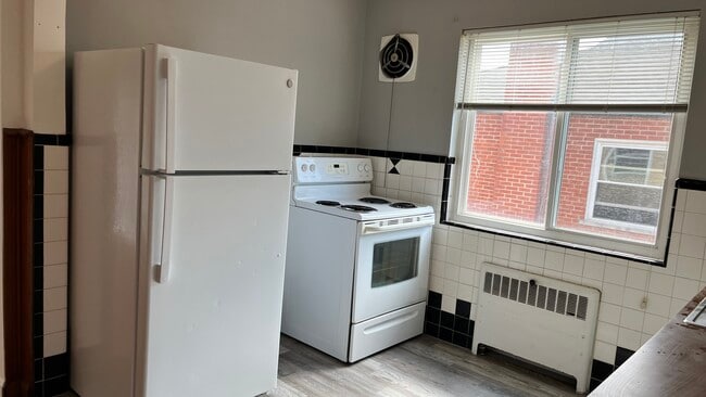
3085 Glenmore Ave Photos
What Are Walk Score®, Transit Score®, and Bike Score® Ratings?
Walk Score® measures the walkability of any address. Transit Score® measures access to public transit. Bike Score® measures the bikeability of any address.
What is a Sound Score Rating?
A Sound Score Rating aggregates noise caused by vehicle traffic, airplane traffic and local sources
3085 Glenmore Ave
Cincinnati, OH 45238