
$2,995
Total Monthly Price
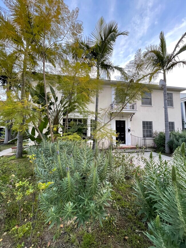
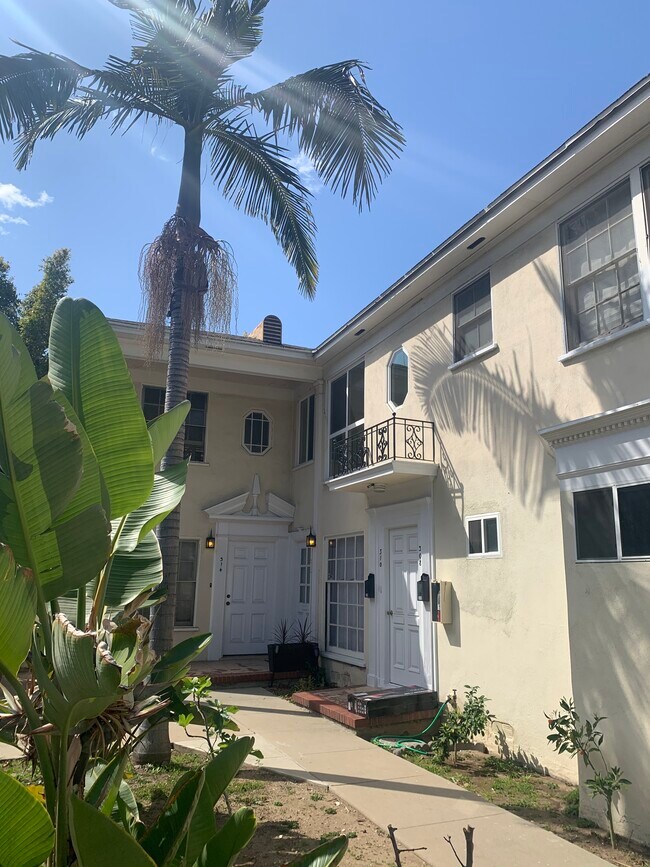
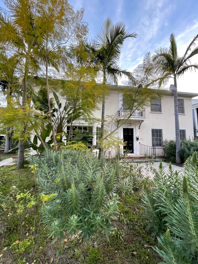
308 E California Blvd Unit 1
Pasadena, CA 91106
2 Weeks Ago
|
Edit
Favorites
308 E California Blvd Unit 1

Favorites
Check Back Soon for Upcoming Availability
| Beds | Baths | Average SF |
|---|---|---|
| 2 Bedrooms 2 Bedrooms 2 Br | 1 Bath 1 Bath 1 Ba | 1,600 SF |
Fees and Policies
The fees listed below are community-provided and may exclude utilities or add-ons. All payments are made directly to the property and are non-refundable unless otherwise specified.
- Dogs Allowed
-
Fees not specified
- Cats Allowed
-
Fees not specified
- Parking
-
Covered--
Details
Utilities Included
-
Water
Property Information
-
2 units
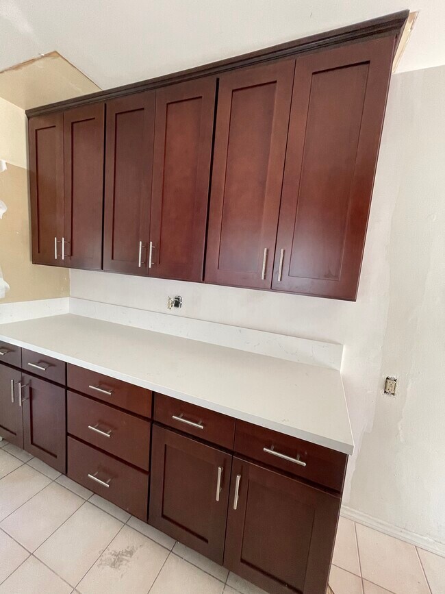
About This Property
Prime location, easy walking to restaurants and shops
308 E California Blvd is an apartment community located in Los Angeles County and the 91106 ZIP Code. This area is served by the Pasadena Unified School District attendance zone.
Apartment Features
- Washer/Dryer Hookup
- Smoke Free
308 E California Blvd,
Pasadena,
CA
91106
Located at the base of the San Gabriel Mountains, Pasadena sits 11 miles northeast of downtown Los Angeles. The city combines historic architecture with modern living, featuring preserved Craftsman bungalows and stately homes along Orange Grove Boulevard. Old Pasadena's walkable streets house local shops, restaurants, and landmarks like the Pasadena Playhouse. One-bedroom apartments rent for $2,385 per month, while two-bedroom units average $3,059.
Home to the California Institute of Technology (Caltech) and the Jet Propulsion Laboratory (JPL), Pasadena boasts significant cultural attractions including the Norton Simon Museum and USC Pacific Asia Museum. Residents enjoy access to hiking trails in the Arroyo Seco and can explore neighborhoods ranging from South Lake Avenue to the historic Bungalow Heaven district. The annual Tournament of Roses Parade, a tradition since 1890, draws visitors from around the world.
Learn more about living in PasadenaBelow are rent ranges for similar nearby apartments
Amenities
- Washer/Dryer Hookup
- Smoke Free
Expenses
Utilities Included
Water
Included
Education
| Colleges & Universities | Distance | ||
|---|---|---|---|
| Colleges & Universities | Distance | ||
| Walk: | 15 min | 0.8 mi | |
| Drive: | 3 min | 1.1 mi | |
| Drive: | 3 min | 1.3 mi | |
| Drive: | 5 min | 1.8 mi |
308 E California Blvd Unit 1 is within 15 minutes or 0.8 mile from Art Center College of Design. It is also near Caltech and Fuller Theological Seminary.
Schools


Public Elementary School
Grades K-5
Nearby
Public Elementary & Middle School
Grades K-8
Attendance Zone
Public Middle & High School
Grades 6-12
Attendance Zone
Private Elementary & Middle School
Grades PK-8
Nearby
Private Elementary, Middle & High School
Grades PK-12
Nearby
Private Elementary & Middle School
Grades K-8
Nearby
Private Middle & High School
Grades 6-10
21 Students
Nearby
School data provided by
 The GreatSchools Rating helps parents compare schools within a state based on a variety of school quality indicators and provides a helpful picture of how effectively each school serves all of its students. Ratings are on a scale of 1 (below average) to 10 (above average) and can include test scores, college readiness, academic progress, advanced courses, equity, discipline and attendance data. We also advise parents to visit schools, consider other information on school performance and programs, and consider family needs as part of the school selection process.
View GreatSchools Rating Methodology
Data provided by GreatSchools.org © 2026. All rights reserved.
View GreatSchools Rating Methodology
Data provided by GreatSchools.org © 2026. All rights reserved.
Transportation options available in Pasadena include Fillmore Station, located 0.5 mile from 308 E California Blvd Unit 1. 308 E California Blvd Unit 1 is near Bob Hope, located 17.1 miles or 24 minutes away, and Los Angeles International, located 24.2 miles or 37 minutes away.
| Transit / Subway | Distance | ||
|---|---|---|---|
| Transit / Subway | Distance | ||
|
|
Walk: | 9 min | 0.5 mi |
|
|
Walk: | 12 min | 0.7 mi |
|
|
Walk: | 20 min | 1.0 mi |
|
|
Drive: | 4 min | 2.0 mi |
|
|
Drive: | 5 min | 2.5 mi |
| Commuter Rail | Distance | ||
|---|---|---|---|
| Commuter Rail | Distance | ||
|
|
Drive: | 15 min | 9.1 mi |
|
|
Drive: | 17 min | 9.2 mi |
|
|
Drive: | 14 min | 9.6 mi |
|
|
Drive: | 18 min | 11.2 mi |
| Drive: | 19 min | 13.3 mi |
| Airports | Distance | ||
|---|---|---|---|
| Airports | Distance | ||
|
Bob Hope
|
Drive: | 24 min | 17.1 mi |
|
Los Angeles International
|
Drive: | 37 min | 24.2 mi |
Walkability Near 308 E California Blvd Pasadena, CA 91106
Getting Around
 What do Walkability, Transit, Drivability, and Bikeability mean?
Walkability measures the walking distance to day-to-day needs.
Transit measures access to public transportation.
Drivability measures congestion, parking availability, and access to major roads.
Bikeability measures the suitability for cycling.
How It Works
What do Walkability, Transit, Drivability, and Bikeability mean?
Walkability measures the walking distance to day-to-day needs.
Transit measures access to public transportation.
Drivability measures congestion, parking availability, and access to major roads.
Bikeability measures the suitability for cycling.
How It Works
Very Walkable
Walkability
80
/ 100
Some Public Transit
Transit
50
/ 100
Exceptionally Drivable
Drivability
90
/ 100
Fairly Bikeable
Bikeability
50
/ 100
Scores provided by
-
Soundscore™
-
/ 100
Traffic
-Airport
-Businesses
-Scores provided by
HowLoud What is a Sound Score Rating? A Sound Score Rating aggregates noise caused by vehicle traffic, airplane traffic and local sources. How It WorksTime and distance from 308 E California Blvd Unit 1.
| Shopping Centers | Distance | ||
|---|---|---|---|
| Shopping Centers | Distance | ||
| Walk: | 6 min | 0.3 mi | |
| Walk: | 6 min | 0.4 mi | |
| Walk: | 9 min | 0.5 mi |
308 E California Blvd Unit 1 has 3 shopping centers within 0.5 mile, which is about a 9-minute walk. The miles and minutes will be for the farthest away property.
| Parks and Recreation | Distance | ||
|---|---|---|---|
| Parks and Recreation | Distance | ||
|
Huntington Botanical Gardens
|
Drive: | 7 min | 2.2 mi |
|
Kidspace Children's Museum
|
Drive: | 6 min | 2.8 mi |
|
Jet Propulsion Laboratory
|
Drive: | 7 min | 4.5 mi |
|
Audubon Center at Debs Park
|
Drive: | 8 min | 5.2 mi |
|
Eaton Canyon Nature Center
|
Drive: | 11 min | 5.8 mi |
308 E California Blvd Unit 1 has 5 parks within 5.8 miles, including Huntington Botanical Gardens, Kidspace Children's Museum, and Jet Propulsion Laboratory.
| Hospitals | Distance | ||
|---|---|---|---|
| Hospitals | Distance | ||
| Walk: | 8 min | 0.4 mi | |
| Drive: | 8 min | 3.4 mi | |
| Drive: | 7 min | 4.0 mi |
308 E California Blvd Unit 1 has 3 hospitals within 4.0 miles, the nearest is Huntington Memorial Hospital which is 0.4 mile away and a 8 minute walk.
| Military Bases | Distance | ||
|---|---|---|---|
| Military Bases | Distance | ||
| Drive: | 35 min | 25.8 mi | |
| Drive: | 44 min | 29.6 mi |
308 E California Blvd Unit 1 is 25.8 miles from Los Angeles Air Force Base, and is convenient to other military bases, including Los Alamitos Army Airfield.
You May Also Like
Similar Rentals Nearby
-
-
2 Beds$3,337+Total Monthly PriceTotal Monthly Price NewPrices include base rent and required monthly fees of $45. Variable costs based on usage may apply.Base Rent:2 Beds$3,292+2 Months Free
Pets Allowed Fitness Center Pool In Unit Washer & Dryer Clubhouse Balcony
-
-
-
-
-
-
-
-


 - Violet on Virgil")


What Are Walk Score®, Transit Score®, and Bike Score® Ratings?
Walk Score® measures the walkability of any address. Transit Score® measures access to public transit. Bike Score® measures the bikeability of any address.
What is a Sound Score Rating?
A Sound Score Rating aggregates noise caused by vehicle traffic, airplane traffic and local sources.
308 E California Blvd
Pasadena, CA 91106