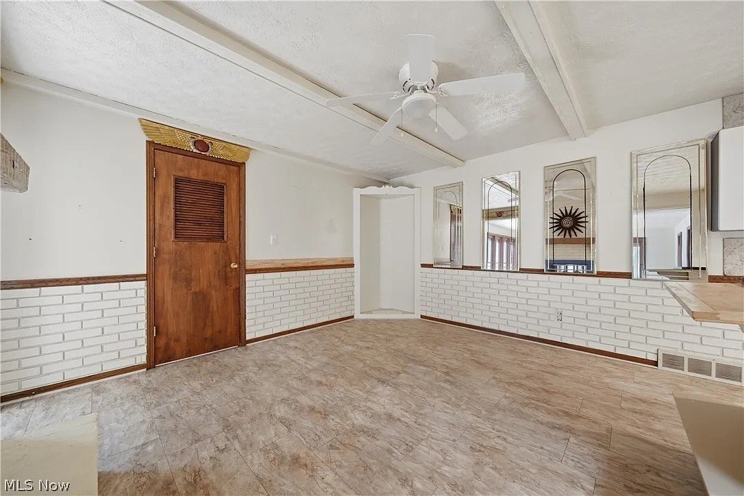
3064 Townsend St NW
Uniontown, OH 44685
-
Bedrooms
3
-
Bathrooms
3
-
Square Feet
2,625 sq ft
-
Available
Available Now
Highlights
- Pets Allowed
- Hardwood Floors
- Fenced Lot

About This Home
Property Id: 2773256 Welcome to your new home at 3064 Townsend St in Uniontown, OH! This charming single-family property features 3 bedrooms, 3 bathrooms, and a fenced yard for your small dogs or cats to roam. Built in 1973, this home comes with all utilities included and modern amenities such as a microwave, washer, and central air. Don't miss out on the opportunity to live in this cozy retreat with a 2-car garage. Contact us now for more details and to schedule a viewing!
3064 Townsend St Nw is a house located in Stark County and the 44685 ZIP Code.
Fees and Policies
The fees listed below are community-provided and may exclude utilities or add-ons. All payments are made directly to the property and are non-refundable unless otherwise specified. Use the Cost Calculator to determine costs based on your needs.
-
One-Time Basics
-
Security Deposit - Refundable$1,200
-
-
Dogs
-
Allowed
-
-
Cats
-
Allowed
-
-
Garage Lot
Property Fee Disclaimer: Based on community-supplied data and independent market research. Subject to change without notice. May exclude fees for mandatory or optional services and usage-based utilities.
Details
Utilities Included
-
Gas
-
Water
-
Electricity
Property Information
-
Built in 1973
House Features
- Microwave
- Hardwood Floors
- Tile Floors
- Fenced Lot
Contact
- Phone Number
- Contact
-
Source

Tucked into Stark County, Uniontown, Ohio sits at a comfortable crossroads between small-town calm and big-city access. Platted in 1816 where two stagecoach lines once converged, the community carries a sense of history that still shapes its quiet, grounded character today. Akron is just a short drive north, while Cleveland, Columbus, and Pittsburgh are all within roughly two hours, making Uniontown a practical base for those who want breathing room without sacrificing reach.
The area covers just five square miles, yet it packs in a noticeable mix of local businesses, community events like the Uniontown Lions Festival, and open green space. Quail Hollow State Park and Wingfoot Lake State Park are close neighbors, giving residents easy access to trails and outdoor recreation year-round. The Canton-Massillon metro area provides additional employment, healthcare, and educational anchors nearby.
Learn more about living in Uniontown- Microwave
- Hardwood Floors
- Tile Floors
- Fenced Lot
| Colleges & Universities | Distance | ||
|---|---|---|---|
| Colleges & Universities | Distance | ||
| Drive: | 15 min | 8.0 mi | |
| Drive: | 17 min | 8.1 mi | |
| Drive: | 19 min | 8.5 mi | |
| Drive: | 21 min | 9.9 mi |
Scores provided by
 What do Walkability, Transit, Drivability, and Bikeability mean?
Walkability measures the walking distance to day-to-day needs.
Transit measures access to public transportation.
Drivability measures congestion, parking availability, and access to major roads.
Bikeability measures the suitability for cycling.
How It Works
What do Walkability, Transit, Drivability, and Bikeability mean?
Walkability measures the walking distance to day-to-day needs.
Transit measures access to public transportation.
Drivability measures congestion, parking availability, and access to major roads.
Bikeability measures the suitability for cycling.
How It Works
Traffic
-Airport
-Businesses
-Scores provided by
HowLoud What is a Sound Score Rating? A Sound Score Rating aggregates noise caused by vehicle traffic, airplane traffic and local sources. How It WorksYou May Also Like
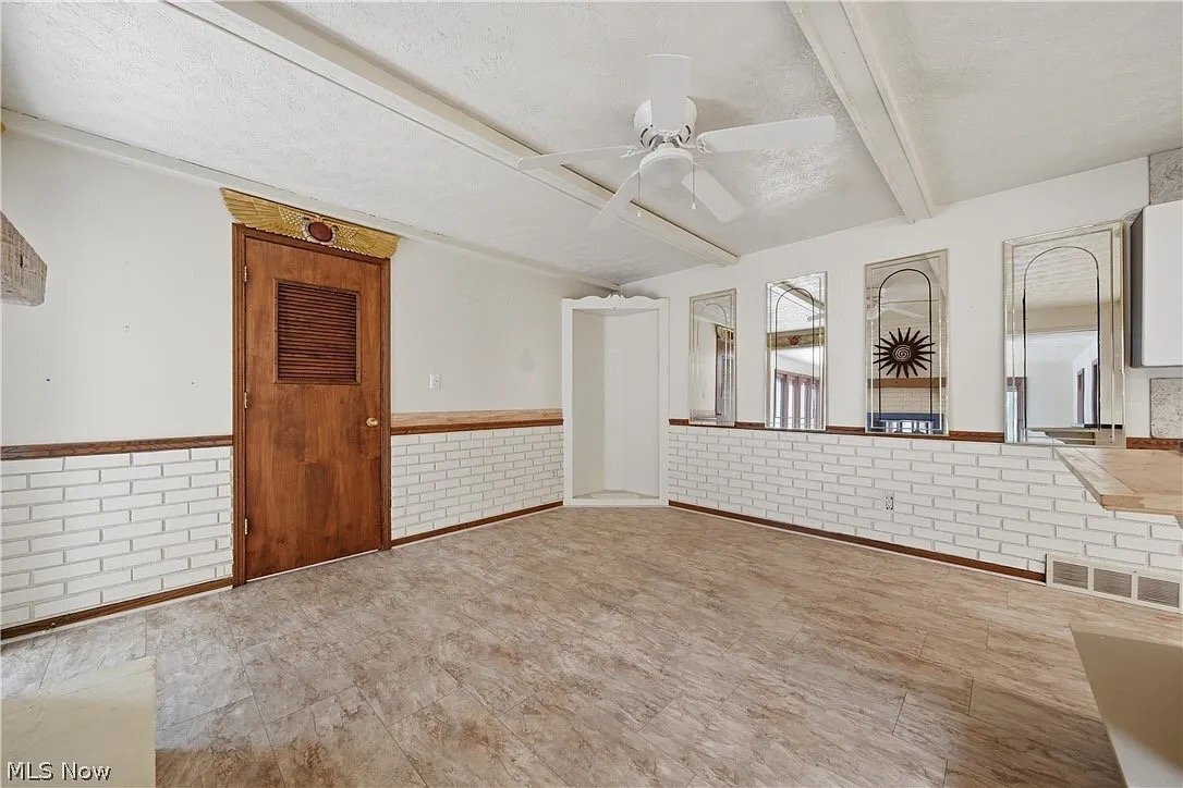
3064 Townsend St NW
Uniontown, OH 44685