1 / 15


| Beds | Baths | Average SF |
|---|---|---|
| 2 Bedrooms 2 Bedrooms 2 Br | 2 Baths 2 Baths 2 Ba | 992 SF |
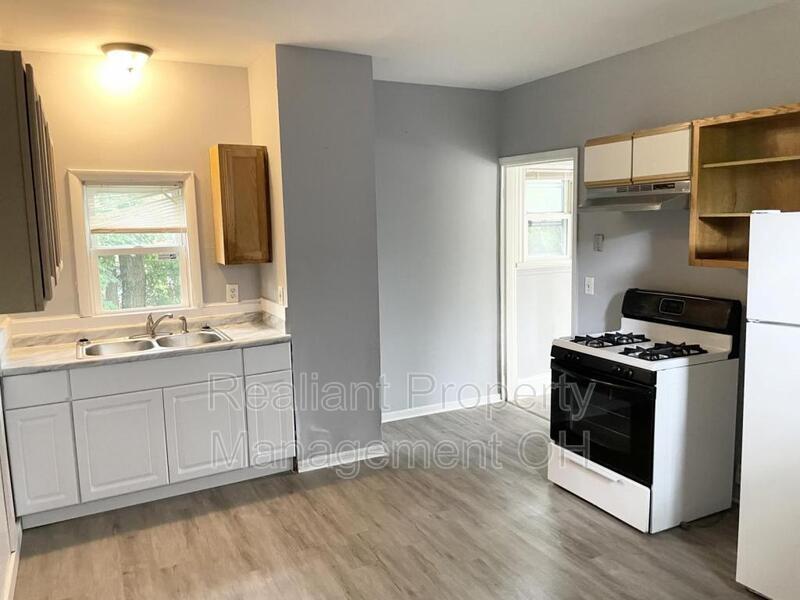
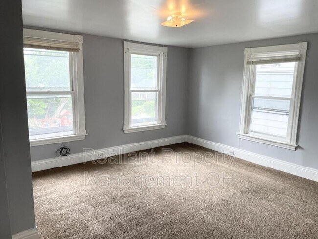
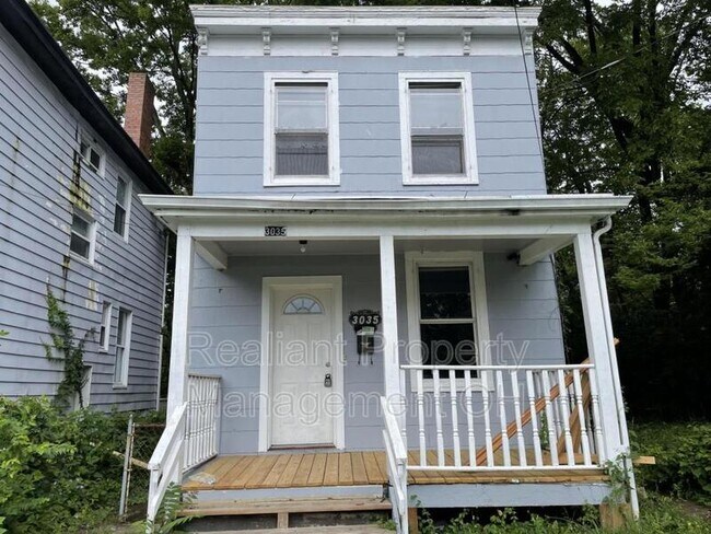
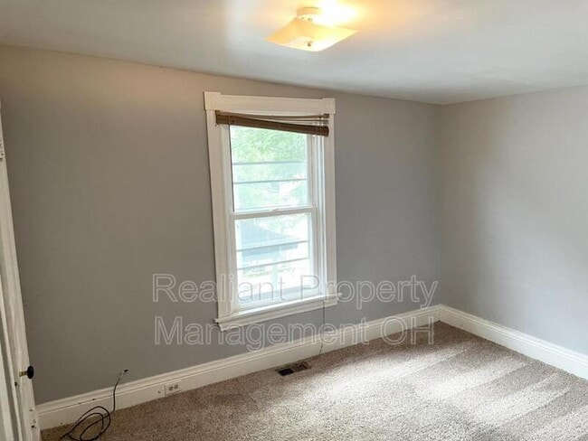
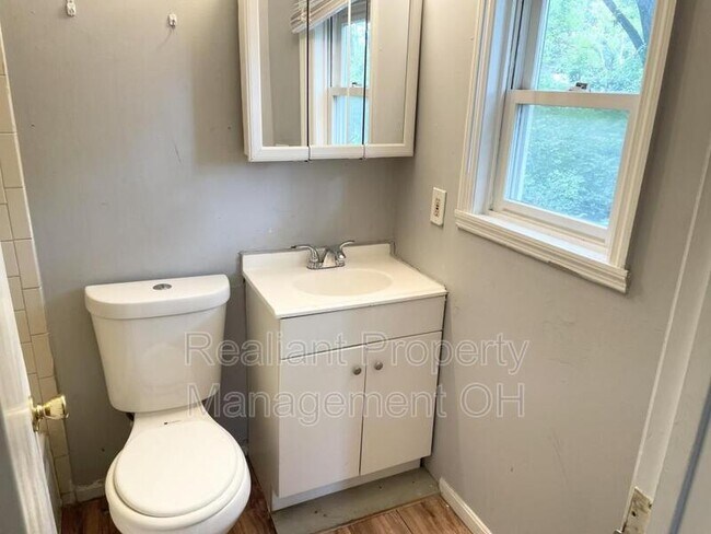
Welcome to 3035 Percy Avenue! This single family home has been completely made over! There is room for you to spread out in this 2 br / 1 bath home. This home wont last! Please visit Realiantpm.com to schedule your visit today!
3035 Percy Ave is a house located in Hamilton County and the 45211 ZIP Code. This area is served by the Cincinnati Public Schools attendance zone.
Situated about five miles northwest of Downtown Cincinnati, Westwood is the largest neighborhood in the city. Residents flock to Westwood for its many affordable historic homes and modern apartments available for rent in addition to its close proximity to I-74, I-75, and all that Downtown Cincinnati has to offer.
While Westwood is a predominantly residential neighborhood, it is also home to a slew of convenient stores and restaurants. Shopping opportunities abound in Westwood, with plenty of national retailers in Western Hills Plaza and local shops in the growing Town Hall District. Numerous neighborhood parks provide ample space to enjoy the outdoors in town as well as the sprawling 1,400-acre Mount Airy Forest, which is partially located in Westwood.
Learn more about living in Westwood| Colleges & Universities | Distance | ||
|---|---|---|---|
| Colleges & Universities | Distance | ||
| Drive: | 12 min | 4.4 mi | |
| Drive: | 11 min | 4.7 mi | |
| Drive: | 12 min | 5.1 mi | |
| Drive: | 15 min | 6.2 mi |


Transportation options available in Cincinnati include Brewery District Station - Elm & Henry, located 4.2 miles from 3035 Percy Ave. 3035 Percy Ave is near Cincinnati/Northern Kentucky International, located 18.5 miles or 34 minutes away.
| Transit / Subway | Distance | ||
|---|---|---|---|
| Transit / Subway | Distance | ||
| Drive: | 10 min | 4.2 mi | |
| Drive: | 10 min | 4.4 mi | |
| Drive: | 10 min | 4.5 mi | |
| Drive: | 10 min | 4.6 mi | |
| Drive: | 11 min | 4.7 mi |
| Commuter Rail | Distance | ||
|---|---|---|---|
| Commuter Rail | Distance | ||
|
|
Drive: | 10 min | 4.5 mi |
| Airports | Distance | ||
|---|---|---|---|
| Airports | Distance | ||
|
Cincinnati/Northern Kentucky International
|
Drive: | 34 min | 18.5 mi |
Scores provided by
Traffic
-Airport
-Businesses
-Scores provided by
HowLoud What is a Sound Score Rating? A Sound Score Rating aggregates noise caused by vehicle traffic, airplane traffic and local sources. How It WorksTime and distance from 3035 Percy Ave.
| Shopping Centers | Distance | ||
|---|---|---|---|
| Shopping Centers | Distance | ||
| Drive: | 6 min | 2.1 mi | |
| Drive: | 6 min | 2.1 mi | |
| Drive: | 6 min | 2.6 mi |
| Parks and Recreation | Distance | ||
|---|---|---|---|
| Parks and Recreation | Distance | ||
|
Mt. Airy Forest
|
Drive: | 9 min | 3.5 mi |
|
Imago Earth Center
|
Drive: | 11 min | 4.1 mi |
|
Buttercup Valley
|
Drive: | 11 min | 4.3 mi |
|
Wilson Commons
|
Drive: | 11 min | 4.4 mi |
|
Museum of Natural History and Science
|
Drive: | 10 min | 4.5 mi |
| Hospitals | Distance | ||
|---|---|---|---|
| Hospitals | Distance | ||
| Drive: | 9 min | 3.9 mi | |
| Drive: | 10 min | 4.1 mi | |
| Drive: | 12 min | 5.2 mi |
| Military Bases | Distance | ||
|---|---|---|---|
| Military Bases | Distance | ||
| Drive: | 74 min | 55.1 mi | |
| Drive: | 80 min | 60.2 mi | |
| Drive: | 83 min | 63.5 mi |


What Are Walk Score®, Transit Score®, and Bike Score® Ratings?
Walk Score® measures the walkability of any address. Transit Score® measures access to public transit. Bike Score® measures the bikeability of any address.
What is a Sound Score Rating?
A Sound Score Rating aggregates noise caused by vehicle traffic, airplane traffic and local sources.

3035 Percy Ave
Cincinnati, OH 45211
