$1,600
Total Monthly Price
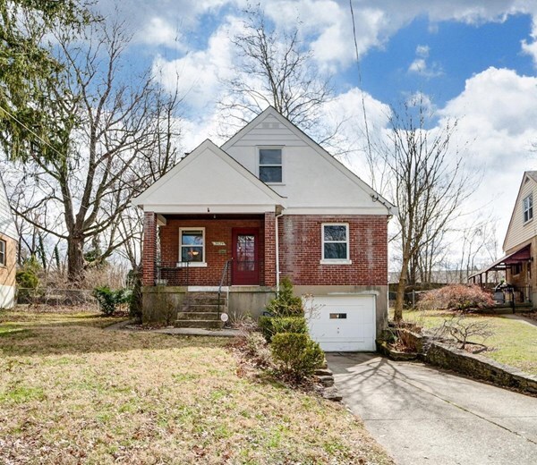
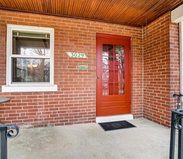
3029 S Hegry Cir
Cincinnati, OH 45238
Today
|
Edit
Favorites
513-654-5269
-
Bedrooms
3
-
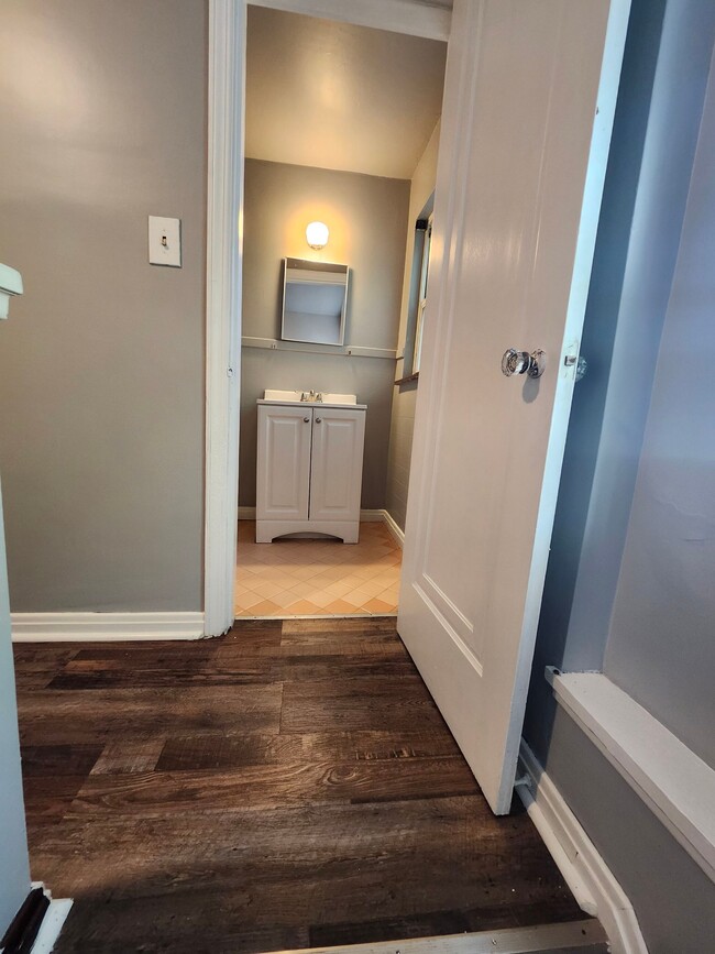
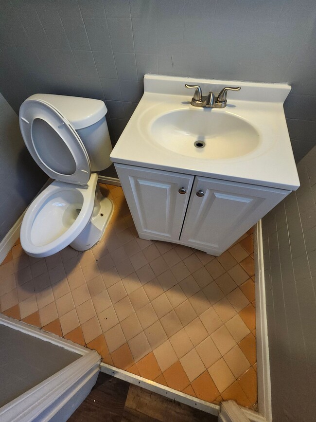
Bathrooms
1.5
-
Square Feet
1,400 sq ft
-
Available
Available Now
Highlights
- Pets Allowed
- Yard
- Smoke Free
3029 S Hegry Cir

Favorites
About This Home
12 Month Lease,
$1,600 deposit,
Available Now
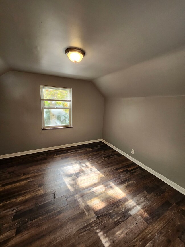
This 1,400 square foot property at 3029 S Hegry Cir features 3 bedrooms and 1.5 bathrooms. The living room offers ample space for relaxation and is designed for comfort. The kitchen is equipped with essential appliances, including a refrigerator and oven, making meal preparation convenient. Each bedroom provides sufficient space for furnishings, while the bathroom includes necessary fixtures for daily use. The property is smoke-free and includes air conditioning for climate control. The exterior offers a manageable yard space, suitable for outdoor activities. This rental is available for a competitive price, providing a practical option for potential renters.
3029 S Hegry Cir is a house located in Hamilton County and the 45238 ZIP Code. This area is served by the Cincinnati Public Schools attendance zone.
* Price shown is total price based on community-supplied monthly required fees. Excludes user-selected optional fees and variable or usage-based fees and required charges due at or prior to move-in or at move-out. Price, availability, fees, and any applicable rent special are subject to change without notice.
* Square footage definitions vary. Displayed square footage is approximate.
House Features
Air Conditioning
Refrigerator
Smoke Free
Heating
- Air Conditioning
- Heating
- Smoke Free
- Kitchen
- Oven
- Refrigerator
- Yard
Fees and Policies
The fees listed below are community-provided and may exclude utilities or add-ons. All payments are made directly to the property and are non-refundable unless otherwise specified.
- Dogs Allowed
-
Fees not specified
- Cats Allowed
-
Fees not specified
- Parking
-
Garage--
Contact
- Listed by Bluevista Realty
- Phone Number
- Contact
Location
Get Directions
Situated about five miles northwest of Downtown Cincinnati, Westwood is the largest neighborhood in the city. Residents flock to Westwood for its many affordable historic homes and modern apartments available for rent in addition to its close proximity to I-74, I-75, and all that Downtown Cincinnati has to offer.
While Westwood is a predominantly residential neighborhood, it is also home to a slew of convenient stores and restaurants. Shopping opportunities abound in Westwood, with plenty of national retailers in Western Hills Plaza and local shops in the growing Town Hall District. Numerous neighborhood parks provide ample space to enjoy the outdoors in town as well as the sprawling 1,400-acre Mount Airy Forest, which is partially located in Westwood.
Learn more about living in Westwood
Education
| Colleges & Universities | Distance | ||
|---|---|---|---|
| Colleges & Universities | Distance | ||
| Drive: | 10 min | 4.3 mi | |
| Drive: | 17 min | 6.1 mi | |
| Drive: | 15 min | 6.3 mi | |
| Drive: | 17 min | 6.8 mi |
3029 S Hegry Cir is within 10 minutes or 4.3 miles from College of Mount St. Joseph. It is also near Cincinnati State and University of Cincinnati.
Schools


Public Elementary & Middle School
Grades PK-8
Attendance Zone
Public Middle & High School
Grades 6-12
Attendance Zone
Public Middle & High School
Grades 6-12
Attendance Zone
Private Elementary & Middle School
Grades PK-8
Nearby
Private Elementary & Middle School
Grades K-8
Nearby
Private High School
Grades 9-12
Nearby
School data provided by
 The GreatSchools Rating helps parents compare schools within a state based on a variety of school quality indicators and provides a helpful picture of how effectively each school serves all of its students. Ratings are on a scale of 1 (below average) to 10 (above average) and can include test scores, college readiness, academic progress, advanced courses, equity, discipline and attendance data. We also advise parents to visit schools, consider other information on school performance and programs, and consider family needs as part of the school selection process.
View GreatSchools Rating Methodology
Data provided by GreatSchools.org © 2026. All rights reserved.
View GreatSchools Rating Methodology
Data provided by GreatSchools.org © 2026. All rights reserved.
Transportation options available in Cincinnati include Brewery District Station - Elm & Henry, located 5.3 miles from 3029 S Hegry Cir. 3029 S Hegry Cir is near Cincinnati/Northern Kentucky International, located 17.8 miles or 32 minutes away.
| Transit / Subway | Distance | ||
|---|---|---|---|
| Transit / Subway | Distance | ||
| Drive: | 13 min | 5.3 mi | |
| Drive: | 13 min | 5.5 mi | |
| Drive: | 13 min | 5.5 mi | |
| Drive: | 13 min | 5.6 mi | |
| Drive: | 14 min | 5.8 mi |
| Commuter Rail | Distance | ||
|---|---|---|---|
| Commuter Rail | Distance | ||
|
|
Drive: | 13 min | 5.5 mi |
| Airports | Distance | ||
|---|---|---|---|
| Airports | Distance | ||
|
Cincinnati/Northern Kentucky International
|
Drive: | 32 min | 17.8 mi |
Time and distance from 3029 S Hegry Cir.
| Shopping Centers | Distance | ||
|---|---|---|---|
| Shopping Centers | Distance | ||
| Walk: | 7 min | 0.4 mi | |
| Walk: | 11 min | 0.6 mi | |
| Walk: | 11 min | 0.6 mi |
3029 S Hegry Cir has 3 shopping centers within 0.6 mile, which is about a 11-minute walk. The miles and minutes will be for the farthest away property.
| Parks and Recreation | Distance | ||
|---|---|---|---|
| Parks and Recreation | Distance | ||
|
Imago Earth Center
|
Drive: | 8 min | 3.1 mi |
|
Embshoff Woods
|
Drive: | 11 min | 3.7 mi |
|
Wilson Commons
|
Drive: | 11 min | 3.8 mi |
|
Mt. Airy Forest
|
Drive: | 10 min | 4.3 mi |
|
Cincinnati History Museum
|
Drive: | 13 min | 5.5 mi |
3029 S Hegry Cir has 5 parks within 5.5 miles, including Imago Earth Center, Embshoff Woods, and Wilson Commons.
| Hospitals | Distance | ||
|---|---|---|---|
| Hospitals | Distance | ||
| Drive: | 11 min | 4.3 mi | |
| Drive: | 14 min | 5.7 mi | |
| Drive: | 16 min | 6.3 mi |
3029 S Hegry Cir has 3 hospitals within 6.3 miles, the nearest is Mercy Health - West Hospital which is 4.3 miles away and a 11 minute drive.
| Military Bases | Distance | ||
|---|---|---|---|
| Military Bases | Distance | ||
| Drive: | 77 min | 56.6 mi | |
| Drive: | 82 min | 61.6 mi | |
| Drive: | 98 min | 70.8 mi |
3029 S Hegry Cir has 3 military bases within 70.8 miles, the nearest is Gentile Air Force Station which is 56.6 miles away and a 77 minute drive.
Amenities
- Air Conditioning
- Heating
- Smoke Free
- Kitchen
- Oven
- Refrigerator
- Yard
3029 S Hegry Cir Photos
What Are Walk Score®, Transit Score®, and Bike Score® Ratings?
Walk Score® measures the walkability of any address. Transit Score® measures access to public transit. Bike Score® measures the bikeability of any address.
What is a Sound Score Rating?
A Sound Score Rating aggregates noise caused by vehicle traffic, airplane traffic and local sources

3029 S Hegry Cir
Cincinnati, OH 45238