$1,800
Total Monthly Price
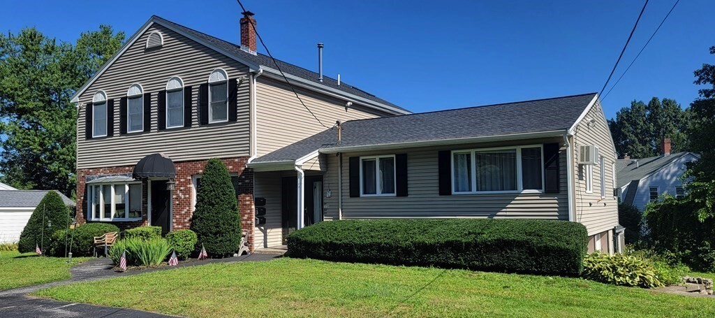
302 Pleasant St Unit 3
North Andover, MA 01845
2 Weeks Ago
|
Edit
Favorites
302 Pleasant St Unit 3

Favorites
Check Back Soon for Upcoming Availability
| Beds | Baths | Average SF |
|---|---|---|
| 1 Bedroom 1 Bedroom 1 Br | 1.5 Baths 1.5 Baths 1.5 Ba | 800 SF |
About This Property
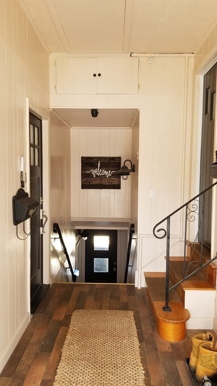
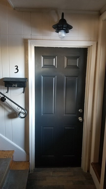
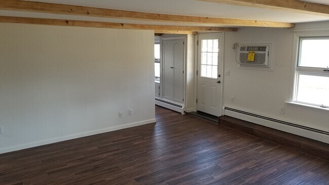
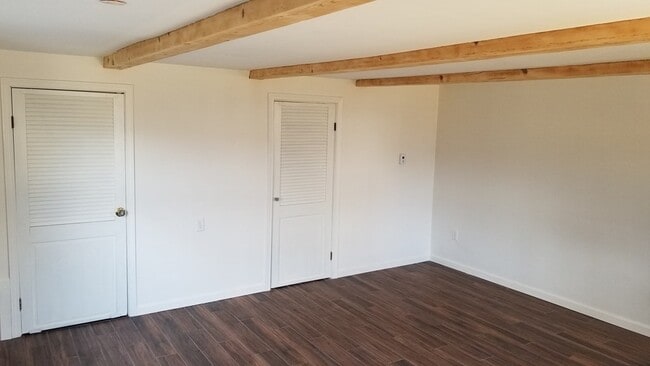
Renovated 1 bedroom,1.5 bathroom apartment. Apartment has a magnolia home feel with exposed natural wood beams,numerous windows for natural light,subway tile back splash,dark wood-like tile flooring,and an eat-in kitchen. The large mudroom area leads to the apartment's entrance and the apartment's back door walks out to the fenced in back yard. There is plenty of off street parking. Access to shared laundry off of garage. Please email or message for requests.
302 Pleasant St is an apartment community located in Essex County and the 01845 ZIP Code.
302 Pleasant St,
North Andover,
MA
01845
Education
| Colleges & Universities | Distance | ||
|---|---|---|---|
| Colleges & Universities | Distance | ||
| Drive: | 5 min | 2.2 mi | |
| Drive: | 20 min | 9.8 mi | |
| Drive: | 25 min | 12.3 mi | |
| Drive: | 21 min | 12.9 mi |
302 Pleasant St Unit 3 is within 5 minutes or 2.2 miles from Merrimack College. It is also near Northern Essex Comm. Coll. and North Shore C.C., Danvers.
Walkability Near 302 Pleasant St North Andover, MA 01845
Getting Around
 What do Walkability, Transit, Drivability, and Bikeability mean?
Walkability measures the walking distance to day-to-day needs.
Transit measures access to public transportation.
Drivability measures congestion, parking availability, and access to major roads.
Bikeability measures the suitability for cycling.
How It Works
What do Walkability, Transit, Drivability, and Bikeability mean?
Walkability measures the walking distance to day-to-day needs.
Transit measures access to public transportation.
Drivability measures congestion, parking availability, and access to major roads.
Bikeability measures the suitability for cycling.
How It Works
Fairly Walkable
Walkability
50
/ 100
Limited Public Transit
Transit
30
/ 100
Exceptionally Drivable
Drivability
100
/ 100
Moderately Bikeable
Bikeability
60
/ 100
Scores provided by
-
Soundscore™
-
/ 100
Traffic
-Airport
-Businesses
-Scores provided by
HowLoud What is a Sound Score Rating? A Sound Score Rating aggregates noise caused by vehicle traffic, airplane traffic and local sources. How It WorksYou May Also Like
Similar Rentals Nearby
-
-
-
-
-
1 Bed$2,485+2 Beds$2,765+3 Beds$4,491+Total Monthly PriceTotal Monthly Price NewPrices include all required monthly fees.Specials
Pets Allowed Fitness Center Pool Kitchen In Unit Washer & Dryer Balcony
-
1 Bed$2,430+2 Beds$2,711+3 Beds$4,102+Total Monthly PriceTotal Monthly Price NewPrices include base rent and required monthly fees. Variable costs based on usage may apply.Specials
Pets Allowed Fitness Center Pool Dishwasher Refrigerator Kitchen
-
-
-
1 Bed$2,464+2 Beds$3,123+Total Monthly PriceTotal Monthly Price NewPrices include required monthly fees of $130.Base Rent:1 Bed$2,334+2 Beds$2,993+2 Months Free
Pets Allowed Fitness Center Pool Walk-In Closets Business Center Package Service Elevator
-


What Are Walk Score®, Transit Score®, and Bike Score® Ratings?
Walk Score® measures the walkability of any address. Transit Score® measures access to public transit. Bike Score® measures the bikeability of any address.
What is a Sound Score Rating?
A Sound Score Rating aggregates noise caused by vehicle traffic, airplane traffic and local sources.
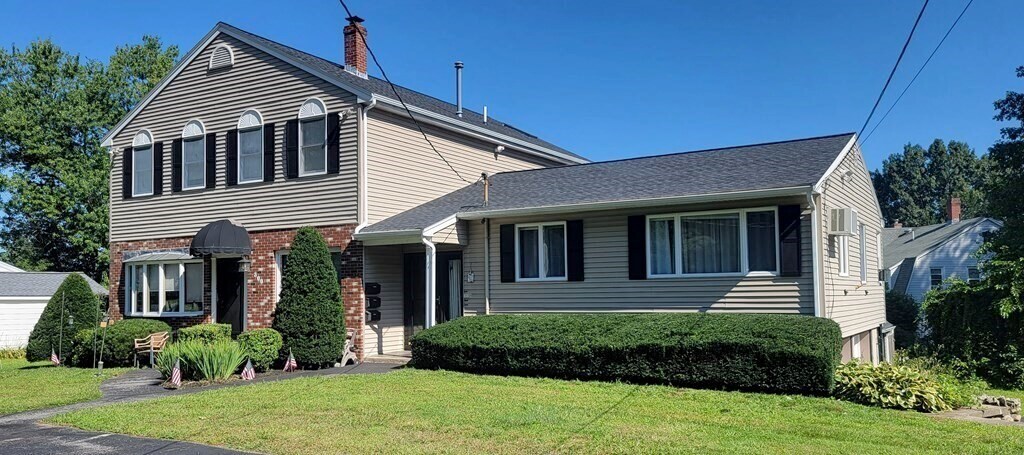
302 Pleasant St
North Andover, MA 01845