

$5,500
/ Month
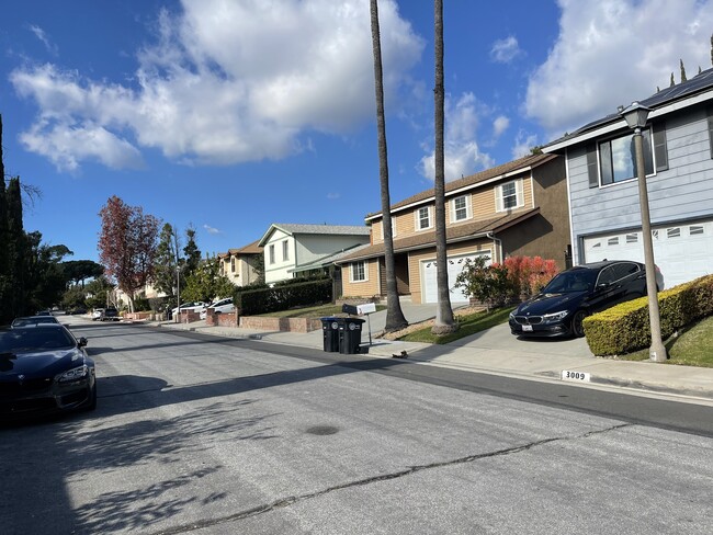
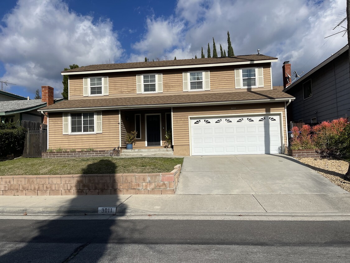
3011 Pinewood Ln
Glendale, CA 91214
2 Weeks Ago
|
Edit
Favorites
3011 Pinewood Ln

Favorites
Check Back Soon for Upcoming Availability
| Beds | Baths | Average SF |
|---|---|---|
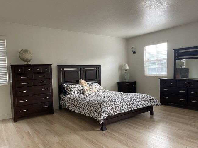
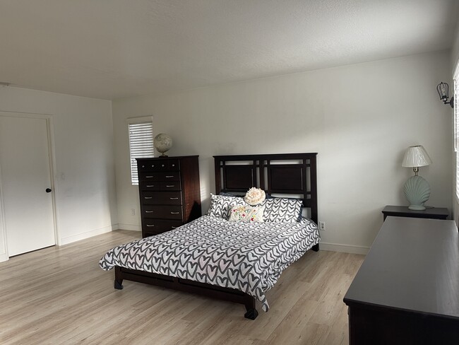
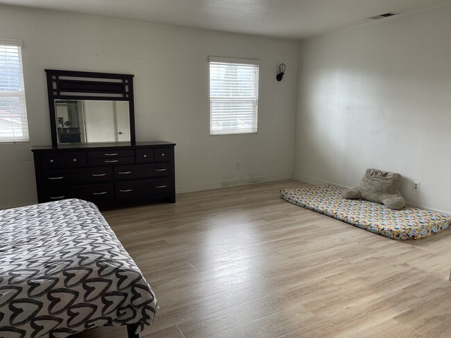
| 5 Bedrooms 5 Bedrooms 5 Br | 2.5 Baths 2.5 Baths 2.5 Ba | 2,296 SF |
Fees and Policies
The fees below are based on community-supplied data and may exclude additional fees and utilities.
- Dogs Allowed
-
Fees not specified
- Cats Allowed
-
Fees not specified
- Parking
-
Garage--
Details
Property Information
-
Built in 1984
About This Property
Walking distance to top rated Crecenta Valley High School, Montrose shopping park. Very quiet and safe neighborhood, easy and close access to I-210 freeway.
3011 Pinewood Ln is a house located in Los Angeles County and the 91214 ZIP Code. This area is served by the Glendale Unified attendance zone.
House Features
Washer/Dryer
Tub/Shower
Heating
Cable Ready
- Washer/Dryer
- Heating
- Cable Ready
- Tub/Shower
- Sprinkler System
Location
Get Directions
Between the Verdugo Mountains and Los Angeles, Glendale combines suburban living with metropolitan convenience. The city offers various housing options, from apartments in downtown near the Americana at Brand to established residential areas like Adams Hill and Verdugo Woodlands. Current rental prices range from $2,045 for studios to $4,344 for four-bedroom units, with annual increases between 1.9% and 3%. Brand Park offers hiking trails and houses the Brand Library, while the historic Alex Theatre continues its tradition of entertainment and cultural programming.
Glendale's location provides easy access to major employment centers, including DreamWorks Animation and Walt Disney Imagineering. The Glendale Galleria and Americana at Brand serve as premier shopping destinations, while the city's dining scene features numerous restaurants specializing in Armenian and international cuisine. Residents appreciate the city's parks system, public services, and transportation options.
Learn more about living in GlendaleBelow are rent ranges for similar nearby apartments
Amenities
- Washer/Dryer
- Heating
- Cable Ready
- Tub/Shower
- Sprinkler System
Education
| Colleges & Universities | Distance | ||
|---|---|---|---|
| Colleges & Universities | Distance | ||
| Drive: | 9 min | 4.4 mi | |
| Drive: | 15 min | 7.5 mi | |
| Drive: | 15 min | 8.8 mi | |
| Drive: | 18 min | 10.4 mi |
3011 Pinewood Ln is within 9 minutes or 4.4 miles from Glendale Community College. It is also near Art Center College of Design and Occidental College.
Schools


Charter Elementary School
Grades K-5
75 Students
Nearby
Public Elementary School
Grades K-6
411 Students
Attendance Zone
Public Middle School
Grades 7-8
1,275 Students
Attendance Zone
Public High School
Grades 9-12
2,488 Students
Attendance Zone
Private Elementary & Middle School
Grades PK-6 & 8
Nearby
Private Elementary, Middle & High School
Grades 5-12
11 Students
Nearby
Private Elementary School
Grades K
139 Students
Nearby
School data provided by
 The GreatSchools Rating helps parents compare schools within a state based on a variety of school quality indicators and provides a helpful picture of how effectively each school serves all of its students. Ratings are on a scale of 1 (below average) to 10 (above average) and can include test scores, college readiness, academic progress, advanced courses, equity, discipline and attendance data. We also advise parents to visit schools, consider other information on school performance and programs, and consider family needs as part of the school selection process.
View GreatSchools Rating Methodology
Data provided by GreatSchools.org © 2025. All rights reserved.
View GreatSchools Rating Methodology
Data provided by GreatSchools.org © 2025. All rights reserved.
Transportation options available in Glendale include Memorial Park Station, located 8.9 miles from 3011 Pinewood Ln. 3011 Pinewood Ln is near Bob Hope, located 10.4 miles or 18 minutes away, and Los Angeles International, located 28.6 miles or 44 minutes away.
| Transit / Subway | Distance | ||
|---|---|---|---|
| Transit / Subway | Distance | ||
|
|
Drive: | 13 min | 8.9 mi |
|
|
Drive: | 13 min | 9.2 mi |
|
|
Drive: | 12 min | 9.5 mi |
|
|
Drive: | 14 min | 9.8 mi |
|
|
Drive: | 18 min | 10.9 mi |
| Commuter Rail | Distance | ||
|---|---|---|---|
| Commuter Rail | Distance | ||
|
|
Drive: | 14 min | 9.3 mi |
|
|
Drive: | 17 min | 9.9 mi |
| Drive: | 17 min | 10.3 mi | |
|
|
Drive: | 15 min | 10.5 mi |
|
|
Drive: | 19 min | 11.3 mi |
| Airports | Distance | ||
|---|---|---|---|
| Airports | Distance | ||
|
Bob Hope
|
Drive: | 18 min | 10.4 mi |
|
Los Angeles International
|
Drive: | 44 min | 28.6 mi |
Time and distance from 3011 Pinewood Ln.
| Shopping Centers | Distance | ||
|---|---|---|---|
| Shopping Centers | Distance | ||
| Walk: | 9 min | 0.5 mi | |
| Walk: | 18 min | 1.0 mi | |
| Drive: | 3 min | 1.4 mi |
3011 Pinewood Ln has 3 shopping centers within 1.4 miles, which is about a 3-minute drive. The miles and minutes will be for the farthest away property.
| Parks and Recreation | Distance | ||
|---|---|---|---|
| Parks and Recreation | Distance | ||
|
Descanso Gardens
|
Drive: | 7 min | 2.7 mi |
|
La Tuna Canyon Park
|
Drive: | 6 min | 3.9 mi |
|
Jet Propulsion Laboratory
|
Drive: | 9 min | 6.3 mi |
|
Kidspace Children's Museum
|
Drive: | 12 min | 8.2 mi |
|
Los Angeles Zoo
|
Drive: | 23 min | 10.2 mi |
3011 Pinewood Ln has 5 parks within 10.2 miles, including Descanso Gardens, La Tuna Canyon Park, and Jet Propulsion Laboratory.
| Hospitals | Distance | ||
|---|---|---|---|
| Hospitals | Distance | ||
| Drive: | 5 min | 2.1 mi | |
| Drive: | 12 min | 6.7 mi | |
| Drive: | 15 min | 10.5 mi |
3011 Pinewood Ln has 3 hospitals within 10.5 miles, the nearest is USC Verdugo Hills Hospital which is 2.1 miles away and a 5 minute drive.
| Military Bases | Distance | ||
|---|---|---|---|
| Military Bases | Distance | ||
| Drive: | 41 min | 30.2 mi |
3011 Pinewood Ln is 30.2 miles and a 41 minute drive from Los Angeles Air Force Base.
You May Also Like
Similar Rentals Nearby


What Are Walk Score®, Transit Score®, and Bike Score® Ratings?
Walk Score® measures the walkability of any address. Transit Score® measures access to public transit. Bike Score® measures the bikeability of any address.
What is a Sound Score Rating?
A Sound Score Rating aggregates noise caused by vehicle traffic, airplane traffic and local sources
3011 Pinewood Ln
Glendale, CA 91214