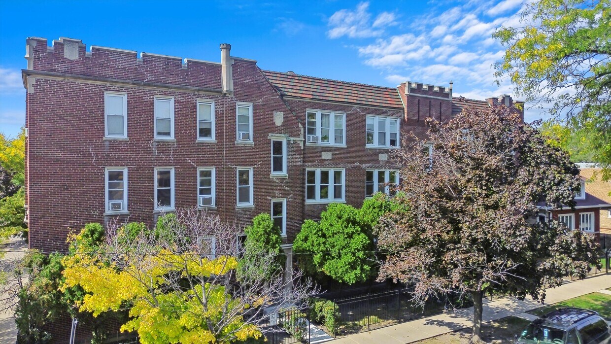
3000-3008 N Whipple St
3000-3008 N Whipple St,
Chicago,
IL
60618
-
Monthly Rent
$1,895 - $1,995
-
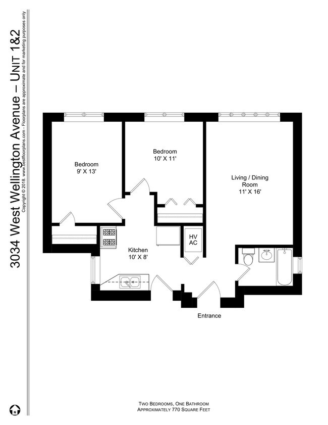
Bedrooms
2 bd
-
Bathrooms
1 ba
-
Square Feet
770 - 1,000 sq ft
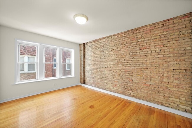
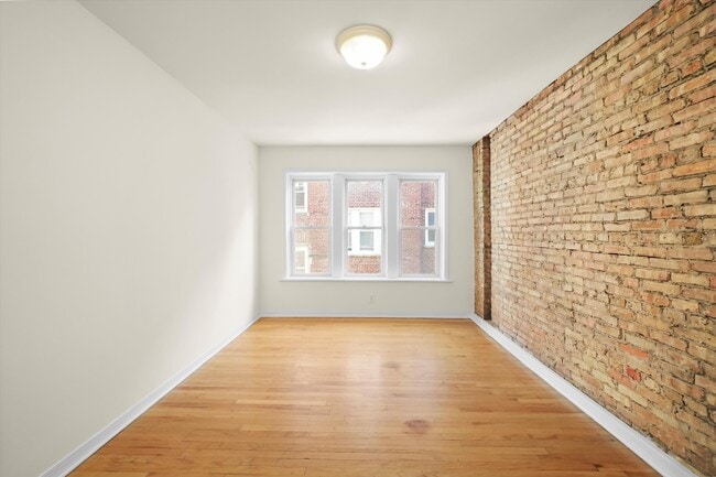
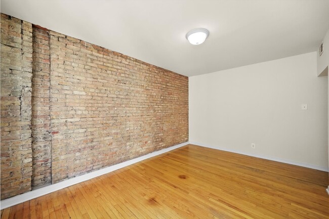
Large 2 bedroom in central Avondale. A stones throw from Small Bar, and walkable to Blue Line train, and the many great restaurants in the area. Features here include hardwood floors throughout, and big windows for great natural light. Great location on a quiet block. Dog and Cat friendly, ask for details. This building features on-site laundry, bike storage, secure entryways, and well-maintained landscaping.
Highlights
- Walker's Paradise
- Gated
- Hardwood Floors
Pricing & Floor Plans
Fees and Policies
The fees listed below are community-provided and may exclude utilities or add-ons. All payments are made directly to the property and are non-refundable unless otherwise specified.
-
Utilities & Essentials
-
Utility - ElectricTenant pays in-unit electric (based on usage). The disclosure lists an estimated annual electricity costs (Including Heating of ($48.26 /month). Charged per unit.Usage-Based
-
Utility BundleTenants pay all common utilities, including water/sewer/trash, hot water (gas) and electric. Listing Agent can provide detailed breakdown of these monthly utility estimates for this apt.. Charged per unit.Varies / mo
-
-
One-Time Basics
-
Application Fee Per ApplicantCharged per applicant.$50
-
Due at Move-In
-
Move-In Fee$400, One Time move-in fee (per tenant). No security deposit. Move-in Fee is due after application approval when tenant picks up keys. Charged per unit.$400
-
-
Pet policies are negotiable.
-
Cats
-
Pet FeeMax of 2. Charged per pet. Payable to 3rd Party$300
0 lbs. Weight Limit, Pet interview, Spayed/NeuteredRestrictions:2 Pet Maximum. No Dogs allowed (unless ESA with paperwork)Read More Read LessComments -
No Parking Available
Property Fee Disclaimer: Based on community-supplied data and independent market research. Subject to change without notice. May exclude fees for mandatory or optional services and usage-based utilities.
Details
Utilities Included
-
Heat
Property Information
-
Built in 1926
-
33 units/3 stories
About 3000-3008 N Whipple St Chicago, IL 60618
Large 2 bedroom in central Avondale. A stones throw from Small Bar, and walkable to Blue Line train, and the many great restaurants in the area. Features here include hardwood floors throughout, and big windows for great natural light. Great location on a quiet block. Dog and Cat friendly, ask for details. This building features on-site laundry, bike storage, secure entryways, and well-maintained landscaping.
3000-3008 N Whipple St is an apartment community located in Cook County and the 60618 ZIP Code. This area is served by the Chicago Public Schools attendance zone.
Contact
Community Amenities
- Laundry Facilities
- Bicycle Storage
- Gated
Apartment Features
Dishwasher
High Speed Internet Access
Hardwood Floors
Refrigerator
- High Speed Internet Access
- Heating
- Smoke Free
- Storage Space
- Dishwasher
- Range
- Refrigerator
- Hardwood Floors
Hip, trendy, and yet somehow still sensible, Logan Square has long been one of Chicago's favorite neighborhoods. The area developed in the early 1800s, when a public green space was designed by landscape architect Jens Jensen. Today, Logan Square Park is located in the heart of the neighborhood, wrapped by Logan Boulevard and divided by Milwaukee Avenue.
Bicycle-friendly Logan Square is all about living local, from its craft breweries to local artists and restaurants. With its wide sidewalks and compact design, Logan Square is very walkable. If you choose a Logan Square apartment, you'll be about five miles from Downtown Chicago, with easy access to mass transit -- just hop on the L's Blue Line from the Logan Square Blue Line Station and you'll be downtown in minutes.
Learn more about living in Logan SquareCompare neighborhood and city base rent averages by bedroom.
| Logan Square | Chicago, IL | |
|---|---|---|
| Studio | $1,374 | $1,632 |
| 1 Bedroom | $1,732 | $2,023 |
| 2 Bedrooms | $2,194 | $2,543 |
| 3 Bedrooms | $2,524 | $3,064 |
- Laundry Facilities
- Gated
- Bicycle Storage
- High Speed Internet Access
- Heating
- Smoke Free
- Storage Space
- Dishwasher
- Range
- Refrigerator
- Hardwood Floors
| Monday | 12am - 12am |
|---|---|
| Tuesday | 12am - 12am |
| Wednesday | 12am - 12am |
| Thursday | 12am - 12am |
| Friday | 12am - 12am |
| Saturday | 12am - 12am |
| Sunday | 12am - 12am |
| Colleges & Universities | Distance | ||
|---|---|---|---|
| Colleges & Universities | Distance | ||
| Drive: | 4 min | 1.5 mi | |
| Drive: | 6 min | 3.0 mi | |
| Drive: | 6 min | 3.5 mi | |
| Drive: | 9 min | 4.8 mi |


View GreatSchools Rating Methodology
Data provided by GreatSchools.org © 2026. All rights reserved.
Transportation options available in Chicago include Belmont Station (Blue Line), located 0.6 mile from 3000-3008 N Whipple St. 3000-3008 N Whipple St is near Chicago Midway International, located 12.0 miles or 23 minutes away, and Chicago O'Hare International, located 12.2 miles or 20 minutes away.
| Transit / Subway | Distance | ||
|---|---|---|---|
| Transit / Subway | Distance | ||
|
|
Walk: | 11 min | 0.6 mi |
|
|
Walk: | 12 min | 0.6 mi |
|
|
Drive: | 3 min | 1.3 mi |
|
|
Drive: | 3 min | 1.4 mi |
|
|
Drive: | 4 min | 2.0 mi |
| Commuter Rail | Distance | ||
|---|---|---|---|
| Commuter Rail | Distance | ||
|
|
Drive: | 4 min | 2.1 mi |
|
|
Drive: | 5 min | 2.4 mi |
|
|
Drive: | 5 min | 2.4 mi |
|
|
Drive: | 5 min | 2.9 mi |
|
|
Drive: | 8 min | 3.7 mi |
| Airports | Distance | ||
|---|---|---|---|
| Airports | Distance | ||
|
Chicago Midway International
|
Drive: | 23 min | 12.0 mi |
|
Chicago O'Hare International
|
Drive: | 20 min | 12.2 mi |
Scores provided by
Traffic
BusyAirport
CalmBusinesses
ActiveScores provided by
HowLoud What is a Sound Score Rating? A Sound Score Rating aggregates noise caused by vehicle traffic, airplane traffic and local sources. How It WorksTime and distance from 3000-3008 N Whipple St.
| Shopping Centers | Distance | ||
|---|---|---|---|
| Shopping Centers | Distance | ||
| Walk: | 10 min | 0.6 mi | |
| Walk: | 15 min | 0.8 mi | |
| Drive: | 3 min | 1.4 mi |
| Parks and Recreation | Distance | ||
|---|---|---|---|
| Parks and Recreation | Distance | ||
|
Kilbourn Park
|
Drive: | 5 min | 2.4 mi |
|
Humboldt Park
|
Drive: | 5 min | 2.5 mi |
|
Wrightwood Park
|
Drive: | 6 min | 3.0 mi |
|
Winnemac Park
|
Drive: | 8 min | 4.1 mi |
|
Chase Park
|
Drive: | 8 min | 4.4 mi |
| Hospitals | Distance | ||
|---|---|---|---|
| Hospitals | Distance | ||
| Drive: | 6 min | 3.0 mi | |
| Drive: | 7 min | 3.4 mi | |
| Drive: | 7 min | 3.6 mi |
| Military Bases | Distance | ||
|---|---|---|---|
| Military Bases | Distance | ||
| Drive: | 28 min | 19.8 mi |
3000-3008 N Whipple St Photos
Nearby Apartments
Within 50 Miles of 3000-3008 N Whipple St Chicago, IL 60618
While 3000-3008 N Whipple St does not provide in‑unit laundry, on‑site laundry facilities are available for shared resident use.
3000-3008 N Whipple St includes heat in rent. Residents are responsible for any other utilities not listed.
Parking is not available at 3000-3008 N Whipple St. Contact this property to explore nearby options.
3000-3008 N Whipple St has two-bedrooms available with rent ranges from $1,895/mo. to $1,995/mo.
Yes, 3000-3008 N Whipple St welcomes pets. Breed restrictions, weight limits, and additional fees may apply. View this property's pet policy.
A good rule of thumb is to spend no more than 30% of your gross income on rent. Based on the lowest available rent of $1,895 for a two-bedrooms, you would need to earn about $75,800 per year to qualify. Want to double-check your budget? Calculate how much rent you can afford with our Rent Affordability Calculator.
3000-3008 N Whipple St is not currently offering any rent specials. Check back soon, as promotions change frequently.
While 3000-3008 N Whipple St does not offer Matterport 3D tours, renters can request a tour directly through our online platform.
What Are Walk Score®, Transit Score®, and Bike Score® Ratings?
Walk Score® measures the walkability of any address. Transit Score® measures access to public transit. Bike Score® measures the bikeability of any address.
What is a Sound Score Rating?
A Sound Score Rating aggregates noise caused by vehicle traffic, airplane traffic and local sources.

3000-3008 N Whipple St
Chicago, IL 60618