

$995
/ Month
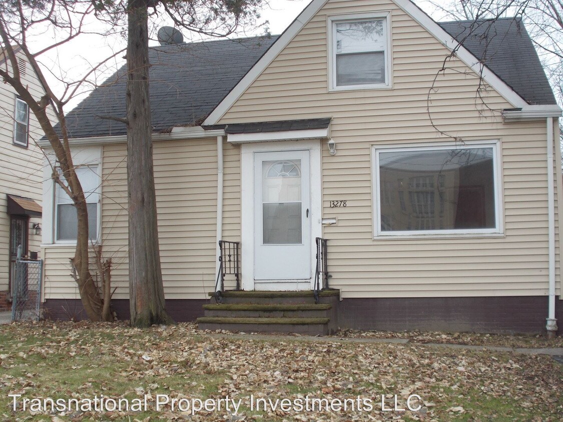
13278 Cedar Rd
Cleveland Heights, OH 44118
2 Weeks Ago
Favorites
13278 Cedar Rd

Favorites
Check Back Soon for Upcoming Availability
| Beds | Baths | Average SF |
|---|---|---|
| 3 Bedrooms 3 Bedrooms 3 Br | 2 Baths 2 Baths 2 Ba | 1,000 SF |
About This Property
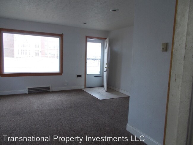
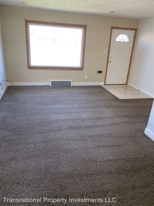
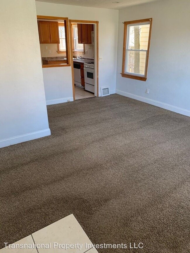
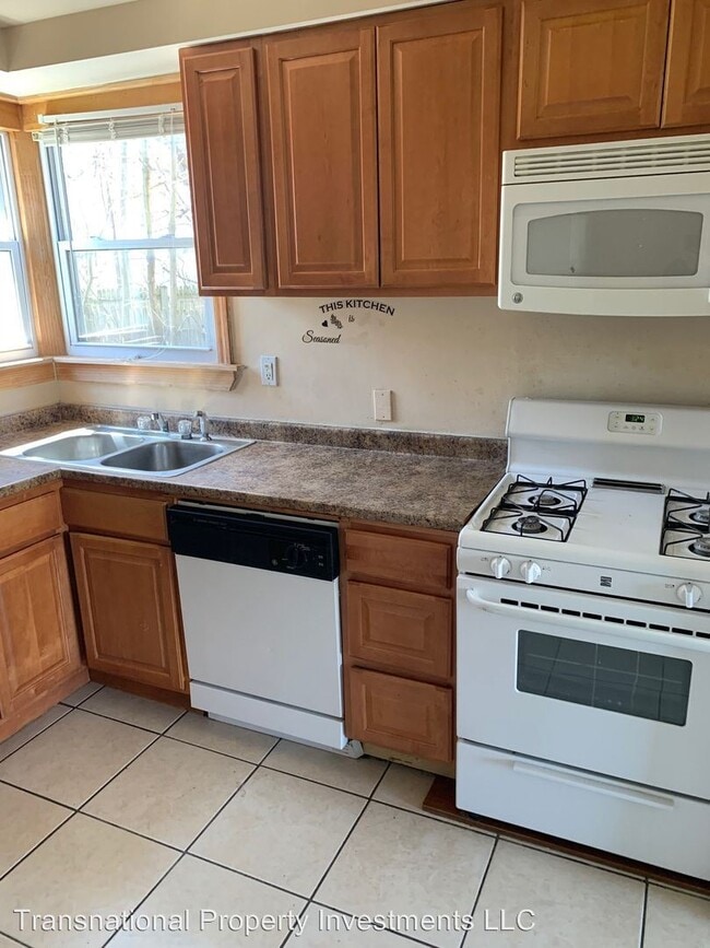
(216) 242-1400 x103 - Beautiful Single Family Home - We our offering a beautiful single family home located in Cleveland heights.This is a 3 bedroom 2 full bathroom home equipped with appliances. Carpeted through-out home. Ceramic tile in bathrooms and kitchen.Nice woodwork framing surrounding the exterior of the home. Updated light fixtures. Nice yard size. Sorry No Subsidy Programs Accepted. (RLNE3849725)
13278 Cedar Rd is a house located in Cuyahoga County and the 44118 ZIP Code. This area is served by the Cleveland Heights-University Heights City attendance zone.
Location
Get Directions
In the 1800s, Cleveland Heights started out as a tiny village preferred by such wealthy Cleveland residents as John D. Rockefeller and Patrick Calhoun. Today, Cleveland Heights is one of the largest cities in the Cleveland Metro Area. It sits between University Heights and University Circle with easy access to schools like Notre Dame College and John Carroll University. With less than 10 miles into Downtown Cleveland, this dynamic, picturesque city is ideal for commuters.
Featuring a variety of architecture ranging from historic mansions to modern apartment complexes, Cleveland Heights has something for everyone. The setting is beautiful, bordering Shaker Lakes and featuring the hiking trails from the Nature Center at Shaker Lakes. Cleveland Heights is known as an arts haven, featuring theaters, art galleries, and a popular arts festival held every summer at Cain Park.
Learn more about living in Cleveland Heights
Education
| Colleges & Universities | Distance | ||
|---|---|---|---|
| Colleges & Universities | Distance | ||
| Drive: | 7 min | 2.6 mi | |
| Drive: | 7 min | 2.8 mi | |
| Drive: | 7 min | 2.9 mi | |
| Drive: | 7 min | 3.0 mi |
13278 Cedar Rd is within 7 minutes or 2.6 miles from John Carroll University. It is also near Cleveland Institute of Art and Case Western Reserve.
Schools


Public Elementary School
Grades K-5
313 Students
Attendance Zone
Public Elementary School
Grades PK-4
386 Students
Nearby
Public Middle School
Grades 6-8
588 Students
Attendance Zone
Public High School
Grades 9-12
1,664 Students
Attendance Zone
Private Elementary, Middle & High School
Grades K-12
Nearby
Private Elementary & Middle School
Grades PK-8
222 Students
Nearby
School data provided by
 The GreatSchools Rating helps parents compare schools within a state based on a variety of school quality indicators and provides a helpful picture of how effectively each school serves all of its students. Ratings are on a scale of 1 (below average) to 10 (above average) and can include test scores, college readiness, academic progress, advanced courses, equity, discipline and attendance data. We also advise parents to visit schools, consider other information on school performance and programs, and consider family needs as part of the school selection process.
View GreatSchools Rating Methodology
Data provided by GreatSchools.org © 2025. All rights reserved.
View GreatSchools Rating Methodology
Data provided by GreatSchools.org © 2025. All rights reserved.
Transportation options available in Cleveland Heights include Lee (Green Line), located 1.6 miles from 13278 Cedar Rd. 13278 Cedar Rd is near Cleveland-Hopkins International, located 19.2 miles or 35 minutes away.
| Transit / Subway | Distance | ||
|---|---|---|---|
| Transit / Subway | Distance | ||
|
|
Drive: | 4 min | 1.6 mi |
|
|
Drive: | 5 min | 1.9 mi |
|
|
Drive: | 5 min | 2.0 mi |
|
|
Drive: | 6 min | 2.2 mi |
|
|
Drive: | 6 min | 2.7 mi |
| Commuter Rail | Distance | ||
|---|---|---|---|
| Commuter Rail | Distance | ||
|
|
Drive: | 21 min | 10.0 mi |
| Drive: | 27 min | 11.1 mi | |
| Drive: | 25 min | 11.2 mi | |
| Drive: | 36 min | 20.8 mi | |
|
Boston Mill
|
Drive: | 38 min | 22.7 mi |
| Airports | Distance | ||
|---|---|---|---|
| Airports | Distance | ||
|
Cleveland-Hopkins International
|
Drive: | 35 min | 19.2 mi |
Time and distance from 13278 Cedar Rd.
| Shopping Centers | Distance | ||
|---|---|---|---|
| Shopping Centers | Distance | ||
| Walk: | 7 min | 0.4 mi | |
| Walk: | 14 min | 0.8 mi | |
| Drive: | 3 min | 1.3 mi |
13278 Cedar Rd has 3 shopping centers within 1.3 miles, which is about a 3-minute walk. The miles and minutes will be for the farthest away property.
| Parks and Recreation | Distance | ||
|---|---|---|---|
| Parks and Recreation | Distance | ||
|
Nature Center at Shaker Lakes
|
Drive: | 5 min | 1.8 mi |
|
Children's Museum of Cleveland
|
Drive: | 6 min | 2.8 mi |
|
Cleveland Botanical Garden
|
Drive: | 7 min | 3.2 mi |
|
Cleveland Museum of Natural History
|
Drive: | 8 min | 3.5 mi |
|
Acacia Reservation
|
Drive: | 9 min | 3.9 mi |
13278 Cedar Rd has 5 parks within 3.9 miles, including Nature Center at Shaker Lakes, Children's Museum of Cleveland, and Cleveland Botanical Garden.
| Hospitals | Distance | ||
|---|---|---|---|
| Hospitals | Distance | ||
| Drive: | 7 min | 3.0 mi | |
| Drive: | 7 min | 3.0 mi | |
| Drive: | 8 min | 3.5 mi |
13278 Cedar Rd has 3 hospitals within 3.5 miles, the nearest is Rainbow Babies and Childrens Hospital which is 3.0 miles away and a 7 minute drive.
| Military Bases | Distance | ||
|---|---|---|---|
| Military Bases | Distance | ||
| Drive: | 108 min | 87.5 mi |
13278 Cedar Rd is 87.5 miles and a 108 minute drive from Mansfield Lahm Airport Air Guard Station.
You May Also Like
Similar Rentals Nearby


What Are Walk Score®, Transit Score®, and Bike Score® Ratings?
Walk Score® measures the walkability of any address. Transit Score® measures access to public transit. Bike Score® measures the bikeability of any address.
What is a Sound Score Rating?
A Sound Score Rating aggregates noise caused by vehicle traffic, airplane traffic and local sources
13278 Cedar Rd
Cleveland Heights, OH 44118