$1,295 / Month
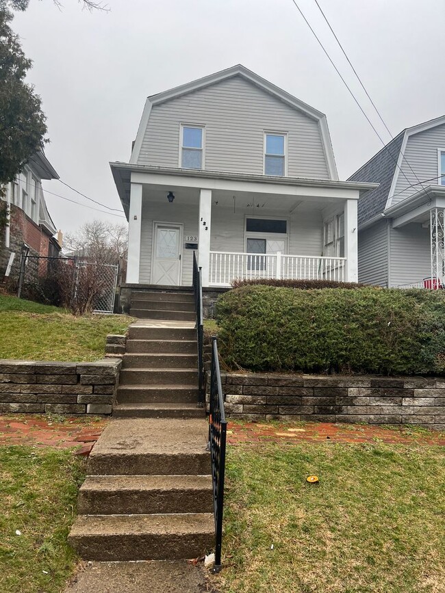
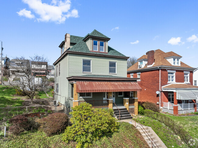
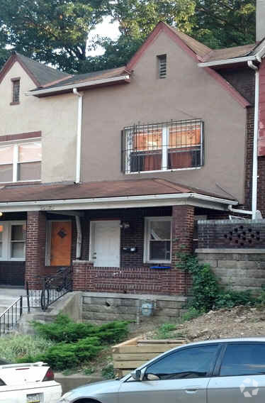
123 Calhoun Ave
Pittsburgh, PA 15210
2 Weeks Ago
Favorites
123 Calhoun Ave

Favorites
Check Back Soon for Upcoming Availability
| Beds | Baths | Average SF |
|---|---|---|
| 2 Bedrooms 2 Bedrooms 2 Br | 1 Bath 1 Bath 1 Ba | 1,100 SF |
About This Property
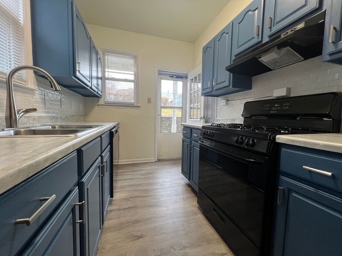
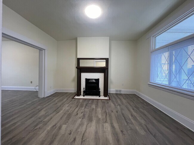
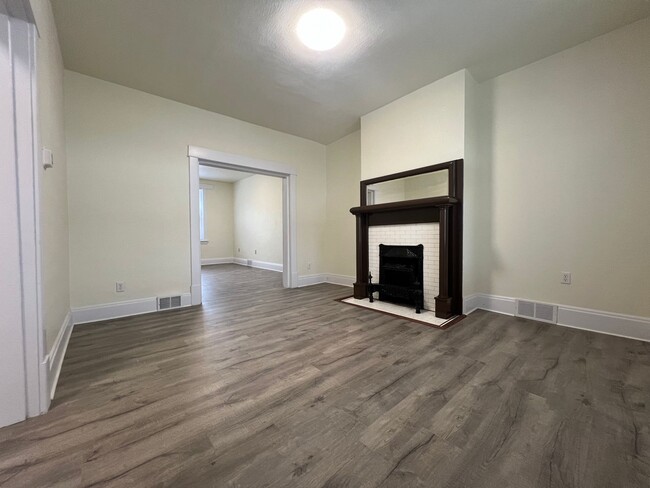
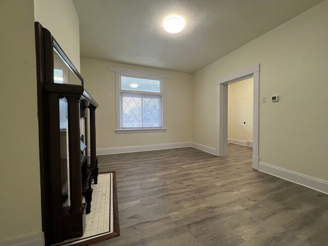
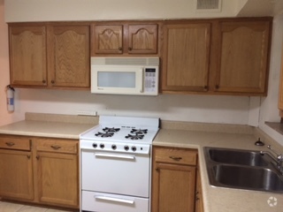
Check out this nice 2BR 1 bath house! On a beautiful / quieter street. Just repainted and floored. Fenced in backyard. Covered front porch, basement great for extra storage, central heat and AC. Tenants responsible for rent plus utilities. -Hard surface flooring throughout (carpeting on steps only) -Forced heat/ AC -Washer/ dryer in unit -Spacious basement -Front porch -Fenced in yard -Online applications ($25 App fee) -In walking distance to bus stops (Brownsville Rd) Right up the street on Brownsville Rd you have access to bus lines, shops, and the library. Echt Coffee House and Brown Bear Bakery are close by for a good cup of coffee or something to eat. Minutes to south side flats - LA fitness, Carmella's Plates and Pints, Giant Eagle Aldi, Cheesecake Factory. Short drive to Oakland, Downtown, Pittsburgh Waterfront. Easy access to 376/51. Leasing requirements: -Monthly income needs to be 3x the amount of rent -No criminal background -No past evictions -Credit score 650+ range *We do accept Co-signers (if income/ credit requirements not met) Don't miss out, SCHEDULE a showing today!
123 Calhoun Ave is a house located in Allegheny County and the 15210 ZIP Code. This area is served by the Pittsburgh Public Schools attendance zone.
Location
Get Directions
Located about five miles south of Downtown Pittsburgh, Carrick merges the feel of a big city with the charming atmosphere of a small town. Known to the locals as "the Hilltop," Carrick is filled with green space and parks for residents to enjoy. Phillips Park provides many activities for everyone, such as outdoor movies, live jazz concerts in the summer, a dedicated off-leash dog park, fitness walks and 5K runs, and summer day camps.
The neighborhood has grocers, stores, and locally owned restaurants, many of which are located along Brownsville Road, the main thoroughfare in the neighborhood. Shop for fresh produce and support local farmers at the Carrick Farmers Market or try longstanding favorites like Ester's Homemade Candy, which has been in business for over 40 years. For even more options for shopping and dining, residents can hop on Highway 51 or use one of Carrick’s subway stations to travel into the heart of the city.
Learn more about living in CarrickBelow are rent ranges for similar nearby apartments
Education
| Colleges & Universities | Distance | ||
|---|---|---|---|
| Colleges & Universities | Distance | ||
| Drive: | 7 min | 3.2 mi | |
| Drive: | 7 min | 3.3 mi | |
| Drive: | 7 min | 3.3 mi | |
| Drive: | 11 min | 4.3 mi |
123 Calhoun Ave is within 7 minutes or 3.3 miles from Duquesne University. It is also near The Art Inst. of Pittsburgh and Point Park University.
Schools


Public Middle & High School
Grades PK & 6-12
616 Students
Attendance Zone
Public Elementary & Middle School
Grades PK-8
558 Students
Attendance Zone
Public Elementary School
Grades PK-5
252 Students
Attendance Zone
Public Middle School
Grades 6-8
272 Students
Attendance Zone
Public High School
Grades 9-12
594 Students
Attendance Zone
Private Elementary & Middle School
Grades PK-8
Nearby
Private Middle & High School
Grades 7-12
60 Students
Nearby
School data provided by
 The GreatSchools Rating helps parents compare schools within a state based on a variety of school quality indicators and provides a helpful picture of how effectively each school serves all of its students. Ratings are on a scale of 1 (below average) to 10 (above average) and can include test scores, college readiness, academic progress, advanced courses, equity, discipline and attendance data. We also advise parents to visit schools, consider other information on school performance and programs, and consider family needs as part of the school selection process.
View GreatSchools Rating Methodology
View GreatSchools Rating Methodology
Transportation options available in Pittsburgh include Bon Air, located 1.1 miles from 123 Calhoun Ave. 123 Calhoun Ave is near Pittsburgh International, located 20.0 miles or 32 minutes away, and Arnold Palmer Regional, located 44.1 miles or 71 minutes away.
| Transit / Subway | Distance | ||
|---|---|---|---|
| Transit / Subway | Distance | ||
|
|
Drive: | 4 min | 1.1 mi |
|
|
Drive: | 3 min | 1.2 mi |
|
|
Drive: | 3 min | 1.3 mi |
|
|
Drive: | 6 min | 2.3 mi |
|
|
Drive: | 6 min | 2.4 mi |
| Commuter Rail | Distance | ||
|---|---|---|---|
| Commuter Rail | Distance | ||
|
|
Drive: | 8 min | 3.6 mi |
|
|
Drive: | 55 min | 34.6 mi |
|
|
Drive: | 67 min | 41.1 mi |
|
|
Drive: | 69 min | 50.8 mi |
| Airports | Distance | ||
|---|---|---|---|
| Airports | Distance | ||
|
Pittsburgh International
|
Drive: | 32 min | 20.0 mi |
|
Arnold Palmer Regional
|
Drive: | 71 min | 44.1 mi |
Time and distance from 123 Calhoun Ave.
| Shopping Centers | Distance | ||
|---|---|---|---|
| Shopping Centers | Distance | ||
| Walk: | 2 min | 0.1 mi | |
| Drive: | 4 min | 1.2 mi | |
| Drive: | 6 min | 2.5 mi |
123 Calhoun Ave has 3 shopping centers within 2.5 miles, which is about a 6-minute walk. The miles and minutes will be for the farthest away property.
| Parks and Recreation | Distance | ||
|---|---|---|---|
| Parks and Recreation | Distance | ||
|
Point State Park
|
Drive: | 9 min | 4.0 mi |
|
Phipps Conservatory and Gardens
|
Drive: | 12 min | 4.8 mi |
|
Carnegie Museum of Natural History
|
Drive: | 13 min | 4.8 mi |
|
Carnegie Science Center
|
Drive: | 11 min | 4.8 mi |
|
Schenley Park
|
Drive: | 13 min | 5.2 mi |
123 Calhoun Ave has 5 parks within 5.2 miles, including Point State Park, Carnegie Museum of Natural History, and Carnegie Science Center.
| Hospitals | Distance | ||
|---|---|---|---|
| Hospitals | Distance | ||
| Drive: | 8 min | 3.6 mi | |
| Drive: | 10 min | 4.0 mi | |
| Drive: | 11 min | 4.4 mi |
123 Calhoun Ave has 3 hospitals within 4.4 miles, the nearest is UPMC Mercy which is 3.6 miles away and a 8 minute drive.
| Military Bases | Distance | ||
|---|---|---|---|
| Military Bases | Distance | ||
| Drive: | 28 min | 18.4 mi |
123 Calhoun Ave is 18.4 miles and a 28 minute drive from Pittsburgh Air Reserve Station.
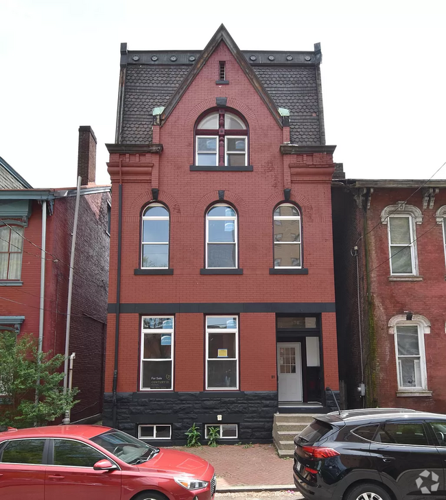
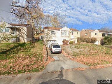
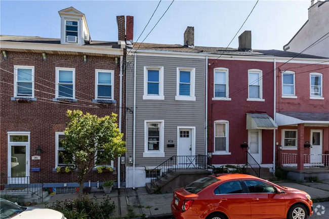
You May Also Like
Similar Rentals Nearby
What Are Walk Score®, Transit Score®, and Bike Score® Ratings?
Walk Score® measures the walkability of any address. Transit Score® measures access to public transit. Bike Score® measures the bikeability of any address.
What is a Sound Score Rating?
A Sound Score Rating aggregates noise caused by vehicle traffic, airplane traffic and local sources

123 Calhoun Ave
Pittsburgh, PA 15210