$2,100
/ Month
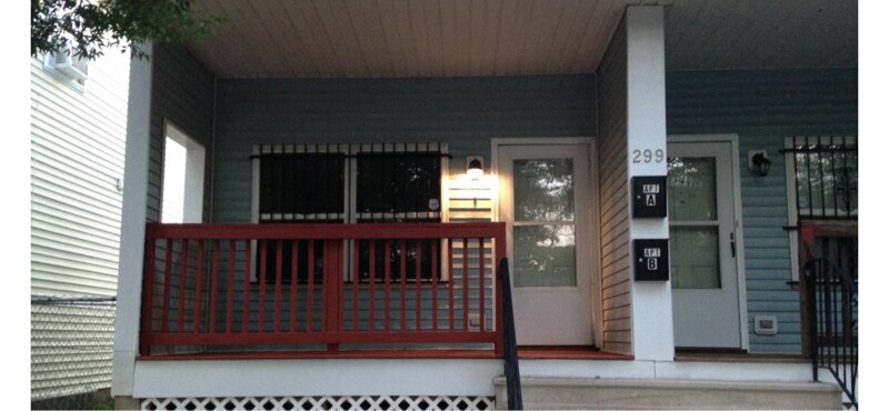
299 Hunterdon St Unit B
Newark, NJ 07103
Favorites
299 Hunterdon St Unit B

Favorites
Check Back Soon for Upcoming Availability
| Beds | Baths | Average SF |
|---|---|---|
| 3 Bedrooms 3 Bedrooms 3 Br | 1.5 Baths 1.5 Baths 1.5 Ba | 1,100 SF |
Fees and Policies
The fees listed below are community-provided and may exclude utilities or add-ons. All payments are made directly to the property and are non-refundable unless otherwise specified.
- Dogs Allowed
-
Fees not specified
- Cats Allowed
-
Fees not specified
Details
Utilities Included
-
Gas
-
Water
-
Sewer
About This Property
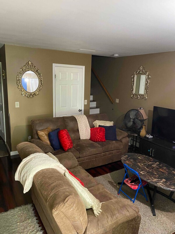
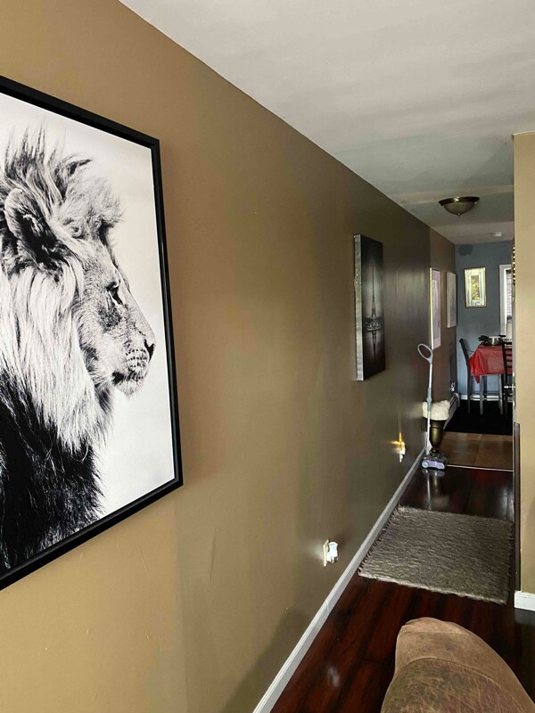
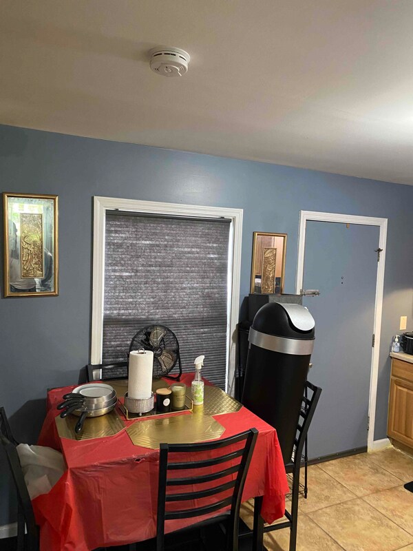
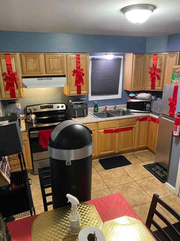
Property Id: 1204703 This is a 2 floor 3 bedroom 1.5 bathroom apartment with heat and hot water included this apt was renovated 2 years ago. Section 8 welcome
299 Hunterdon St is an apartment community located in Essex County and the 07103 ZIP Code.
Features
- Oven
- Fenced Lot
299 Hunterdon St,
Newark,
NJ
07103
Springfield-Belmont is an urban neighborhood in the heart of Newark. Filled with community parks like Jesse Allen Park and Nat Turner Park, the area is very family friendly. Springfield-Belmont sits just south of Rutgers University Newark Campus in University Heights. Residents of this convenient area have easy access to everything Downtown Newark has to offer, including the Prudential Center, the New Jersey Performing Arts Center, and University Hospital. Locals can easily travel to New York City as well, making this an ideal neighborhood for students and commuters.
Learn more about living in Springfield-BelmontBelow are rent ranges for similar nearby apartments
Amenities
- Oven
- Fenced Lot
Expenses
Utilities Included
Gas, Water, Sewer
Included
Education
| Colleges & Universities | Distance | ||
|---|---|---|---|
| Colleges & Universities | Distance | ||
| Drive: | 2 min | 1.2 mi | |
| Drive: | 3 min | 1.4 mi | |
| Drive: | 3 min | 1.7 mi | |
| Drive: | 8 min | 3.5 mi |
299 Hunterdon St Unit B is within 2 minutes or 1.2 miles from Essex County College. It is also near N.J. Inst. of Technology and Rutgers, Newark Campus.
Transportation options available in Newark include Warren Street, located 1.2 miles from 299 Hunterdon St Unit B. 299 Hunterdon St Unit B is near Newark Liberty International, located 5.7 miles or 9 minutes away, and LaGuardia, located 28.4 miles or 43 minutes away.
| Transit / Subway | Distance | ||
|---|---|---|---|
| Transit / Subway | Distance | ||
|
|
Drive: | 2 min | 1.2 mi |
|
|
Drive: | 2 min | 1.3 mi |
|
|
Drive: | 2 min | 1.3 mi |
|
|
Drive: | 3 min | 1.4 mi |
|
|
Drive: | 3 min | 1.5 mi |
| Commuter Rail | Distance | ||
|---|---|---|---|
| Commuter Rail | Distance | ||
|
|
Drive: | 3 min | 1.8 mi |
|
|
Drive: | 4 min | 2.0 mi |
|
|
Drive: | 5 min | 2.6 mi |
|
|
Drive: | 6 min | 2.7 mi |
|
|
Drive: | 10 min | 4.1 mi |
| Airports | Distance | ||
|---|---|---|---|
| Airports | Distance | ||
|
Newark Liberty International
|
Drive: | 9 min | 5.7 mi |
|
LaGuardia
|
Drive: | 43 min | 28.4 mi |
Walkability Near 299 Hunterdon St Newark, NJ 07103
Getting Around
 What do Walkability, Transit, Drivability, and Bikeability mean?
Walkability measures the walking distance to day-to-day needs.
Transit measures access to public transportation.
Drivability measures congestion, parking availability, and access to major roads.
Bikeability measures the suitability for cycling.
How It Works
What do Walkability, Transit, Drivability, and Bikeability mean?
Walkability measures the walking distance to day-to-day needs.
Transit measures access to public transportation.
Drivability measures congestion, parking availability, and access to major roads.
Bikeability measures the suitability for cycling.
How It Works
Exceptionally Walkable
Walkability
100
/ 100
Exceptional Public Transit
Transit
90
/ 100
Fairly Drivable
Drivability
40
/ 100
Fairly Bikeable
Bikeability
50
/ 100
Scores provided by
-
Soundscore™
-
/ 100
Traffic
-Airport
-Businesses
-Scores provided by
HowLoud What is a Sound Score Rating? A Sound Score Rating aggregates noise caused by vehicle traffic, airplane traffic and local sources. How It WorksTime and distance from 299 Hunterdon St Unit B.
| Shopping Centers | Distance | ||
|---|---|---|---|
| Shopping Centers | Distance | ||
| Walk: | 8 min | 0.4 mi | |
| Walk: | 10 min | 0.5 mi | |
| Walk: | 14 min | 0.7 mi |
299 Hunterdon St Unit B has 3 shopping centers within 0.7 mile, which is about a 14-minute walk. The miles and minutes will be for the farthest away property.
| Parks and Recreation | Distance | ||
|---|---|---|---|
| Parks and Recreation | Distance | ||
|
Newark Museum and Dreyfuss Planetarium
|
Drive: | 3 min | 1.6 mi |
|
Branch Brook Park
|
Drive: | 7 min | 3.1 mi |
|
Kearny Marsh
|
Drive: | 10 min | 4.6 mi |
|
Edison National Historic Site
|
Drive: | 11 min | 5.3 mi |
|
Turtle Back Zoo
|
Drive: | 14 min | 7.3 mi |
299 Hunterdon St Unit B has 5 parks within 7.3 miles, including Newark Museum and Dreyfuss Planetarium, Branch Brook Park, and Kearny Marsh.
| Hospitals | Distance | ||
|---|---|---|---|
| Hospitals | Distance | ||
| Walk: | 9 min | 0.5 mi | |
| Drive: | 3 min | 1.7 mi | |
| Drive: | 4 min | 2.3 mi |
299 Hunterdon St Unit B has 3 hospitals within 2.3 miles, the nearest is The University Hospital which is 0.5 mile away and a 9 minute walk.
| Military Bases | Distance | ||
|---|---|---|---|
| Military Bases | Distance | ||
| Drive: | 15 min | 9.5 mi | |
| Drive: | 27 min | 17.1 mi | |
| Drive: | 31 min | 17.7 mi |
299 Hunterdon St Unit B has 3 military bases within 17.7 miles, the nearest is Military Ocean Terminal which is 9.5 miles away and a 15 minute drive.
You May Also Like
How do I access Social Services in New Jersey?
Statewide service is free, confidential, multilingual and always open. Three easy ways to reach Social Services in NJ: Dial 2-1-1; text your zip code to 898-211; or chat at https://www.nj211.org
Similar Rentals Nearby
-
-
-
1 / 15
 3 Beds$7,027+Total Monthly PriceTotal Monthly Price NewPrices include base rent and required monthly fees of $94. Variable costs based on usage may apply.Base Rent:3 Beds$6,932+2 Months Free
Pets Allowed
-
-
-
-
-
-
-


What Are Walk Score®, Transit Score®, and Bike Score® Ratings?
Walk Score® measures the walkability of any address. Transit Score® measures access to public transit. Bike Score® measures the bikeability of any address.
What is a Sound Score Rating?
A Sound Score Rating aggregates noise caused by vehicle traffic, airplane traffic and local sources.

299 Hunterdon St
Newark, NJ 07103