

$3,100
/ Month
299 Cole St
San Francisco, CA 94117
Favorites
299 Cole St

Favorites
Check Back Soon for Upcoming Availability
| Beds | Baths | Average SF |
|---|---|---|
| 1 Bedroom 1 Bedroom 1 Br | 1 Bath 1 Bath 1 Ba | — |
About This Property
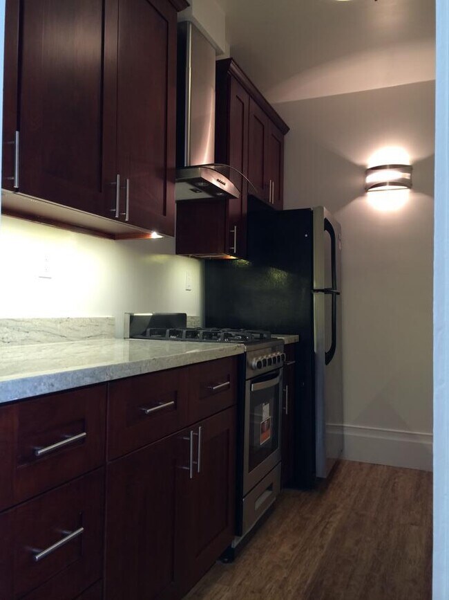
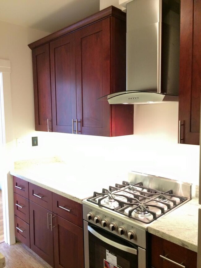
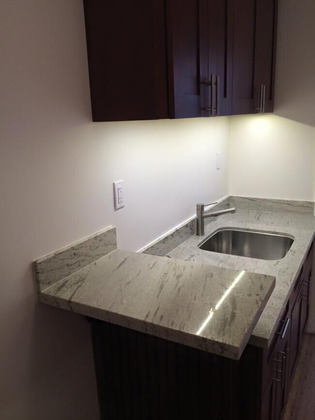
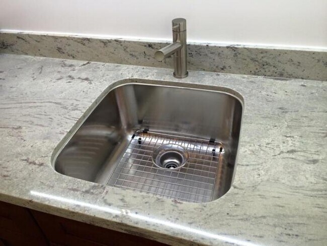
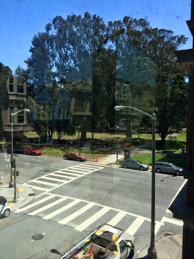
This beautiful 1BR has a view of the Panhandle, a new kitchen with marble countertops and a large, new, bathroom. NOTE: the pictures do not reflect the new, smaller, heaters which were recently installed or the smart/IFTT fixtures. The apartment is designed for efficiency and energy savings: - double paned windows - on-demand hot water - energy efficient appliances - independent thermostatic control - built-in USB charging - HomeKit, Alexa, Google Assistant, WiFi, IFTT light switches. With a walkscore.com score of 94-79-93, this is an urban dweller's dream. Within easy reach by walking, biking or a short transit ride: - Grocery - - Trader Joe's, Whole Foods, Haight Street Market (Guss'), New May Wah/Clement Street, Safeway - Restaurants/Bars - - 9th and Irving Corridor, Geary Corridor, Clement Street, The Haight, Cole Valley, The Castro, Inner Mission, Dolores Corridor Golden Gate Park and Keezar Stadium are a short walk/run away and all corners of the City are reachable with one transfer. This apartment is rent controlled! We pay water usage and garbage (including recycling and compost). Optional bike parking in the lower levels. Incoming laundry. LID: 42779941.
299 Cole St is a condo located in San Francisco County and the 94117 ZIP Code. This area is served by the San Francisco Unified School District attendance zone.
299 Cole St,
San Francisco,
CA
94117
Rent your apartment in the Panhandle neighborhood and enjoy San Francisco's Golden Gate Park any time you want. The neighborhood is only a block wide for much of its 10-block length, so most neighborhood rentals are within steps of Golden Gate Park's panhandle and the trails leading into the heart of that famous open space.
Find your neighbors at a picnic area in the panhandle or at a number of attractions at Golden Gate Park, such as the tranquil Japanese Gardens, the zoo, or the California Academy of Sciences. Explore the park's Spreckels Lake, where model boat lovers launch their creations. Head to the western edge of the park and find Ocean Beach roughly four miles away.
You'll find Tony's Cable Car Restaurant, a local burger hangout complete with old-style neon signs, less than a mile from the panhandle. The closest shopping malls include the Westfield San Francisco Centre and the Potrero Center, both about three miles east.
Learn more about living in Panhandle
Education
| Colleges & Universities | Distance | ||
|---|---|---|---|
| Colleges & Universities | Distance | ||
| Walk: | 8 min | 0.4 mi | |
| Drive: | 5 min | 1.6 mi | |
| Drive: | 5 min | 1.6 mi | |
| Drive: | 9 min | 3.1 mi |
299 Cole St is within 8 minutes or 0.4 mile from University of San Francisco. It is also near UC San Francisco, Parnassus and UC San Francisco, Mount Zion.
Schools


Public Elementary School
Grades K-5
Nearby
Public Elementary School
Grades K-5
259 Students
Attendance Zone
Public Middle School
Grades 6-8
657 Students
Attendance Zone
Public High School
Grades 9-12
522 Students
Nearby
Private Elementary & Middle School
Grades K-8
421 Students
Nearby
Private Middle & High School
Grades 6-12
7 Students
Nearby
Private Middle & High School
Grades 6-12
46 Students
Nearby
School data provided by
 The GreatSchools Rating helps parents compare schools within a state based on a variety of school quality indicators and provides a helpful picture of how effectively each school serves all of its students. Ratings are on a scale of 1 (below average) to 10 (above average) and can include test scores, college readiness, academic progress, advanced courses, equity, discipline and attendance data. We also advise parents to visit schools, consider other information on school performance and programs, and consider family needs as part of the school selection process.
View GreatSchools Rating Methodology
Data provided by GreatSchools.org © 2026. All rights reserved.
View GreatSchools Rating Methodology
Data provided by GreatSchools.org © 2026. All rights reserved.
Transportation options available in San Francisco include Carl St & Cole St, located 0.5 mile from 299 Cole St. 299 Cole St is near San Francisco International, located 15.1 miles or 26 minutes away, and Metro Oakland International, located 22.5 miles or 36 minutes away.
| Transit / Subway | Distance | ||
|---|---|---|---|
| Transit / Subway | Distance | ||
| Walk: | 9 min | 0.5 mi | |
| Walk: | 12 min | 0.6 mi | |
|
|
Walk: | 16 min | 0.8 mi |
| Walk: | 17 min | 0.9 mi | |
|
|
Drive: | 3 min | 1.2 mi |
| Commuter Rail | Distance | ||
|---|---|---|---|
| Commuter Rail | Distance | ||
| Drive: | 9 min | 4.2 mi | |
| Drive: | 15 min | 7.3 mi | |
| Drive: | 20 min | 11.7 mi | |
| Drive: | 22 min | 12.1 mi | |
|
|
Drive: | 25 min | 14.1 mi |
| Airports | Distance | ||
|---|---|---|---|
| Airports | Distance | ||
|
San Francisco International
|
Drive: | 26 min | 15.1 mi |
|
Metro Oakland International
|
Drive: | 36 min | 22.5 mi |
Walkability Near 299 Cole St San Francisco, CA 94117
Getting Around
 What do Walkability, Transit, Drivability, and Bikeability mean?
Walkability measures the walking distance to day-to-day needs.
Transit measures access to public transportation.
Drivability measures congestion, parking availability, and access to major roads.
Bikeability measures the suitability for cycling.
How It Works
What do Walkability, Transit, Drivability, and Bikeability mean?
Walkability measures the walking distance to day-to-day needs.
Transit measures access to public transportation.
Drivability measures congestion, parking availability, and access to major roads.
Bikeability measures the suitability for cycling.
How It Works
Very Walkable
Walkability
80
/ 100
Exceptional Public Transit
Transit
100
/ 100
Moderately Drivable
Drivability
60
/ 100
Exceptionally Bikeable
Bikeability
90
/ 100
Scores provided by
-
Soundscore™
-
/ 100
Traffic
-Airport
-Businesses
-Scores provided by
HowLoud What is a Sound Score Rating? A Sound Score Rating aggregates noise caused by vehicle traffic, airplane traffic and local sources. How It WorksTime and distance from 299 Cole St.
| Shopping Centers | Distance | ||
|---|---|---|---|
| Shopping Centers | Distance | ||
| Walk: | 20 min | 1.0 mi | |
| Drive: | 5 min | 1.6 mi |
299 Cole St has 2 shopping centers within 1.6 miles, which is about a 5-minute drive. The miles and minutes will be for the farthest away property.
| Parks and Recreation | Distance | ||
|---|---|---|---|
| Parks and Recreation | Distance | ||
|
Conservatory of Flowers
|
Walk: | 9 min | 0.5 mi |
|
Buena Vista Park
|
Drive: | 4 min | 1.2 mi |
|
Randall Museum
|
Drive: | 4 min | 1.3 mi |
|
California Academy of Sciences
|
Drive: | 4 min | 1.4 mi |
|
Steinhart Aquarium
|
Drive: | 4 min | 1.4 mi |
299 Cole St has 5 parks within 1.4 miles, including Conservatory of Flowers, Buena Vista Park, and California Academy of Sciences.
| Hospitals | Distance | ||
|---|---|---|---|
| Hospitals | Distance | ||
| Walk: | 5 min | 0.3 mi | |
| Walk: | 17 min | 0.9 mi | |
| Walk: | 18 min | 1.0 mi |
299 Cole St has 3 hospitals within 1.0 mile, the nearest is St. Mary's Medical Center which is 0.3 mile away and a 5 minute walk.
| Military Bases | Distance | ||
|---|---|---|---|
| Military Bases | Distance | ||
| Drive: | 10 min | 3.7 mi | |
| Drive: | 11 min | 4.2 mi | |
| Drive: | 19 min | 8.6 mi |
299 Cole St has 3 military bases within 8.6 miles, the nearest is East Fort Miley which is 3.7 miles away and a 10 minute drive.
You May Also Like
Similar Rentals Nearby


What Are Walk Score®, Transit Score®, and Bike Score® Ratings?
Walk Score® measures the walkability of any address. Transit Score® measures access to public transit. Bike Score® measures the bikeability of any address.
What is a Sound Score Rating?
A Sound Score Rating aggregates noise caused by vehicle traffic, airplane traffic and local sources.
299 Cole St
San Francisco, CA 94117