
$2,395
/ Month
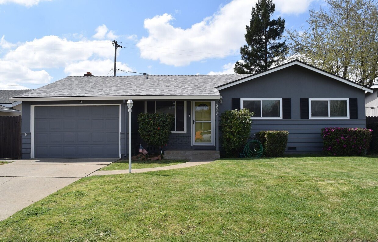
2956 Terilyn St
Sacramento, CA 95826
2 Weeks Ago
Favorites
2956 Terilyn St

Favorites
Check Back Soon for Upcoming Availability
| Beds | Baths | Average SF |
|---|---|---|
| 3 Bedrooms 3 Bedrooms 3 Br | 2 Baths 2 Baths 2 Ba | 1,126 SF |
About This Property
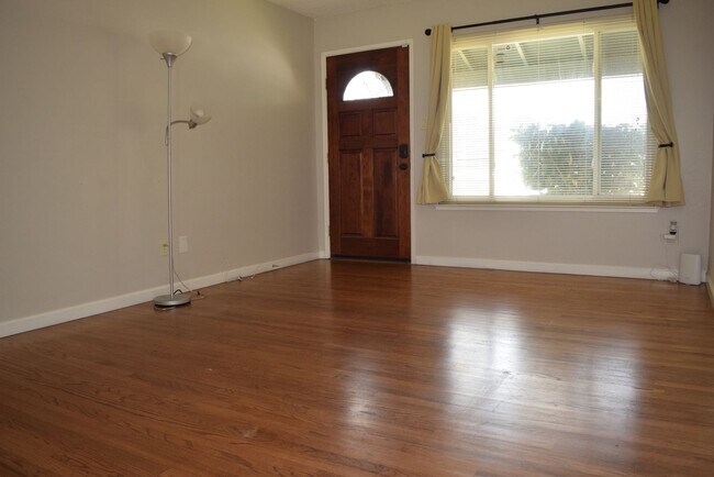
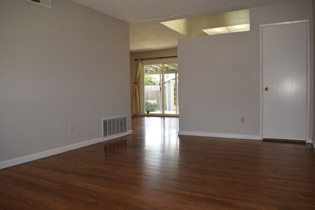
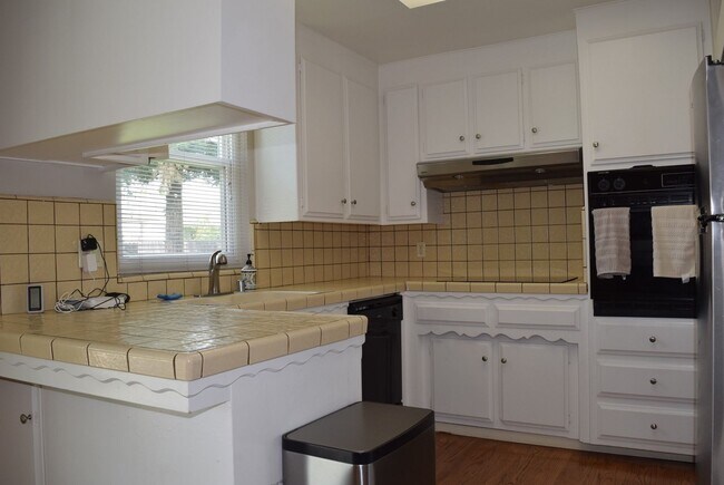
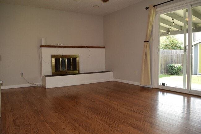
Located in the Rosemont area of East Sacramento, this 3 bed 2 bath home is in close proximity to a list of shopping and dining locations, schools, local parks, and easy access to Highway 50. This property has been recently updated a with a fresh coat of paint throughout bringing a modern touch to a classic home, includes a 1 car garage, and a detached bonus room in the backyard for the tenant's use. The owner is willing to consider working with pets under 25 pounds on a case by case basis, depending on the strength of your application. Resident Benefits Package (RBP) - $50/month All RNB residents for this property are enrolled in the Resident Benefits Package which includes a variety of services designed to enhance your living experience and help manage your home efficiently. More details will be provided upon request.
2956 Terilyn St is a house located in Sacramento County and the 95826 ZIP Code. This area is served by the Sacramento City Unified attendance zone.
Location
Get Directions
Southeastern Sacramento gives residents a chance to live in a spread-out residential area just 25 minutes from downtown. Located near Tahoe Park and the U.C. Davis Medical Center, the neighborhood displays old and new homes alike. Locals in Southeastern Sacramento enjoy a suburban neighborhood and the option of attending shows and taking in the delights of Old Sacramento just a short distance away.
Sacramento, California’s capital city, continues to cement its reputation as a developing metropolitan center in the middle of California. With lower rents than in the San Francisco Bay Area and close proximity to vacation spots in Lake Tahoe and Yosemite National Park, Sacramento proves to be a great option for travelers who want a taste of California at a more affordable price.
Learn more about living in Southeastern SacramentoBelow are rent ranges for similar nearby apartments
| Beds | Average Size | Lowest | Typical | Premium |
|---|---|---|---|---|
| Studio Studio Studio | 362 Sq Ft | $1,385 | $1,392 | $1,395 |
| 1 Bed 1 Bed 1 Bed | 651-652 Sq Ft | $1,350 | $2,403 | $4,724 |
| 2 Beds 2 Beds 2 Beds | 872 Sq Ft | $575 | $2,451 | $6,207 |
| 3 Beds 3 Beds 3 Beds | 1274-1292 Sq Ft | $1,199 | $2,384 | $3,741 |
| 4 Beds 4 Beds 4 Beds | 1416 Sq Ft | $899 | $1,084 | $2,450 |
Education
| Colleges & Universities | Distance | ||
|---|---|---|---|
| Colleges & Universities | Distance | ||
| Drive: | 7 min | 3.1 mi | |
| Drive: | 14 min | 7.8 mi | |
| Drive: | 20 min | 9.4 mi | |
| Drive: | 20 min | 9.4 mi |
2956 Terilyn St is within 7 minutes or 3.1 miles from Sacramento State. It is also near Sacramento City College and American River College.
Schools


Public Elementary School
Grades K-3
372 Students
Nearby
Public Elementary School
Grades K-6
399 Students
Attendance Zone
Public Middle & High School
Grades 7-12
536 Students
Attendance Zone
Public High School
Grades 9-12
1,514 Students
Attendance Zone
Private Elementary School
Grades PK-6
211 Students
Nearby
Private Elementary, Middle & High School
Grades PK-12
507 Students
Nearby
Private High School
Grades 9-12
373 Students
Nearby
School data provided by
 The GreatSchools Rating helps parents compare schools within a state based on a variety of school quality indicators and provides a helpful picture of how effectively each school serves all of its students. Ratings are on a scale of 1 (below average) to 10 (above average) and can include test scores, college readiness, academic progress, advanced courses, equity, discipline and attendance data. We also advise parents to visit schools, consider other information on school performance and programs, and consider family needs as part of the school selection process.
View GreatSchools Rating Methodology
Data provided by GreatSchools.org © 2025. All rights reserved.
View GreatSchools Rating Methodology
Data provided by GreatSchools.org © 2025. All rights reserved.
Transportation options available in Sacramento include College Greens, located 1.0 mile from 2956 Terilyn St. 2956 Terilyn St is near Sacramento International, located 19.4 miles or 29 minutes away.
| Transit / Subway | Distance | ||
|---|---|---|---|
| Transit / Subway | Distance | ||
|
|
Walk: | 18 min | 1.0 mi |
|
|
Walk: | 21 min | 1.1 mi |
|
|
Drive: | 4 min | 1.8 mi |
|
|
Drive: | 5 min | 2.1 mi |
|
|
Drive: | 6 min | 2.8 mi |
| Commuter Rail | Distance | ||
|---|---|---|---|
| Commuter Rail | Distance | ||
| Drive: | 15 min | 7.6 mi | |
|
|
Drive: | 30 min | 18.4 mi |
|
|
Drive: | 31 min | 20.5 mi |
|
|
Drive: | 28 min | 21.0 mi |
|
|
Drive: | 44 min | 32.8 mi |
| Airports | Distance | ||
|---|---|---|---|
| Airports | Distance | ||
|
Sacramento International
|
Drive: | 29 min | 19.4 mi |
Time and distance from 2956 Terilyn St.
| Shopping Centers | Distance | ||
|---|---|---|---|
| Shopping Centers | Distance | ||
| Walk: | 18 min | 1.0 mi | |
| Walk: | 18 min | 1.0 mi | |
| Drive: | 3 min | 1.2 mi |
2956 Terilyn St has 3 shopping centers within 1.2 miles, which is about a 3-minute walk. The miles and minutes will be for the farthest away property.
| Parks and Recreation | Distance | ||
|---|---|---|---|
| Parks and Recreation | Distance | ||
|
Paradise Beach County Recreation Area
|
Drive: | 8 min | 3.9 mi |
|
Sutter's Fort State Historical Monument
|
Drive: | 10 min | 5.6 mi |
|
River Bend Park
|
Drive: | 15 min | 5.7 mi |
|
River City Paddlers
|
Drive: | 11 min | 6.0 mi |
|
Governor's Mansion State Historic Park
|
Drive: | 13 min | 6.8 mi |
2956 Terilyn St has 5 parks within 6.8 miles, including Paradise Beach County Recreation Area, Sutter's Fort State Historical Monument, and River Bend Park.
| Hospitals | Distance | ||
|---|---|---|---|
| Hospitals | Distance | ||
| Drive: | 4 min | 2.0 mi | |
| Drive: | 9 min | 4.8 mi | |
| Drive: | 10 min | 4.9 mi |
2956 Terilyn St has 3 hospitals within 4.9 miles, the nearest is Sutter Center for Psychiatry which is 2.0 miles away and a 4 minute drive.
| Military Bases | Distance | ||
|---|---|---|---|
| Military Bases | Distance | ||
| Drive: | 30 min | 12.5 mi |
2956 Terilyn St is 12.5 miles and a 30 minute drive from McClellan Air Force Base.
You May Also Like
Similar Rentals Nearby


What Are Walk Score®, Transit Score®, and Bike Score® Ratings?
Walk Score® measures the walkability of any address. Transit Score® measures access to public transit. Bike Score® measures the bikeability of any address.
What is a Sound Score Rating?
A Sound Score Rating aggregates noise caused by vehicle traffic, airplane traffic and local sources

2956 Terilyn St
Sacramento, CA 95826