1 / 9


| Beds | Baths | Average SF |
|---|---|---|
| 4 Bedrooms 4 Bedrooms 4 Br | 1 Bath 1 Bath 1 Ba | — |
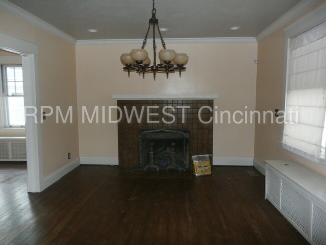
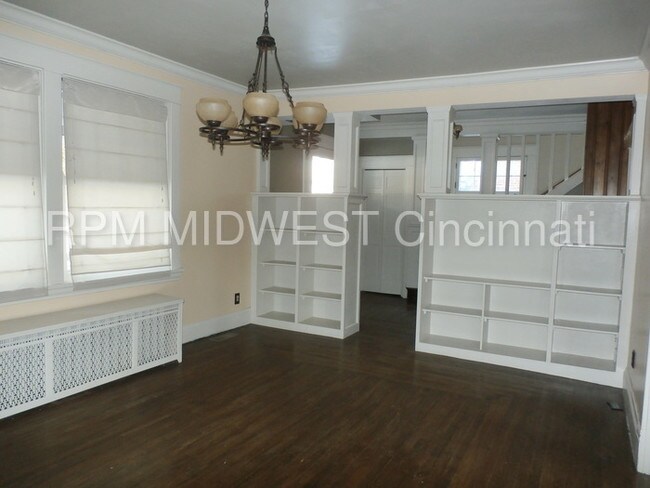
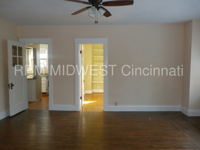
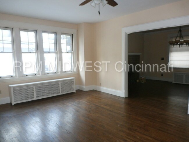
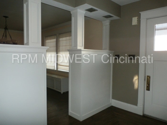
BEAUTIFUL 2 STORY WITH SO MUCH CHARACTER, NATURAL WOODWORK, ROOKWOOD FIREPLACE, ORIGINAL UNIQUE FEATURES, POCKET DOORS, UPDATED KITCHEN AND BATHS. PRIVATE STUDY ON 1ST FLOOR. OVERSIZED 2 CAR GARAGE, PRIVATE YARD WITH TURNAROUND DRIVEWAY. ONE BLOCK FROM WESTWOOD TOWN SQUARE. RENT INCLUDES FREE INTERNET AND VIVINT HOME SECURITY SYSTEM. WASHER AND DRYER INCL. This property allows self guided viewing without an appointment. Contact for details.
2931 Montana Ave is a house located in Hamilton County and the 45211 ZIP Code. This area is served by the Cincinnati Public Schools attendance zone.
Situated about five miles northwest of Downtown Cincinnati, Westwood is the largest neighborhood in the city. Residents flock to Westwood for its many affordable historic homes and modern apartments available for rent in addition to its close proximity to I-74, I-75, and all that Downtown Cincinnati has to offer.
While Westwood is a predominantly residential neighborhood, it is also home to a slew of convenient stores and restaurants. Shopping opportunities abound in Westwood, with plenty of national retailers in Western Hills Plaza and local shops in the growing Town Hall District. Numerous neighborhood parks provide ample space to enjoy the outdoors in town as well as the sprawling 1,400-acre Mount Airy Forest, which is partially located in Westwood.
Learn more about living in Westwood| Colleges & Universities | Distance | ||
|---|---|---|---|
| Colleges & Universities | Distance | ||
| Drive: | 12 min | 4.9 mi | |
| Drive: | 11 min | 5.2 mi | |
| Drive: | 12 min | 5.7 mi | |
| Drive: | 13 min | 5.8 mi |


Transportation options available in Cincinnati include Brewery District Station - Elm & Henry, located 5.3 miles from 2931 Montana Ave. 2931 Montana Ave is near Cincinnati/Northern Kentucky International, located 20.0 miles or 36 minutes away.
| Transit / Subway | Distance | ||
|---|---|---|---|
| Transit / Subway | Distance | ||
| Drive: | 12 min | 5.3 mi | |
| Drive: | 13 min | 5.6 mi | |
| Drive: | 12 min | 6.1 mi | |
| Drive: | 13 min | 6.1 mi | |
| Drive: | 13 min | 6.3 mi |
| Commuter Rail | Distance | ||
|---|---|---|---|
| Commuter Rail | Distance | ||
|
|
Drive: | 12 min | 5.9 mi |
| Airports | Distance | ||
|---|---|---|---|
| Airports | Distance | ||
|
Cincinnati/Northern Kentucky International
|
Drive: | 36 min | 20.0 mi |
Scores provided by
Traffic
-Airport
-Businesses
-Scores provided by
HowLoud What is a Sound Score Rating? A Sound Score Rating aggregates noise caused by vehicle traffic, airplane traffic and local sources. How It WorksTime and distance from 2931 Montana Ave.
| Shopping Centers | Distance | ||
|---|---|---|---|
| Shopping Centers | Distance | ||
| Drive: | 5 min | 1.6 mi | |
| Drive: | 5 min | 2.0 mi | |
| Drive: | 5 min | 2.2 mi |
| Parks and Recreation | Distance | ||
|---|---|---|---|
| Parks and Recreation | Distance | ||
|
Mt. Airy Forest
|
Drive: | 7 min | 3.0 mi |
|
Buttercup Valley
|
Drive: | 9 min | 3.9 mi |
|
Imago Earth Center
|
Drive: | 12 min | 4.9 mi |
|
Embshoff Woods
|
Drive: | 15 min | 5.4 mi |
|
Wilson Commons
|
Drive: | 13 min | 5.6 mi |
| Hospitals | Distance | ||
|---|---|---|---|
| Hospitals | Distance | ||
| Drive: | 8 min | 3.1 mi | |
| Drive: | 9 min | 4.5 mi | |
| Drive: | 12 min | 5.7 mi |
| Military Bases | Distance | ||
|---|---|---|---|
| Military Bases | Distance | ||
| Drive: | 72 min | 54.7 mi | |
| Drive: | 78 min | 59.8 mi | |
| Drive: | 80 min | 63.1 mi |


What Are Walk Score®, Transit Score®, and Bike Score® Ratings?
Walk Score® measures the walkability of any address. Transit Score® measures access to public transit. Bike Score® measures the bikeability of any address.
What is a Sound Score Rating?
A Sound Score Rating aggregates noise caused by vehicle traffic, airplane traffic and local sources.
2931 Montana Ave
Cincinnati, OH 45211