
Skyline On Stokes
2132 Stokes Blvd,
Cleveland, OH 44106
$1,199 - $3,395
Studio - 2 Beds

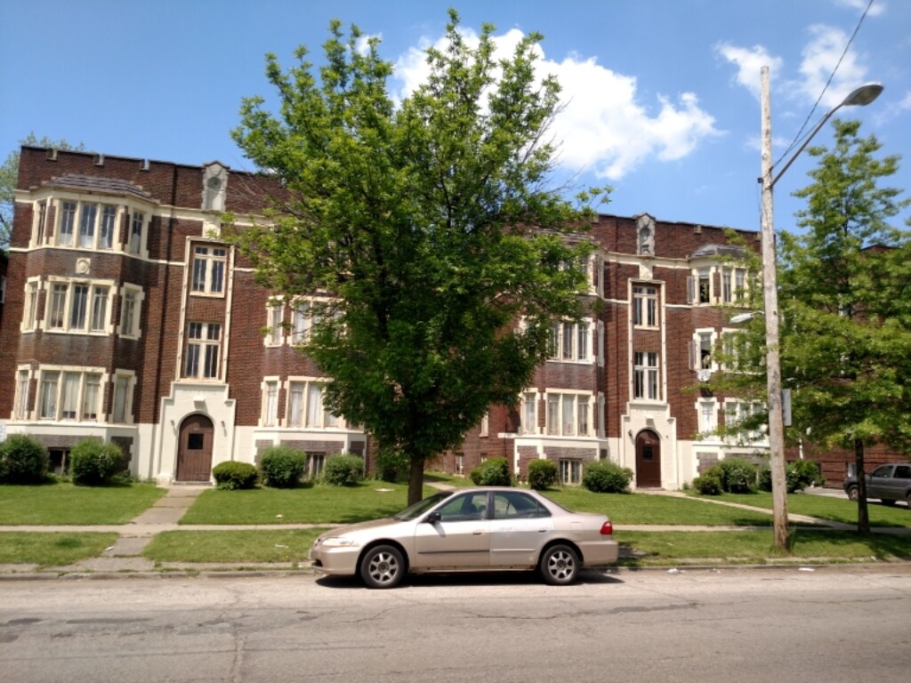

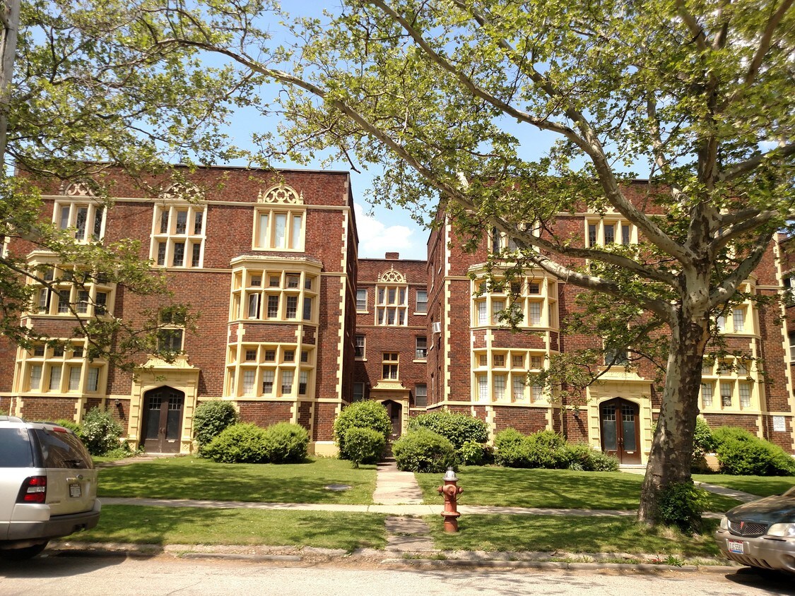
2928 S Moreland Blvd offers a combination of comfort, quality and design. In a location on S. Moreland Blvd in Cleveland's 44120 area, residents can easily connect with a number of attractions found in the neighborhood. Be sure to come for a visit to see the available floorplan options. Here at this community, the community staff will be ready to help you find your perfect floorplan option. So get a head start on your move. Contact or stop by 2928 S Moreland Blvd to talk about leasing your new apartment!
2928 S Moreland Blvd is an apartment community located in Cuyahoga County and the 44120 ZIP Code. This area is served by the Shaker Heights City School District attendance zone.
Known as one of Cleveland, Ohio's, premiere shopping and dining districts, the Buckeye-Shaker neighborhood sits on the east side of the city and contains the old Buckeye, Larchmere, and Shaker Square areas. Originally known as Little Hungary, the area of Cleveland in and around Buckeye Road contains many older single-family homes and apartment buildings. The Larchmere and Shaker Square sections of the neighborhood hold a large selection of shops and restaurants, all within easy walking distance of one another.
Bordered by University Circle to the north, Shaker Heights to the east, Mount Pleasant to the south, and Woodland Hills to the west, the Buckeye-Shaker area lies roughly six miles to the east of downtown Cleveland. Getting from the Buckeye-Shaker area to downtown is made easier thanks to the rapid transit station located near the Shaker Square shopping district.
Learn more about living in Buckeye-ShakerCompare neighborhood and city base rent averages by bedroom.
| Buckeye-Shaker | Cleveland, OH | |
|---|---|---|
| Studio | $860 | $1,195 |
| 1 Bedroom | $1,112 | $1,367 |
| 2 Bedrooms | $1,219 | $1,716 |
| 3 Bedrooms | $1,495 | $2,154 |
| Colleges & Universities | Distance | ||
|---|---|---|---|
| Colleges & Universities | Distance | ||
| Drive: | 8 min | 3.3 mi | |
| Drive: | 9 min | 3.3 mi | |
| Drive: | 9 min | 3.6 mi | |
| Drive: | 12 min | 4.8 mi |


Transportation options available in Cleveland include Drexmore, located 0.4 mile from 2928 S Moreland Blvd. 2928 S Moreland Blvd is near Cleveland-Hopkins International, located 17.7 miles or 32 minutes away.
| Transit / Subway | Distance | ||
|---|---|---|---|
| Transit / Subway | Distance | ||
|
|
Walk: | 7 min | 0.4 mi |
|
|
Walk: | 7 min | 0.4 mi |
|
|
Walk: | 8 min | 0.4 mi |
|
|
Walk: | 13 min | 0.7 mi |
|
|
Walk: | 13 min | 0.7 mi |
| Commuter Rail | Distance | ||
|---|---|---|---|
| Commuter Rail | Distance | ||
| Drive: | 20 min | 8.3 mi | |
|
|
Drive: | 21 min | 8.6 mi |
| Drive: | 22 min | 10.0 mi | |
| Drive: | 33 min | 15.8 mi | |
|
Boston Mill
|
Drive: | 37 min | 22.5 mi |
| Airports | Distance | ||
|---|---|---|---|
| Airports | Distance | ||
|
Cleveland-Hopkins International
|
Drive: | 32 min | 17.7 mi |
Time and distance from 2928 S Moreland Blvd.
| Shopping Centers | Distance | ||
|---|---|---|---|
| Shopping Centers | Distance | ||
| Walk: | 7 min | 0.4 mi | |
| Walk: | 8 min | 0.5 mi | |
| Drive: | 4 min | 1.1 mi |
| Parks and Recreation | Distance | ||
|---|---|---|---|
| Parks and Recreation | Distance | ||
|
Nature Center at Shaker Lakes
|
Drive: | 4 min | 1.7 mi |
|
Children's Museum of Cleveland
|
Drive: | 7 min | 3.0 mi |
|
Cleveland Botanical Garden
|
Drive: | 8 min | 3.4 mi |
|
Cleveland Museum of Natural History
|
Drive: | 9 min | 3.7 mi |
|
Garfield Park Nature Center
|
Drive: | 11 min | 5.4 mi |
| Hospitals | Distance | ||
|---|---|---|---|
| Hospitals | Distance | ||
| Drive: | 4 min | 1.4 mi | |
| Drive: | 8 min | 3.2 mi | |
| Drive: | 8 min | 3.2 mi |
| Military Bases | Distance | ||
|---|---|---|---|
| Military Bases | Distance | ||
| Drive: | 107 min | 86.5 mi | |
| Drive: | 109 min | 87.7 mi |
Pets Allowed Fitness Center Pool Kitchen In Unit Washer & Dryer Clubhouse Maintenance on site
What Are Walk Score®, Transit Score®, and Bike Score® Ratings?
Walk Score® measures the walkability of any address. Transit Score® measures access to public transit. Bike Score® measures the bikeability of any address.
What is a Sound Score Rating?
A Sound Score Rating aggregates noise caused by vehicle traffic, airplane traffic and local sources.
2928 S Moreland Blvd
Cleveland, OH 44120


