
$1,295
/ Month
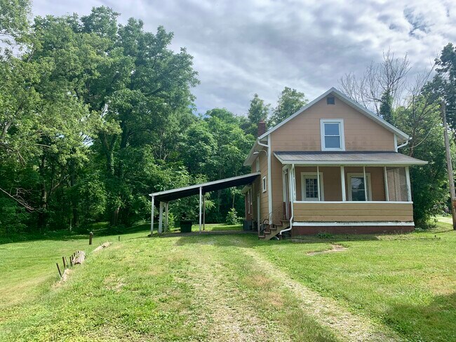
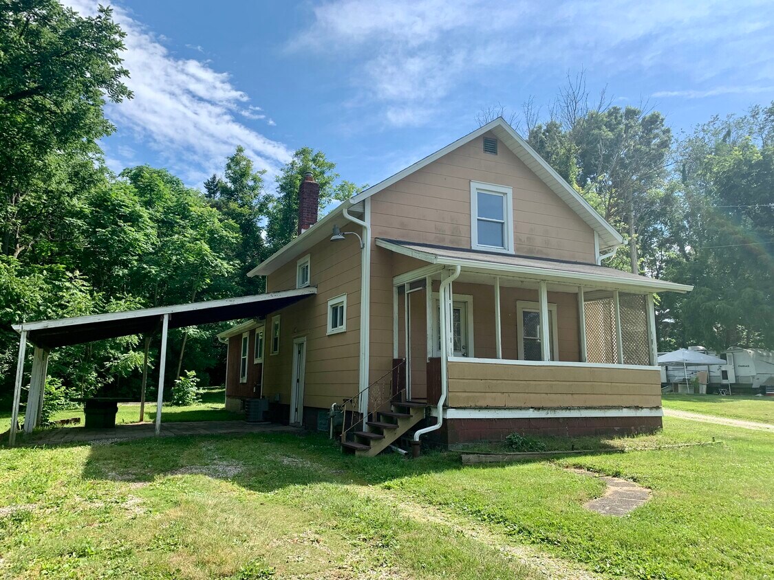
2925 Southway St SW
Massillon, OH 44646
Favorites
2925 Southway St SW

Favorites
Check Back Soon for Upcoming Availability
| Beds | Baths | Average SF |
|---|---|---|
| 3 Bedrooms 3 Bedrooms 3 Br | 2 Baths 2 Baths 2 Ba | 1,440 SF |
Fees and Policies
The fees listed below are community-provided and may exclude utilities or add-ons. All payments are made directly to the property and are non-refundable unless otherwise specified.
- Dogs Allowed
-
Fees not specified
- Cats Allowed
-
Fees not specified
About This Property
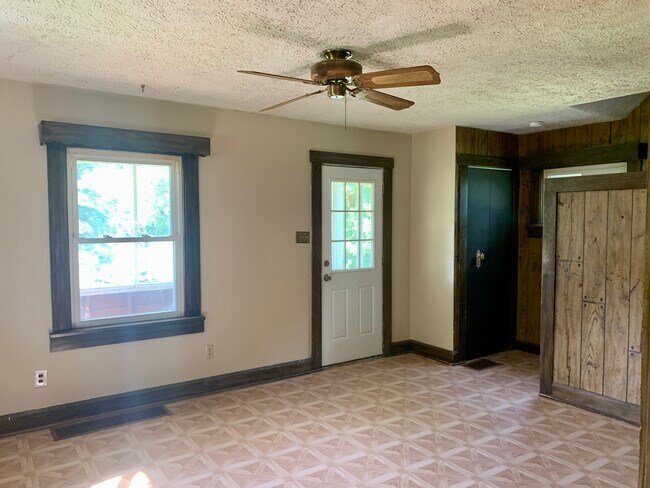
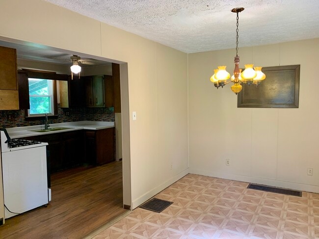
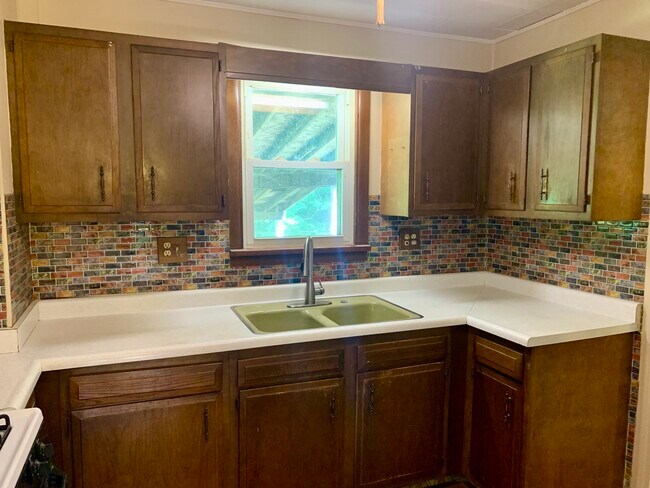
Welcome to 2925 Southway St SW in Massillon! Must See Spacious Home in Perry Local School District! Nice big yard and Covered Patio/Carport. You'll enjoy one floor living with a 1st floor master bedroom, Full bathroom and First floor laundry hook ups! Additional bedrooms and another full bath on the 2nd floor. Additional amenities include Central Air, Full basement for storage and a nice front porch. Pets are Allowed with owners Approval Additional Fees apply. Asking Listing agent for details! Call to schedule your showing today! Apply Now at
2925 Southway St Sw is a house located in Stark County and the 44646 ZIP Code. This area is served by the Perry Local School District attendance zone.
House Features
- Washer/Dryer
- Washer/Dryer Hookup
2925 Southway St SW,
Massillon,
OH
44646
Massillon sits along the Tuscarawas River in western Stark County, about eight miles west of Canton and roughly 30 miles south of Akron, occupying a steady, grounded place in northeast Ohio's landscape. The city carries a strong sense of identity rooted in its industrial past and a high school football tradition that draws intense community pride each season at Paul Brown Tiger Stadium, named after the legendary coach who got his start here. Lincoln Way serves as the central commercial corridor, anchoring everyday life with local businesses, shops, and services within a walkable stretch of the historic downtown.
The surrounding area spans around 21 square miles, offering a range of neighborhoods from tree-lined residential streets near the river to quieter pockets on the city's edges. The Massillon Museum, free to the public, reflects the city's commitment to arts and local history.
Learn more about living in Massillon
Amenities
- Washer/Dryer
- Washer/Dryer Hookup
Education
| Colleges & Universities | Distance | ||
|---|---|---|---|
| Colleges & Universities | Distance | ||
| Drive: | 18 min | 8.7 mi | |
| Drive: | 20 min | 9.3 mi | |
| Drive: | 20 min | 9.9 mi | |
| Drive: | 22 min | 12.4 mi |
2925 Southway St SW is within 18 minutes or 8.7 miles from Malone University. It is also near Kent State University, Stark and Stark State College.
Schools


Public Elementary School
Grades K-5
581 Students
Nearby
Public Elementary, Middle & High School
Grades K-12
61 Students
Nearby
Public Elementary School
Grades K-5
485 Students
Nearby
Public Elementary School
Grades K-5
524 Students
Attendance Zone
Public Elementary School
Grades K-5
467 Students
Attendance Zone
Public Middle School
Grades 6-8
581 Students
Attendance Zone
Public High School
Grades 9-12
1,330 Students
Attendance Zone
Private Elementary & Middle School
Grades PK-8
200 Students
Nearby
Private High School
Grades 9-12
293 Students
Nearby
School data provided by
 The GreatSchools Rating helps parents compare schools within a state based on a variety of school quality indicators and provides a helpful picture of how effectively each school serves all of its students. Ratings are on a scale of 1 (below average) to 10 (above average) and can include test scores, college readiness, academic progress, advanced courses, equity, discipline and attendance data. We also advise parents to visit schools, consider other information on school performance and programs, and consider family needs as part of the school selection process.
View GreatSchools Rating Methodology
Data provided by GreatSchools.org © 2026. All rights reserved.
View GreatSchools Rating Methodology
Data provided by GreatSchools.org © 2026. All rights reserved.
Walkability Near 2925 Southway St SW Massillon, OH 44646
Getting Around
 What do Walkability, Transit, Drivability, and Bikeability mean?
Walkability measures the walking distance to day-to-day needs.
Transit measures access to public transportation.
Drivability measures congestion, parking availability, and access to major roads.
Bikeability measures the suitability for cycling.
How It Works
What do Walkability, Transit, Drivability, and Bikeability mean?
Walkability measures the walking distance to day-to-day needs.
Transit measures access to public transportation.
Drivability measures congestion, parking availability, and access to major roads.
Bikeability measures the suitability for cycling.
How It Works
Somewhat Walkable
Walkability
20
/ 100
Minimal Public Transit
Transit
10
/ 100
Exceptionally Drivable
Drivability
100
/ 100
Fairly Bikeable
Bikeability
40
/ 100
Scores provided by
-
Soundscore™
-
/ 100
Traffic
-Airport
-Businesses
-Scores provided by
HowLoud What is a Sound Score Rating? A Sound Score Rating aggregates noise caused by vehicle traffic, airplane traffic and local sources. How It WorksYou May Also Like
Similar Rentals Nearby


What Are Walk Score®, Transit Score®, and Bike Score® Ratings?
Walk Score® measures the walkability of any address. Transit Score® measures access to public transit. Bike Score® measures the bikeability of any address.
What is a Sound Score Rating?
A Sound Score Rating aggregates noise caused by vehicle traffic, airplane traffic and local sources.
2925 Southway St SW
Massillon, OH 44646