

$2,950 / Month
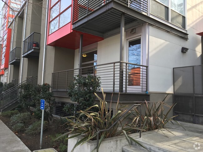
2925 California St Unit 4
San Francisco, CA 94115
2 Weeks Ago
Favorites
2925 California St Unit 4

Favorites
Check Back Soon for Upcoming Availability
| Beds | Baths | Average SF |
|---|---|---|
| 1 Bedroom 1 Bedroom 1 Br | 1 Bath 1 Bath 1 Ba | 484 SF |
Fees and Policies
The fees below are based on community-supplied data and may exclude additional fees and utilities.
- Parking
-
Garage--
Details
Utilities Included
-
Trash Removal
Property Information
-
Furnished Units Available
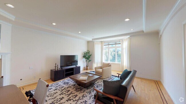
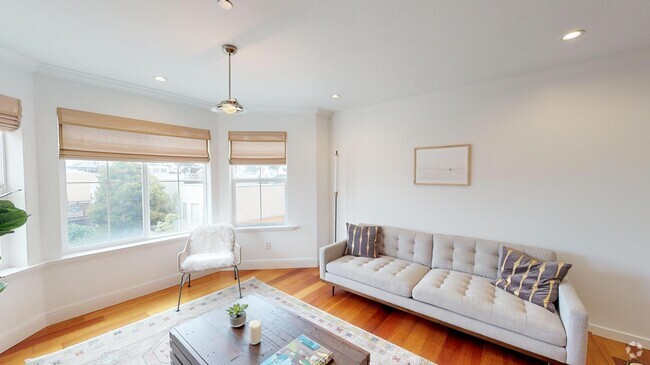
About This Property
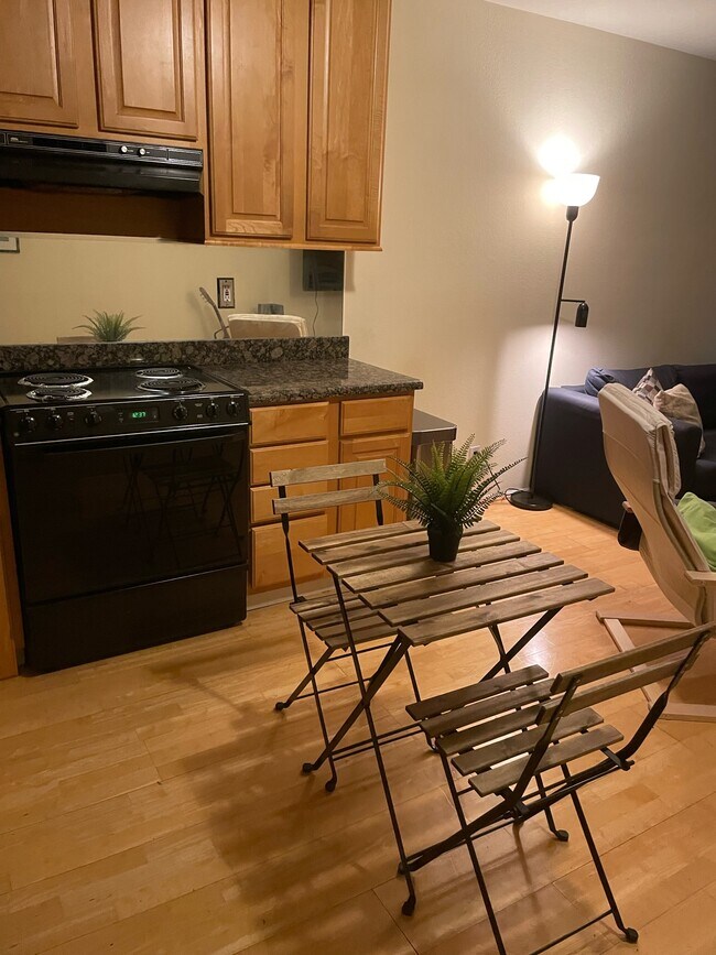
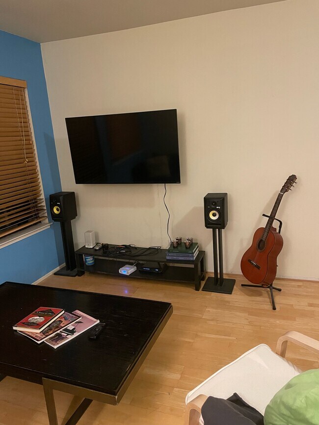
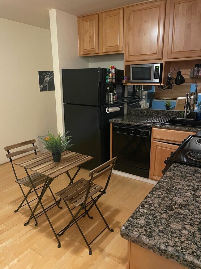
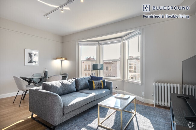
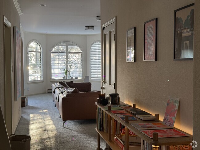
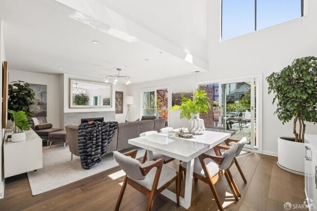
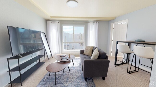
Fully furnished 1 bed and 1 bathroom apartment. Could be unfurnished if desired. Indoor garage parking space included with outdoor space in the common backyard and deck. In building laundry! Very nice neighbors in a great neighborhood close to fantastic cafés and restaurants such as B Patisserie, Spruce, Sorel, and Routier. A 10 minute walk to Fillmore street with more restaurants and shopping and 15 minutes from Japantown. Nice and quiet area but close enough to the best that SF has to offer! The Presidio and Alta Vista Park are about a 10 minute walk away. Bus stop is right in front of the apartment giving easy access to downtown and inner/ outer Richmond.
2925 California St is a condo located in San Francisco County and the 94115 ZIP Code.
Condo Features
Washer/Dryer
Dishwasher
High Speed Internet Access
Granite Countertops
- High Speed Internet Access
- Washer/Dryer
- Smoke Free
- Storage Space
- Tub/Shower
- Intercom
- Dishwasher
- Disposal
- Granite Countertops
- Eat-in Kitchen
- Kitchen
- Microwave
- Oven
- Refrigerator
- Freezer
- Coffee System
- Furnished
- Laundry Facilities
- Furnished Units Available
- Balcony
- Deck
- Yard
- Garden
Location
Get Directions
Lower Pacific Heights is a vibrant San Francisco neighborhood situated between Pacific Heights, Japantown, the Fillmore District, and Laurel Heights. Formerly known as Upper Fillmore, Lower Pacific Heights offers residents a wide variety of apartments, condos, and houses available for rent, many of which boast scenic views due to the neighborhood’s hilly environment.
Lower Pacific Heights is regarded for its walkable layout, with many rentals situated within easy walking distance of the diverse restaurants, shops, coffeehouses, and bars that line Fillmore Street, the community’s main commercial thoroughfare. The neighborhood’s central locale is a major part of its allure, providing quick access to Union Square, the University of San Francisco, the Financial District, several prominent medical centers, tech employers, landmarks, and more.
Learn more about living in Lower Pacific HeightsBelow are rent ranges for similar nearby apartments
Amenities
- High Speed Internet Access
- Washer/Dryer
- Smoke Free
- Storage Space
- Tub/Shower
- Intercom
- Dishwasher
- Disposal
- Granite Countertops
- Eat-in Kitchen
- Kitchen
- Microwave
- Oven
- Refrigerator
- Freezer
- Coffee System
- Furnished
- Laundry Facilities
- Furnished Units Available
- Balcony
- Deck
- Yard
- Garden
Expenses
Utilities Included
Trash Removal
Included
Education
| Colleges & Universities | Distance | ||
|---|---|---|---|
| Colleges & Universities | Distance | ||
| Walk: | 7 min | 0.4 mi | |
| Drive: | 3 min | 1.1 mi | |
| Drive: | 6 min | 2.1 mi | |
| Drive: | 9 min | 3.2 mi |
2925 California St Unit 4 is within 7 minutes or 0.4 mile from UC San Francisco, Mount Zion. It is also near University of San Francisco and Academy of Art University.
Transportation options available in San Francisco include California And Van Ness, located 1.2 miles from 2925 California St Unit 4. 2925 California St Unit 4 is near San Francisco International, located 15.3 miles or 25 minutes away, and Metro Oakland International, located 21.3 miles or 35 minutes away.
| Transit / Subway | Distance | ||
|---|---|---|---|
| Transit / Subway | Distance | ||
|
|
Drive: | 3 min | 1.2 mi |
| Drive: | 3 min | 1.3 mi | |
| Drive: | 3 min | 1.3 mi | |
|
|
Drive: | 4 min | 1.3 mi |
|
|
Drive: | 5 min | 1.6 mi |
| Commuter Rail | Distance | ||
|---|---|---|---|
| Commuter Rail | Distance | ||
| Drive: | 9 min | 4.4 mi | |
| Drive: | 9 min | 4.5 mi | |
| Drive: | 11 min | 5.2 mi | |
| Drive: | 11 min | 5.3 mi | |
| Drive: | 14 min | 7.5 mi |
| Airports | Distance | ||
|---|---|---|---|
| Airports | Distance | ||
|
San Francisco International
|
Drive: | 25 min | 15.3 mi |
|
Metro Oakland International
|
Drive: | 35 min | 21.3 mi |
Time and distance from 2925 California St Unit 4.
| Shopping Centers | Distance | ||
|---|---|---|---|
| Shopping Centers | Distance | ||
| Walk: | 13 min | 0.7 mi | |
| Walk: | 18 min | 0.9 mi | |
| Drive: | 4 min | 1.5 mi |
2925 California St Unit 4 has 3 shopping centers within 1.5 miles, which is about a 4-minute walk. The miles and minutes will be for the farthest away property.
| Parks and Recreation | Distance | ||
|---|---|---|---|
| Parks and Recreation | Distance | ||
|
Exploratorium
|
Drive: | 4 min | 1.7 mi |
|
Conservatory of Flowers
|
Drive: | 4 min | 1.7 mi |
|
Buena Vista Park
|
Drive: | 6 min | 2.0 mi |
|
Randall Museum
|
Drive: | 6 min | 2.1 mi |
|
California Academy of Sciences
|
Drive: | 7 min | 2.5 mi |
2925 California St Unit 4 has 5 parks within 2.5 miles, including Exploratorium, Buena Vista Park, and Conservatory of Flowers.
| Hospitals | Distance | ||
|---|---|---|---|
| Hospitals | Distance | ||
| Walk: | 7 min | 0.4 mi | |
| Drive: | 4 min | 1.5 mi | |
| Drive: | 4 min | 1.6 mi |
2925 California St Unit 4 has 3 hospitals within 1.6 miles, the nearest is Kaiser Foundation Hospital - San Francisco which is 0.4 mile away and a 7 minute walk.
| Military Bases | Distance | ||
|---|---|---|---|
| Military Bases | Distance | ||
| Drive: | 10 min | 3.4 mi | |
| Drive: | 11 min | 3.8 mi | |
| Drive: | 17 min | 7.4 mi |
2925 California St Unit 4 has 3 military bases within 7.4 miles, the nearest is East Fort Miley which is 3.4 miles away and a 10 minute drive.
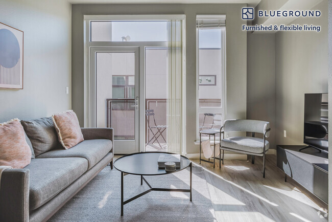
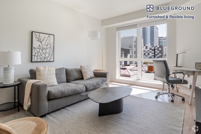
You May Also Like
Similar Rentals Nearby
What Are Walk Score®, Transit Score®, and Bike Score® Ratings?
Walk Score® measures the walkability of any address. Transit Score® measures access to public transit. Bike Score® measures the bikeability of any address.
What is a Sound Score Rating?
A Sound Score Rating aggregates noise caused by vehicle traffic, airplane traffic and local sources

2925 California St
San Francisco, CA 94115