
$1,325
/ Month
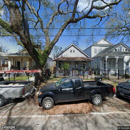
2917 Banks St
New Orleans, LA 70119
Favorites
2917 Banks St

Favorites
Check Back Soon for Upcoming Availability
| Beds | Baths | Average SF |
|---|---|---|
| 2 Bedrooms 2 Bedrooms 2 Br | 1 Bath 1 Bath 1 Ba | 850 SF |
About This Property
Come see this beautiful 1bd/1ba apartment located in the heart of Mid City. This unit boasts ample room from the open front room and kitchen to the guest bedroom/ home office. This unit has W/D in unit, a private back porch and yard and shared front porch! Grab this unit before Mardi Gras with one of New Orleans largest parades will be rolling just blocks from your front door!
2917 Banks St is a townhome located in Orleans County and the 70119 ZIP Code. This area is served by the Orleans Parish School District attendance zone.
2917 Banks St,
New Orleans,
LA
70119
Nestled between City Park and the French Quarter, Mid-City is a predominantly residential neighborhood right in the middle of New Orleans. Residents love Mid-City’s central locale along with its quirky vibe and laidback atmosphere.
Mid-City contains a bevy of charming bungalows and loft-style apartments. Numerous eclectic restaurants and bars are strewn throughout the neighborhood, which also happens to be remarkably walkable and bikeable. Mid-City is accessible to the Lafitte Greenway, Canal streetcar line, I-10, and U.S. 90, affording residents easy commutes and travels.
Learn more about living in Mid-CityBelow are rent ranges for similar nearby apartments
| Beds | Average Size | Lowest | Typical | Premium |
|---|---|---|---|---|
| Studio Studio Studio | 534 Sq Ft | $1,455 | $1,648 | $1,842 |
| 1 Bed 1 Bed 1 Bed | 800-801 Sq Ft | $1,000 | $1,727 | $3,256 |
| 2 Beds 2 Beds 2 Beds | 1165-1168 Sq Ft | $726 | $2,149 | $5,156 |
| 3 Beds 3 Beds 3 Beds | 1250-1258 Sq Ft | $841 | $2,028 | $2,620 |
| 4 Beds 4 Beds 4 Beds | 1469-1521 Sq Ft | $932 | $3,808 | $10,114 |
Education
| Colleges & Universities | Distance | ||
|---|---|---|---|
| Colleges & Universities | Distance | ||
| Walk: | 16 min | 0.9 mi | |
| Drive: | 3 min | 1.3 mi | |
| Drive: | 4 min | 1.6 mi | |
| Drive: | 7 min | 2.7 mi |
2917 Banks St is within 16 minutes or 0.9 mile from LSU Health Center, Downtown. It is also near Tulane Univ., Health Ctr and Xavier Univ of La, New Orleans.
Schools


Public Elementary & Middle School
Grades PK-8
747 Students
Attendance Zone
Public Elementary & Middle School
Grades PK-8
745 Students
Attendance Zone
Public Elementary & Middle School
Grades PK-8
1,575 Students
Nearby
Public High School
Grades 9-12
Attendance Zone
Private Elementary & Middle School
Grades PK-8
128 Students
Nearby
Private Middle & High School
Grades 6-12
Nearby
School data provided by
 The GreatSchools Rating helps parents compare schools within a state based on a variety of school quality indicators and provides a helpful picture of how effectively each school serves all of its students. Ratings are on a scale of 1 (below average) to 10 (above average) and can include test scores, college readiness, academic progress, advanced courses, equity, discipline and attendance data. We also advise parents to visit schools, consider other information on school performance and programs, and consider family needs as part of the school selection process.
View GreatSchools Rating Methodology
Data provided by GreatSchools.org © 2026. All rights reserved.
View GreatSchools Rating Methodology
Data provided by GreatSchools.org © 2026. All rights reserved.
Transportation options available in New Orleans include Canal And Gayoso, located 0.3 mile from 2917 Banks St. 2917 Banks St is near Louis Armstrong New Orleans International, located 13.3 miles or 20 minutes away.
| Transit / Subway | Distance | ||
|---|---|---|---|
| Transit / Subway | Distance | ||
|
|
Walk: | 5 min | 0.3 mi |
|
|
Walk: | 6 min | 0.3 mi |
|
|
Walk: | 6 min | 0.3 mi |
|
|
Walk: | 7 min | 0.4 mi |
|
|
Walk: | 7 min | 0.4 mi |
| Commuter Rail | Distance | ||
|---|---|---|---|
| Commuter Rail | Distance | ||
|
|
Drive: | 5 min | 2.2 mi |
|
|
Drive: | 41 min | 32.5 mi |
| Airports | Distance | ||
|---|---|---|---|
| Airports | Distance | ||
|
Louis Armstrong New Orleans International
|
Drive: | 20 min | 13.3 mi |
Walkability Near 2917 Banks St New Orleans, LA 70119
Getting Around
 What do Walkability, Transit, Drivability, and Bikeability mean?
Walkability measures the walking distance to day-to-day needs.
Transit measures access to public transportation.
Drivability measures congestion, parking availability, and access to major roads.
Bikeability measures the suitability for cycling.
How It Works
What do Walkability, Transit, Drivability, and Bikeability mean?
Walkability measures the walking distance to day-to-day needs.
Transit measures access to public transportation.
Drivability measures congestion, parking availability, and access to major roads.
Bikeability measures the suitability for cycling.
How It Works
Exceptionally Walkable
Walkability
90
/ 100
Some Public Transit
Transit
50
/ 100
Moderately Drivable
Drivability
70
/ 100
Very Bikeable
Bikeability
80
/ 100
Scores provided by
-
Soundscore™
-
/ 100
Traffic
-Airport
-Businesses
-Scores provided by
HowLoud What is a Sound Score Rating? A Sound Score Rating aggregates noise caused by vehicle traffic, airplane traffic and local sources. How It WorksTime and distance from 2917 Banks St.
| Shopping Centers | Distance | ||
|---|---|---|---|
| Shopping Centers | Distance | ||
| Drive: | 2 min | 1.1 mi | |
| Drive: | 2 min | 1.2 mi | |
| Drive: | 3 min | 1.4 mi |
2917 Banks St has 3 shopping centers within 1.4 miles, which is about a 3-minute drive. The miles and minutes will be for the farthest away property.
| Parks and Recreation | Distance | ||
|---|---|---|---|
| Parks and Recreation | Distance | ||
|
Entergy IMAX Theatre
|
Drive: | 5 min | 2.3 mi |
|
New Orleans Botanical Garden
|
Drive: | 6 min | 2.4 mi |
|
New Orleans Jazz National Historical Park
|
Drive: | 7 min | 2.6 mi |
|
Louisiana Children's Museum
|
Drive: | 6 min | 2.6 mi |
|
New Orleans City Park
|
Drive: | 6 min | 2.8 mi |
2917 Banks St has 5 parks within 2.8 miles, including New Orleans Jazz National Historical Park, Entergy IMAX Theatre, and New Orleans Botanical Garden.
| Hospitals | Distance | ||
|---|---|---|---|
| Hospitals | Distance | ||
| Walk: | 17 min | 0.9 mi | |
| Drive: | 3 min | 1.6 mi | |
| Drive: | 6 min | 3.4 mi |
2917 Banks St has 3 hospitals within 3.4 miles, the nearest is University Medical Center New Orleans which is 0.9 mile away and a 17 minute walk.
| Military Bases | Distance | ||
|---|---|---|---|
| Military Bases | Distance | ||
| Drive: | 14 min | 7.6 mi | |
| Drive: | 29 min | 16.9 mi | |
| Drive: | 75 min | 57.9 mi |
2917 Banks St has 3 military bases within 57.9 miles, the nearest is New Orleans Naval Support which is 7.6 miles away and a 14 minute drive.
You May Also Like
Similar Rentals Nearby


What Are Walk Score®, Transit Score®, and Bike Score® Ratings?
Walk Score® measures the walkability of any address. Transit Score® measures access to public transit. Bike Score® measures the bikeability of any address.
What is a Sound Score Rating?
A Sound Score Rating aggregates noise caused by vehicle traffic, airplane traffic and local sources.
2917 Banks St
New Orleans, LA 70119