
$3,500 / Month
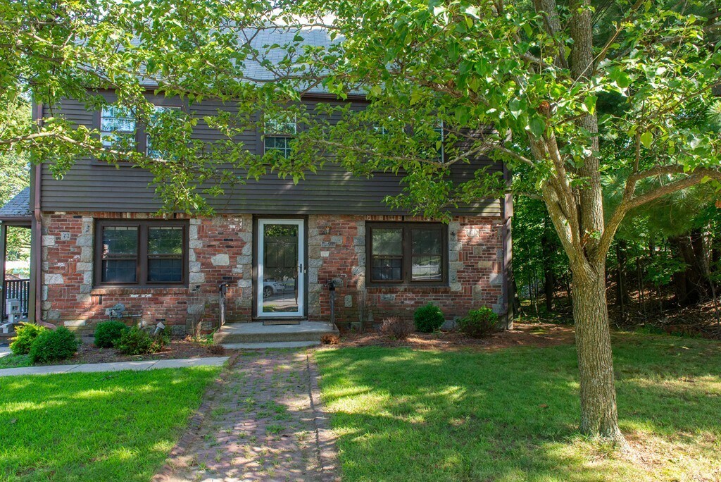
291 Linden St
Wellesley, MA 02481
Today
Favorites
617-257-3012
-
Bedrooms
3
-
Bathrooms
1
-
Square Feet
1,070 sq ft
-
Available
Available Aug 15
291 Linden St

Favorites
About This Home
Available Aug 15
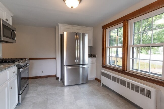
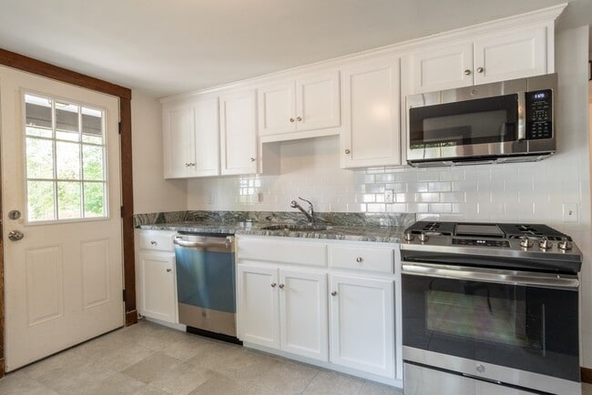
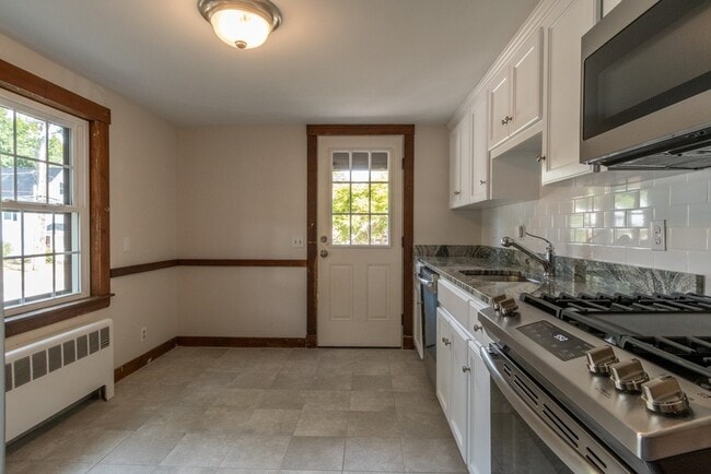
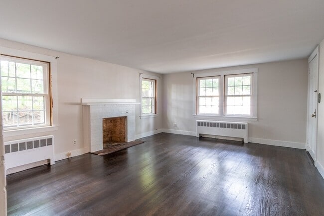
Recently renovated 3 bedroom apartment on the first floor of the property. Updated kitchen with granite countertops,new cabinets and new appliances. New windows,new washer & dryer and hardwood floors throughout. Located minutes from shopping,restaurants and commuter rail. Easy commute to schools,library and parks. Water,snow removal and landscaping included in rent. MLS# 73396467
291 Linden St is a townhome located in Norfolk County and the 02481 ZIP Code.
* Price shown is base rent and may not include non-optional fees and utilities.
Price, availability, fees, and any applicable rent special are subject to change without notice.
* Square footage definitions vary. Displayed square footage is approximate.
Townhome Features
Dishwasher
Microwave
Refrigerator
Disposal
- Dishwasher
- Disposal
- Microwave
- Range
- Refrigerator
Fees and Policies
The fees below are based on community-supplied data and may exclude additional fees and utilities.
Contact
- Listed by Alison Borrelli | Berkshire Hathaway HomeServices Commonwealth Real Estate
- Phone Number
-
Source
 MLS Property Information Network
The property listing data and information set forth herein were provided to MLS Property Information Network, Inc. from third party sources, including sellers, lessors and public records, and were compiled by MLS Property Information Network, Inc. The property listing data and information are for the personal, non-commercial use of consumers having a good faith interest in purchasing or leasing listed properties of the type displayed to them and may not be used for any purpose other than to identify prospective properties which such consumers may have a good faith interest in purchasing or leasing. MLS Property Information Network, Inc. and its subscribers disclaim any and all representations and warranties as to the accuracy of the property listing data and information set forth herein. All properties are subject to prior sale, change or withdrawal. Copyright © 2025 MLS Property Information Network, Inc. All rights reserved.
Location
Get Directions
Amenities
- Dishwasher
- Disposal
- Microwave
- Range
- Refrigerator
Just west of Boston and East of Worcester sits Metro West, a region that houses a group of towns and cities with significant historical backgrounds. A total of 19 municipalities make up the core of this community, but other municipalities are considered to be a part of the Interstate 495/Metro West Corridor.
Learn more about living in Metro West
Education
| Colleges & Universities | Distance | ||
|---|---|---|---|
| Colleges & Universities | Distance | ||
| Drive: | 5 min | 1.7 mi | |
| Drive: | 4 min | 1.9 mi | |
| Drive: | 13 min | 5.8 mi | |
| Drive: | 15 min | 8.0 mi |
291 Linden St is within 5 minutes or 1.7 miles from Wellesley College. It is also near Babson College and Brandeis University.
Transportation options available in Wellesley include Woodland Station, located 3.3 miles from 291 Linden St. 291 Linden St is near General Edward Lawrence Logan International, located 17.3 miles or 28 minutes away, and Worcester Regional, located 32.3 miles or 54 minutes away.
| Transit / Subway | Distance | ||
|---|---|---|---|
| Transit / Subway | Distance | ||
|
|
Drive: | 6 min | 3.3 mi |
|
|
Drive: | 8 min | 3.4 mi |
|
|
Drive: | 7 min | 4.0 mi |
|
|
Drive: | 9 min | 4.6 mi |
|
|
Drive: | 9 min | 4.8 mi |
| Commuter Rail | Distance | ||
|---|---|---|---|
| Commuter Rail | Distance | ||
|
|
Walk: | 13 min | 0.7 mi |
|
|
Walk: | 18 min | 1.0 mi |
|
|
Drive: | 5 min | 2.1 mi |
|
|
Drive: | 8 min | 3.4 mi |
|
|
Drive: | 6 min | 3.6 mi |
| Airports | Distance | ||
|---|---|---|---|
| Airports | Distance | ||
|
General Edward Lawrence Logan International
|
Drive: | 28 min | 17.3 mi |
|
Worcester Regional
|
Drive: | 54 min | 32.3 mi |
Time and distance from 291 Linden St.
| Shopping Centers | Distance | ||
|---|---|---|---|
| Shopping Centers | Distance | ||
| Walk: | 2 min | 0.1 mi | |
| Walk: | 7 min | 0.4 mi | |
| Walk: | 13 min | 0.7 mi |
291 Linden St has 3 shopping centers within 0.7 mile, which is about a 13-minute walk. The miles and minutes will be for the farthest away property.
| Parks and Recreation | Distance | ||
|---|---|---|---|
| Parks and Recreation | Distance | ||
|
Whitin Observatory
|
Drive: | 3 min | 1.1 mi |
|
Wellesley College Botanic Gardens
|
Drive: | 2 min | 1.4 mi |
|
Weezie's Garden for Children
|
Drive: | 8 min | 2.9 mi |
|
Elm Bank Reservation
|
Drive: | 8 min | 2.9 mi |
|
Horticultural Society at Elm Bank
|
Drive: | 9 min | 3.1 mi |
291 Linden St has 5 parks within 3.1 miles, including Whitin Observatory, Wellesley College Botanic Gardens, and Horticultural Society at Elm Bank.
| Hospitals | Distance | ||
|---|---|---|---|
| Hospitals | Distance | ||
| Drive: | 5 min | 3.1 mi | |
| Drive: | 7 min | 3.8 mi | |
| Drive: | 13 min | 6.3 mi |
291 Linden St has 3 hospitals within 6.3 miles, the nearest is Newton - Wellesley Hospital which is 3.1 miles away and a 5 minute drive.
| Military Bases | Distance | ||
|---|---|---|---|
| Military Bases | Distance | ||
| Drive: | 8 min | 4.3 mi | |
| Drive: | 23 min | 13.2 mi |
291 Linden St is 4.3 miles from US Military Reservation, and is convenient to other military bases, including Hanscom Air Force Base.
You May Also Like
Similar Rentals Nearby


What Are Walk Score®, Transit Score®, and Bike Score® Ratings?
Walk Score® measures the walkability of any address. Transit Score® measures access to public transit. Bike Score® measures the bikeability of any address.
What is a Sound Score Rating?
A Sound Score Rating aggregates noise caused by vehicle traffic, airplane traffic and local sources

291 Linden St
Wellesley, MA 02481