
$1,195 / Month
2901 S Harlem Ave Unit 7
Berwyn, IL 60402
2 Weeks Ago
Favorites
2901 S Harlem Ave Unit 7

Favorites
Check Back Soon for Upcoming Availability
| Beds | Baths | Average SF |
|---|---|---|
| 1 Bedroom 1 Bedroom 1 Br | 1 Bath 1 Bath 1 Ba | — |
About This Property
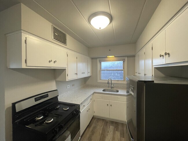
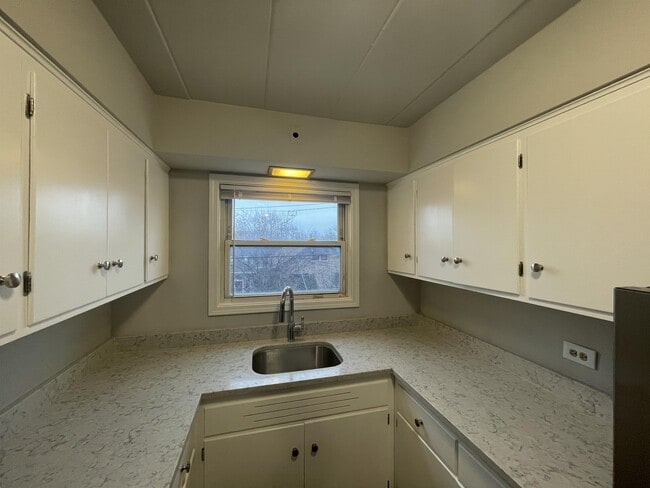
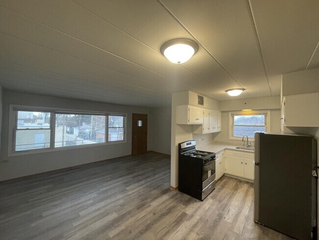
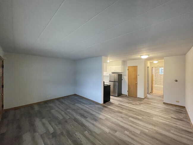
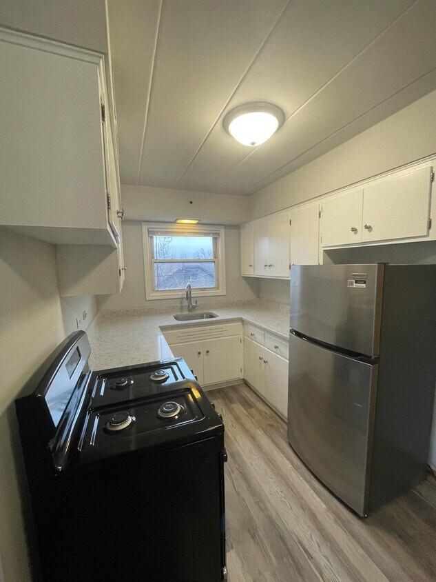
BERWYN one bedroom one bathroom spacious apartment. New hardwood type flooring, freshly painted, updated kitchen offers new quartz countertops, new appliances. Updated bathroom and heat included, ON-SITE laundry. Pet Friendly. Text/Email William @ to schedule your tour today. Nearby schools include Emerson Elementary School, Heritage Middle School and J Sterling Morton West High School. The closest grocery stores are Tony's Finer Foods, Valle's Produce and Aldi. Nearby coffee shops include Bungalow Joe's Coffee, Sonny's Slots and Cafe and Starbucks. Nearby restaurants include To Your Taste, Lalo's Restaurant and Raising Canes Chicken Fingers. Near Proksa Park, Janura Park and Mraz Park.
2901 S Harlem Ave is an apartment community located in Cook County and the 60402 ZIP Code.
Features
- Air Conditioning
- Refrigerator
- Laundry Facilities
- Storage Space
Location
Get Directions
West Cook is a multicultural neighborhood south of O’Hare International Airport. Golfers in the community enjoy its numerous golf greens, including Oak Park Country Club and Edgewood Valley Country Club.
Public transit abounds in West Cook, attracting renters who wish to live outside the cities in which they work. Residents appreciate the shopping opportunities at Fashion Outlets of Chicago and North Riverside Park Mall.
The Brookfield Zoo is a fun-filled attraction in West Cook which houses hundreds of animals. Locals adore the neighborhood’s lush green spaces – many of which are in walking distance of affordable West Cook apartments. Direct access to Interstate 55 and Interstate 294 makes commuting easy, whether you’re traveling into Chicago or a neighboring state.
Learn more about living in West CookBelow are rent ranges for similar nearby apartments
| Beds | Average Size | Lowest | Typical | Premium |
|---|---|---|---|---|
| Studio Studio Studio | 568 Sq Ft | $900 | $2,071 | $4,676 |
| 1 Bed 1 Bed 1 Bed | 767 Sq Ft | $1,025 | $2,237 | $4,909 |
| 2 Beds 2 Beds 2 Beds | 1154-1155 Sq Ft | $1,250 | $2,886 | $7,770 |
| 3 Beds 3 Beds 3 Beds | 1525 Sq Ft | $1,695 | $3,078 | $7,140 |
| 4 Beds 4 Beds 4 Beds | 2378 Sq Ft | $2,500 | $4,189 | $11,500 |
Amenities
- Air Conditioning
- Refrigerator
- Laundry Facilities
- Storage Space
Education
| Colleges & Universities | Distance | ||
|---|---|---|---|
| Colleges & Universities | Distance | ||
| Drive: | 10 min | 4.5 mi | |
| Drive: | 10 min | 4.6 mi | |
| Drive: | 11 min | 5.1 mi | |
| Drive: | 15 min | 7.2 mi |
2901 S Harlem Ave Unit 7 is within 10 minutes or 4.6 miles from Concordia University-Chicago. It is also near Dominican University, Priory and Dominican University.
Transportation options available in Berwyn include Oak Park Station (Blue Line), located 3.1 miles from 2901 S Harlem Ave Unit 7. 2901 S Harlem Ave Unit 7 is near Chicago Midway International, located 5.9 miles or 10 minutes away, and Chicago O'Hare International, located 14.6 miles or 29 minutes away.
| Transit / Subway | Distance | ||
|---|---|---|---|
| Transit / Subway | Distance | ||
|
|
Drive: | 6 min | 3.1 mi |
|
|
Drive: | 7 min | 3.1 mi |
|
|
Drive: | 7 min | 3.4 mi |
|
|
Drive: | 7 min | 3.8 mi |
|
|
Drive: | 9 min | 5.1 mi |
| Commuter Rail | Distance | ||
|---|---|---|---|
| Commuter Rail | Distance | ||
|
|
Walk: | 12 min | 0.6 mi |
|
|
Walk: | 16 min | 0.9 mi |
|
|
Drive: | 4 min | 1.5 mi |
|
|
Drive: | 4 min | 1.8 mi |
|
|
Drive: | 7 min | 2.3 mi |
| Airports | Distance | ||
|---|---|---|---|
| Airports | Distance | ||
|
Chicago Midway International
|
Drive: | 10 min | 5.9 mi |
|
Chicago O'Hare International
|
Drive: | 29 min | 14.6 mi |
Time and distance from 2901 S Harlem Ave Unit 7.
| Shopping Centers | Distance | ||
|---|---|---|---|
| Shopping Centers | Distance | ||
| Walk: | 12 min | 0.6 mi | |
| Walk: | 15 min | 0.8 mi | |
| Walk: | 15 min | 0.8 mi |
2901 S Harlem Ave Unit 7 has 3 shopping centers within 0.8 mile, which is about a 15-minute walk. The miles and minutes will be for the farthest away property.
| Parks and Recreation | Distance | ||
|---|---|---|---|
| Parks and Recreation | Distance | ||
|
White Eagle Woods-North
|
Drive: | 3 min | 1.5 mi |
|
Andrew Toman Grove
|
Drive: | 3 min | 1.6 mi |
|
White Eagle Woods-South
|
Drive: | 4 min | 1.7 mi |
|
Schuth's Grove / Callahan Grove
|
Drive: | 4 min | 1.9 mi |
|
Brookfield Zoo
|
Drive: | 6 min | 2.1 mi |
2901 S Harlem Ave Unit 7 has 5 parks within 2.1 miles, including Andrew Toman Grove, White Eagle Woods-North, and White Eagle Woods-South.
| Hospitals | Distance | ||
|---|---|---|---|
| Hospitals | Distance | ||
| Walk: | 18 min | 1.0 mi | |
| Drive: | 5 min | 2.8 mi | |
| Drive: | 6 min | 2.9 mi |
2901 S Harlem Ave Unit 7 has 3 hospitals within 2.9 miles, the nearest is MacNeal Hospital which is 1.0 mile away and a 18 minute walk.
| Military Bases | Distance | ||
|---|---|---|---|
| Military Bases | Distance | ||
| Drive: | 33 min | 20.5 mi |
2901 S Harlem Ave Unit 7 is 20.5 miles and a 33 minute drive from US Military Reservation Naperville.
You May Also Like
Similar Rentals Nearby


What Are Walk Score®, Transit Score®, and Bike Score® Ratings?
Walk Score® measures the walkability of any address. Transit Score® measures access to public transit. Bike Score® measures the bikeability of any address.
What is a Sound Score Rating?
A Sound Score Rating aggregates noise caused by vehicle traffic, airplane traffic and local sources
2901 S Harlem Ave
Berwyn, IL 60402