

$1,131
/ Month
2900 Laurel Ridge Way Unit #2900
East Point, GA 30344
Favorites
-
Bedrooms
3
-
Bathrooms
2
-
Square Feet
--
2900 Laurel Ridge Way Unit #2900

Favorites
About This Home
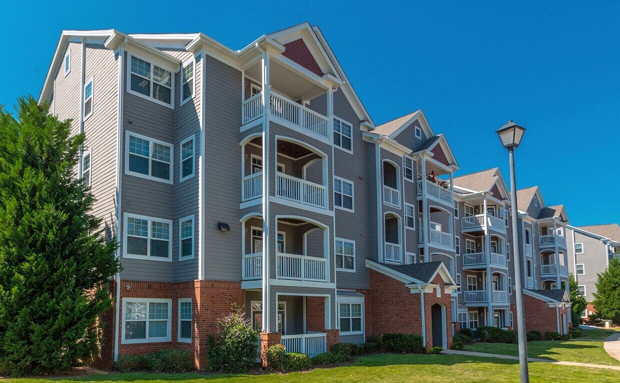
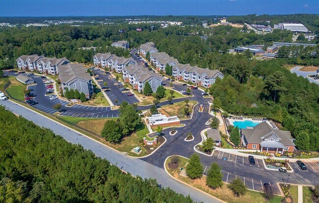
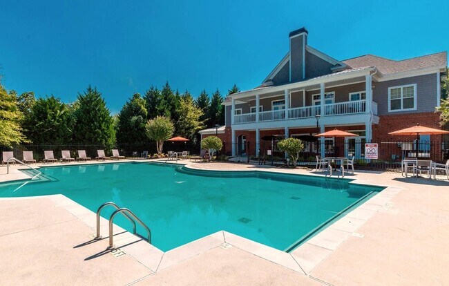
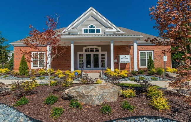
Offering exceptional customer service, cozy living areas, and a wide selection of floorplans, Leyland Pointe provides all the amenities you desire along with a prime location in East Point. Select from our range of roomy one, two, and three-bedroom apartment layouts. Whether itOs our modernized units or our convenient laundry facilities, youOll have all the essentials at your fingertips. Get in touch with us today to schedule your tour! Prepare to unwind and enjoy the comforts of your new residence in East Point, GA, featuring modern finishes, generous living spaces, communal perks, and beyond. Additionally, our residences in East Point, GA boast a sparkling pool and community grilling station to enhance your daily routine. Experience the unexpected delights of everyday living at Leyland Pointe.
2900 Laurel Ridge Way is a condo located in Fulton County and the 30344 ZIP Code.
* Price shown is base rent. Excludes user-selected optional fees and variable or usage-based fees and required charges due at or prior to move-in or at move-out. Price, availability, fees, and any applicable rent special are subject to change without notice.
* Square footage definitions vary. Displayed square footage is approximate.
Contact
- Listed by Leasing Agent | Leasing Agent
Location
Get Directions
Aerotropolis refers to an array of Southside Atlanta communities surrounding Hartsfield-Jackson Atlanta International Airport, the world’s busiest airport. The cities of College Park, Chattahoochee Hills, East Point, Fairburn, Forest Park, Union City, Hapeville, Morrow, and Palmetto are all a part of the Aerotropolis Alliance, working together on initiatives to improve their respective communities.
Aerotropolis’ close proximity to the airport makes the region an ideal choice for local employees and frequent travelers alike. A wide variety of rentals are available throughout the region, from luxury apartments and cozy condos to charming townhomes and spacious houses. Getting around from Aerotropolis is easy with access to I-75, I-85, and I-285.
Learn more about living in Aerotropolis
Education
| Colleges & Universities | Distance | ||
|---|---|---|---|
| Colleges & Universities | Distance | ||
| Drive: | 17 min | 10.2 mi | |
| Drive: | 19 min | 10.6 mi | |
| Drive: | 21 min | 10.9 mi | |
| Drive: | 21 min | 10.9 mi |
2900 Laurel Ridge Way Unit #2900 is within 17 minutes or 10.2 miles from Atlanta Metropolitan State. It is also near Atlanta Technical College and Morehouse School of Medicine.
Transportation options available in East Point include College Park, located 3.8 miles from 2900 Laurel Ridge Way Unit #2900. 2900 Laurel Ridge Way Unit #2900 is near Hartsfield - Jackson Atlanta International, located 9.3 miles or 17 minutes away.
| Transit / Subway | Distance | ||
|---|---|---|---|
| Transit / Subway | Distance | ||
|
|
Drive: | 8 min | 3.8 mi |
|
|
Drive: | 9 min | 4.2 mi |
|
|
Drive: | 12 min | 5.7 mi |
|
|
Drive: | 14 min | 7.5 mi |
|
|
Drive: | 15 min | 8.3 mi |
| Commuter Rail | Distance | ||
|---|---|---|---|
| Commuter Rail | Distance | ||
|
|
Drive: | 27 min | 16.7 mi |
| Airports | Distance | ||
|---|---|---|---|
| Airports | Distance | ||
|
Hartsfield - Jackson Atlanta International
|
Drive: | 17 min | 9.3 mi |
Getting Around
 What do Walkability, Transit, Drivability, and Bikeability mean?
Walkability measures the walking distance to day-to-day needs.
Transit measures access to public transportation.
Drivability measures congestion, parking availability, and access to major roads.
Bikeability measures the suitability for cycling.
How It Works
What do Walkability, Transit, Drivability, and Bikeability mean?
Walkability measures the walking distance to day-to-day needs.
Transit measures access to public transportation.
Drivability measures congestion, parking availability, and access to major roads.
Bikeability measures the suitability for cycling.
How It Works
Somewhat Walkable
Walkability
30
/ 100
Limited Public Transit
Transit
20
/ 100
Exceptionally Drivable
Drivability
100
/ 100
Not Bikeable
Bikeability
0
/ 100
Scores provided by
-
Soundscore™
-
/ 100
Traffic
-Airport
-Businesses
-Scores provided by
HowLoud What is a Sound Score Rating? A Sound Score Rating aggregates noise caused by vehicle traffic, airplane traffic and local sources. How It WorksTime and distance from 2900 Laurel Ridge Way Unit #2900.
| Shopping Centers | Distance | ||
|---|---|---|---|
| Shopping Centers | Distance | ||
| Walk: | 10 min | 0.5 mi | |
| Drive: | 6 min | 1.9 mi | |
| Drive: | 5 min | 1.9 mi |
2900 Laurel Ridge Way Unit #2900 has 3 shopping centers within 1.9 miles, which is about a 5-minute drive. The miles and minutes will be for the farthest away property.
| Parks and Recreation | Distance | ||
|---|---|---|---|
| Parks and Recreation | Distance | ||
|
Cascade Springs Nature Preserve
|
Drive: | 12 min | 7.3 mi |
|
West Atlanta Watershed Alliance (WAWA)
|
Drive: | 17 min | 9.1 mi |
|
Atlanta BeltLine Southwest Connector Spur Trail
|
Drive: | 17 min | 9.6 mi |
|
Park Pride
|
Drive: | 20 min | 11.4 mi |
|
Zoo Atlanta
|
Drive: | 22 min | 12.6 mi |
2900 Laurel Ridge Way Unit #2900 has 5 parks within 12.6 miles, including Cascade Springs Nature Preserve, West Atlanta Watershed Alliance (WAWA), and Atlanta BeltLine Southwest Connector Spur Trail.
| Hospitals | Distance | ||
|---|---|---|---|
| Hospitals | Distance | ||
| Drive: | 14 min | 6.8 mi | |
| Drive: | 19 min | 9.7 mi | |
| Drive: | 18 min | 10.4 mi |
2900 Laurel Ridge Way Unit #2900 has 3 hospitals within 10.4 miles, the nearest is Southern Crescent Behavioral Health System - Anchor Hospital Campus which is 6.8 miles away and a 14 minute drive.
| Military Bases | Distance | ||
|---|---|---|---|
| Military Bases | Distance | ||
| Drive: | 16 min | 8.2 mi | |
| Drive: | 26 min | 15.6 mi | |
| Drive: | 33 min | 21.3 mi |
2900 Laurel Ridge Way Unit #2900 has 3 military bases within 21.3 miles, the nearest is Fort McPherson which is 8.2 miles away and a 16 minute drive.
You May Also Like
Similar Rentals Nearby


2900 Laurel Ridge Way
East Point, GA 30344