

$2,600 / Month
29 Lambert St
Medford, MA 02155
Today
Favorites
617-642-9315
-
Bedrooms
2
-
Bathrooms
1
-
Square Feet
1,242 sq ft
-
Available
Available Now
Highlights
- Medical Services
- Property is near public transit
- Porch
- No Cooling
- Park
- Shops
29 Lambert St

Favorites
About This Home
$2,700 deposit,
Available Now
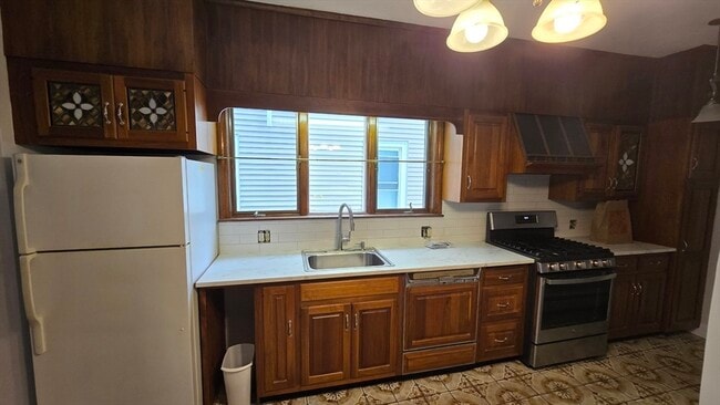
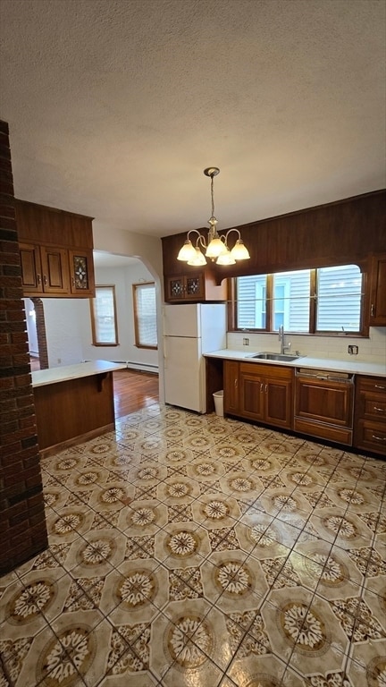
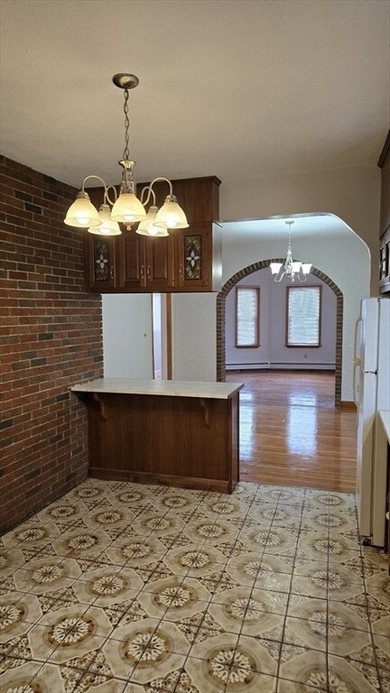
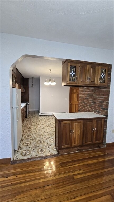
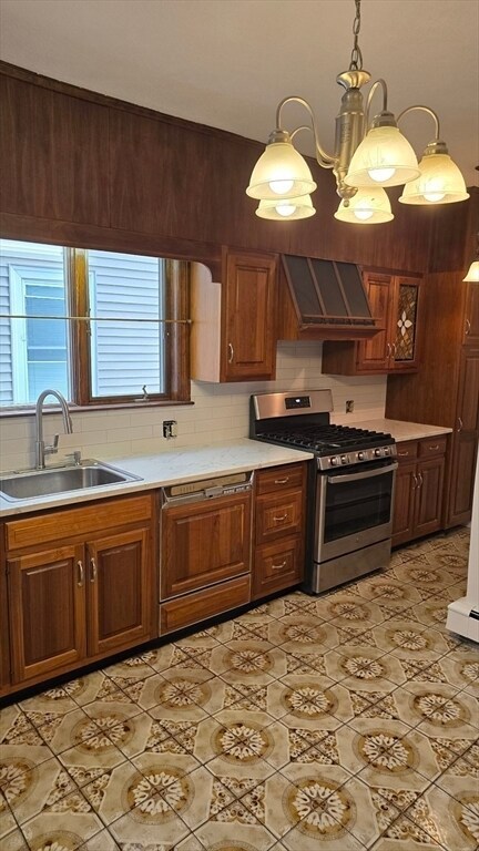
Available Aug 1st!! Welcome to this charming 2 bed 1 bath apartment located on the first floor of a 3-family home. This unit offers single level living with a spacious layout,large windows throughout boosting natural light with new fixtures and new countertops. Conveniently located to shopping centers,including Target,Walgreens,Gym,Hair Salon and Spa and a 2-minute drive to access major highway RT 93,both North and South. No Pets no exceptions. Schedule you showing now and don't miss out!!! MLS# 73394218
29 Lambert St is a townhome located in Middlesex County and the 02155 ZIP Code. This area is served by the Medford attendance zone.
* Price shown is base rent and may not include non-optional fees and utilities.
Price, availability, fees, and any applicable rent special are subject to change without notice.
* Square footage definitions vary. Displayed square footage is approximate.
Home Details
Year Built
Built in 1900
Accessible Home Design
Entry on the 1st floor
Bedrooms and Bathrooms
1 Full Bathroom
2 Bedrooms
Home Design
Property Attached
Interior Spaces
1-Story Property
1,242 Sq Ft Home
Kitchen
Range
Dishwasher
Listing and Financial Details
Security Deposit $2,700
Property Available on 8/1/25
12 Month Lease Term
Rent includes water
Location
Property is near public transit
Property is near schools
Outdoor Features
Porch
Parking
2 Car Parking Spaces
Utilities
No Cooling
Heating System Uses Natural Gas
Community Details
Amenities
Medical Services
Shops
Coin Laundry
Common Area
Overview
No Home Owners Association
Pet Policy
No Pets Allowed
Recreation
Park
Fees and Policies
The fees below are based on community-supplied data and may exclude additional fees and utilities.
Contact
- Listed by Tina Almeida | Elite Realty Experts,LLC
- Phone Number
-
Source
 MLS Property Information Network
The property listing data and information set forth herein were provided to MLS Property Information Network, Inc. from third party sources, including sellers, lessors and public records, and were compiled by MLS Property Information Network, Inc. The property listing data and information are for the personal, non-commercial use of consumers having a good faith interest in purchasing or leasing listed properties of the type displayed to them and may not be used for any purpose other than to identify prospective properties which such consumers may have a good faith interest in purchasing or leasing. MLS Property Information Network, Inc. and its subscribers disclaim any and all representations and warranties as to the accuracy of the property listing data and information set forth herein. All properties are subject to prior sale, change or withdrawal. Copyright © 2025 MLS Property Information Network, Inc. All rights reserved.
Location
Get Directions
Amenities
- Dishwasher
- Range
- Porch
Only 15 minutes from the center of Boston, the Glenwood neighborhood provides city living at a lower cost. Many of the residential properties were built in the 1920s and '30s, which have since intertwined with newer structures built from 1970 up until present day. Today Glenwood is one of Medford’s most diverse neighborhoods and known as being one of the best places for college students to reside. The safe neighborhood also provides a friendly place for families and young professionals. The excess of rental homes make it easier for young students to find housing within their budgets, while families find the older characteristics of the neighborhood and houses appealing.
Glenwood is in a prime location for any lifestyle. Several universities are convenient to the neighborhood. Tufts University is 10 minutes away, Harvard University is 18 minutes away, and Massachusetts Institute of Technology is 20 minutes way.
Learn more about living in Glenwood
Education
| Colleges & Universities | Distance | ||
|---|---|---|---|
| Colleges & Universities | Distance | ||
| Drive: | 4 min | 2.1 mi | |
| Drive: | 8 min | 3.9 mi | |
| Drive: | 7 min | 4.2 mi | |
| Drive: | 8 min | 4.3 mi |
29 Lambert St is within 4 minutes or 2.1 miles from Tufts Univ., Medford. It is also near Lesley University, Porter and Lesley University.
Schools


Public Elementary School
Grades PK-5
552 Students
Attendance Zone
Public High School
Grades PK & 9-12
1,260 Students
Attendance Zone
Public Middle School
Grades 6-8
456 Students
Attendance Zone
Public Middle School
Grades 6-8
461 Students
Attendance Zone
Private Elementary & Middle School
Grades PK-8
229 Students
Nearby
Private Elementary, Middle & High School
Grades K-10
Nearby
Private Middle & High School
Grades 6-12
Nearby
School data provided by
 The GreatSchools Rating helps parents compare schools within a state based on a variety of school quality indicators and provides a helpful picture of how effectively each school serves all of its students. Ratings are on a scale of 1 (below average) to 10 (above average) and can include test scores, college readiness, academic progress, advanced courses, equity, discipline and attendance data. We also advise parents to visit schools, consider other information on school performance and programs, and consider family needs as part of the school selection process.
View GreatSchools Rating Methodology
Data provided by GreatSchools.org © 2025. All rights reserved.
View GreatSchools Rating Methodology
Data provided by GreatSchools.org © 2025. All rights reserved.
Transportation options available in Medford include Malden Center Station, located 1.2 miles from 29 Lambert St. 29 Lambert St is near General Edward Lawrence Logan International, located 8.2 miles or 14 minutes away.
| Transit / Subway | Distance | ||
|---|---|---|---|
| Transit / Subway | Distance | ||
|
|
Drive: | 2 min | 1.2 mi |
|
|
Drive: | 4 min | 2.0 mi |
| Drive: | 4 min | 2.1 mi | |
|
|
Drive: | 5 min | 2.4 mi |
| Drive: | 5 min | 2.5 mi |
| Commuter Rail | Distance | ||
|---|---|---|---|
| Commuter Rail | Distance | ||
|
|
Drive: | 2 min | 1.2 mi |
|
|
Drive: | 4 min | 2.3 mi |
|
|
Drive: | 6 min | 3.0 mi |
|
|
Drive: | 8 min | 3.5 mi |
|
|
Drive: | 9 min | 4.2 mi |
| Airports | Distance | ||
|---|---|---|---|
| Airports | Distance | ||
|
General Edward Lawrence Logan International
|
Drive: | 14 min | 8.2 mi |
Time and distance from 29 Lambert St.
| Shopping Centers | Distance | ||
|---|---|---|---|
| Shopping Centers | Distance | ||
| Walk: | 5 min | 0.3 mi | |
| Walk: | 18 min | 1.0 mi | |
| Drive: | 2 min | 1.1 mi |
29 Lambert St has 3 shopping centers within 1.1 miles, which is about a 2-minute walk. The miles and minutes will be for the farthest away property.
| Parks and Recreation | Distance | ||
|---|---|---|---|
| Parks and Recreation | Distance | ||
|
Mystic River Reservation
|
Drive: | 4 min | 2.3 mi |
|
Middlesex Fells Reservation
|
Drive: | 6 min | 3.2 mi |
|
Friends of Middlesex Fells Reservation
|
Drive: | 7 min | 3.4 mi |
|
Walter D. Stone Memorial Zoo
|
Drive: | 7 min | 4.4 mi |
|
Mineralogical and Geological Museum
|
Drive: | 9 min | 4.6 mi |
29 Lambert St has 5 parks within 4.6 miles, including Mystic River Reservation, Middlesex Fells Reservation, and Friends of Middlesex Fells Reservation.
| Hospitals | Distance | ||
|---|---|---|---|
| Hospitals | Distance | ||
| Drive: | 8 min | 3.9 mi | |
| Drive: | 9 min | 4.6 mi | |
| Drive: | 9 min | 4.6 mi |
29 Lambert St has 3 hospitals within 4.6 miles, the nearest is MelroseWakefield Healthcare which is 3.9 miles away and a 8 minute drive.
| Military Bases | Distance | ||
|---|---|---|---|
| Military Bases | Distance | ||
| Drive: | 24 min | 13.6 mi | |
| Drive: | 30 min | 15.8 mi |
29 Lambert St is 13.6 miles from Hanscom Air Force Base, and is convenient to other military bases, including Fort Pickering.
You May Also Like
Similar Rentals Nearby


What Are Walk Score®, Transit Score®, and Bike Score® Ratings?
Walk Score® measures the walkability of any address. Transit Score® measures access to public transit. Bike Score® measures the bikeability of any address.
What is a Sound Score Rating?
A Sound Score Rating aggregates noise caused by vehicle traffic, airplane traffic and local sources
29 Lambert St
Medford, MA 02155