


$2,100
Total Monthly Price
12 Month Lease
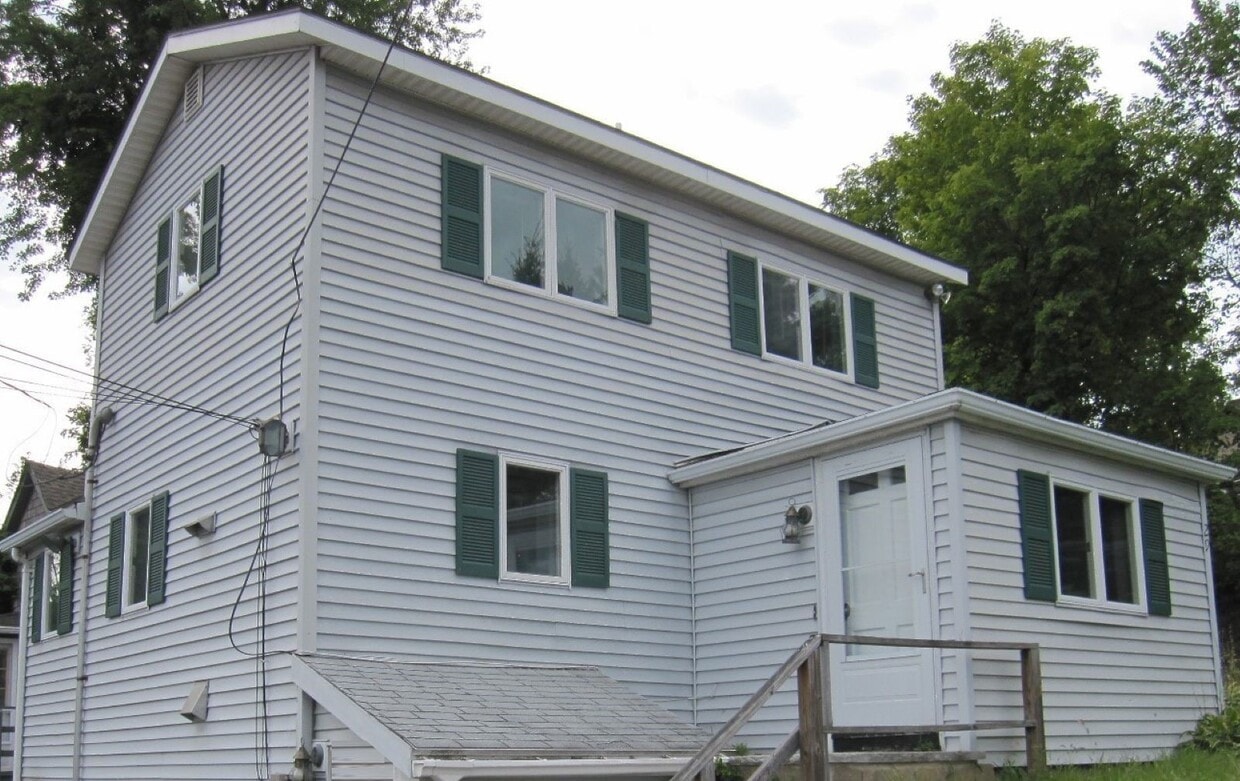
29 Curve St
Framingham, MA 01702
Today
|
Edit
Favorites
508-233-4468
-
Bedrooms
1
-
Bathrooms
1
-
Square Feet
886 sq ft
-
Available
Available Now
29 Curve St

Favorites
About This Home
12 Month Lease,
$2,100 deposit,
Available Now
NO PETS! This is an updated one-bedroom single family home. Most of the interior has been freshly painted and most rooms have recessed lighting. There is a first-floor office/storage room and laundry plus enough off-street parking for two cars. The heating system is hot water baseboard heat. Close to shopping, park, highway, and commuter rail. THE RENT INCLUDES LANDSCAPING AND SNOW REMOVAL.
29 Curve St is a house located in Middlesex County and the 01702 ZIP Code. This area is served by the Framingham attendance zone.
* Price shown is total price based on community-supplied monthly required fees. Excludes user-selected optional fees and variable or usage-based fees and required charges due at or prior to move-in or at move-out. Price, availability, fees, and any applicable rent special are subject to change without notice.
* Square footage definitions vary. Displayed square footage is approximate.
House Features
Washer/Dryer Hookup
Office
Ceiling Fans
Heating
- Washer/Dryer Hookup
- Heating
- Ceiling Fans
- Instant Hot Water
- Office
Fees and Policies
The fees listed below are community-provided and may exclude utilities or add-ons. All payments are made directly to the property and are non-refundable unless otherwise specified.
- One-Time Move-In Fees
-
Broker Fee$0
- Parking
-
Surface Lot--
Contact
- Listed by John Pasciuti
- Phone Number
- Contact
Location
Get Directions
Just west of Boston and East of Worcester sits Metro West, a region that houses a group of towns and cities with significant historical backgrounds. A total of 19 municipalities make up the core of this community, but other municipalities are considered to be a part of the Interstate 495/Metro West Corridor.
Learn more about living in Metro West
Education
| Colleges & Universities | Distance | ||
|---|---|---|---|
| Colleges & Universities | Distance | ||
| Walk: | 14 min | 0.7 mi | |
| Drive: | 15 min | 8.1 mi | |
| Drive: | 16 min | 9.0 mi | |
| Drive: | 21 min | 12.5 mi |
29 Curve St is within 14 minutes or 0.7 mile from Framingham State College. It is also near Wellesley College and Babson College.
Schools


Public Elementary School
Grades PK-5
401 Students
Nearby
Public Elementary School
Grades K-5
696 Students
Attendance Zone
Public Elementary School
Grades K-5
550 Students
Attendance Zone
Public Middle School
Grades 6-8
789 Students
Attendance Zone
Public Middle School
Grades 6-8
616 Students
Attendance Zone
Public High School
Grades 9-12
2,566 Students
Attendance Zone
Private Elementary & Middle School
Grades PK-8
301 Students
Nearby
Private High School
Grades 9-12
227 Students
Nearby
School data provided by
 The GreatSchools Rating helps parents compare schools within a state based on a variety of school quality indicators and provides a helpful picture of how effectively each school serves all of its students. Ratings are on a scale of 1 (below average) to 10 (above average) and can include test scores, college readiness, academic progress, advanced courses, equity, discipline and attendance data. We also advise parents to visit schools, consider other information on school performance and programs, and consider family needs as part of the school selection process.
View GreatSchools Rating Methodology
Data provided by GreatSchools.org © 2026. All rights reserved.
View GreatSchools Rating Methodology
Data provided by GreatSchools.org © 2026. All rights reserved.
Transportation options available in Framingham include Woodland Station, located 10.4 miles from 29 Curve St. 29 Curve St is near General Edward Lawrence Logan International, located 24.6 miles or 36 minutes away, and Worcester Regional, located 24.8 miles or 43 minutes away.
| Transit / Subway | Distance | ||
|---|---|---|---|
| Transit / Subway | Distance | ||
|
|
Drive: | 17 min | 10.4 mi |
|
|
Drive: | 18 min | 11.5 mi |
| Commuter Rail | Distance | ||
|---|---|---|---|
| Commuter Rail | Distance | ||
|
|
Drive: | 5 min | 2.1 mi |
|
|
Drive: | 5 min | 2.2 mi |
|
|
Drive: | 9 min | 3.4 mi |
|
|
Drive: | 8 min | 4.9 mi |
|
|
Drive: | 17 min | 5.7 mi |
| Airports | Distance | ||
|---|---|---|---|
| Airports | Distance | ||
|
General Edward Lawrence Logan International
|
Drive: | 36 min | 24.6 mi |
|
Worcester Regional
|
Drive: | 43 min | 24.8 mi |
Time and distance from 29 Curve St.
| Shopping Centers | Distance | ||
|---|---|---|---|
| Shopping Centers | Distance | ||
| Walk: | 9 min | 0.5 mi | |
| Walk: | 11 min | 0.6 mi | |
| Walk: | 35 min | 1.8 mi |
29 Curve St has 3 shopping centers within 1.8 miles, which is about a 35-minute walk. The miles and minutes will be for the farthest away property.
| Parks and Recreation | Distance | ||
|---|---|---|---|
| Parks and Recreation | Distance | ||
|
Callahan State Park
|
Drive: | 6 min | 3.0 mi |
|
Cowassock Woods and Ashland Town Forest
|
Drive: | 7 min | 3.1 mi |
|
Hop Brook Natural Area
|
Drive: | 6 min | 3.2 mi |
|
Garden in the Woods
|
Drive: | 9 min | 4.4 mi |
|
Cochituate State Park
|
Drive: | 17 min | 10.9 mi |
29 Curve St has 5 parks within 10.9 miles, including Callahan State Park, Cowassock Woods and Ashland Town Forest, and Hop Brook Natural Area.
| Hospitals | Distance | ||
|---|---|---|---|
| Hospitals | Distance | ||
| Drive: | 3 min | 1.4 mi | |
| Drive: | 18 min | 9.6 mi | |
| Drive: | 18 min | 10.9 mi |
29 Curve St has 3 hospitals within 10.9 miles, the nearest is MetroWest Medical Center which is 1.4 miles away and a 3 minute drive.
| Military Bases | Distance | ||
|---|---|---|---|
| Military Bases | Distance | ||
| Drive: | 8 min | 4.5 mi | |
| Drive: | 32 min | 17.1 mi |
29 Curve St is 4.5 miles from US Military Reservation, and is convenient to other military bases, including Hanscom Air Force Base.
Amenities
- Washer/Dryer Hookup
- Heating
- Ceiling Fans
- Instant Hot Water
- Office
29 Curve St Photos
What Are Walk Score®, Transit Score®, and Bike Score® Ratings?
Walk Score® measures the walkability of any address. Transit Score® measures access to public transit. Bike Score® measures the bikeability of any address.
What is a Sound Score Rating?
A Sound Score Rating aggregates noise caused by vehicle traffic, airplane traffic and local sources
29 Curve St
Framingham, MA 01702