


$2,795 / Month
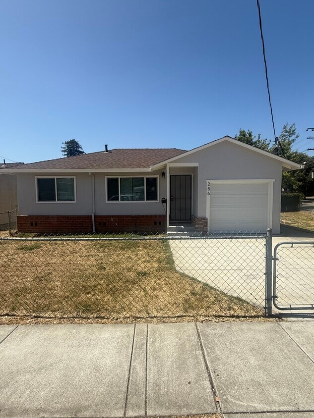
286 Laurel Ave
Hayward, CA 94541
Today
Favorites
510-735-8445
-
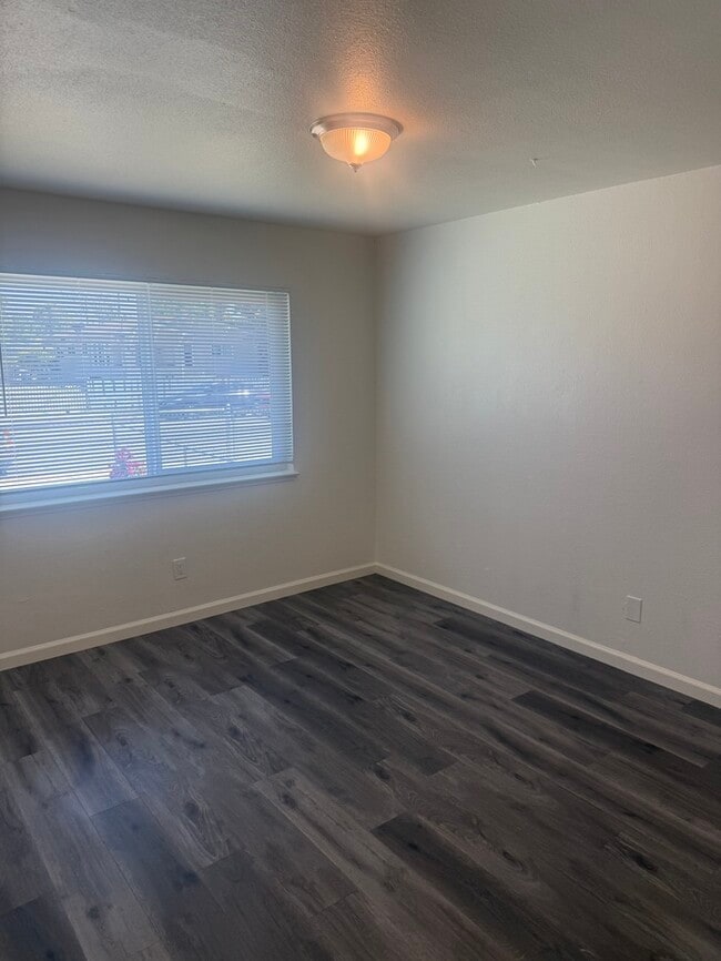
Bedrooms
2
-
Bathrooms
1
-
Square Feet
--
-
Available
Available Now
286 Laurel Ave

Favorites
About This Home
Available Now
This property allows self guided viewing without an appointment. Contact for details.
286 Laurel Ave is a house located in Alameda County and the 94541 ZIP Code. This area is served by the Hayward Unified attendance zone.
* Price shown is base rent and may not include non-optional fees and utilities.
Price, availability, fees, and any applicable rent special are subject to change without notice.
* Square footage definitions vary. Displayed square footage is approximate.
Contact
- Listed by Attorneys Property Management Group
- Phone Number
- Contact
Location
Get Directions
South of Oakland and north of Hayward lies the dreamily named Cherryland, an unincorporated community of quiet residential streets and lush parks. Clues to its namesake dot the neighborhood's streets, from Cherry Way to Blossom Way. The San Lorenzo Creek connects the area via water to the San Francisco Bay, cementing its place in the greater East Bay region.
Learn more about living in Cherryland
Education
| Colleges & Universities | Distance | ||
|---|---|---|---|
| Colleges & Universities | Distance | ||
| Drive: | 8 min | 3.1 mi | |
| Drive: | 9 min | 4.1 mi | |
| Drive: | 20 min | 11.9 mi | |
| Drive: | 18 min | 13.2 mi |
286 Laurel Ave is within 8 minutes or 3.1 miles from Cal State East Bay. It is also near Chabot College and Mills College.
Schools


Public Elementary School
Grades K-6
903 Students
Attendance Zone
Charter Elementary School
Grades K-5
483 Students
Nearby
Public Middle School
Grades 7-8
498 Students
Attendance Zone
Public High School
Grades 9-12
1,712 Students
Attendance Zone
Private Elementary, Middle & High School
Grades 4-12
Nearby
Private Elementary, Middle & High School
Grades K-12
27 Students
Nearby
Private Elementary School
Grades PK-3
18 Students
Nearby
School data provided by
 The GreatSchools Rating helps parents compare schools within a state based on a variety of school quality indicators and provides a helpful picture of how effectively each school serves all of its students. Ratings are on a scale of 1 (below average) to 10 (above average) and can include test scores, college readiness, academic progress, advanced courses, equity, discipline and attendance data. We also advise parents to visit schools, consider other information on school performance and programs, and consider family needs as part of the school selection process.
View GreatSchools Rating Methodology
Data provided by GreatSchools.org © 2025. All rights reserved.
View GreatSchools Rating Methodology
Data provided by GreatSchools.org © 2025. All rights reserved.
Transportation options available in Hayward include Hayward, located 0.8 mile from 286 Laurel Ave. 286 Laurel Ave is near Metro Oakland International, located 9.8 miles or 15 minutes away, and San Francisco International, located 23.5 miles or 31 minutes away.
| Transit / Subway | Distance | ||
|---|---|---|---|
| Transit / Subway | Distance | ||
|
|
Walk: | 16 min | 0.8 mi |
|
|
Drive: | 6 min | 2.9 mi |
|
|
Drive: | 8 min | 3.7 mi |
|
|
Drive: | 10 min | 5.6 mi |
|
|
Drive: | 11 min | 7.0 mi |
| Commuter Rail | Distance | ||
|---|---|---|---|
| Commuter Rail | Distance | ||
|
|
Walk: | 9 min | 0.5 mi |
| Walk: | 9 min | 0.5 mi | |
| Drive: | 16 min | 10.5 mi | |
| Drive: | 24 min | 16.0 mi | |
| Drive: | 24 min | 16.1 mi |
| Airports | Distance | ||
|---|---|---|---|
| Airports | Distance | ||
|
Metro Oakland International
|
Drive: | 15 min | 9.8 mi |
|
San Francisco International
|
Drive: | 31 min | 23.5 mi |
Time and distance from 286 Laurel Ave.
| Shopping Centers | Distance | ||
|---|---|---|---|
| Shopping Centers | Distance | ||
| Walk: | 18 min | 1.0 mi | |
| Walk: | 18 min | 1.0 mi | |
| Drive: | 3 min | 1.2 mi |
286 Laurel Ave has 3 shopping centers within 1.2 miles, which is about a 3-minute walk. The miles and minutes will be for the farthest away property.
| Parks and Recreation | Distance | ||
|---|---|---|---|
| Parks and Recreation | Distance | ||
|
Sulphur Creek Nature Center
|
Drive: | 7 min | 2.4 mi |
|
Don Castro Regional Recreation Area
|
Drive: | 7 min | 3.4 mi |
|
Lake Chabot Regional Park
|
Drive: | 10 min | 4.5 mi |
|
Cull Canyon Regional Recreation Area
|
Drive: | 12 min | 5.0 mi |
|
Hayward Regional Shoreline
|
Drive: | 13 min | 5.5 mi |
286 Laurel Ave has 5 parks within 5.5 miles, including Sulphur Creek Nature Center, Don Castro Regional Recreation Area, and Lake Chabot Regional Park.
| Hospitals | Distance | ||
|---|---|---|---|
| Hospitals | Distance | ||
| Drive: | 7 min | 3.9 mi | |
| Drive: | 8 min | 4.6 mi | |
| Drive: | 9 min | 6.1 mi |
286 Laurel Ave has 3 hospitals within 6.1 miles, the nearest is St. Rose Hospital which is 3.9 miles away and a 7 minute drive.
| Military Bases | Distance | ||
|---|---|---|---|
| Military Bases | Distance | ||
| Drive: | 26 min | 17.2 mi |
286 Laurel Ave is 17.2 miles and a 26 minute drive from Alameda/US Naval Air Station Alameda.
You May Also Like
Similar Rentals Nearby


What Are Walk Score®, Transit Score®, and Bike Score® Ratings?
Walk Score® measures the walkability of any address. Transit Score® measures access to public transit. Bike Score® measures the bikeability of any address.
What is a Sound Score Rating?
A Sound Score Rating aggregates noise caused by vehicle traffic, airplane traffic and local sources

286 Laurel Ave
Hayward, CA 94541