
286 Grove St Unit 3
Auburndale, MA 02466
-
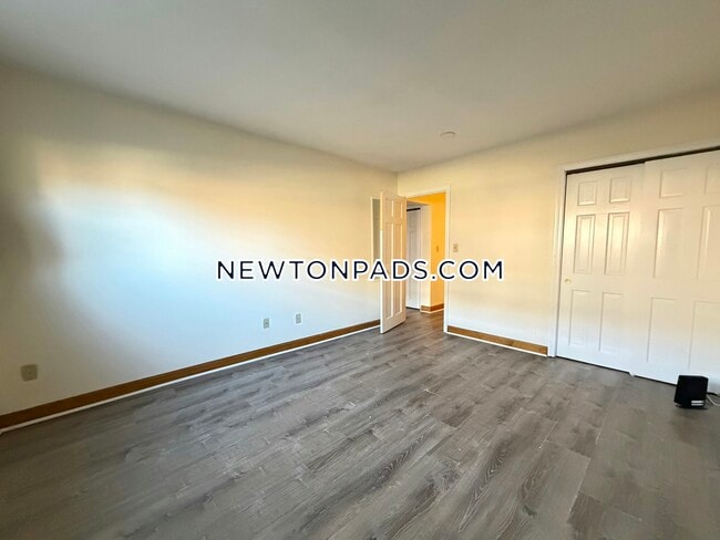
Bedrooms
1
-
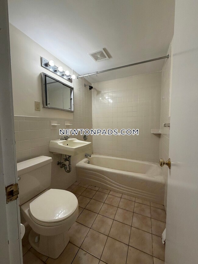
Bathrooms
1
-
Square Feet
9,999 sq ft
-
Available
Available Now

286 Grove St is an apartment community located in Middlesex County and the 02466 ZIP Code. This area is served by the Newton attendance zone.
Apartment Features
- Laundry Facilities
Fees and Policies
The fees listed below are community-provided and may exclude utilities or add-ons. All payments are made directly to the property and are non-refundable unless otherwise specified.
- One-Time Move-In Fees
-
Broker Fee$0
Contact
- Phone Number
- Contact
Auburndale, affectionately referred to as “The Dale” by locals, is one of 13 villages in the City of Newton. Situated near the intersection of Interstates 90 and 95, the Dale is surrounded by the City of Waltham and the Charles River as well as three other Newton villages including West Newton, Waban, and Newton Lower Falls. Getting around from the Dale is simple with access to the MBTA commuter rail.
The western end of Auburndale is well known for containing two historic parks, Norumbega Park and the Auburndale Cove Park and Playground, which offer plenty of options for outdoor recreation. The Auburndale Historic District is comprised of about 275 properties, many of which are on the National Register of Historic Places. Treasured resources like the Auburndale Community Library and Lasell College provide learning opportunities for the community.
Learn more about living in Auburndale| Colleges & Universities | Distance | ||
|---|---|---|---|
| Colleges & Universities | Distance | ||
| Drive: | 8 min | 3.2 mi | |
| Drive: | 13 min | 4.5 mi | |
| Drive: | 10 min | 4.6 mi | |
| Drive: | 10 min | 5.4 mi |


View GreatSchools Rating Methodology
Data provided by GreatSchools.org © 2026. All rights reserved.
Transportation options available in Auburndale include Riverside Station, located 0.2 mile from 286 Grove St Unit 3. 286 Grove St Unit 3 is near General Edward Lawrence Logan International, located 14.5 miles or 24 minutes away, and Worcester Regional, located 38.8 miles or 54 minutes away.
| Transit / Subway | Distance | ||
|---|---|---|---|
| Transit / Subway | Distance | ||
|
|
Walk: | 3 min | 0.2 mi |
|
|
Drive: | 4 min | 1.6 mi |
|
|
Drive: | 5 min | 2.3 mi |
|
|
Drive: | 8 min | 3.9 mi |
|
|
Drive: | 8 min | 4.2 mi |
| Commuter Rail | Distance | ||
|---|---|---|---|
| Commuter Rail | Distance | ||
|
|
Drive: | 4 min | 1.7 mi |
|
|
Drive: | 6 min | 2.4 mi |
|
|
Drive: | 5 min | 2.8 mi |
|
|
Drive: | 11 min | 6.7 mi |
|
|
Drive: | 12 min | 7.5 mi |
| Airports | Distance | ||
|---|---|---|---|
| Airports | Distance | ||
|
General Edward Lawrence Logan International
|
Drive: | 24 min | 14.5 mi |
|
Worcester Regional
|
Drive: | 54 min | 38.8 mi |
Time and distance from 286 Grove St Unit 3.
| Shopping Centers | Distance | ||
|---|---|---|---|
| Shopping Centers | Distance | ||
| Walk: | 19 min | 1.0 mi | |
| Drive: | 5 min | 2.6 mi | |
| Drive: | 5 min | 2.7 mi |
| Parks and Recreation | Distance | ||
|---|---|---|---|
| Parks and Recreation | Distance | ||
|
Land's Sake Farm
|
Drive: | 8 min | 3.7 mi |
|
Hemlock Gorge Reservation
|
Drive: | 8 min | 3.7 mi |
|
Whitin Observatory
|
Drive: | 12 min | 4.3 mi |
|
Cutler Park Reservation
|
Drive: | 8 min | 4.5 mi |
|
Hammond Pond Reservation
|
Drive: | 9 min | 5.2 mi |
| Hospitals | Distance | ||
|---|---|---|---|
| Hospitals | Distance | ||
| Drive: | 3 min | 1.3 mi | |
| Drive: | 6 min | 3.0 mi | |
| Drive: | 9 min | 5.2 mi |
| Military Bases | Distance | ||
|---|---|---|---|
| Military Bases | Distance | ||
| Drive: | 15 min | 7.9 mi | |
| Drive: | 19 min | 11.1 mi |
- Laundry Facilities
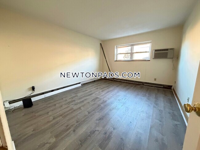
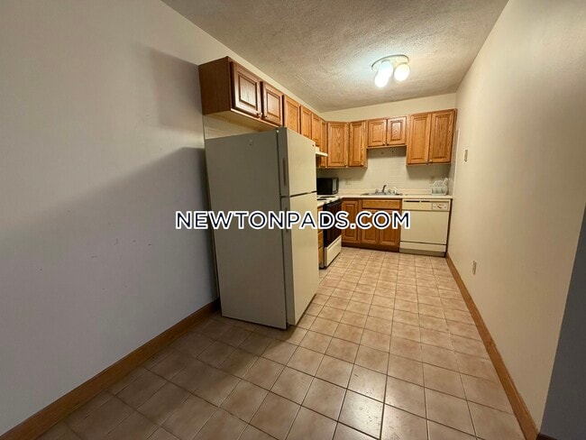
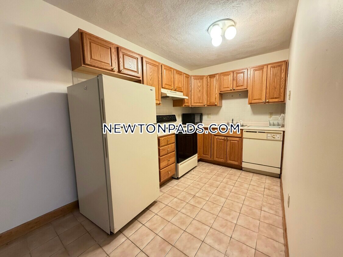
286 Grove St Unit 3 Photos
What Are Walk Score®, Transit Score®, and Bike Score® Ratings?
Walk Score® measures the walkability of any address. Transit Score® measures access to public transit. Bike Score® measures the bikeability of any address.
What is a Sound Score Rating?
A Sound Score Rating aggregates noise caused by vehicle traffic, airplane traffic and local sources
286 Grove St
Auburndale, MA 02466