2855 Cincinnati St
Los Angeles, CA 90033
-
Bedrooms
1
-
Bathrooms
1
-
Square Feet
--
-
Available
Available Now

About This Home
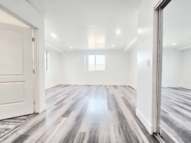
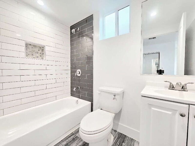
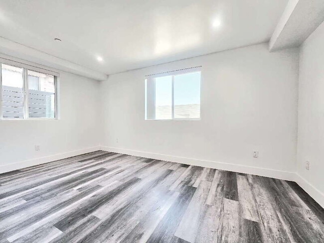
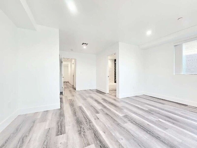
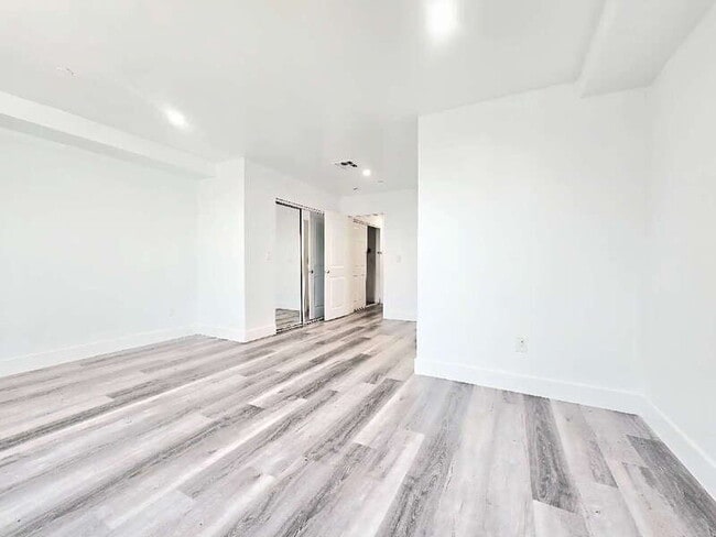
***THIS IS A SHARED SPACE*** ROOM 7 AVAILABLE NOW | No pets allowed. This well-lit single bedroom offers LVP flooring, two windows, and an ample closet with mirrored doors. The private bathroom includes a soaking tub, standing shower, and natural ventilation. The unit shares the kitchen and living room with six other tenants. No parking or laundry onsite. Utilities are $150/month apart form the rent. !! Move-in special: Get $500 off your first month’s rent !! Security Deposit: $1,400 12-month lease term. Requirements: *650 credit score or higher. *Household income of 2.5 times the rental price. *No past evictions *We ACCEPT 3rd party vouchers. *Every person of 18 years and older needs to submit a separate application ($50.00 application fee per person). PMI Los Angeles residents are enrolled in the Resident Benefits Package (RBP) for $35/month which includes credit building to help boost the resident’s credit score with timely rent payments, up to $1M Identity Theft Protection, HVAC air filter delivery (for applicable properties), move-in concierge service making utility connection and home service setup a breeze during your move-in, our best-in-class resident rewards program and much more! More details upon application.
2855 Cincinnati St is a house located in Los Angeles County and the 90033 ZIP Code. This area is served by the Los Angeles Unified attendance zone.
Contact
- Phone Number
- Website View Property Website
- Contact
-
Source

Southeast Los Angeles is directly south of the Fashion District and east of the University of Southern California (USC). This large neighborhood is minutes from downtown Los Angeles, Hollywood, and Beverly Hills, with easy access to the 110 Freeway. This great location places you near sunny beaches, nature trails, and a bevy of leading employers. Students can access both USC and California State University Long Beach from their Southeast LA apartment.
This densely populated, diverse neighborhood features everything from food trucks and corner markets to wide sidewalks and residential areas filled with bungalows, ranch, and Spanish Colonial architecture. Southeast LA features palm trees and mountain views, tampered with gritty undertones to give it a cool, funky vibe.
As for outdoor fun, take your pick between Catalina Island, Venus Beach, or the Santa Monica Pier. Nearby, you’ll find more sunny beaches like White Point, Cabrillo, and Long Beach.
Learn more about living in Southeast Los Angeles| Colleges & Universities | Distance | ||
|---|---|---|---|
| Colleges & Universities | Distance | ||
| Drive: | 4 min | 1.8 mi | |
| Drive: | 7 min | 3.0 mi | |
| Drive: | 7 min | 3.8 mi | |
| Drive: | 8 min | 4.6 mi |


View GreatSchools Rating Methodology
Data provided by GreatSchools.org © 2025. All rights reserved.
Transportation options available in Los Angeles include Soto, located 0.8 mile from 2855 Cincinnati St. 2855 Cincinnati St is near Bob Hope, located 17.7 miles or 25 minutes away, and Los Angeles International, located 18.9 miles or 30 minutes away.
| Transit / Subway | Distance | ||
|---|---|---|---|
| Transit / Subway | Distance | ||
|
|
Walk: | 15 min | 0.8 mi |
|
|
Walk: | 20 min | 1.0 mi |
|
|
Drive: | 3 min | 1.4 mi |
|
|
Drive: | 3 min | 1.8 mi |
| Drive: | 5 min | 2.5 mi |
| Commuter Rail | Distance | ||
|---|---|---|---|
| Commuter Rail | Distance | ||
|
|
Drive: | 7 min | 2.5 mi |
|
|
Drive: | 5 min | 2.7 mi |
|
|
Drive: | 12 min | 6.2 mi |
| Drive: | 9 min | 6.6 mi | |
|
|
Drive: | 12 min | 7.3 mi |
| Airports | Distance | ||
|---|---|---|---|
| Airports | Distance | ||
|
Bob Hope
|
Drive: | 25 min | 17.7 mi |
|
Los Angeles International
|
Drive: | 30 min | 18.9 mi |
Time and distance from 2855 Cincinnati St.
| Shopping Centers | Distance | ||
|---|---|---|---|
| Shopping Centers | Distance | ||
| Walk: | 9 min | 0.5 mi | |
| Walk: | 17 min | 0.9 mi | |
| Walk: | 20 min | 1.0 mi |
| Parks and Recreation | Distance | ||
|---|---|---|---|
| Parks and Recreation | Distance | ||
|
Hollenbeck Lake
|
Drive: | 3 min | 1.4 mi |
|
Vista Hermosa Natural Park
|
Drive: | 8 min | 4.2 mi |
|
Audubon Center at Debs Park
|
Drive: | 9 min | 5.1 mi |
|
Elysian Park
|
Drive: | 13 min | 5.2 mi |
|
Chavez Ravine Arboretum
|
Drive: | 10 min | 6.0 mi |
| Hospitals | Distance | ||
|---|---|---|---|
| Hospitals | Distance | ||
| Drive: | 4 min | 1.8 mi | |
| Drive: | 4 min | 1.9 mi | |
| Drive: | 5 min | 2.2 mi |
| Military Bases | Distance | ||
|---|---|---|---|
| Military Bases | Distance | ||
| Drive: | 28 min | 20.3 mi |
You May Also Like
What Are Walk Score®, Transit Score®, and Bike Score® Ratings?
Walk Score® measures the walkability of any address. Transit Score® measures access to public transit. Bike Score® measures the bikeability of any address.
What is a Sound Score Rating?
A Sound Score Rating aggregates noise caused by vehicle traffic, airplane traffic and local sources

2855 Cincinnati St
Los Angeles, CA 90033