
$1,595
/ Month
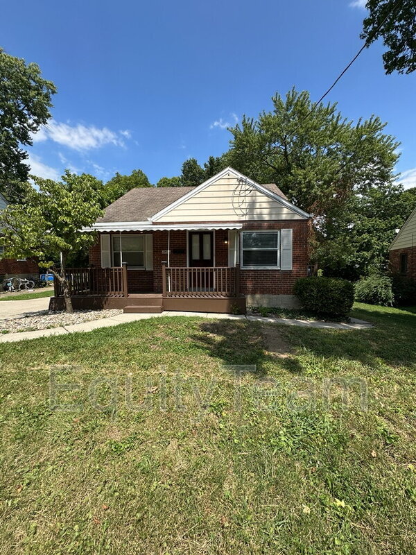
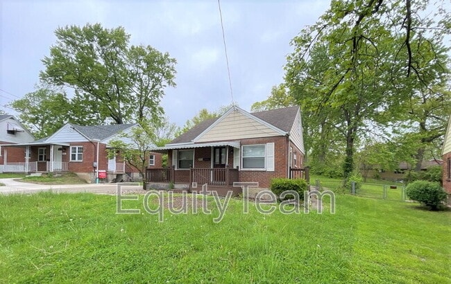
2854 Allview Cir
Cincinnati, OH 45238
2 Weeks Ago
|
Edit
Favorites
-
Bedrooms
4
-
Bathrooms
1
-
Square Feet
1,274 sq ft
2854 Allview Cir

Favorites
About This Home
$1,595 deposit
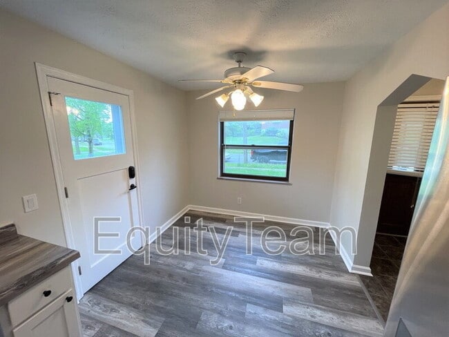
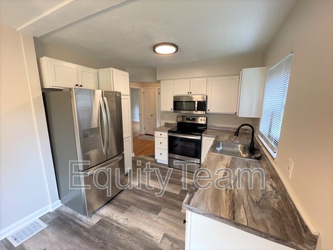
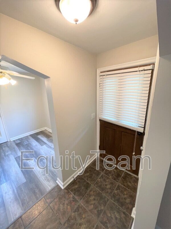
Recently renovated 4 Bed/ 1.5 Bath Cape in Western Hills close to Cincinnati public schools, restaurants, shopping, and entertainment. This home features: Fresh Paint; LVT and HW flooring; renovated kitchen with cabinets, counters & SS appliances. Updated bathroom with vanity and tub; Washer & Dryer hookups only; fenced yard for outside entertainment; Parking Driveway and on-street parking, and more! *Pet Friendly(Small Pets Only)* In addition to rent, there is a mandatory Resident Benefit Package ($29 per month), which includes: $100,000 liability coverage on the property $10,000 in tenant personal property coverage HVAC filters delivered to your unit to be changed out quarterly (if applicable) Free ACH payments Credit reporting of rent payments to help improve credit Tenant & Maintenance Portals Resident Concierge Service to help tenants save money on frequently used services *Virtual Tour Link: *Multiple Security Deposit options/alternatives available *Tenant Benefits Package includes $10k in personal property coverage *See Application Terms & Conditions on for other charges *$49 Application Fee per adult Resident Benefit Package Resident Onboarding Fee Pet Onboarding Fee Pet Rent
2854 Allview Cir is a house located in Hamilton County and the 45238 ZIP Code. This area is served by the Cincinnati Public Schools attendance zone.
* Price shown is base rent. Excludes user-selected optional fees and variable or usage-based fees and required charges due at or prior to move-in or at move-out. Price, availability, fees, and any applicable rent special are subject to change without notice.
* Square footage definitions vary. Displayed square footage is approximate.
Fees and Policies
The fees below are based on community-supplied data and may exclude additional fees and utilities.
- Dogs Allowed
-
Fees not specified
- Cats Allowed
-
Fees not specified
Contact
Location
Get Directions
Situated about five miles northwest of Downtown Cincinnati, Westwood is the largest neighborhood in the city. Residents flock to Westwood for its many affordable historic homes and modern apartments available for rent in addition to its close proximity to I-74, I-75, and all that Downtown Cincinnati has to offer.
While Westwood is a predominantly residential neighborhood, it is also home to a slew of convenient stores and restaurants. Shopping opportunities abound in Westwood, with plenty of national retailers in Western Hills Plaza and local shops in the growing Town Hall District. Numerous neighborhood parks provide ample space to enjoy the outdoors in town as well as the sprawling 1,400-acre Mount Airy Forest, which is partially located in Westwood.
Learn more about living in Westwood
Education
| Colleges & Universities | Distance | ||
|---|---|---|---|
| Colleges & Universities | Distance | ||
| Drive: | 9 min | 3.9 mi | |
| Drive: | 17 min | 7.1 mi | |
| Drive: | 16 min | 7.4 mi | |
| Drive: | 18 min | 7.8 mi |
2854 Allview Cir is within 9 minutes or 3.9 miles from College of Mount St. Joseph. It is also near Cincinnati State and University of Cincinnati.
Schools


Public Elementary & Middle School
Grades PK-7 & 9
561 Students
Attendance Zone
Public Middle & High School
Grades 6-12
1,418 Students
Attendance Zone
Public Middle & High School
Grades 7-12
897 Students
Attendance Zone
Private Elementary & Middle School
Grades PK-8
381 Students
Nearby
Private Elementary & Middle School
Grades K-8
308 Students
Nearby
Private High School
Grades 9-12
495 Students
Nearby
School data provided by
 The GreatSchools Rating helps parents compare schools within a state based on a variety of school quality indicators and provides a helpful picture of how effectively each school serves all of its students. Ratings are on a scale of 1 (below average) to 10 (above average) and can include test scores, college readiness, academic progress, advanced courses, equity, discipline and attendance data. We also advise parents to visit schools, consider other information on school performance and programs, and consider family needs as part of the school selection process.
View GreatSchools Rating Methodology
Data provided by GreatSchools.org © 2025. All rights reserved.
View GreatSchools Rating Methodology
Data provided by GreatSchools.org © 2025. All rights reserved.
Transportation options available in Cincinnati include Brewery District Station, Elm & Henry, located 6.1 miles from 2854 Allview Cir. 2854 Allview Cir is near Cincinnati/Northern Kentucky International, located 20.4 miles or 40 minutes away.
| Transit / Subway | Distance | ||
|---|---|---|---|
| Transit / Subway | Distance | ||
| Drive: | 15 min | 6.1 mi | |
| Drive: | 15 min | 6.3 mi | |
| Drive: | 15 min | 6.4 mi | |
| Drive: | 15 min | 6.5 mi | |
| Drive: | 16 min | 6.6 mi |
| Commuter Rail | Distance | ||
|---|---|---|---|
| Commuter Rail | Distance | ||
|
|
Drive: | 15 min | 6.4 mi |
| Airports | Distance | ||
|---|---|---|---|
| Airports | Distance | ||
|
Cincinnati/Northern Kentucky International
|
Drive: | 40 min | 20.4 mi |
Time and distance from 2854 Allview Cir.
| Shopping Centers | Distance | ||
|---|---|---|---|
| Shopping Centers | Distance | ||
| Walk: | 10 min | 0.5 mi | |
| Walk: | 11 min | 0.6 mi | |
| Walk: | 12 min | 0.6 mi |
2854 Allview Cir has 3 shopping centers within 0.6 mile, which is about a 12-minute walk. The miles and minutes will be for the farthest away property.
| Parks and Recreation | Distance | ||
|---|---|---|---|
| Parks and Recreation | Distance | ||
|
Imago Earth Center
|
Drive: | 11 min | 4.1 mi |
|
Mt. Airy Forest
|
Drive: | 11 min | 4.6 mi |
|
Wilson Commons
|
Drive: | 13 min | 4.8 mi |
|
Embshoff Woods
|
Drive: | 13 min | 5.3 mi |
|
Fernbank Park
|
Drive: | 15 min | 7.1 mi |
2854 Allview Cir has 5 parks within 7.1 miles, including Imago Earth Center, Mt. Airy Forest, and Embshoff Woods.
| Hospitals | Distance | ||
|---|---|---|---|
| Hospitals | Distance | ||
| Drive: | 11 min | 4.7 mi | |
| Drive: | 14 min | 6.7 mi | |
| Drive: | 18 min | 7.2 mi |
2854 Allview Cir has 3 hospitals within 7.2 miles, the nearest is Mercy Health - West Hospital which is 4.7 miles away and a 11 minute drive.
| Military Bases | Distance | ||
|---|---|---|---|
| Military Bases | Distance | ||
| Drive: | 77 min | 56.9 mi | |
| Drive: | 83 min | 61.9 mi | |
| Drive: | 86 min | 65.2 mi |
2854 Allview Cir has 3 military bases within 65.2 miles, the nearest is Gentile Air Force Station which is 56.9 miles away and a 77 minute drive.
You May Also Like
Similar Rentals Nearby


What Are Walk Score®, Transit Score®, and Bike Score® Ratings?
Walk Score® measures the walkability of any address. Transit Score® measures access to public transit. Bike Score® measures the bikeability of any address.
What is a Sound Score Rating?
A Sound Score Rating aggregates noise caused by vehicle traffic, airplane traffic and local sources

2854 Allview Cir
Cincinnati, OH 45238