-
2836 Harrison Ave.

-
2836 Harrison Ave.
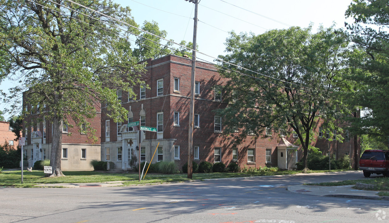
2836 Harrison Ave
2836 Harrison Ave,
Cincinnati,
OH
45211
-
Monthly Rent
Call for Rent
-
Bedrooms
1 - 2 bd
-
Bathrooms
1 ba
-
Square Feet
750 - 1,000 sq ft

Discover your next home at 2836 Harrison Ave. The Harrison Ave address in the 45211 Zip code of Cincinnati makes a popular place to move to. The professional leasing staff is waiting to show you all that this community has in store. Be sure to see the available floorplan options. Stop by to talk about leasing your new apartment.
Pricing & Floor Plans
Fees and Policies
The fees below are based on community-supplied data and may exclude additional fees and utilities.
-
One-Time Basics
-
Application Fee Per Applicant$10
-
-
Surface Lot
Property Fee Disclaimer: Based on community-supplied data and independent market research. Subject to change without notice. May exclude fees for mandatory or optional services and usage-based utilities.
Details
Utilities Included
-
Heat
-
Air Conditioning
Property Information
-
Built in 1930
-
31 units/3 stories
About 2836 Harrison Ave Cincinnati, OH 45211
Discover your next home at 2836 Harrison Ave. The Harrison Ave address in the 45211 Zip code of Cincinnati makes a popular place to move to. The professional leasing staff is waiting to show you all that this community has in store. Be sure to see the available floorplan options. Stop by to talk about leasing your new apartment.
2836 Harrison Ave is an apartment community located in Hamilton County and the 45211 ZIP Code. This area is served by the Cincinnati Public Schools attendance zone.
Contact
Apartment Features
Air Conditioning
High Speed Internet Access
Refrigerator
Disposal
- High Speed Internet Access
- Air Conditioning
- Smoke Free
- Disposal
- Kitchen
- Oven
- Range
- Refrigerator
- High Speed Internet Access
- Air Conditioning
- Smoke Free
- Disposal
- Kitchen
- Oven
- Range
- Refrigerator
| Monday | 8am - 6pm |
|---|---|
| Tuesday | 8am - 6pm |
| Wednesday | 8am - 6pm |
| Thursday | 8am - 6pm |
| Friday | 8am - 6pm |
| Saturday | By Appointment |
| Sunday | By Appointment |
Situated about five miles northwest of Downtown Cincinnati, Westwood is the largest neighborhood in the city. Residents flock to Westwood for its many affordable historic homes and modern apartments available for rent in addition to its close proximity to I-74, I-75, and all that Downtown Cincinnati has to offer.
While Westwood is a predominantly residential neighborhood, it is also home to a slew of convenient stores and restaurants. Shopping opportunities abound in Westwood, with plenty of national retailers in Western Hills Plaza and local shops in the growing Town Hall District. Numerous neighborhood parks provide ample space to enjoy the outdoors in town as well as the sprawling 1,400-acre Mount Airy Forest, which is partially located in Westwood.
Learn more about living in Westwood| Colleges & Universities | Distance | ||
|---|---|---|---|
| Colleges & Universities | Distance | ||
| Drive: | 14 min | 5.6 mi | |
| Drive: | 13 min | 5.6 mi | |
| Drive: | 12 min | 5.8 mi | |
| Drive: | 14 min | 6.3 mi |


View GreatSchools Rating Methodology
Data provided by GreatSchools.org © 2025. All rights reserved.
Transportation options available in Cincinnati include Brewery District Station, Elm & Henry, located 4.8 miles from 2836 Harrison Ave. 2836 Harrison Ave is near Cincinnati/Northern Kentucky International, located 19.1 miles or 36 minutes away.
| Transit / Subway | Distance | ||
|---|---|---|---|
| Transit / Subway | Distance | ||
| Drive: | 11 min | 4.8 mi | |
| Drive: | 11 min | 5.0 mi | |
| Drive: | 12 min | 5.0 mi | |
| Drive: | 12 min | 5.1 mi | |
| Drive: | 12 min | 5.3 mi |
| Commuter Rail | Distance | ||
|---|---|---|---|
| Commuter Rail | Distance | ||
|
|
Drive: | 11 min | 5.0 mi |
| Airports | Distance | ||
|---|---|---|---|
| Airports | Distance | ||
|
Cincinnati/Northern Kentucky International
|
Drive: | 36 min | 19.1 mi |
Time and distance from 2836 Harrison Ave.
| Shopping Centers | Distance | ||
|---|---|---|---|
| Shopping Centers | Distance | ||
| Drive: | 4 min | 1.5 mi | |
| Drive: | 5 min | 1.8 mi | |
| Drive: | 5 min | 2.0 mi |
| Parks and Recreation | Distance | ||
|---|---|---|---|
| Parks and Recreation | Distance | ||
|
Mt. Airy Forest
|
Drive: | 8 min | 3.7 mi |
|
Imago Earth Center
|
Drive: | 11 min | 4.2 mi |
|
Buttercup Valley
|
Drive: | 11 min | 4.5 mi |
|
Embshoff Woods
|
Drive: | 14 min | 4.8 mi |
|
Wilson Commons
|
Drive: | 12 min | 5.0 mi |
| Hospitals | Distance | ||
|---|---|---|---|
| Hospitals | Distance | ||
| Drive: | 9 min | 3.5 mi | |
| Drive: | 11 min | 5.1 mi | |
| Drive: | 14 min | 6.3 mi |
| Military Bases | Distance | ||
|---|---|---|---|
| Military Bases | Distance | ||
| Drive: | 73 min | 55.3 mi | |
| Drive: | 79 min | 60.4 mi | |
| Drive: | 82 min | 63.7 mi |
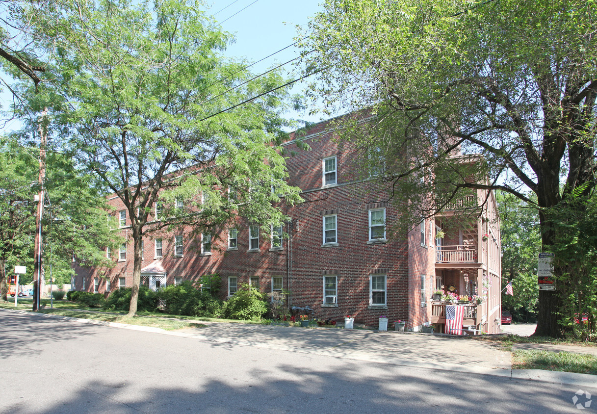
2836 Harrison Ave Photos
-
2836 Harrison Ave.
-
2836 Harrison Ave.
Nearby Apartments
Within 50 Miles of 2836 Harrison Ave Cincinnati, OH 45211
2836 Harrison Ave does not offer in-unit laundry or shared facilities. Please contact the property to learn about nearby laundry options.
Select utilities are included in rent at 2836 Harrison Ave, including heat and air conditioning. Residents are responsible for any other utilities not listed.
2836 Harrison Ave does not allow pets, though service animals are always welcome in accordance with applicable laws.
2836 Harrison Ave is not currently offering any rent specials. Check back soon, as promotions change frequently.
While 2836 Harrison Ave does not offer Matterport 3D tours, renters can request a tour directly through our online platform.
What Are Walk Score®, Transit Score®, and Bike Score® Ratings?
Walk Score® measures the walkability of any address. Transit Score® measures access to public transit. Bike Score® measures the bikeability of any address.
What is a Sound Score Rating?
A Sound Score Rating aggregates noise caused by vehicle traffic, airplane traffic and local sources
2836 Harrison Ave
Cincinnati, OH 45211
Property Manager Responded