
$2,138
/ Month
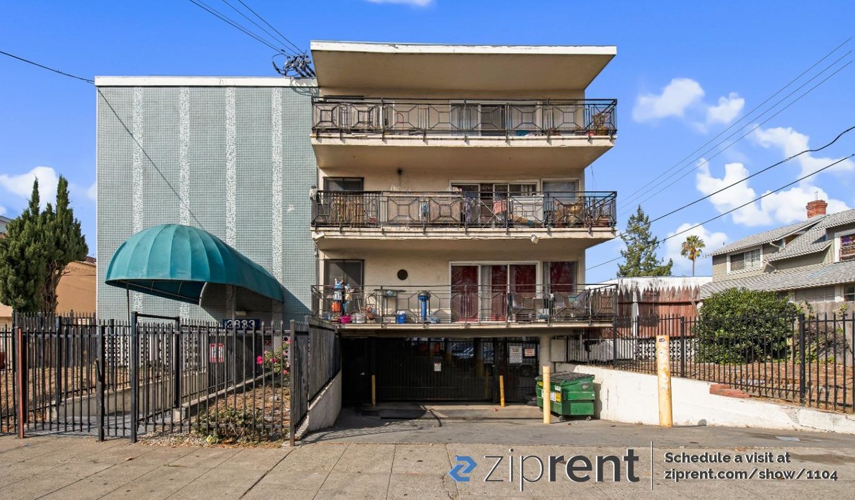
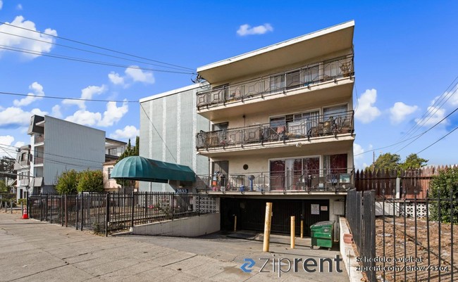
2833 High St
Oakland, CA 94619
2 Weeks Ago
Favorites
2833 High St

Favorites
Check Back Soon for Upcoming Availability
| Beds | Baths | Average SF |
|---|---|---|
| 2 Bedrooms 2 Bedrooms 2 Br | 1 Bath 1 Bath 1 Ba | 750 SF |
Fees and Policies
The fees below are based on community-supplied data and may exclude additional fees and utilities.
- Parking
-
Garage--
Details
Utilities Included
-
Gas
-
Water
-
Trash Removal
-
Sewer
About This Property
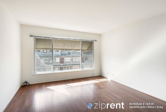
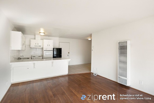
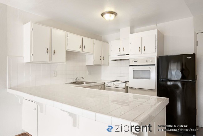
Please Note: If this ad is still up, the property is still available. Please inquire on this site to schedule a showing! Light and bright upper level 2/1 apartment unit conveniently located 2 blocks north of Maxwell park and a few blocks away from the 580. Wood flooring and tile in the kitchen. Minutes from mills college. Onsite parking requires a permit which is available for an additional $120/month. Owner pays for water and trash. Come check it out today.
2833 High St is a house located in Alameda County and the 94619 ZIP Code. This area is served by the Oakland Unified attendance zone.
Location
Get Directions
Allendale is a mostly residential community just off the MacArthur Freeway. Residents enjoy a walkable landscape with a wide array of local amenities: Allendale Elementary School’s location in the north-central portion of the neighborhood gives students the option to walk to class safely; small grocers, cafes, and specialty businesses in the neighborhood keep folks well-fed and well-supplied; and Allendale Recreation Center provides a terrific venue for enjoying the sunshine with friends and neighbors.
A more diverse selection restaurants and shops can be found along MacArthur Boulevard just a few blocks to the northeast, and many more public parks surround Allendale on all sides. Numerous healthcare facilities in and around the neighborhood make it a great spot for medical professionals. Mills College is only a few blocks to the east, and of course the close proximity to the freeway makes it easy to reach anywhere in the Bay Area and beyond.
Learn more about living in AllendaleBelow are rent ranges for similar nearby apartments
Expenses
Utilities Included
Gas, Water, Trash Removal, Sewer
Included
Education
| Colleges & Universities | Distance | ||
|---|---|---|---|
| Colleges & Universities | Distance | ||
| Drive: | 5 min | 1.5 mi | |
| Drive: | 7 min | 4.2 mi | |
| Drive: | 9 min | 5.6 mi | |
| Drive: | 12 min | 6.8 mi |
2833 High St is within 5 minutes or 1.5 miles from Mills College. It is also near Laney College and Lincoln University, Oakland.
Schools


Public Elementary & Middle School
Grades K-8
656 Students
Nearby
Public Elementary School
Grades K-5
362 Students
Nearby
Public High School
Grades 9-12
1,146 Students
Nearby
Private Elementary, Middle & High School
Grades 1-12
Nearby
Private Elementary, Middle & High School
Grades PK-10
Nearby
School data provided by
 The GreatSchools Rating helps parents compare schools within a state based on a variety of school quality indicators and provides a helpful picture of how effectively each school serves all of its students. Ratings are on a scale of 1 (below average) to 10 (above average) and can include test scores, college readiness, academic progress, advanced courses, equity, discipline and attendance data. We also advise parents to visit schools, consider other information on school performance and programs, and consider family needs as part of the school selection process.
View GreatSchools Rating Methodology
Data provided by GreatSchools.org © 2025. All rights reserved.
View GreatSchools Rating Methodology
Data provided by GreatSchools.org © 2025. All rights reserved.
Transportation options available in Oakland include Fruitvale Station, located 1.7 miles from 2833 High St. 2833 High St is near Metro Oakland International, located 6.6 miles or 11 minutes away, and San Francisco International, located 27.0 miles or 39 minutes away.
| Transit / Subway | Distance | ||
|---|---|---|---|
| Transit / Subway | Distance | ||
|
|
Drive: | 3 min | 1.7 mi |
|
|
Drive: | 5 min | 2.9 mi |
|
|
Drive: | 8 min | 4.9 mi |
|
|
Drive: | 8 min | 5.5 mi |
|
|
Drive: | 8 min | 5.5 mi |
| Commuter Rail | Distance | ||
|---|---|---|---|
| Commuter Rail | Distance | ||
|
|
Drive: | 8 min | 5.0 mi |
|
|
Drive: | 11 min | 8.0 mi |
|
|
Drive: | 14 min | 10.1 mi |
|
|
Drive: | 17 min | 11.8 mi |
| Drive: | 17 min | 11.8 mi |
| Airports | Distance | ||
|---|---|---|---|
| Airports | Distance | ||
|
Metro Oakland International
|
Drive: | 11 min | 6.6 mi |
|
San Francisco International
|
Drive: | 39 min | 27.0 mi |
Time and distance from 2833 High St.
| Shopping Centers | Distance | ||
|---|---|---|---|
| Shopping Centers | Distance | ||
| Walk: | 16 min | 0.9 mi | |
| Walk: | 20 min | 1.0 mi | |
| Drive: | 3 min | 2.1 mi |
2833 High St has 3 shopping centers within 2.1 miles, which is about a 3-minute walk. The miles and minutes will be for the farthest away property.
| Parks and Recreation | Distance | ||
|---|---|---|---|
| Parks and Recreation | Distance | ||
|
Roberts Regional Recreation Area
|
Drive: | 9 min | 4.2 mi |
|
Redwood Regional Park
|
Drive: | 9 min | 4.4 mi |
|
Chabot Space & Science Center
|
Drive: | 12 min | 4.8 mi |
|
Joaquin Miller Park
|
Drive: | 12 min | 5.0 mi |
|
Martin Luther King Jr. Regional Shoreline
|
Drive: | 10 min | 5.6 mi |
2833 High St has 5 parks within 5.6 miles, including Joaquin Miller Park, Roberts Regional Recreation Area, and Martin Luther King Jr. Regional Shoreline.
| Hospitals | Distance | ||
|---|---|---|---|
| Hospitals | Distance | ||
| Drive: | 4 min | 2.3 mi | |
| Drive: | 4 min | 2.8 mi | |
| Drive: | 9 min | 3.7 mi |
2833 High St has 3 hospitals within 3.7 miles, the nearest is Telecare Heritage Psychiatric Health Facility which is 2.3 miles away and a 4 minute drive.
| Military Bases | Distance | ||
|---|---|---|---|
| Military Bases | Distance | ||
| Drive: | 16 min | 8.3 mi | |
| Drive: | 16 min | 8.5 mi |
2833 High St is 8.3 miles from Alameda/US Naval Air Station Alameda, and is convenient to other military bases, including Oakland Army Base.
You May Also Like
Similar Rentals Nearby


What Are Walk Score®, Transit Score®, and Bike Score® Ratings?
Walk Score® measures the walkability of any address. Transit Score® measures access to public transit. Bike Score® measures the bikeability of any address.
What is a Sound Score Rating?
A Sound Score Rating aggregates noise caused by vehicle traffic, airplane traffic and local sources

2833 High St
Oakland, CA 94619