
$1,700
Total Monthly Price
2832 Saxton Rd
Philadelphia, PA 19114
Favorites
-
Bedrooms
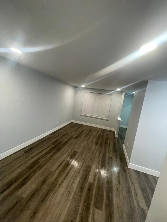
2
-
Bathrooms
1
-
Square Feet
924 sq ft
-
Available
Available Now
2832 Saxton Rd

Favorites
About This Home
12 Month Lease,
$1,700 deposit,
Available Now
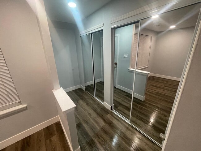
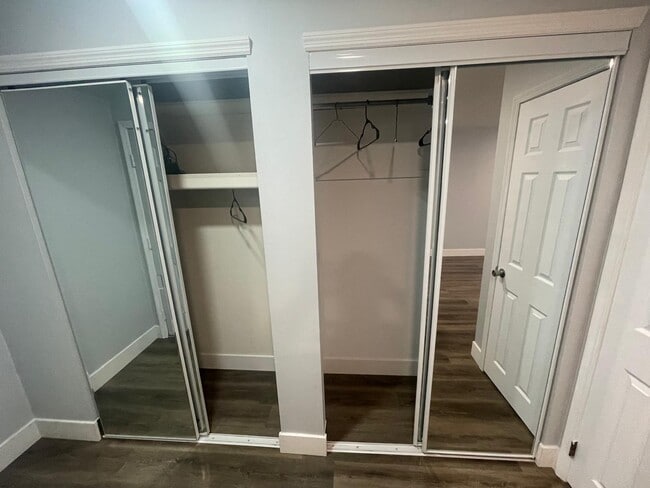
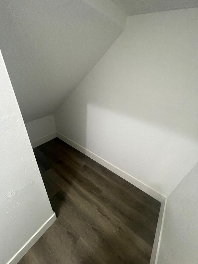
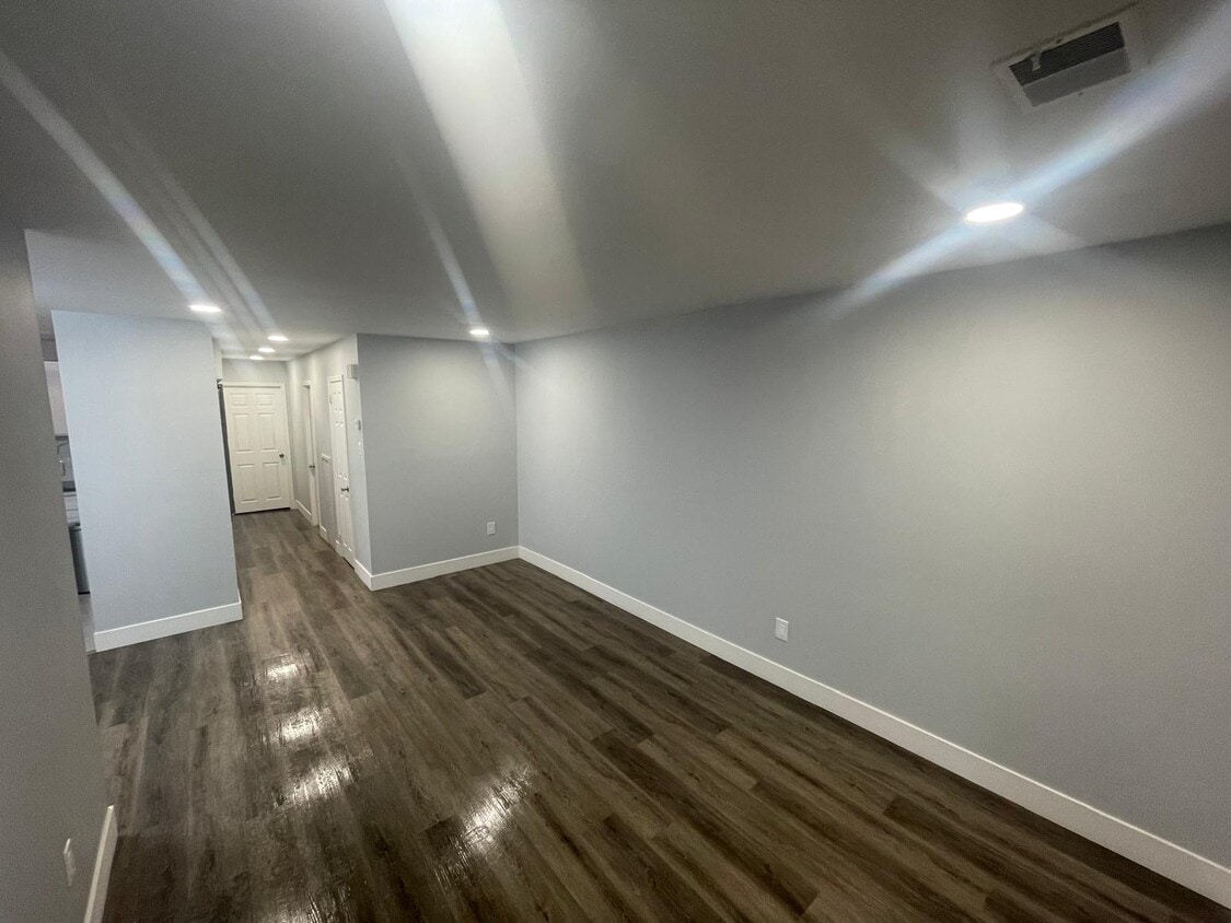
2-bedroom, 1-bathroom 1st floor duplex rental located in a prime Northeast Philadelphia location. Situated just moments from Roosevelt Boulevard, this offers unparalleled access to transportation, retail stores and supermarkets while tucked away in a residential pocket. This unit offers abundant closet space throughout, including bedroom closets and additional hallway storage to keep your living areas organized.
2832 Saxton Rd is a house located in Philadelphia County and the 19114 ZIP Code. This area is served by the The School District of Philadelphia attendance zone.
* Price shown is total price based on community-supplied monthly required fees. Excludes user-selected optional fees and variable or usage-based fees and required charges due at or prior to move-in or at move-out. Price, availability, fees, and any applicable rent special are subject to change without notice.
* Square footage definitions vary. Displayed square footage is approximate.
House Features
- Ceiling Fans
- Storage Space
Fees and Policies
The fees listed below are community-provided and may exclude utilities or add-ons. All payments are made directly to the property and are non-refundable unless otherwise specified.
Details
Utilities Included
-
Water
Contact
- Contact
Location
Get Directions
Nestled along the Delaware River, Torresdale is a wooded neighborhood located about 13 miles northeast of Center City, Philadelphia’s downtown district. There are several parks and a golf course for residents to enjoy. Pennypack Park neighbors Torresdale to the west and is a popular spot for mountain biking and fishing. There are multiple restaurants, grocers, and shopping plazas located in and around Torresdale, so residents have access to plenty of amenities. There is a wide variety of rental options available for every budget and style including houses, apartments, condos, and townhomes. Along with a train station, U.S. Route 13 and Interstate 13 run through Torresdale, so the neighborhood is a great option for renters who commute to work or want a quieter setting that isn’t too far from the heart of the city.
Learn more about living in Torresdale
Education
| Colleges & Universities | Distance | ||
|---|---|---|---|
| Colleges & Universities | Distance | ||
| Drive: | 5 min | 2.1 mi | |
| Drive: | 10 min | 4.2 mi | |
| Drive: | 17 min | 9.2 mi | |
| Drive: | 20 min | 9.2 mi |
2832 Saxton Rd is within 5 minutes or 2.1 miles from Holy Family University. It is also near C.C. of Philadelphia, NE Ctr and Penn State Abington.
Schools


Public Elementary & Middle School
Grades K-8
685 Students
Attendance Zone
Public High School
Grades PK & 9-12
2,207 Students
Attendance Zone
School data provided by
 The GreatSchools Rating helps parents compare schools within a state based on a variety of school quality indicators and provides a helpful picture of how effectively each school serves all of its students. Ratings are on a scale of 1 (below average) to 10 (above average) and can include test scores, college readiness, academic progress, advanced courses, equity, discipline and attendance data. We also advise parents to visit schools, consider other information on school performance and programs, and consider family needs as part of the school selection process.
View GreatSchools Rating Methodology
Data provided by GreatSchools.org © 2026. All rights reserved.
View GreatSchools Rating Methodology
Data provided by GreatSchools.org © 2026. All rights reserved.
Transportation options available in Philadelphia include Palmyra, located 8.4 miles from 2832 Saxton Rd. 2832 Saxton Rd is near Trenton Mercer, located 21.3 miles or 34 minutes away, and Philadelphia International, located 24.1 miles or 38 minutes away.
| Transit / Subway | Distance | ||
|---|---|---|---|
| Transit / Subway | Distance | ||
|
|
Drive: | 20 min | 8.4 mi |
|
|
Drive: | 21 min | 8.9 mi |
|
|
Drive: | 23 min | 9.8 mi |
|
|
Drive: | 26 min | 12.4 mi |
|
|
Drive: | 29 min | 13.7 mi |
| Commuter Rail | Distance | ||
|---|---|---|---|
| Commuter Rail | Distance | ||
|
|
Drive: | 6 min | 2.4 mi |
|
|
Drive: | 10 min | 3.1 mi |
|
|
Drive: | 11 min | 4.9 mi |
|
|
Drive: | 11 min | 5.3 mi |
|
|
Drive: | 11 min | 5.5 mi |
| Airports | Distance | ||
|---|---|---|---|
| Airports | Distance | ||
|
Trenton Mercer
|
Drive: | 34 min | 21.3 mi |
|
Philadelphia International
|
Drive: | 38 min | 24.1 mi |
Getting Around
 What do Walkability, Transit, Drivability, and Bikeability mean?
Walkability measures the walking distance to day-to-day needs.
Transit measures access to public transportation.
Drivability measures congestion, parking availability, and access to major roads.
Bikeability measures the suitability for cycling.
How It Works
What do Walkability, Transit, Drivability, and Bikeability mean?
Walkability measures the walking distance to day-to-day needs.
Transit measures access to public transportation.
Drivability measures congestion, parking availability, and access to major roads.
Bikeability measures the suitability for cycling.
How It Works
Moderately Walkable
Walkability
60
/ 100
Some Public Transit
Transit
40
/ 100
Very Drivable
Drivability
80
/ 100
Fairly Bikeable
Bikeability
50
/ 100
Scores provided by
-
Soundscore™
-
/ 100
Traffic
-Airport
-Businesses
-Scores provided by
HowLoud What is a Sound Score Rating? A Sound Score Rating aggregates noise caused by vehicle traffic, airplane traffic and local sources. How It WorksTime and distance from 2832 Saxton Rd.
| Shopping Centers | Distance | ||
|---|---|---|---|
| Shopping Centers | Distance | ||
| Walk: | 15 min | 0.8 mi | |
| Drive: | 3 min | 1.1 mi | |
| Drive: | 3 min | 1.2 mi |
2832 Saxton Rd has 3 shopping centers within 1.2 miles, which is about a 3-minute drive. The miles and minutes will be for the farthest away property.
| Parks and Recreation | Distance | ||
|---|---|---|---|
| Parks and Recreation | Distance | ||
|
Insectarium
|
Drive: | 8 min | 2.3 mi |
|
Pennypack Park
|
Drive: | 7 min | 3.3 mi |
|
Lorimer Park
|
Drive: | 11 min | 4.4 mi |
|
Benjamin Rush State Park
|
Drive: | 15 min | 6.0 mi |
|
Amico Island Park
|
Drive: | 27 min | 12.0 mi |
2832 Saxton Rd has 5 parks within 12.0 miles, including Insectarium, Pennypack Park, and Lorimer Park.
| Hospitals | Distance | ||
|---|---|---|---|
| Hospitals | Distance | ||
| Drive: | 6 min | 2.0 mi | |
| Drive: | 6 min | 2.9 mi | |
| Drive: | 12 min | 6.1 mi |
2832 Saxton Rd has 3 hospitals within 6.1 miles, the nearest is Nazareth Hospital which is 2.0 miles away and a 6 minute drive.
| Military Bases | Distance | ||
|---|---|---|---|
| Military Bases | Distance | ||
| Drive: | 25 min | 13.3 mi | |
| Drive: | 29 min | 15.3 mi | |
| Drive: | 29 min | 18.5 mi |
2832 Saxton Rd has 3 military bases within 18.5 miles, the nearest is Naval Air Development Center which is 13.3 miles away and a 25 minute drive.
Amenities
- Ceiling Fans
- Storage Space
2832 Saxton Rd Photos
What Are Walk Score®, Transit Score®, and Bike Score® Ratings?
Walk Score® measures the walkability of any address. Transit Score® measures access to public transit. Bike Score® measures the bikeability of any address.
What is a Sound Score Rating?
A Sound Score Rating aggregates noise caused by vehicle traffic, airplane traffic and local sources.
2832 Saxton Rd
Philadelphia, PA 19114