
2825 Glendora Ave
Cincinnati, OH 45219
-
Bedrooms
3
-
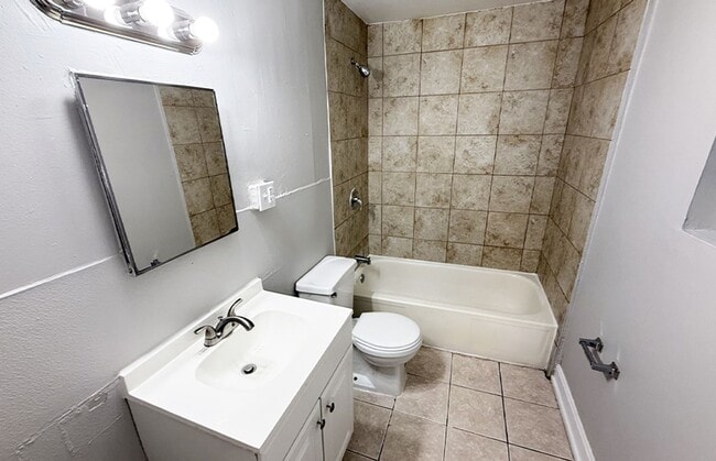
Bathrooms
1
-
Square Feet
1,242 sq ft
-
Available
Available Now

About This Home
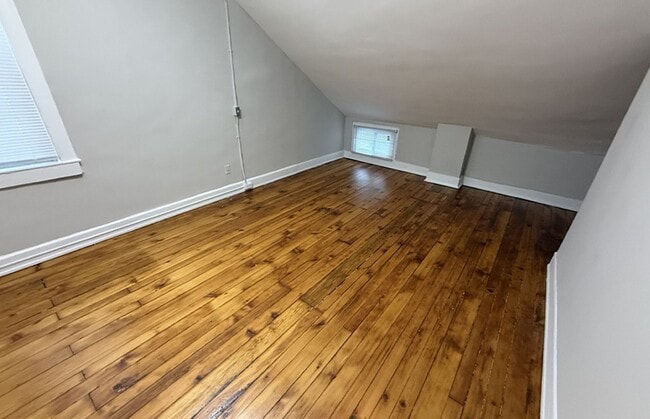
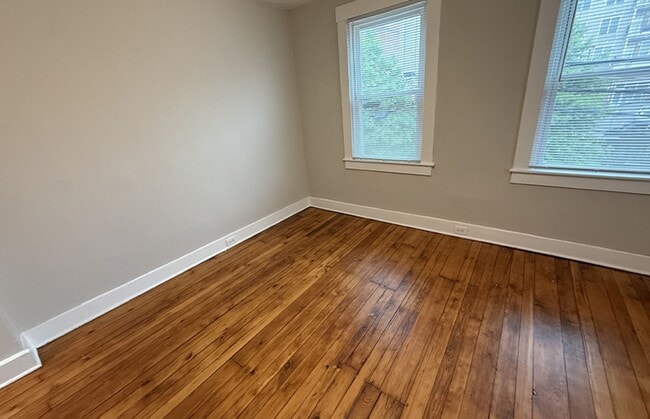
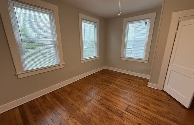
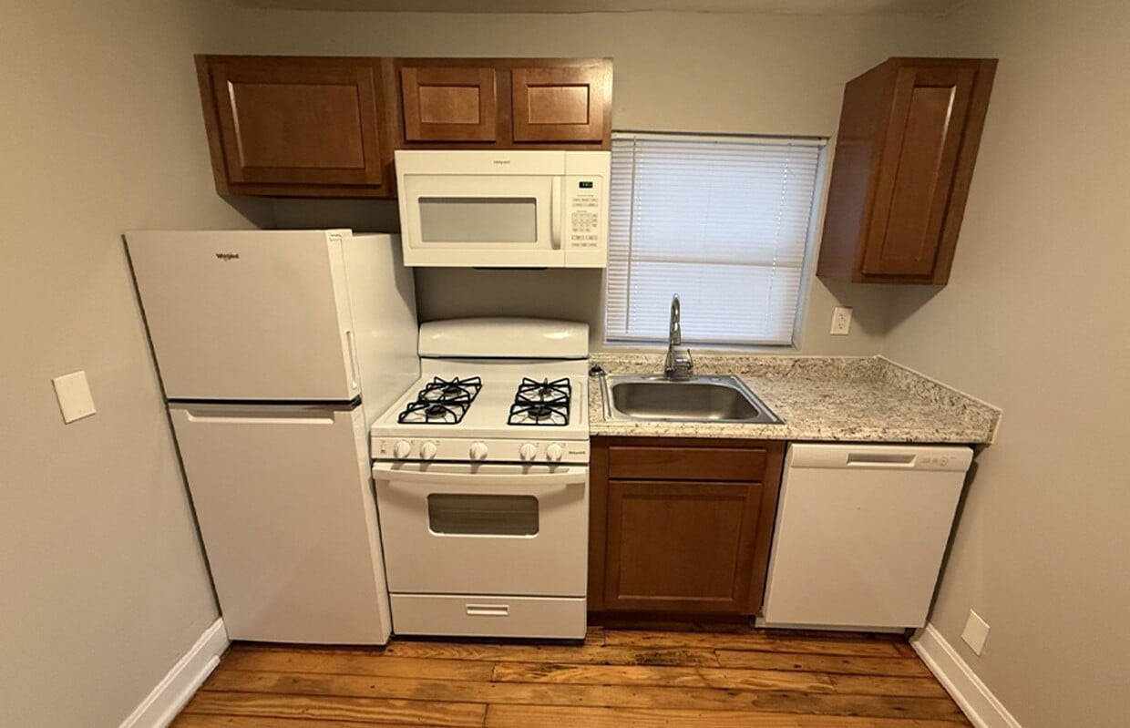
This building is one block from the University of Cincinnati campus and one block from Short Vine. Inside, you'll find features such as Dishwasher, Gas Range, Hardwood Flooring, Microwave, with more amenities designed for your comfort.
2825 Glendora Ave is a house located in Hamilton County and the 45219 ZIP Code. This area is served by the Cincinnati Public Schools attendance zone.
Fees and Policies
The fees listed below are community-provided and may exclude utilities or add-ons. All payments are made directly to the property and are non-refundable unless otherwise specified. Use the Cost Calculator to determine costs based on your needs.
-
One-Time Basics
-
Due at Move-In
-
Security Deposit - RefundableCharged per unit.$2,195
-
-
Due at Move-In
Property Fee Disclaimer: Based on community-supplied data and independent market research. Subject to change without notice. May exclude fees for mandatory or optional services and usage-based utilities.
House Features
- Dishwasher
Contact
- Phone Number
- Website View Property Website
- Contact
-
Source

Corryville is an up-and-coming community just four miles from Cincinnati’s Central Business District. The neighborhood is next to the University of Cincinnati campus, containing the school’s College of Medicine classrooms.
Because of its proximity to the university, Corryville has experienced rapid growth in the construction of new student apartments and trendy restaurants. Even with such development, the Mecklenburg Gardens restaurant continues to be a popular dining spot for locals since its opening in 1870.
Residents and students alike enjoy the many happy hour options on Short Vine Street. The Bogart’s theater is a cool landmark, known for its metal band concerts. Locals adore the walkability of Corryville, direct access to Interstate 71, and the nearby scenic landscapes of Burnet Woods.
Learn more about living in Corryville- Dishwasher
| Colleges & Universities | Distance | ||
|---|---|---|---|
| Colleges & Universities | Distance | ||
| Walk: | 5 min | 0.3 mi | |
| Walk: | 12 min | 0.6 mi | |
| Drive: | 9 min | 2.9 mi | |
| Drive: | 9 min | 3.1 mi |


View GreatSchools Rating Methodology
Data provided by GreatSchools.org © 2026. All rights reserved.
Transportation options available in Cincinnati include Findlay Market-Race Station - Race & Elder, located 1.4 miles from 2825 Glendora Ave. 2825 Glendora Ave is near Cincinnati/Northern Kentucky International, located 15.3 miles or 27 minutes away.
| Transit / Subway | Distance | ||
|---|---|---|---|
| Transit / Subway | Distance | ||
| Drive: | 4 min | 1.4 mi | |
| Drive: | 4 min | 1.5 mi | |
| Drive: | 5 min | 1.5 mi | |
| Drive: | 4 min | 1.6 mi | |
| Drive: | 5 min | 1.9 mi |
| Commuter Rail | Distance | ||
|---|---|---|---|
| Commuter Rail | Distance | ||
|
|
Drive: | 8 min | 2.9 mi |
| Airports | Distance | ||
|---|---|---|---|
| Airports | Distance | ||
|
Cincinnati/Northern Kentucky International
|
Drive: | 27 min | 15.3 mi |
Time and distance from 2825 Glendora Ave.
| Shopping Centers | Distance | ||
|---|---|---|---|
| Shopping Centers | Distance | ||
| Drive: | 4 min | 1.9 mi | |
| Drive: | 6 min | 2.1 mi | |
| Drive: | 5 min | 2.1 mi |
| Parks and Recreation | Distance | ||
|---|---|---|---|
| Parks and Recreation | Distance | ||
|
Cincinnati Zoo and Botanical Garden
|
Walk: | 14 min | 0.7 mi |
|
Trailside Nature Center
|
Walk: | 14 min | 0.8 mi |
|
Burnet Woods
|
Walk: | 16 min | 0.9 mi |
|
William H. Taft National Historic Site
|
Walk: | 20 min | 1.0 mi |
|
Eden Park
|
Drive: | 6 min | 2.4 mi |
| Hospitals | Distance | ||
|---|---|---|---|
| Hospitals | Distance | ||
| Walk: | 13 min | 0.7 mi | |
| Walk: | 16 min | 0.8 mi | |
| Walk: | 17 min | 0.9 mi |
| Military Bases | Distance | ||
|---|---|---|---|
| Military Bases | Distance | ||
| Drive: | 69 min | 51.7 mi | |
| Drive: | 74 min | 56.7 mi | |
| Drive: | 90 min | 65.9 mi |
You May Also Like
What Are Walk Score®, Transit Score®, and Bike Score® Ratings?
Walk Score® measures the walkability of any address. Transit Score® measures access to public transit. Bike Score® measures the bikeability of any address.
What is a Sound Score Rating?
A Sound Score Rating aggregates noise caused by vehicle traffic, airplane traffic and local sources
2825 Glendora Ave
Cincinnati, OH 45219