$3,995
/ Month
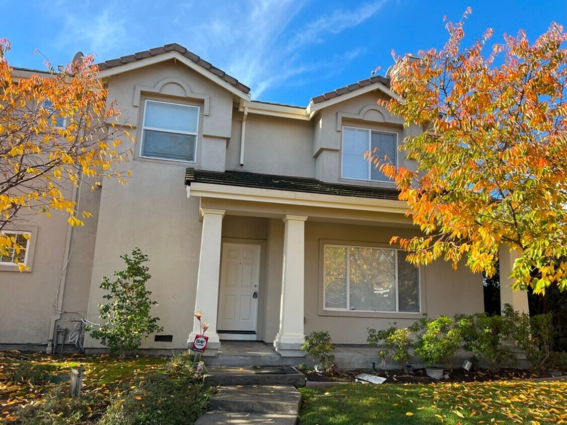
28187 St Tropez Pl
Hayward, CA 94544
2 Weeks Ago
|
Edit
Favorites
28187 St Tropez Pl

Favorites
Check Back Soon for Upcoming Availability
| Beds | Baths | Average SF |
|---|---|---|
| 4 Bedrooms 4 Bedrooms 4 Br | 2.5 Baths 2.5 Baths 2.5 Ba | 1,856 SF |
Fees and Policies
The fees below are based on community-supplied data and may exclude additional fees and utilities.
- Dogs Allowed
-
Fees not specified
- Cats Allowed
-
Fees not specified
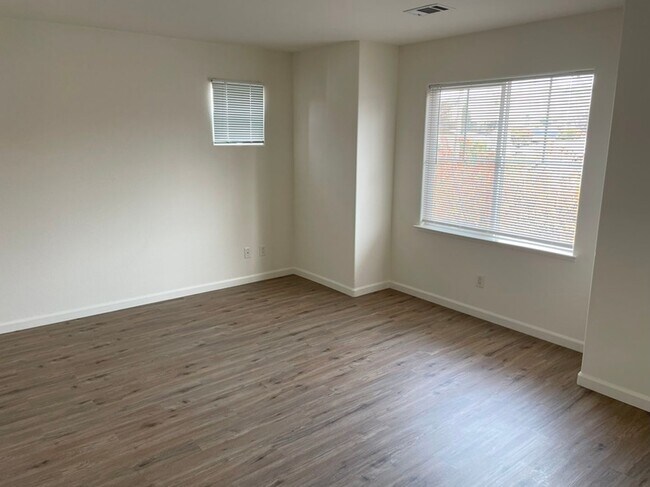
About This Property
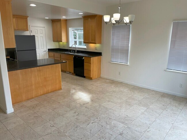
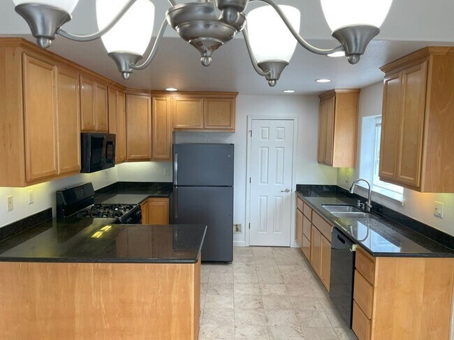
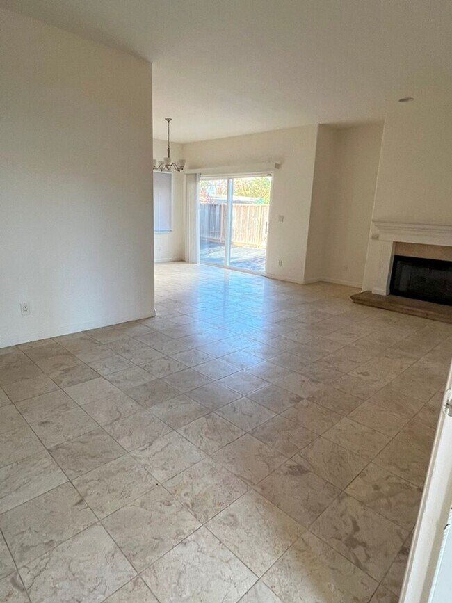
This 1856 square foot single family home has 4 bedrooms and 2.5 bathrooms. This home is located at 28187 Saint Tropez Pl, Hayward, CA 94544.
28187 St Tropez Pl is a house located in Alameda County and the 94544 ZIP Code. This area is served by the Hayward Unified attendance zone.
Location
Get Directions
Located in the East Bay, Hayward combines city living with natural surroundings. The rental market remains steady, with one-bedroom apartments averaging $2,102 and showing a 2% annual increase. Housing choices include downtown apartments and residential areas near California State University, East Bay. With two BART stations and easy freeway access, Hayward provides convenient transportation for Bay Area commuters. Outdoor spaces include the Hayward Regional Shoreline and Japanese Gardens, which features traditional design elements dating back generations.
Downtown Hayward showcases public art through its mural program, adding character to the streetscape. The California State University, East Bay campus sits atop the hills, while Chabot College adds to the educational landscape. Historic architecture dots the city, including the distinctive City Hall and the Green Shutter Hotel, a National Register of Historic Places landmark.
Learn more about living in HaywardBelow are rent ranges for similar nearby apartments
Education
| Colleges & Universities | Distance | ||
|---|---|---|---|
| Colleges & Universities | Distance | ||
| Drive: | 6 min | 2.7 mi | |
| Drive: | 8 min | 3.4 mi | |
| Drive: | 16 min | 11.3 mi | |
| Drive: | 22 min | 11.7 mi |
28187 St Tropez Pl is within 6 minutes or 2.7 miles from Cal State East Bay. It is also near Chabot College and Ohlone College, Newark.
Schools


Charter Elementary School
Grades K-5
483 Students
Nearby
Public Elementary School
Grades K-6
283 Students
Attendance Zone
Public Middle School
Grades 7-8
482 Students
Attendance Zone
Public High School
Grades 9-12
1,551 Students
Attendance Zone
Private Elementary School
Grades PK-3
18 Students
Nearby
Private Elementary & Middle School
Grades K-8
Nearby
Private High School
Grades 9-12
836 Students
Nearby
School data provided by
 The GreatSchools Rating helps parents compare schools within a state based on a variety of school quality indicators and provides a helpful picture of how effectively each school serves all of its students. Ratings are on a scale of 1 (below average) to 10 (above average) and can include test scores, college readiness, academic progress, advanced courses, equity, discipline and attendance data. We also advise parents to visit schools, consider other information on school performance and programs, and consider family needs as part of the school selection process.
View GreatSchools Rating Methodology
Data provided by GreatSchools.org © 2025. All rights reserved.
View GreatSchools Rating Methodology
Data provided by GreatSchools.org © 2025. All rights reserved.
Transportation options available in Hayward include South Hayward Station, located 0.5 mile from 28187 St Tropez Pl. 28187 St Tropez Pl is near Metro Oakland International, located 13.1 miles or 19 minutes away, and San Francisco International, located 23.7 miles or 31 minutes away.
| Transit / Subway | Distance | ||
|---|---|---|---|
| Transit / Subway | Distance | ||
|
|
Walk: | 10 min | 0.5 mi |
|
|
Drive: | 10 min | 4.5 mi |
|
|
Drive: | 9 min | 4.6 mi |
|
|
Drive: | 12 min | 5.8 mi |
|
|
Drive: | 11 min | 7.0 mi |
| Commuter Rail | Distance | ||
|---|---|---|---|
| Commuter Rail | Distance | ||
|
|
Drive: | 9 min | 4.9 mi |
| Drive: | 9 min | 4.9 mi | |
| Drive: | 14 min | 8.6 mi | |
| Drive: | 15 min | 8.8 mi | |
| Drive: | 28 min | 18.1 mi |
| Airports | Distance | ||
|---|---|---|---|
| Airports | Distance | ||
|
Metro Oakland International
|
Drive: | 19 min | 13.1 mi |
|
San Francisco International
|
Drive: | 31 min | 23.7 mi |
Time and distance from 28187 St Tropez Pl.
| Shopping Centers | Distance | ||
|---|---|---|---|
| Shopping Centers | Distance | ||
| Walk: | 4 min | 0.3 mi | |
| Walk: | 7 min | 0.4 mi | |
| Walk: | 9 min | 0.5 mi |
28187 St Tropez Pl has 3 shopping centers within 0.5 mile, which is about a 9-minute walk. The miles and minutes will be for the farthest away property.
| Parks and Recreation | Distance | ||
|---|---|---|---|
| Parks and Recreation | Distance | ||
|
Garin/Dry Creek Pioneer Parks
|
Drive: | 7 min | 3.4 mi |
|
Sulphur Creek Nature Center
|
Drive: | 11 min | 4.4 mi |
|
Don Castro Regional Recreation Area
|
Drive: | 12 min | 5.4 mi |
|
Hayward Shoreline Interpretive Center
|
Drive: | 11 min | 5.8 mi |
|
Alameda Creek Regional Trail
|
Drive: | 13 min | 6.6 mi |
28187 St Tropez Pl has 5 parks within 6.6 miles, including Garin/Dry Creek Pioneer Parks, Sulphur Creek Nature Center, and Don Castro Regional Recreation Area.
| Hospitals | Distance | ||
|---|---|---|---|
| Hospitals | Distance | ||
| Drive: | 4 min | 2.0 mi | |
| Drive: | 12 min | 7.9 mi | |
| Drive: | 15 min | 8.4 mi |
28187 St Tropez Pl has 3 hospitals within 8.4 miles, the nearest is St. Rose Hospital which is 2.0 miles away and a 4 minute drive.
| Military Bases | Distance | ||
|---|---|---|---|
| Military Bases | Distance | ||
| Drive: | 30 min | 20.5 mi | |
| Drive: | 36 min | 24.7 mi |
28187 St Tropez Pl is 20.5 miles from Alameda/US Naval Air Station Alameda, and is convenient to other military bases, including Ames Research Center.
You May Also Like
Similar Rentals Nearby


What Are Walk Score®, Transit Score®, and Bike Score® Ratings?
Walk Score® measures the walkability of any address. Transit Score® measures access to public transit. Bike Score® measures the bikeability of any address.
What is a Sound Score Rating?
A Sound Score Rating aggregates noise caused by vehicle traffic, airplane traffic and local sources

28187 St Tropez Pl
Hayward, CA 94544