
$3,300 / Month
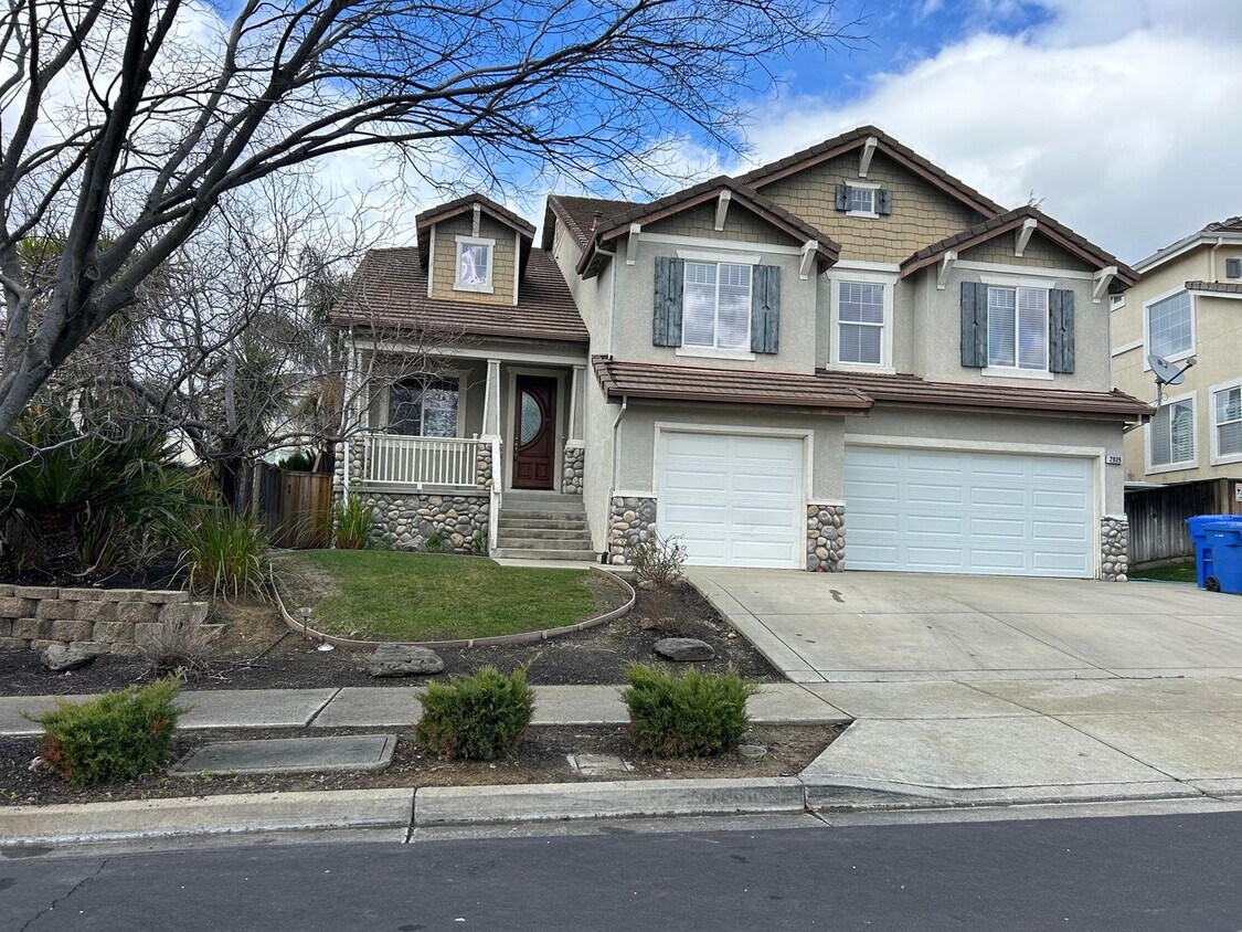
2809 Abbeydale Ct
Brentwood, CA 94513
2 Weeks Ago
Favorites
-
Bedrooms
5
-
Bathrooms
4
-
Square Feet
3,081 sq ft
2809 Abbeydale Ct

Favorites
About This Home
$3,300 deposit
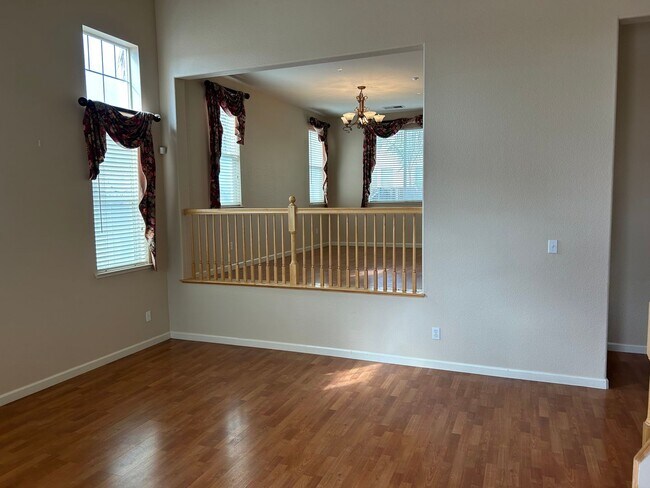
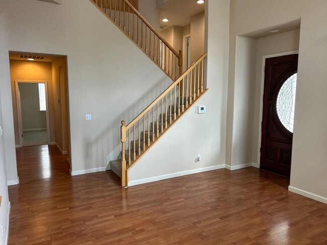
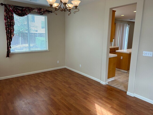
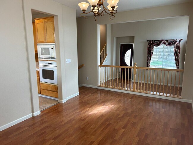
Beautiful Tri-Level Shadow Lakes Home. Best Property Management . 5 Bedroom, 4 Full Baths and one large entertainment/bonus room. One bedroom, 1 bath downstairs. Mid level has 1 bedroom, 1 Bath and bonus room. Upper level has Master and 2 additional room with Jack and Jill bath. Separate Living Room, Family Room and Dining room. Three Car garage. Spacious and gorgeous backyard for entertaining and relaxing. Landscaper included. Please give Reese a call to schedule a showing. . One-year lease to start. Applicant must have gross income 3 times higher than the rental rate and be able to pass rental history and criminal background check. FICO score of 650 or higher preferred. Brendan Reese Cal BRE #01978176
2809 Abbeydale Ct is a house located in Contra Costa County and the 94513 ZIP Code. This area is served by the Brentwood Union Elementary attendance zone.
* Price shown is base rent and may not include non-optional fees and utilities.
Price, availability, fees, and any applicable rent special are subject to change without notice.
* Square footage definitions vary. Displayed square footage is approximate.
Contact
- Listed by Best Property Management | Best Property Management
Location
Get Directions
Brentwood, California is a great place to live for those seeking a peaceful suburban lifestyle while still being within close proximity to the action of The Bay. Located in Contra Costa County, Brentwood has a population of around 60,000 people and is known for its picturesque parks, top-notch schools, and friendly community.
For potential renters looking for a place to call home in Brentwood, there are a variety of options available. Rental properties in the area range from apartments and townhomes to single-family homes and condos, giving renters a wide range of choices to fit their lifestyle and budget. One of the most attractive features of Brentwood is its abundance of parks and outdoor recreation areas. For those who love to hike, bike, or simply enjoy a leisurely stroll, the Iron Horse Trail is a popular choice. This paved trail stretches over 30 miles from Concord to Dublin and is perfect for all fitness levels.
Learn more about living in Brentwood
Education
| Colleges & Universities | Distance | ||
|---|---|---|---|
| Colleges & Universities | Distance | ||
| Drive: | 10 min | 3.8 mi | |
| Drive: | 23 min | 13.9 mi | |
| Drive: | 41 min | 27.4 mi | |
| Drive: | 52 min | 36.0 mi |
2809 Abbeydale Ct is within 10 minutes or 3.8 miles from Los Medanos College, Brentwood. It is also near Los Medanos College, Pittsburg and Las Positas College.
Schools


Public Elementary School
Grades K-5
792 Students
Attendance Zone
Public Elementary School
Grades K-5
478 Students
Nearby
Public Middle School
Grades 6-8
1,067 Students
Attendance Zone
Public High School
Grades 9-12
2,559 Students
Attendance Zone
Private Elementary School
Grades PK-5
Nearby
Private Elementary, Middle & High School
Grades K-12
112 Students
Nearby
School data provided by
 The GreatSchools Rating helps parents compare schools within a state based on a variety of school quality indicators and provides a helpful picture of how effectively each school serves all of its students. Ratings are on a scale of 1 (below average) to 10 (above average) and can include test scores, college readiness, academic progress, advanced courses, equity, discipline and attendance data. We also advise parents to visit schools, consider other information on school performance and programs, and consider family needs as part of the school selection process.
View GreatSchools Rating Methodology
Data provided by GreatSchools.org © 2025. All rights reserved.
View GreatSchools Rating Methodology
Data provided by GreatSchools.org © 2025. All rights reserved.
Transportation options available in Brentwood include Antioch, located 8.4 miles from 2809 Abbeydale Ct. 2809 Abbeydale Ct is near Stockton Metro, located 34.2 miles or 51 minutes away, and Metro Oakland International, located 51.6 miles or 68 minutes away.
| Transit / Subway | Distance | ||
|---|---|---|---|
| Transit / Subway | Distance | ||
|
|
Drive: | 12 min | 8.4 mi |
|
|
Drive: | 19 min | 14.6 mi |
| Commuter Rail | Distance | ||
|---|---|---|---|
| Commuter Rail | Distance | ||
|
|
Drive: | 17 min | 11.6 mi |
| Drive: | 34 min | 23.2 mi | |
| Drive: | 39 min | 25.1 mi | |
| Drive: | 39 min | 26.0 mi | |
| Drive: | 51 min | 33.8 mi |
| Airports | Distance | ||
|---|---|---|---|
| Airports | Distance | ||
|
Stockton Metro
|
Drive: | 51 min | 34.2 mi |
|
Metro Oakland International
|
Drive: | 68 min | 51.6 mi |
Time and distance from 2809 Abbeydale Ct.
| Shopping Centers | Distance | ||
|---|---|---|---|
| Shopping Centers | Distance | ||
| Walk: | 11 min | 0.6 mi | |
| Drive: | 7 min | 1.6 mi | |
| Drive: | 7 min | 1.7 mi |
2809 Abbeydale Ct has 3 shopping centers within 1.7 miles, which is about a 7-minute walk. The miles and minutes will be for the farthest away property.
| Parks and Recreation | Distance | ||
|---|---|---|---|
| Parks and Recreation | Distance | ||
|
Marsh Creek Regional Trail
|
Drive: | 10 min | 4.0 mi |
|
Vasco Caves Regional Preserve
|
Drive: | 13 min | 7.5 mi |
|
Contra Loma Regional Park
|
Drive: | 19 min | 7.7 mi |
|
Big Break Regional Shoreline
|
Drive: | 16 min | 8.8 mi |
|
Round Valley Regional Preserve
|
Drive: | 23 min | 11.4 mi |
2809 Abbeydale Ct has 5 parks within 11.4 miles, including Marsh Creek Regional Trail, Big Break Regional Shoreline, and Vasco Caves Regional Preserve.
| Hospitals | Distance | ||
|---|---|---|---|
| Hospitals | Distance | ||
| Drive: | 10 min | 4.1 mi | |
| Drive: | 15 min | 7.0 mi |
2809 Abbeydale Ct is 4.1 miles from Kaiser Foundation Hospital - Antioch, and is convenient to other hospitals, including Sutter Delta Medical Center.
You May Also Like
Similar Rentals Nearby


What Are Walk Score®, Transit Score®, and Bike Score® Ratings?
Walk Score® measures the walkability of any address. Transit Score® measures access to public transit. Bike Score® measures the bikeability of any address.
What is a Sound Score Rating?
A Sound Score Rating aggregates noise caused by vehicle traffic, airplane traffic and local sources

2809 Abbeydale Ct
Brentwood, CA 94513