$3,300
/ Month
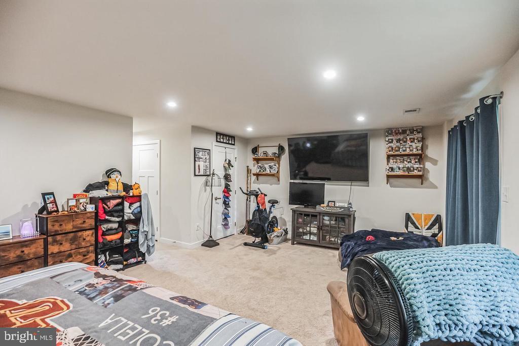
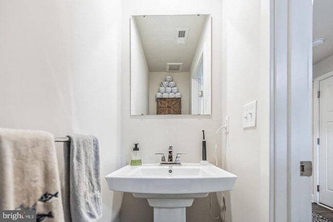
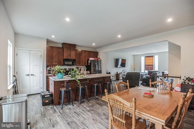
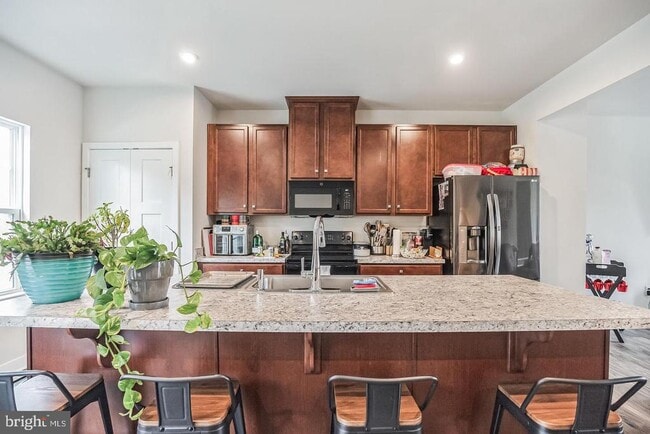
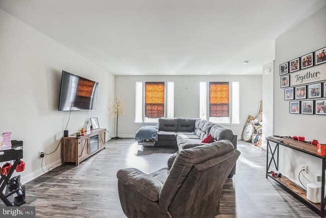
28 Sparrow Cir
Washington Township, NJ 08080
Today
|
Edit
Favorites
-
Bedrooms
3
-
Bathrooms
2.5
-
Square Feet
2,136 sq ft
28 Sparrow Cir

Favorites
Contact
- Listed by Lucas M Romano | Romano Realty
-
Source
 Bright MLS, Inc.
Copyright © 2026 Bright MLS, Inc.
Location
Get Directions
Education
| Colleges & Universities | Distance | ||
|---|---|---|---|
| Colleges & Universities | Distance | ||
| Drive: | 11 min | 5.5 mi | |
| Drive: | 12 min | 6.0 mi | |
| Drive: | 13 min | 6.4 mi | |
| Drive: | 26 min | 17.5 mi |
28 Sparrow Cir is within 11 minutes or 5.5 miles from Rowan University. It is also near Camden Co. Coll., Blackwood and Gloucester County College.
Schools


Public Elementary School
Grades K-5
519 Students
Attendance Zone
Public Elementary School
Grades PK-3
493 Students
Nearby
Public Middle School
Grades 6-8
608 Students
Attendance Zone
Public High School
Grades 9-12
2,075 Students
Attendance Zone
Private Elementary School
Grades PK-K
185 Students
Nearby
Private Elementary & Middle School
Grades 1-7
Nearby
Private Elementary & Middle School
Grades K-8
132 Students
Nearby
Private Elementary, Middle & High School
Grades 4-12
31 Students
Nearby
School data provided by
 The GreatSchools Rating helps parents compare schools within a state based on a variety of school quality indicators and provides a helpful picture of how effectively each school serves all of its students. Ratings are on a scale of 1 (below average) to 10 (above average) and can include test scores, college readiness, academic progress, advanced courses, equity, discipline and attendance data. We also advise parents to visit schools, consider other information on school performance and programs, and consider family needs as part of the school selection process.
View GreatSchools Rating Methodology
Data provided by GreatSchools.org © 2026. All rights reserved.
View GreatSchools Rating Methodology
Data provided by GreatSchools.org © 2026. All rights reserved.
Transportation options available in Washington Township include Lindenwold (Patco), located 9.9 miles from 28 Sparrow Cir. 28 Sparrow Cir is near Philadelphia International, located 23.8 miles or 40 minutes away, and Atlantic City International, located 37.8 miles or 66 minutes away.
| Transit / Subway | Distance | ||
|---|---|---|---|
| Transit / Subway | Distance | ||
|
|
Drive: | 19 min | 9.9 mi |
|
|
Drive: | 21 min | 12.8 mi |
| Commuter Rail | Distance | ||
|---|---|---|---|
| Commuter Rail | Distance | ||
|
|
Drive: | 18 min | 9.8 mi |
|
|
Drive: | 18 min | 11.6 mi |
|
|
Drive: | 28 min | 16.6 mi |
|
|
Drive: | 25 min | 18.3 mi |
|
|
Drive: | 41 min | 23.4 mi |
| Airports | Distance | ||
|---|---|---|---|
| Airports | Distance | ||
|
Philadelphia International
|
Drive: | 40 min | 23.8 mi |
|
Atlantic City International
|
Drive: | 66 min | 37.8 mi |
Time and distance from 28 Sparrow Cir.
| Shopping Centers | Distance | ||
|---|---|---|---|
| Shopping Centers | Distance | ||
| Walk: | 5 min | 0.3 mi | |
| Walk: | 14 min | 0.8 mi | |
| Walk: | 15 min | 0.8 mi |
28 Sparrow Cir has 3 shopping centers within 0.8 mile, which is about a 15-minute walk. The miles and minutes will be for the farthest away property.
| Hospitals | Distance | ||
|---|---|---|---|
| Hospitals | Distance | ||
| Drive: | 11 min | 5.9 mi | |
| Drive: | 16 min | 9.0 mi | |
| Drive: | 22 min | 12.0 mi |
28 Sparrow Cir has 3 hospitals within 12.0 miles, the nearest is Northbrook Behavioral Health Hospital which is 5.9 miles away and a 11 minute drive.
| Military Bases | Distance | ||
|---|---|---|---|
| Military Bases | Distance | ||
| Drive: | 30 min | 18.9 mi |
28 Sparrow Cir is 18.9 miles and a 30 minute drive from Philadelphia Naval Busi Center.
You May Also Like
How do I access Social Services in New Jersey?
Statewide service is free, confidential, multilingual and always open. Three easy ways to reach Social Services in NJ: Dial 2-1-1; text your zip code to 898-211; or chat at https://www.nj211.org
Similar Rentals Nearby


What Are Walk Score®, Transit Score®, and Bike Score® Ratings?
Walk Score® measures the walkability of any address. Transit Score® measures access to public transit. Bike Score® measures the bikeability of any address.
What is a Sound Score Rating?
A Sound Score Rating aggregates noise caused by vehicle traffic, airplane traffic and local sources

28 Sparrow Cir
Washington Township, NJ 08080