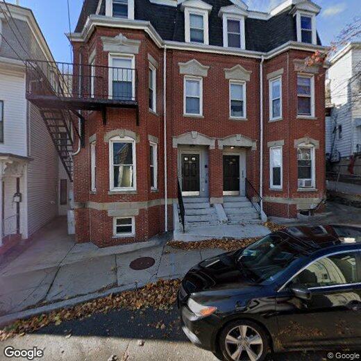

28 Pinckney St
12 Month Lease
28 Pinckney St
Somerville, MA 02145
2 Weeks Ago
|
Edit
Favorites
28 Pinckney St

Favorites
Check Back Soon for Upcoming Availability
28 Pinckney St,
Somerville,
MA
02145
Nestled in the heart of Greater Boston, Somerville combines historic architecture with contemporary city living. The community features diverse housing options, from traditional triple-deckers to modern apartments, with current rental rates of $3,277 for one-bedroom units and $3,993 for two-bedroom homes. The rental market has seen moderate growth, with one-bedroom rates increasing by 3.9% over the past year.
Somerville's character shines through its distinct squares and neighborhoods. Davis Square pulses with activity around the landmark Somerville Theatre, while Union Square draws visitors to its farmers market and international restaurants. The Somerville Community Path offers residents a tree-lined route for recreation and commuting. The presence of Tufts University adds to the area's educational atmosphere.
Learn more about living in Somerville
Education
| Colleges & Universities | Distance | ||
|---|---|---|---|
| Colleges & Universities | Distance | ||
| Drive: | 3 min | 1.2 mi | |
| Drive: | 6 min | 2.2 mi | |
| Drive: | 5 min | 2.2 mi | |
| Drive: | 6 min | 2.3 mi |
28 Pinckney St is within 3 minutes or 1.2 miles from Bunker Hill Community College. It is also near Cambridge College and MIT.
Transportation options available in Somerville include East Somerville, located 0.5 mile from 28 Pinckney St. 28 Pinckney St is near General Edward Lawrence Logan International, located 5.2 miles or 11 minutes away.
| Transit / Subway | Distance | ||
|---|---|---|---|
| Transit / Subway | Distance | ||
| Walk: | 10 min | 0.5 mi | |
| Walk: | 17 min | 0.9 mi | |
| Drive: | 2 min | 1.1 mi | |
| Drive: | 3 min | 1.6 mi | |
|
|
Drive: | 4 min | 2.1 mi |
| Commuter Rail | Distance | ||
|---|---|---|---|
| Commuter Rail | Distance | ||
|
|
Drive: | 5 min | 2.2 mi |
|
|
Drive: | 7 min | 2.5 mi |
| Drive: | 7 min | 3.3 mi | |
|
|
Drive: | 11 min | 3.7 mi |
|
|
Drive: | 6 min | 4.1 mi |
| Airports | Distance | ||
|---|---|---|---|
| Airports | Distance | ||
|
General Edward Lawrence Logan International
|
Drive: | 11 min | 5.2 mi |
Walkability Near 28 Pinckney St Somerville, MA 02145
Getting Around
 What do Walkability, Transit, Drivability, and Bikeability mean?
Walkability measures the walking distance to day-to-day needs.
Transit measures access to public transportation.
Drivability measures congestion, parking availability, and access to major roads.
Bikeability measures the suitability for cycling.
How It Works
What do Walkability, Transit, Drivability, and Bikeability mean?
Walkability measures the walking distance to day-to-day needs.
Transit measures access to public transportation.
Drivability measures congestion, parking availability, and access to major roads.
Bikeability measures the suitability for cycling.
How It Works
Exceptionally Walkable
Walkability
90
/ 100
Strong Public Transit
Transit
80
/ 100
Fairly Drivable
Drivability
50
/ 100
Very Bikeable
Bikeability
80
/ 100
Scores provided by
Busy
Soundscore™
67
/ 100
Traffic
BusyAirport
CalmBusinesses
BusyScores provided by
HowLoud What is a Sound Score Rating? A Sound Score Rating aggregates noise caused by vehicle traffic, airplane traffic and local sources. How It WorksTime and distance from 28 Pinckney St.
| Shopping Centers | Distance | ||
|---|---|---|---|
| Shopping Centers | Distance | ||
| Walk: | 20 min | 1.1 mi | |
| Drive: | 4 min | 1.7 mi | |
| Drive: | 4 min | 1.8 mi |
28 Pinckney St has 3 shopping centers within 1.8 miles, which is about a 4-minute drive. The miles and minutes will be for the farthest away property.
| Parks and Recreation | Distance | ||
|---|---|---|---|
| Parks and Recreation | Distance | ||
|
Museum of Science
|
Drive: | 5 min | 1.9 mi |
|
Harvard Museum of Natural History
|
Drive: | 5 min | 2.1 mi |
|
Mineralogical and Geological Museum
|
Drive: | 5 min | 2.1 mi |
|
Boston African American National Historic Site
|
Drive: | 7 min | 3.1 mi |
|
Mystic River Reservation
|
Drive: | 6 min | 3.4 mi |
28 Pinckney St has 5 parks within 3.4 miles, including Museum of Science, Harvard Museum of Natural History, and Mineralogical and Geological Museum.
| Hospitals | Distance | ||
|---|---|---|---|
| Hospitals | Distance | ||
| Drive: | 3 min | 1.5 mi | |
| Drive: | 6 min | 2.6 mi | |
| Drive: | 6 min | 2.8 mi |
28 Pinckney St has 3 hospitals within 2.8 miles, the nearest is Cambridge Health Alliance which is 1.5 miles away and a 3 minute drive.
| Military Bases | Distance | ||
|---|---|---|---|
| Military Bases | Distance | ||
| Drive: | 27 min | 13.0 mi | |
| Drive: | 31 min | 18.9 mi |
28 Pinckney St is 13.0 miles from Hanscom Air Force Base, and is convenient to other military bases, including Fort Miller.
You May Also Like
Similar Rentals Nearby


What Are Walk Score®, Transit Score®, and Bike Score® Ratings?
Walk Score® measures the walkability of any address. Transit Score® measures access to public transit. Bike Score® measures the bikeability of any address.
What is a Sound Score Rating?
A Sound Score Rating aggregates noise caused by vehicle traffic, airplane traffic and local sources.