
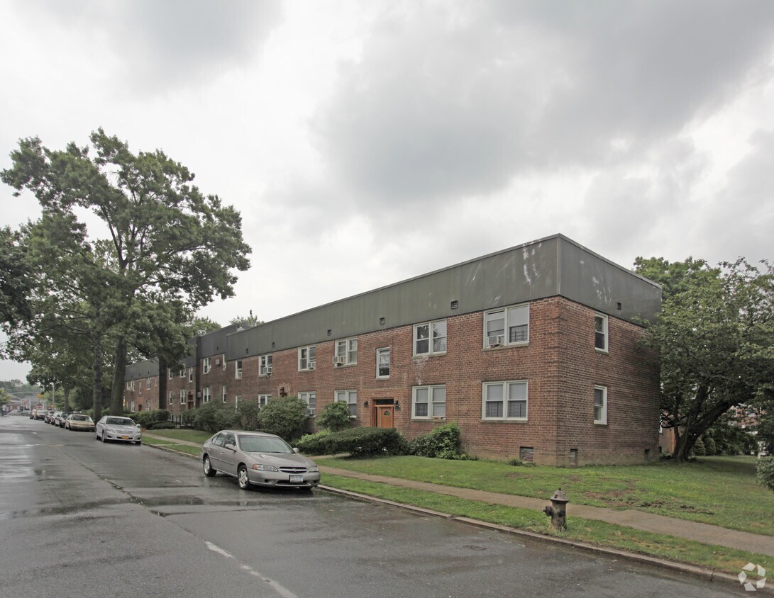
Urbn Edge
3510 Union St,
Flushing, NY 11354
$3,050 - $4,200 Total Monthly Price
1-2 Beds 12 Month Lease

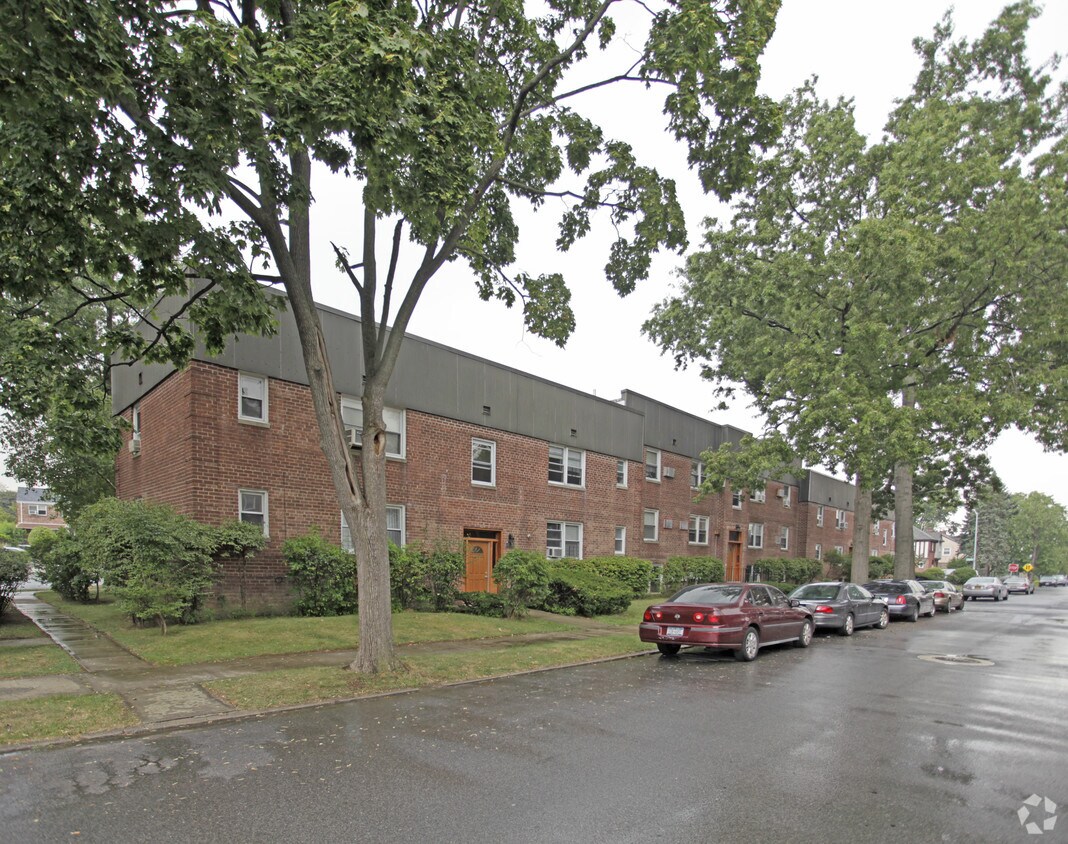

Experience Flushing living at 28-06-28-26 172nd St. This community is located on 28-06-28-26 172nd St. in Flushing. Let the leasing team show you everything this community has to offer. At 28-06-28-26 172nd St you're right at home.
28-06-28-26 172nd St is an apartment community located in Queens County and the 11358 ZIP Code. This area is served by the New York City Geographic District #25 attendance zone.
Air Conditioning
Heating
Oven
Range
Situated between Bayside and Murray Hill in Queens, Auburndale is a suburban neighborhood known for its charming Tudor-style homes nestled along tree-lined avenues. Auburndale is predominantly residential, offering its inhabitants a peaceful atmosphere to come home to.
The neighborhood is also convenient to a host of popular parks, including Kissena Park, Cunningham Park, Alley Pond Park, and Fort Totten Park, where residents enjoy an array of outdoor activities. Vibrant city life is just minutes away from Auburndale as well, with direct access to I-295, I-495, and the Long Island Rail Road’s Port Washington Line.
Learn more about living in AuburndaleCompare neighborhood and city base rent averages by bedroom.
| Auburndale | Flushing, NY | |
|---|---|---|
| Studio | $1,741 | $1,768 |
| 1 Bedroom | $1,759 | $2,053 |
| 2 Bedrooms | $2,198 | $2,472 |
| 3 Bedrooms | $2,862 | $2,865 |
| Colleges & Universities | Distance | ||
|---|---|---|---|
| Colleges & Universities | Distance | ||
| Drive: | 7 min | 3.3 mi | |
| Drive: | 8 min | 3.7 mi | |
| Drive: | 9 min | 4.8 mi | |
| Drive: | 12 min | 7.6 mi |


Transportation options available in Flushing include Flushing-Main Street, located 2.7 miles from 28-06-28-26 172nd St. 28-06-28-26 172nd St is near LaGuardia, located 6.9 miles or 13 minutes away, and John F Kennedy International, located 11.5 miles or 19 minutes away.
| Transit / Subway | Distance | ||
|---|---|---|---|
| Transit / Subway | Distance | ||
|
|
Drive: | 6 min | 2.7 mi |
|
|
Drive: | 8 min | 3.6 mi |
|
|
Drive: | 9 min | 4.2 mi |
|
|
Drive: | 10 min | 4.6 mi |
|
|
Drive: | 9 min | 6.0 mi |
| Commuter Rail | Distance | ||
|---|---|---|---|
| Commuter Rail | Distance | ||
|
|
Walk: | 14 min | 0.7 mi |
|
|
Drive: | 3 min | 1.4 mi |
|
|
Drive: | 4 min | 1.9 mi |
|
|
Drive: | 5 min | 2.3 mi |
|
|
Drive: | 8 min | 3.0 mi |
| Airports | Distance | ||
|---|---|---|---|
| Airports | Distance | ||
|
LaGuardia
|
Drive: | 13 min | 6.9 mi |
|
John F Kennedy International
|
Drive: | 19 min | 11.5 mi |
Scores provided by
Traffic
-Airport
-Businesses
-Scores provided by
HowLoud What is a Sound Score Rating? A Sound Score Rating aggregates noise caused by vehicle traffic, airplane traffic and local sources. How It WorksTime and distance from 28-06-28-26 172nd St.
| Shopping Centers | Distance | ||
|---|---|---|---|
| Shopping Centers | Distance | ||
| Walk: | 16 min | 0.9 mi | |
| Drive: | 4 min | 1.3 mi | |
| Drive: | 3 min | 1.5 mi |
| Parks and Recreation | Distance | ||
|---|---|---|---|
| Parks and Recreation | Distance | ||
|
Crocheron Park
|
Drive: | 5 min | 1.7 mi |
|
Little Bay Park
|
Drive: | 5 min | 2.2 mi |
|
Fort Totten Park
|
Drive: | 5 min | 2.3 mi |
|
Alley Pond Environmental Center
|
Drive: | 5 min | 2.8 mi |
|
Kissena Park
|
Drive: | 8 min | 3.3 mi |
| Hospitals | Distance | ||
|---|---|---|---|
| Hospitals | Distance | ||
| Drive: | 6 min | 2.7 mi | |
| Drive: | 9 min | 4.4 mi | |
| Drive: | 8 min | 5.2 mi |
| Military Bases | Distance | ||
|---|---|---|---|
| Military Bases | Distance | ||
| Drive: | 5 min | 2.3 mi | |
| Drive: | 33 min | 17.8 mi |
What Are Walk Score®, Transit Score®, and Bike Score® Ratings?
Walk Score® measures the walkability of any address. Transit Score® measures access to public transit. Bike Score® measures the bikeability of any address.
What is a Sound Score Rating?
A Sound Score Rating aggregates noise caused by vehicle traffic, airplane traffic and local sources.
28-06-28-26 172nd St
Flushing, NY 11358


