2790 Queen City Ave Unit 2
Cincinnati, OH 45238
-
Bedrooms
2
-
Bathrooms
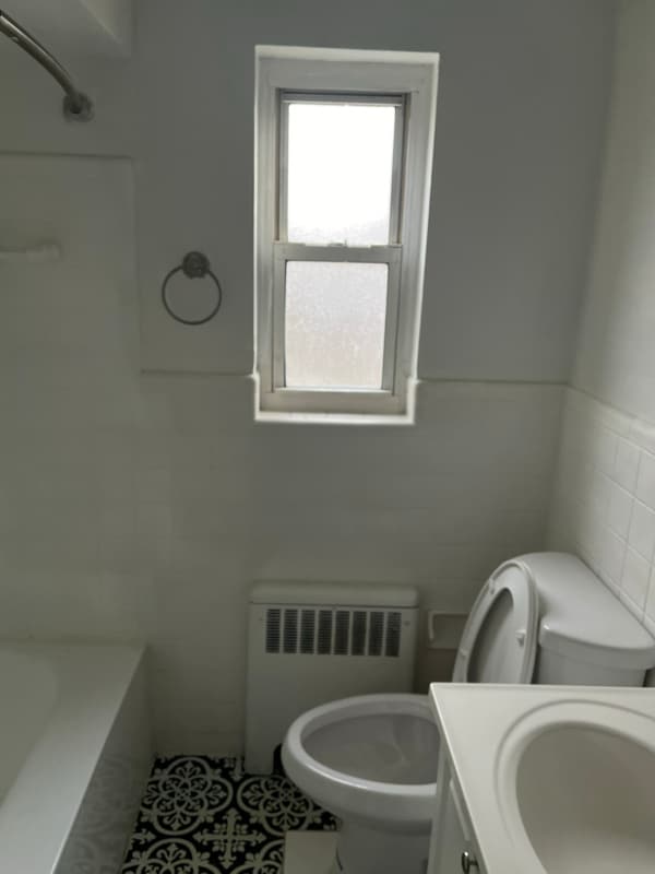
1
-
Square Feet
950 sq ft
-
Available
Available Now
Highlights
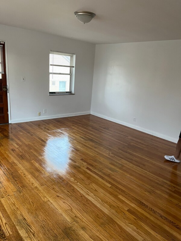
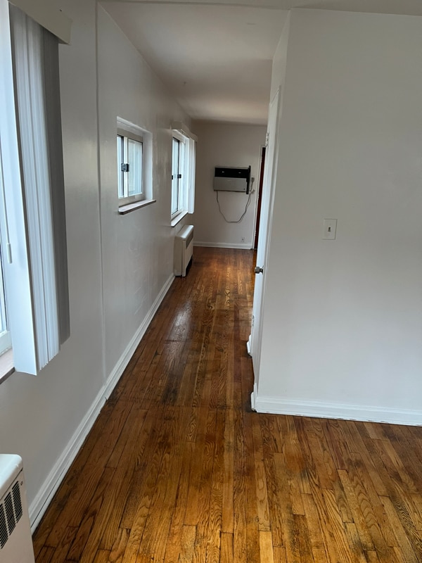
- Hardwood Floors
- Fitness Center

About This Home
Property Id: 2001582 Clean and quiet apartment. There's plenty of parking space in the back. Short distance from major roads and other services.
2790 Queen City Ave is an apartment community located in Hamilton County and the 45238 ZIP Code.
Features
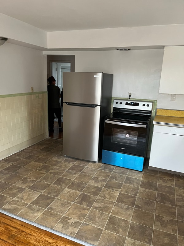
- Oven
- Refrigerator
- Hardwood Floors
- Fitness Center
- Bicycle Storage
Fees and Policies
The fees below are based on community-supplied data and may exclude additional fees and utilities.
Details
Utilities Included
-
Water
-
Trash Removal
-
Sewer
Contact
- Phone Number
- Contact
-
Source

- Oven
- Refrigerator
- Hardwood Floors
- Fitness Center
- Bicycle Storage
Situated about five miles northwest of Downtown Cincinnati, Westwood is the largest neighborhood in the city. Residents flock to Westwood for its many affordable historic homes and modern apartments available for rent in addition to its close proximity to I-74, I-75, and all that Downtown Cincinnati has to offer.
While Westwood is a predominantly residential neighborhood, it is also home to a slew of convenient stores and restaurants. Shopping opportunities abound in Westwood, with plenty of national retailers in Western Hills Plaza and local shops in the growing Town Hall District. Numerous neighborhood parks provide ample space to enjoy the outdoors in town as well as the sprawling 1,400-acre Mount Airy Forest, which is partially located in Westwood.
Learn more about living in Westwood| Colleges & Universities | Distance | ||
|---|---|---|---|
| Colleges & Universities | Distance | ||
| Drive: | 11 min | 5.1 mi | |
| Drive: | 13 min | 5.6 mi | |
| Drive: | 15 min | 5.9 mi | |
| Drive: | 15 min | 6.1 mi |
Transportation options available in Cincinnati include Brewery District Station, Elm & Henry, located 4.5 miles from 2790 Queen City Ave Unit 2. 2790 Queen City Ave Unit 2 is near Cincinnati/Northern Kentucky International, located 18.9 miles or 35 minutes away.
| Transit / Subway | Distance | ||
|---|---|---|---|
| Transit / Subway | Distance | ||
| Drive: | 11 min | 4.5 mi | |
| Drive: | 11 min | 4.7 mi | |
| Drive: | 11 min | 4.8 mi | |
| Drive: | 11 min | 4.9 mi | |
| Drive: | 12 min | 5.1 mi |
| Commuter Rail | Distance | ||
|---|---|---|---|
| Commuter Rail | Distance | ||
|
|
Drive: | 11 min | 4.8 mi |
| Airports | Distance | ||
|---|---|---|---|
| Airports | Distance | ||
|
Cincinnati/Northern Kentucky International
|
Drive: | 35 min | 18.9 mi |
Time and distance from 2790 Queen City Ave Unit 2.
| Shopping Centers | Distance | ||
|---|---|---|---|
| Shopping Centers | Distance | ||
| Walk: | 17 min | 0.9 mi | |
| Drive: | 3 min | 1.2 mi | |
| Drive: | 3 min | 1.3 mi |
| Parks and Recreation | Distance | ||
|---|---|---|---|
| Parks and Recreation | Distance | ||
|
Imago Earth Center
|
Drive: | 9 min | 3.4 mi |
|
Embshoff Woods
|
Drive: | 12 min | 4.2 mi |
|
Mt. Airy Forest
|
Drive: | 10 min | 4.2 mi |
|
Wilson Commons
|
Drive: | 10 min | 4.3 mi |
|
Cincinnati History Museum
|
Drive: | 11 min | 4.8 mi |
| Hospitals | Distance | ||
|---|---|---|---|
| Hospitals | Distance | ||
| Drive: | 10 min | 4.3 mi | |
| Drive: | 14 min | 5.6 mi | |
| Drive: | 12 min | 5.6 mi |
| Military Bases | Distance | ||
|---|---|---|---|
| Military Bases | Distance | ||
| Drive: | 76 min | 56.5 mi | |
| Drive: | 82 min | 61.6 mi | |
| Drive: | 85 min | 64.9 mi |
You May Also Like
What Are Walk Score®, Transit Score®, and Bike Score® Ratings?
Walk Score® measures the walkability of any address. Transit Score® measures access to public transit. Bike Score® measures the bikeability of any address.
What is a Sound Score Rating?
A Sound Score Rating aggregates noise caused by vehicle traffic, airplane traffic and local sources

2790 Queen City Ave
Cincinnati, OH 45238