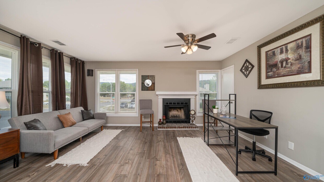
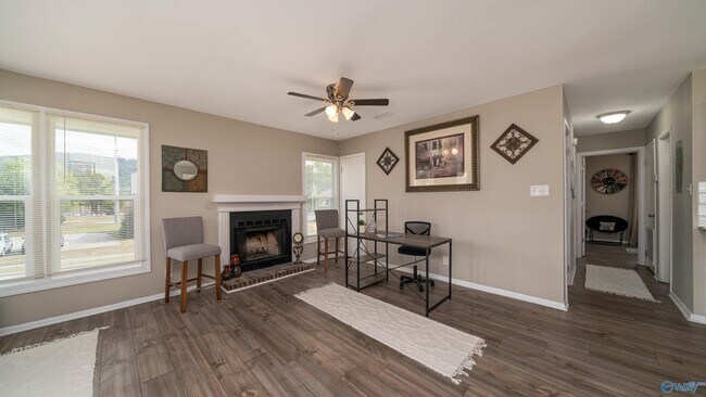
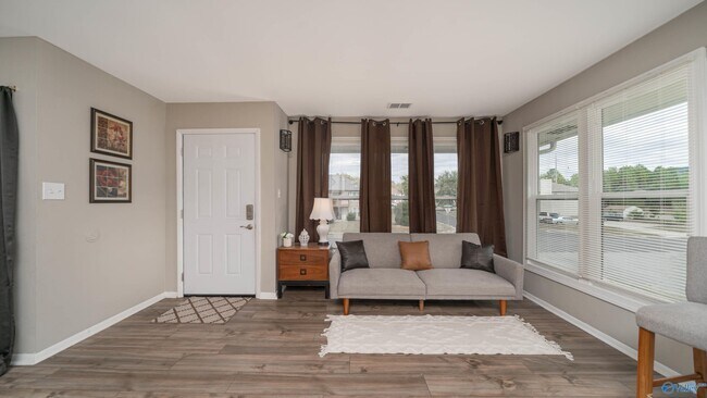
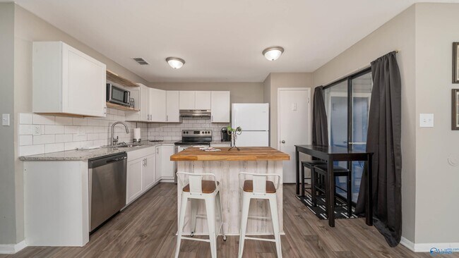
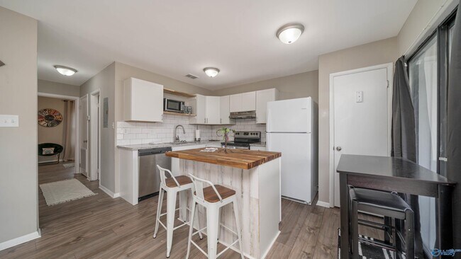
$1,000 / Month

2709 Lantern Walk SE Unit C

,

Huntsville, AL 35803

Share Listing
Favorites
2709 Lantern Walk SE Unit C
Share Listing
Favorites

Check Back Soon for Upcoming Availability

Beds Baths Average SF
2 Bedrooms 2 Bedrooms 2 Br 2 Baths 2 Baths 2 Ba

Fees and Policies

The fees listed below are community-provided and may exclude utilities or add-ons. All payments are made directly to the property and are non-refundable unless otherwise specified.

About This Property

Welcome to our newly renovated 2-bedroom,2-bathroom condo located in the vibrant city of Huntsville,AL! Situated just minutes away from the parkway and the Redstone Arsenal,our apartment offers convenience and accessibility. As you step into this downstairs unit,you'll be greeted by the modern and stylish LVP flooring that flows seamlessly throughout the entire space. The apartment comes fully furnished,ensuring that you have everything you need to settle in comfortably. Whether you're a culinary enthusiast or simply enjoy having extra storage space in your kitchen,the pantry in our apartment is perfect for all your needs. Apply today!

2709 Lantern Walk Se is a condo located in Madison County and the 35803 ZIP Code. This area is served by the Huntsville City School District attendance zone.

Condo Features

  • Washer/Dryer
  • Air Conditioning
  • Refrigerator
Location
2709 Lantern Walk SE, Huntsville,
AL 35803
Get Directions
| Edit

Under 30 minutes

Commute Time is calculated at rush hour.
Neighborhood

The Huntsville neighborhood of Farley-Oakhurst Place is a vast, diverse area just south of Downtown Huntsville. Situated along the banks of the Tennessee River, bounded to the north by Mountain Gap Road, and to the east by Shawdee Road, Farley-Oakhurst encompasses both suburban residential developments and untouched countryside. The neighborhood, especially the northern section, has become popular with families and renters looking to stay to close to the action of Huntsville while enjoying a more affordable space of their own. Memorial Parkway Southwest (Highway 231) is where you’ll find both locally owned restaurants and national chains ranging from pizza and wings to sandwiches and Italian food.

Most of the rentals in this part of the city can be found closer to Downtown Huntsville. Low-rise apartments with plenty of amenities and new single-family home developments round the rental market.

Learn more about living in Farley-Oakhurst Place 

Below are rent ranges for similar nearby apartments

Amenities
  • Washer/Dryer
  • Air Conditioning
  • Refrigerator
Education
Colleges & Universities Distance
Drive: 21 min 12.0 mi
Drive: 22 min 12.1 mi
Drive: 25 min 14.2 mi
Drive: 26 min 14.4 mi
2709 Lantern Walk SE Unit C is within 21 minutes or 12.0 miles from Univ. of Ala. Huntsville. It is also near Calhoun C.C., Huntsville and Alabama A&M University.
Schools
Public Elementary School
Grades PK-5
503 Students
Attendance Zone
Public Middle School
Grades 6-8
438 Students
Attendance Zone
Public High School
Grades 9-12
1,974 Students
Attendance Zone
Private Elementary, Middle & High School
Grades PK-12
746 Students
Nearby
Private Elementary School
Grades PK-5
104 Students
Nearby
Private Elementary & Middle School
Grades PK-8
114 Students
Nearby
Transportation

2709 Lantern Walk SE Unit C is near Huntsville International-Carl T Jones Field, located 22.4 miles or 35 minutes away.

Airports Distance
Airports Distance
Huntsville International-Carl T Jones Field
Drive: 35 min 22.4 mi

Walkability Near 2709 Lantern Walk SE Huntsville, AL 35803

Getting Around
Somewhat Walkable
Walkability
20 / 100
Very Drivable
Drivability
80 / 100
Moderately Bikeable
Bikeability
60 / 100

Scores provided by

What do Walkability, Transit, Drivability, and Bikeability mean? Walkability measures the walking distance to day-to-day needs. Transit measures access to public transportation. Drivability measures congestion, parking availability, and access to major roads. Bikeability measures the suitability for cycling. How It Works
-
Soundscore
- / 100

Traffic

-

Airport

-

Businesses

-

Scores provided by

HowLoud What is a Sound Score Rating? A Sound Score Rating aggregates noise caused by vehicle traffic, airplane traffic and local sources. How It Works
Points of Interest

Time and distance from 2709 Lantern Walk SE Unit C.

Shopping Centers Distance
Drive: 4 min 1.4 mi
Drive: 6 min 2.9 mi
Drive: 6 min 2.9 mi
2709 Lantern Walk SE Unit C has 3 shopping centers within 2.9 miles, which is about a 6-minute drive. The miles and minutes will be for the farthest away property.
Parks and Recreation Distance
Blevins Gap Nature Preserve Trailhead (Fanning Trail)
Drive: 11 min 5.4 mi
Blevins Gap Nature Preserve Trailhead (Smoke Rise and Certain Trails)
Drive: 13 min 7.1 mi
John Hunt Park
Drive: 14 min 7.4 mi
Earlyworks Children's History Museum
Drive: 17 min 9.7 mi
Monte Sano Nature Preserve Trailhead (Trough Springs Trail)
Drive: 22 min 11.9 mi
2709 Lantern Walk SE Unit C has 5 parks within 11.9 miles, including Blevins Gap Nature Preserve Trailhead (Smoke Rise and Certain Trails), Blevins Gap Nature Preserve Trailhead (Fanning Trail), and John Hunt Park.
Hospitals Distance
Hospitals Distance
Drive: 13 min 7.2 mi
Drive: 16 min 9.4 mi
2709 Lantern Walk SE Unit C is 7.2 miles from Crestwood Medical Center, and is convenient to other hospitals, including Huntsville Hospital.
Military Bases Distance
Drive: 25 min 8.9 mi
Drive: 102 min 68.0 mi
Drive: 119 min 85.3 mi
2709 Lantern Walk SE Unit C has 3 military bases within 85.3 miles, the nearest is Redstone Arsenal which is 8.9 miles away and a 25 minute drive.

You May Also Like

Similar Rentals Nearby