
$1,100
/ Month
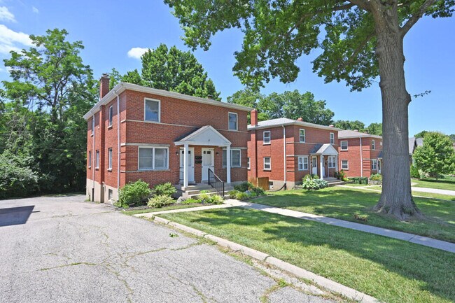
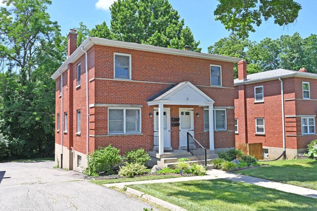
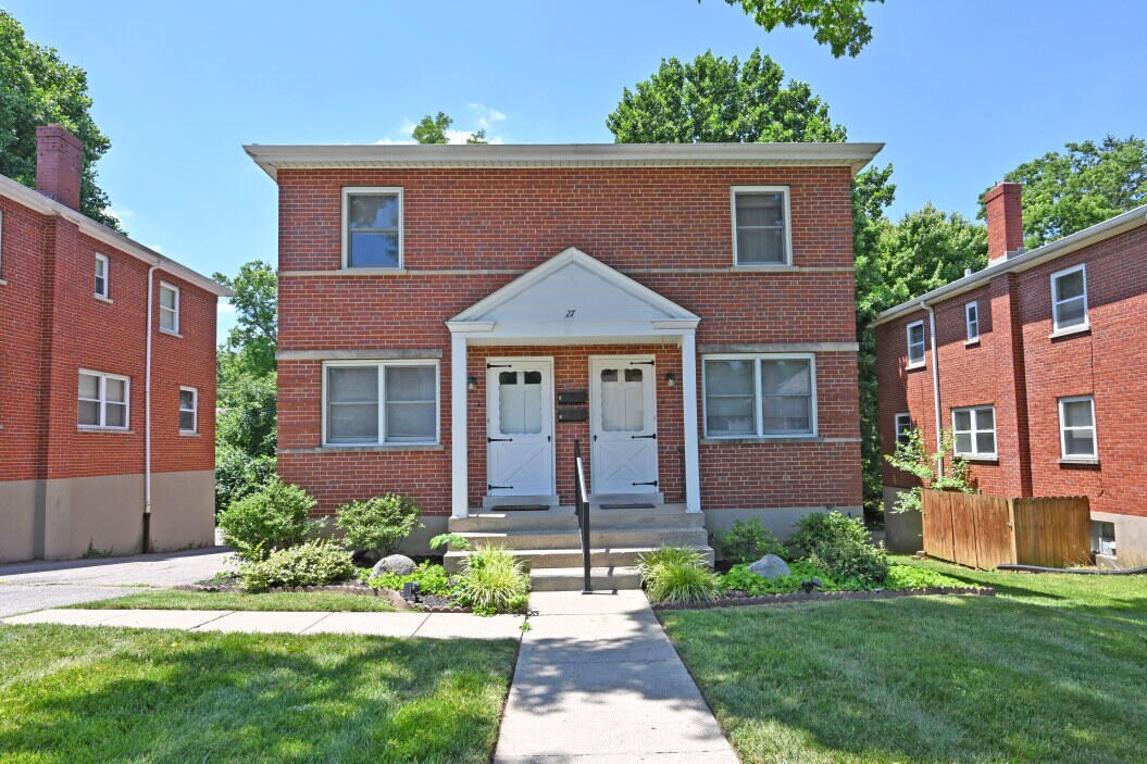
27 Pleasant Ridge Ave
Fort Mitchell, KY 41017
2 Weeks Ago
|
Edit
Favorites
27 Pleasant Ridge Ave

Favorites
Check Back Soon for Upcoming Availability
| Beds | Baths | Average SF |
|---|---|---|
| 2 Bedrooms 2 Bedrooms 2 Br | 1 Bath 1 Bath 1 Ba | — |
About This Property
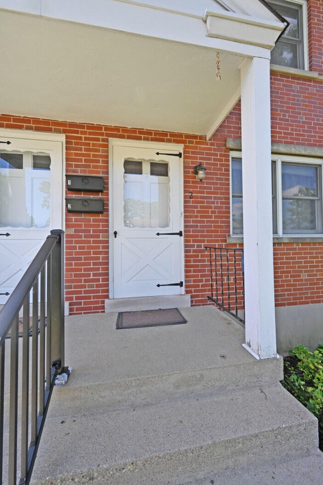
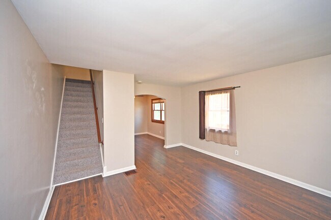
Superb,central location in the heart of Ft. Mitchell! One of two beautiful updated townhomes comprising approximately 1,070 SF/Each,offering comfortable living spaces. Laminate flooring in living and dining rooms,ceramic tile in the kitchen and bath. All appliances,including washer and dryer are included. Full basement with garage. What a great opportunity!
27 Pleasant Ridge Ave is a townhome located in Kenton County and the 41017 ZIP Code. This area is served by the Beechwood Independent attendance zone.
Townhome Features
Washer/Dryer
Dishwasher
Disposal
Oven
- Washer/Dryer
- Dishwasher
- Disposal
- Oven
- Range
- Views
Location
Get Directions
Northern Kentucky is a sprawling region located just south of Cincinnati, Ohio. The Ohio River hugs the northern, eastern, and western portions of the region, serving as a scenic destination for all kinds of outdoor recreation throughout the year. Florence, Dayton, Newport, Covington, Burlington, and Highland Heights are among the many communities included in the Northern Kentucky region.
Each community in Northern Kentucky offers its own unique identity and sense of character. The rentals in the area are just as diverse as Northern Kentucky itself, ranging from luxury apartments to charming houses and everything in between. Getting around the region is a breeze with convenience to Interstates 71, 75, 275, and 471.
Learn more about living in Northern KentuckyBelow are rent ranges for similar nearby apartments
Amenities
- Washer/Dryer
- Dishwasher
- Disposal
- Oven
- Range
- Views
Education
| Colleges & Universities | Distance | ||
|---|---|---|---|
| Colleges & Universities | Distance | ||
| Drive: | 5 min | 2.2 mi | |
| Drive: | 14 min | 8.4 mi | |
| Drive: | 16 min | 10.0 mi | |
| Drive: | 24 min | 13.1 mi |
27 Pleasant Ridge Ave is within 5 minutes or 2.2 miles from Thomas More College. It is also near Northern Kentucky University and University of Cincinnati.
Schools


Public Elementary School
Grades PK-6
752 Students
Attendance Zone
Public Middle & High School
Grades 7-12
727 Students
Attendance Zone
Private Elementary School
Grades PK-5
92 Students
Nearby
Private Elementary, Middle & High School
Grades K-12
Nearby
Private Elementary & Middle School
Grades K-8
525 Students
Nearby
School data provided by
 The GreatSchools Rating helps parents compare schools within a state based on a variety of school quality indicators and provides a helpful picture of how effectively each school serves all of its students. Ratings are on a scale of 1 (below average) to 10 (above average) and can include test scores, college readiness, academic progress, advanced courses, equity, discipline and attendance data. We also advise parents to visit schools, consider other information on school performance and programs, and consider family needs as part of the school selection process.
View GreatSchools Rating Methodology
Data provided by GreatSchools.org © 2026. All rights reserved.
View GreatSchools Rating Methodology
Data provided by GreatSchools.org © 2026. All rights reserved.
Transportation options available in Fort Mitchell include The Banks Station, 2Nd & Main, located 5.9 miles from 27 Pleasant Ridge Ave. 27 Pleasant Ridge Ave is near Cincinnati/Northern Kentucky International, located 7.8 miles or 19 minutes away.
| Transit / Subway | Distance | ||
|---|---|---|---|
| Transit / Subway | Distance | ||
| Drive: | 10 min | 5.9 mi | |
| Drive: | 10 min | 6.0 mi | |
| Drive: | 11 min | 6.1 mi | |
| Drive: | 11 min | 6.2 mi | |
| Drive: | 11 min | 6.3 mi |
| Commuter Rail | Distance | ||
|---|---|---|---|
| Commuter Rail | Distance | ||
|
|
Drive: | 13 min | 6.9 mi |
| Airports | Distance | ||
|---|---|---|---|
| Airports | Distance | ||
|
Cincinnati/Northern Kentucky International
|
Drive: | 19 min | 7.8 mi |
Time and distance from 27 Pleasant Ridge Ave.
| Shopping Centers | Distance | ||
|---|---|---|---|
| Shopping Centers | Distance | ||
| Walk: | 8 min | 0.4 mi | |
| Walk: | 17 min | 0.9 mi | |
| Walk: | 20 min | 1.1 mi |
27 Pleasant Ridge Ave has 3 shopping centers within 1.1 miles, which is about a 20-minute walk. The miles and minutes will be for the farthest away property.
| Parks and Recreation | Distance | ||
|---|---|---|---|
| Parks and Recreation | Distance | ||
|
John G. & Phyllis W. Smale Riverfront Park
|
Drive: | 10 min | 5.9 mi |
|
Cincinnati History Museum
|
Drive: | 13 min | 7.0 mi |
|
Wilson Commons
|
Drive: | 14 min | 8.1 mi |
|
Imago Earth Center
|
Drive: | 16 min | 9.3 mi |
|
Embshoff Woods
|
Drive: | 19 min | 10.9 mi |
27 Pleasant Ridge Ave has 5 parks within 10.9 miles, including John G. & Phyllis W. Smale Riverfront Park, Cincinnati History Museum, and Wilson Commons.
| Hospitals | Distance | ||
|---|---|---|---|
| Hospitals | Distance | ||
| Drive: | 7 min | 3.0 mi | |
| Drive: | 7 min | 3.5 mi | |
| Drive: | 10 min | 6.1 mi |
27 Pleasant Ridge Ave has 3 hospitals within 6.1 miles, the nearest is St. Elizabeth Edgewood which is 3.0 miles away and a 7 minute drive.
| Military Bases | Distance | ||
|---|---|---|---|
| Military Bases | Distance | ||
| Drive: | 79 min | 60.4 mi | |
| Drive: | 85 min | 65.5 mi | |
| Drive: | 87 min | 68.8 mi |
27 Pleasant Ridge Ave has 3 military bases within 68.8 miles, the nearest is Gentile Air Force Station which is 60.4 miles away and a 79 minute drive.
You May Also Like
Similar Rentals Nearby
-
-
-
-
-
-
-
-
-
1 / 18

-
1 / 23


What Are Walk Score®, Transit Score®, and Bike Score® Ratings?
Walk Score® measures the walkability of any address. Transit Score® measures access to public transit. Bike Score® measures the bikeability of any address.
What is a Sound Score Rating?
A Sound Score Rating aggregates noise caused by vehicle traffic, airplane traffic and local sources
27 Pleasant Ridge Ave
Fort Mitchell, KY 41017