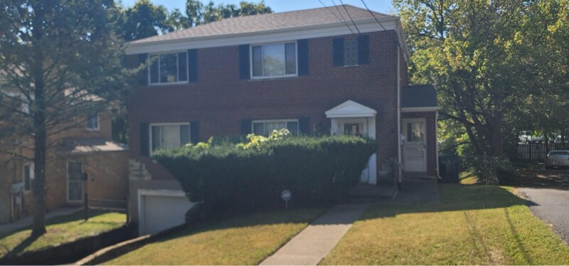
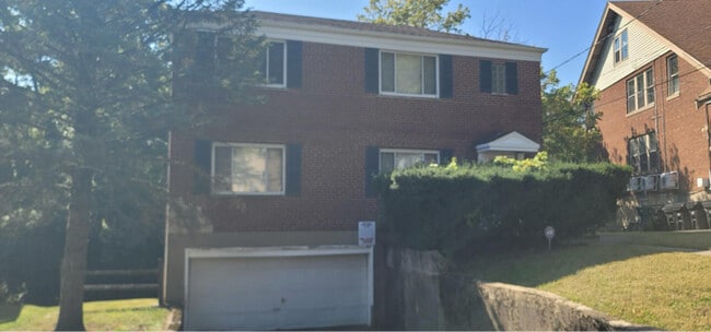
27-31 Powell Dr Unit Apt 1
Cincinnati, OH 45211
-
Bedrooms
2
-
Bathrooms
1
-
Square Feet
1,000 sq ft
-
Available
Available Sep 30
Highlights
- Fenced Lot
- Security System

About This Home
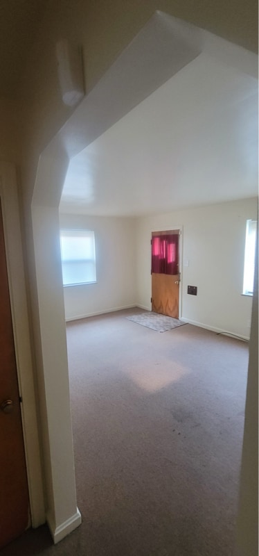
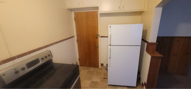
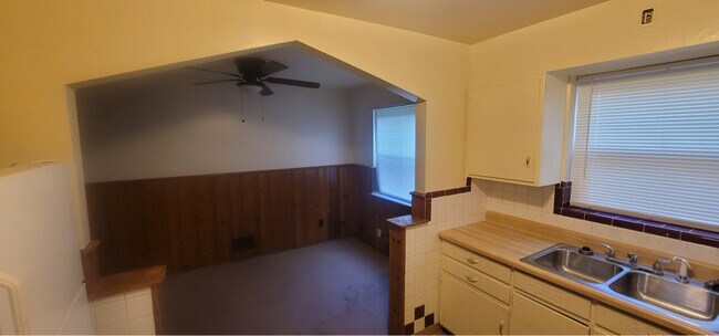
Property Id: 2140685 Looking for a quiet, family oriented street! 2 bedroom in a 2 family home on the first floor. 2 bedrooms and a dining room. Small front porch, access to a large backyard, driveway for parking. Water and garbage pickup is included. Tenant pays for gas and electric. Washer and dryer hook up available in the basement. Apartment has ADT alarm system that can be activated . Call to schedule a showing. You can also text your availability to that number and we will confirm. No pets , no smoking, no evictions in the past 5 years. Verifiable employment . Rent is $1,250.00. 1 month rent for deposit. Background check and application required.
27-31 Powell Dr is an apartment community located in Hamilton County and the 45211 ZIP Code.
Features
Refrigerator
Disposal
Security System
Oven
- Security System
- Disposal
- Oven
- Refrigerator
- Vinyl Flooring
- Fenced Lot
- Lawn
Fees and Policies
The fees below are based on community-supplied data and may exclude additional fees and utilities.
Details
Utilities Included
-
Water
-
Trash Removal
Contact
- Phone Number
- Contact
-
Source

- Security System
- Disposal
- Oven
- Refrigerator
- Vinyl Flooring
- Fenced Lot
- Lawn
Situated about five miles northwest of Downtown Cincinnati, Westwood is the largest neighborhood in the city. Residents flock to Westwood for its many affordable historic homes and modern apartments available for rent in addition to its close proximity to I-74, I-75, and all that Downtown Cincinnati has to offer.
While Westwood is a predominantly residential neighborhood, it is also home to a slew of convenient stores and restaurants. Shopping opportunities abound in Westwood, with plenty of national retailers in Western Hills Plaza and local shops in the growing Town Hall District. Numerous neighborhood parks provide ample space to enjoy the outdoors in town as well as the sprawling 1,400-acre Mount Airy Forest, which is partially located in Westwood.
Learn more about living in Westwood| Colleges & Universities | Distance | ||
|---|---|---|---|
| Colleges & Universities | Distance | ||
| Drive: | 14 min | 4.9 mi | |
| Drive: | 12 min | 5.2 mi | |
| Drive: | 13 min | 5.6 mi | |
| Drive: | 14 min | 5.7 mi |
Transportation options available in Cincinnati include Brewery District Station, Elm & Henry, located 4.7 miles from 27-31 Powell Dr Unit Apt 1. 27-31 Powell Dr Unit Apt 1 is near Cincinnati/Northern Kentucky International, located 19.0 miles or 36 minutes away.
| Transit / Subway | Distance | ||
|---|---|---|---|
| Transit / Subway | Distance | ||
| Drive: | 11 min | 4.7 mi | |
| Drive: | 11 min | 4.9 mi | |
| Drive: | 12 min | 5.0 mi | |
| Drive: | 12 min | 5.1 mi | |
| Drive: | 12 min | 5.2 mi |
| Commuter Rail | Distance | ||
|---|---|---|---|
| Commuter Rail | Distance | ||
|
|
Drive: | 11 min | 5.0 mi |
| Airports | Distance | ||
|---|---|---|---|
| Airports | Distance | ||
|
Cincinnati/Northern Kentucky International
|
Drive: | 36 min | 19.0 mi |
Time and distance from 27-31 Powell Dr Unit Apt 1.
| Shopping Centers | Distance | ||
|---|---|---|---|
| Shopping Centers | Distance | ||
| Drive: | 4 min | 1.5 mi | |
| Drive: | 4 min | 1.7 mi | |
| Drive: | 5 min | 2.0 mi |
| Parks and Recreation | Distance | ||
|---|---|---|---|
| Parks and Recreation | Distance | ||
|
Mt. Airy Forest
|
Drive: | 9 min | 3.8 mi |
|
Imago Earth Center
|
Drive: | 11 min | 4.2 mi |
|
Buttercup Valley
|
Drive: | 11 min | 4.6 mi |
|
Embshoff Woods
|
Drive: | 14 min | 4.8 mi |
|
Wilson Commons
|
Drive: | 12 min | 5.0 mi |
| Hospitals | Distance | ||
|---|---|---|---|
| Hospitals | Distance | ||
| Drive: | 9 min | 3.6 mi | |
| Drive: | 11 min | 4.5 mi | |
| Drive: | 14 min | 5.7 mi |
| Military Bases | Distance | ||
|---|---|---|---|
| Military Bases | Distance | ||
| Drive: | 74 min | 55.5 mi | |
| Drive: | 80 min | 60.5 mi | |
| Drive: | 82 min | 63.8 mi |
You May Also Like
What Are Walk Score®, Transit Score®, and Bike Score® Ratings?
Walk Score® measures the walkability of any address. Transit Score® measures access to public transit. Bike Score® measures the bikeability of any address.
What is a Sound Score Rating?
A Sound Score Rating aggregates noise caused by vehicle traffic, airplane traffic and local sources

27-31 Powell Dr
Cincinnati, OH 45211