
$1,775
/ Month
2698 N 43rd Ave
Phoenix, AZ 85009
Today
|
Edit
Favorites
650-222-0650
-
Bedrooms
3
-
Bathrooms
2
-
Square Feet
1,106 sq ft
-
Available
Available Now
Highlights
- Santa Fe Architecture
- Covered Patio or Porch
- Balcony
- Double Pane Windows
- Cooling Available
- Security Guard
2698 N 43rd Ave

Favorites
About This Home
$1,850 deposit,
Available Now
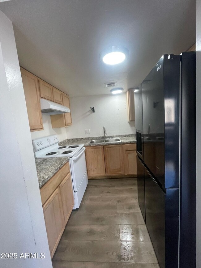
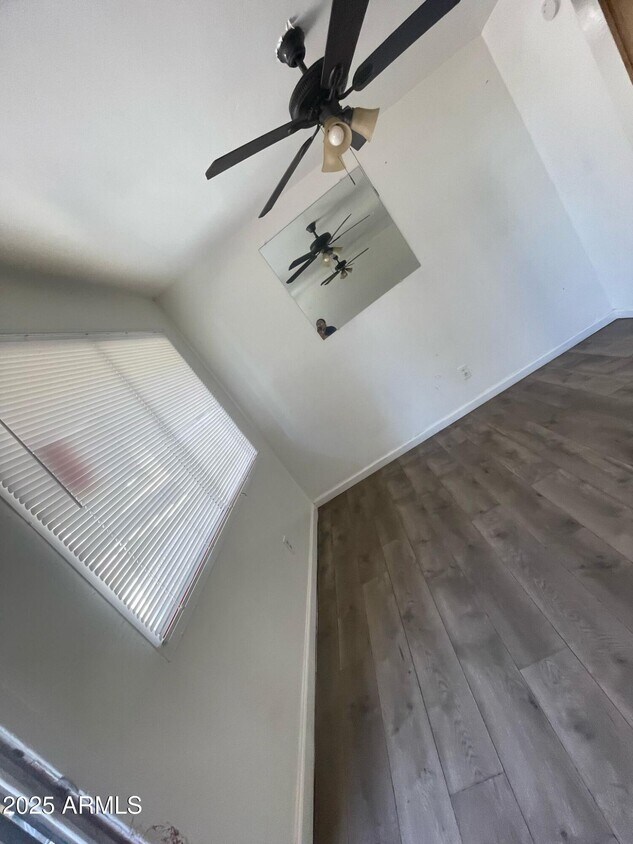
Convenience of urban living! This lovely 3-bedroom,2-bathroom unit is ideally located near restaurants,shopping options,& bus stops for an easy commute! Clean rental . This is an upstairs unit,all one level. Pet Friendly. Sec 8 and voucher programs welcomed. Additional properties available. Secure your lease today. Owner/Agent.
2698 N 43Rd Ave is a townhome located in Maricopa County and the 85009 ZIP Code. This area is served by the Cartwright Elementary District attendance zone.
* Price shown is base rent. Excludes user-selected optional fees and variable or usage-based fees and required charges due at or prior to move-in or at move-out. Price, availability, fees, and any applicable rent special are subject to change without notice.
* Square footage definitions vary. Displayed square footage is approximate.
Home Details
Home Type
Townhome
Year Built
Built in 1982
Accessible Home Design
No Interior Steps
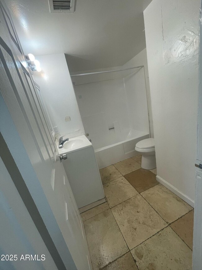
Bedrooms and Bathrooms
Primary Bathroom is a Full Bathroom
2 Bathrooms
3 Bedrooms
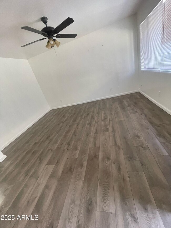
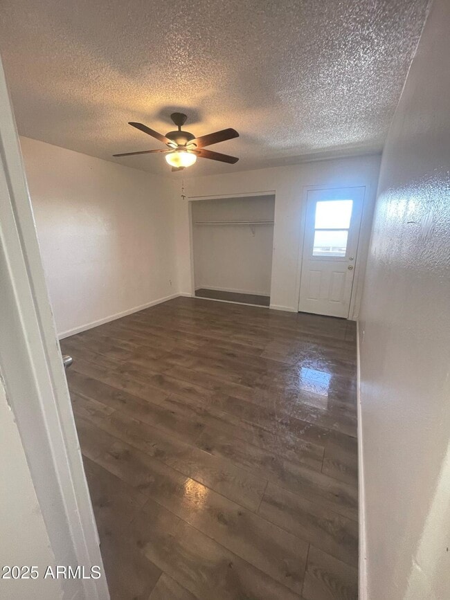
Flooring
Tile
Carpet
Home Design
Santa Fe Architecture
Built-Up Roof
Stucco
Wood Frame Construction
Interior Spaces
Double Pane Windows
1,106 Sq Ft Home
2-Story Property
Laundry
Laundry in Garage
Washer Hookup
Listing and Financial Details
Property Available on 12/1/25
$250 Move-In Fee
12-Month Minimum Lease Term
Legal Lot and Block 4 / 4002
Assessor Parcel Number 103-22-179
Rent includes water, sewer, garbage collection
Location
Property is near bus stop
Lot Details
266 Sq Ft Lot
Block Wall Fence
East or West Exposure
Outdoor Features
Covered Patio or Porch
Balcony
Parking
1 Carport Space
Assigned Parking
Schools
Alta E Butler Elementary School
Pueblo Del Sol Middle School
Phoenix Union Bioscience High School
Utilities
Cooling Available
High Speed Internet
Heating Available
Community Details
Overview
Property has a Home Owners Association
Woodmar IV Association, Phone Number (480) 759-4945
Woodmar 4 Subdivision
Security
Security Guard
Fees and Policies
The fees listed below are community-provided and may exclude utilities or add-ons. All payments are made directly to the property and are non-refundable unless otherwise specified. Use the Cost Calculator to determine costs based on your needs.
-
One-Time Basics
-
Due at Application
-
Application Fee Per ApplicantCharged per applicant.$0
-
-
Due at Move-In
-
Security Deposit - RefundableCharged per unit.$1,850
-
-
Due at Application
Property Fee Disclaimer: Based on community-supplied data and independent market research. Subject to change without notice. May exclude fees for mandatory or optional services and usage-based utilities.
Contact
- Listed by Lauren Vargas | Charles Edward Realty
- Phone Number
- Contact
-
Source
Arizona Regional MLS
Copyright 2026 Arizona Regional MLS. All rights reserved. Information is deemed reliable but not guaranteed.
Location
Get Directions
Although surrounded by inhospitable desert, Phoenix is one of the largest cities in the United States, and the nation’s single largest state capital city. The area contains numerous galleries and museums, putting the people in contact with everything from the European masters to Native American craftsmanship to modern originals from Phoenix’s diverse artistic community. The Downtown cultural scene has developed into a top-notch feast of visual and performing arts, with symphony performances, live theater, and the popular First Friday exhibitions. Phoenix is also an excellent city for sports fans, being one of the few cities in America with local franchises in the NFL, MLB, NBA, and NHL. Several thousand students attend the two Arizona State University campuses in the city, as well as the over-50,000 who attend the main campus in neighboring Tempe.
Learn more about living in Phoenix
Education
| Colleges & Universities | Distance | ||
|---|---|---|---|
| Colleges & Universities | Distance | ||
| Drive: | 10 min | 4.1 mi | |
| Drive: | 11 min | 4.5 mi | |
| Drive: | 12 min | 6.0 mi | |
| Drive: | 11 min | 7.0 mi |
2698 N 43rd Ave is within 10 minutes or 4.1 miles from Grand Canyon University. It is also near Phoenix College and Arizona State Univ., Downtown.
Schools


Public Elementary & Middle School
Grades PK-8
955 Students
Nearby
Public Elementary & Middle School
Grades PK-8
681 Students
Nearby
Public Elementary School
Grades K-5
384 Students
Attendance Zone
Public High School
Grades 9-12
2,528 Students
Attendance Zone
Private Elementary & Middle School
Grades PK-8
495 Students
Nearby
Private High School
Grades 9-12
345 Students
Nearby
School data provided by
 The GreatSchools Rating helps parents compare schools within a state based on a variety of school quality indicators and provides a helpful picture of how effectively each school serves all of its students. Ratings are on a scale of 1 (below average) to 10 (above average) and can include test scores, college readiness, academic progress, advanced courses, equity, discipline and attendance data. We also advise parents to visit schools, consider other information on school performance and programs, and consider family needs as part of the school selection process.
View GreatSchools Rating Methodology
Data provided by GreatSchools.org © 2026. All rights reserved.
View GreatSchools Rating Methodology
Data provided by GreatSchools.org © 2026. All rights reserved.
Transportation options available in Phoenix include Thomas/Central Ave, located 4.9 miles from 2698 N 43rd Ave. 2698 N 43rd Ave is near Phoenix Sky Harbor International, located 12.0 miles or 19 minutes away, and Phoenix-Mesa Gateway, located 38.8 miles or 52 minutes away.
| Transit / Subway | Distance | ||
|---|---|---|---|
| Transit / Subway | Distance | ||
|
|
Drive: | 11 min | 4.9 mi |
|
|
Drive: | 12 min | 5.4 mi |
|
|
Drive: | 12 min | 5.7 mi |
|
|
Drive: | 13 min | 6.4 mi |
|
|
Drive: | 12 min | 6.5 mi |
| Commuter Rail | Distance | ||
|---|---|---|---|
| Commuter Rail | Distance | ||
|
|
Drive: | 51 min | 39.9 mi |
| Airports | Distance | ||
|---|---|---|---|
| Airports | Distance | ||
|
Phoenix Sky Harbor International
|
Drive: | 19 min | 12.0 mi |
|
Phoenix-Mesa Gateway
|
Drive: | 52 min | 38.8 mi |
Time and distance from 2698 N 43rd Ave.
| Shopping Centers | Distance | ||
|---|---|---|---|
| Shopping Centers | Distance | ||
| Walk: | 6 min | 0.4 mi | |
| Walk: | 7 min | 0.4 mi | |
| Walk: | 7 min | 0.4 mi |
2698 N 43rd Ave has 3 shopping centers within 0.4 mile, which is about a 7-minute walk. The miles and minutes will be for the farthest away property.
| Parks and Recreation | Distance | ||
|---|---|---|---|
| Parks and Recreation | Distance | ||
|
Maryvale Park
|
Drive: | 6 min | 2.5 mi |
|
El Oso Park
|
Drive: | 10 min | 4.7 mi |
|
Colter Park
|
Drive: | 10 min | 5.7 mi |
|
Japanese Friendship Garden
|
Drive: | 10 min | 5.9 mi |
|
Alkire Park
|
Drive: | 12 min | 6.6 mi |
2698 N 43rd Ave has 5 parks within 6.6 miles, including Maryvale Park, El Oso Park, and Japanese Friendship Garden.
| Hospitals | Distance | ||
|---|---|---|---|
| Hospitals | Distance | ||
| Drive: | 10 min | 4.5 mi | |
| Drive: | 11 min | 6.2 mi | |
| Drive: | 11 min | 7.0 mi |
2698 N 43rd Ave has 3 hospitals within 7.0 miles, the nearest is St. Joseph's Hospital and Medical Center which is 4.5 miles away and a 10 minute drive.
| Military Bases | Distance | ||
|---|---|---|---|
| Military Bases | Distance | ||
| Drive: | 20 min | 11.8 mi | |
| Drive: | 26 min | 15.0 mi | |
| Drive: | 94 min | 70.3 mi |
2698 N 43rd Ave has 3 military bases within 70.3 miles, the nearest is Phoenix Sky Harbor Airport Air Guard Station which is 11.8 miles away and a 20 minute drive.
You May Also Like
Similar Rentals Nearby
-
-
-
-
-
-
-
-
-
3 Beds$2,986Total Monthly PriceTotal Monthly Price NewPrices include base rent and required monthly fees of $111. Variable costs based on usage may apply.Base Rent:3 Beds$2,875Specials
Pets Allowed Fitness Center Pool Dishwasher In Unit Washer & Dryer Walk-In Closets Balcony
-


What Are Walk Score®, Transit Score®, and Bike Score® Ratings?
Walk Score® measures the walkability of any address. Transit Score® measures access to public transit. Bike Score® measures the bikeability of any address.
What is a Sound Score Rating?
A Sound Score Rating aggregates noise caused by vehicle traffic, airplane traffic and local sources
2698 N 43rd Ave
Phoenix, AZ 85009