

$2,195 / Month
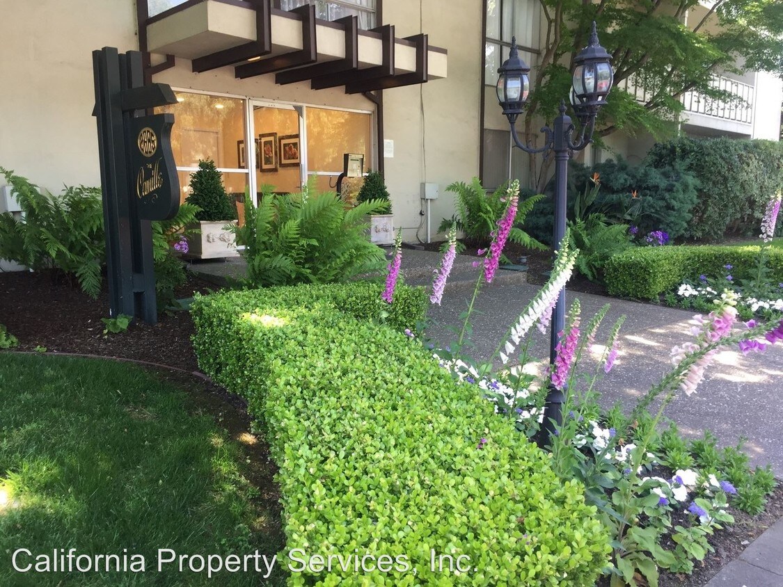
2685 California St Unit 105
Mountain View, CA 94040
2 Weeks Ago
Favorites
2685 California St Unit 105

Favorites
Check Back Soon for Upcoming Availability
| Beds | Baths | Average SF |
|---|---|---|
| 1 Bedroom 1 Bedroom 1 Br | 1 Bath 1 Bath 1 Ba | 589 SF |
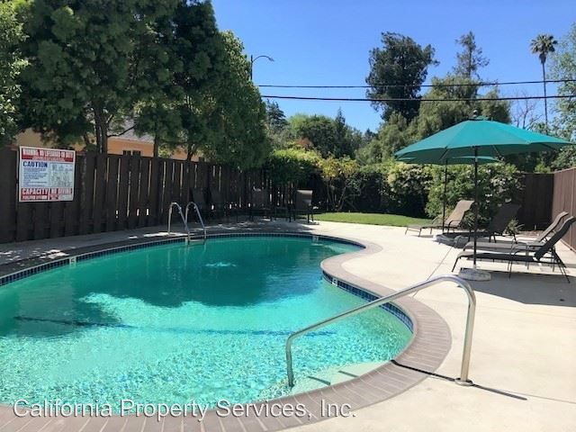
About This Property
(650) 941-3299 - Mountain View - The Camille North Apartments - Bamboo floors, vinyl floors in kitchen and bathroom, Corian countertops in kitchen and bathroom, single sink in kitchen and bathroom, shower over bathtub with sliding glass doors, central heat, single paned windows, balcony or patio. No Pets Allowed (RLNE2016956) Pet policies - No Dogs Allowed, No Cats Allowed.
2685 California St is a condo located in Santa Clara County and the 94040 ZIP Code. This area is served by the Los Altos Elementary attendance zone.
Location
Get Directions
Located in the heart of Silicon Valley, Mountain View is a wonderful place to put down roots. This lavish city houses many high-tech companies, like Google. This bustling city has nearly 80,000 residents and continues to increase in popularity. Named for its scenic views of the Santa Cruz Mountains, Mountain View will leave you speechless with its incredible views of mountains, waterscapes, cityscapes, and open land.
Mountain View Whisman School District houses public schools in the area such as Mountain View High. Highly rated public schools, as well as private schools, are an asset to the community’s strength and educational growth. Historical homes have become landmarks to the city, such as the Rengstorff House, and there’s an abundance of public parks and open green space nearby. Shoreline Lake and Park are complete with a boathouse where you can bike, run, or simply relax lakeside.
Learn more about living in Mountain View
Education
| Colleges & Universities | Distance | ||
|---|---|---|---|
| Colleges & Universities | Distance | ||
| Drive: | 5 min | 1.5 mi | |
| Drive: | 9 min | 4.0 mi | |
| Drive: | 11 min | 4.1 mi | |
| Drive: | 15 min | 6.3 mi |
2685 California St Unit 105 is within 5 minutes or 1.5 miles from Foothill College, Middlefield. It is also near Stanford University and Foothill Coll., Los Altos.
Schools

Public Elementary School
Grades K-5
367 Students
Nearby
Public Elementary School
Grades K-6
385 Students
Attendance Zone
Public Middle School
Grades 7-8
497 Students
Attendance Zone
Public High School
Grades 9-12
2,141 Students
Attendance Zone
Private Elementary School
Grades PK-5
Nearby
Private Elementary & Middle School
Grades K-8
307 Students
Nearby
Private Middle & High School
Grades 6-12
140 Students
Nearby
School data provided by
 The GreatSchools Rating helps parents compare schools within a state based on a variety of school quality indicators and provides a helpful picture of how effectively each school serves all of its students. Ratings are on a scale of 1 (below average) to 10 (above average) and can include test scores, college readiness, academic progress, advanced courses, equity, discipline and attendance data. We also advise parents to visit schools, consider other information on school performance and programs, and consider family needs as part of the school selection process.
View GreatSchools Rating Methodology
Data provided by GreatSchools.org © 2025. All rights reserved.
View GreatSchools Rating Methodology
Data provided by GreatSchools.org © 2025. All rights reserved.
Transportation options available in Mountain View include Mountain View Station, located 2.4 miles from 2685 California St Unit 105. 2685 California St Unit 105 is near Norman Y Mineta San Jose International, located 11.9 miles or 19 minutes away, and San Francisco International, located 24.2 miles or 33 minutes away.
| Transit / Subway | Distance | ||
|---|---|---|---|
| Transit / Subway | Distance | ||
| Drive: | 5 min | 2.4 mi | |
|
|
Drive: | 5 min | 2.5 mi |
|
|
Drive: | 8 min | 3.7 mi |
| Drive: | 8 min | 4.4 mi | |
|
|
Drive: | 9 min | 4.4 mi |
| Commuter Rail | Distance | ||
|---|---|---|---|
| Commuter Rail | Distance | ||
| Walk: | 13 min | 0.7 mi | |
| Drive: | 7 min | 2.7 mi | |
| Drive: | 8 min | 2.9 mi | |
| Drive: | 7 min | 2.9 mi | |
| Drive: | 8 min | 3.4 mi |
| Airports | Distance | ||
|---|---|---|---|
| Airports | Distance | ||
|
Norman Y Mineta San Jose International
|
Drive: | 19 min | 11.9 mi |
|
San Francisco International
|
Drive: | 33 min | 24.2 mi |
Time and distance from 2685 California St Unit 105.
| Shopping Centers | Distance | ||
|---|---|---|---|
| Shopping Centers | Distance | ||
| Walk: | 6 min | 0.3 mi | |
| Walk: | 7 min | 0.4 mi | |
| Walk: | 9 min | 0.5 mi |
2685 California St Unit 105 has 3 shopping centers within 0.5 mile, which is about a 9-minute walk. The miles and minutes will be for the farthest away property.
| Parks and Recreation | Distance | ||
|---|---|---|---|
| Parks and Recreation | Distance | ||
|
Terman Park
|
Drive: | 5 min | 1.7 mi |
|
J. Pearce Mitchell Park
|
Drive: | 7 min | 2.3 mi |
|
Bol Park
|
Drive: | 6 min | 2.5 mi |
|
Esther Clark Nature Preserve
|
Drive: | 7 min | 2.7 mi |
|
Redwood Grove
|
Drive: | 7 min | 2.9 mi |
2685 California St Unit 105 has 5 parks within 2.9 miles, including Terman Park, J. Pearce Mitchell Park, and Bol Park.
| Hospitals | Distance | ||
|---|---|---|---|
| Hospitals | Distance | ||
| Drive: | 9 min | 3.8 mi | |
| Drive: | 12 min | 4.8 mi | |
| Drive: | 13 min | 5.3 mi |
2685 California St Unit 105 has 3 hospitals within 5.3 miles, the nearest is El Camino Hospital which is 3.8 miles away and a 9 minute drive.
| Military Bases | Distance | ||
|---|---|---|---|
| Military Bases | Distance | ||
| Drive: | 11 min | 4.7 mi |
2685 California St Unit 105 is 4.7 miles and a 11 minute drive from Ames Research Center.
You May Also Like
Similar Rentals Nearby
-
-

-
-
-
-
-
1 / 7

-
-
1 / 7

-


What Are Walk Score®, Transit Score®, and Bike Score® Ratings?
Walk Score® measures the walkability of any address. Transit Score® measures access to public transit. Bike Score® measures the bikeability of any address.
What is a Sound Score Rating?
A Sound Score Rating aggregates noise caused by vehicle traffic, airplane traffic and local sources
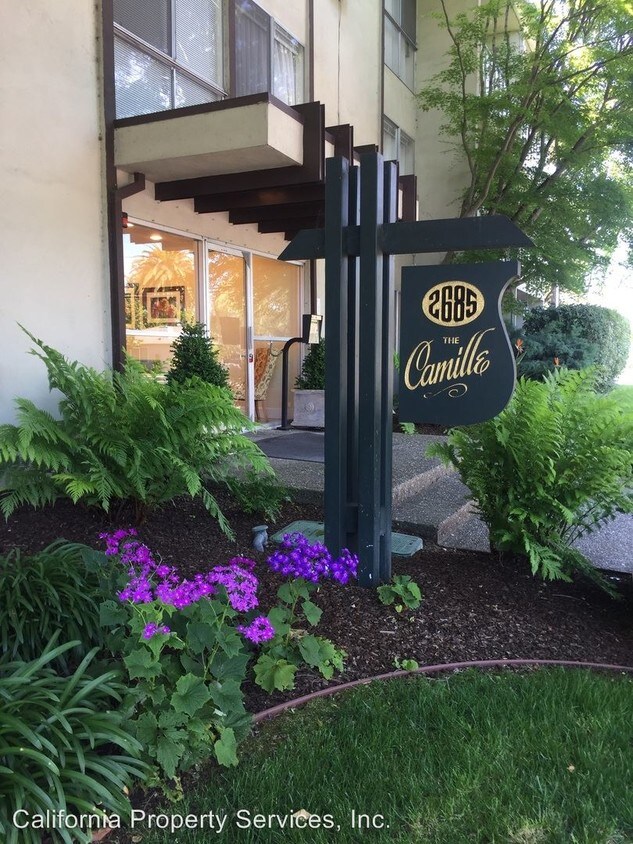
2685 California St
Mountain View, CA 94040