
eaves West Valley
700 S Saratoga Ave,
San Jose, CA 95129
$2,005 - $3,595
Studio - 2 Beds

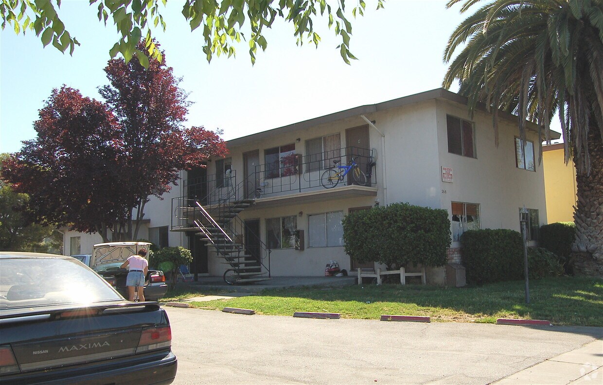

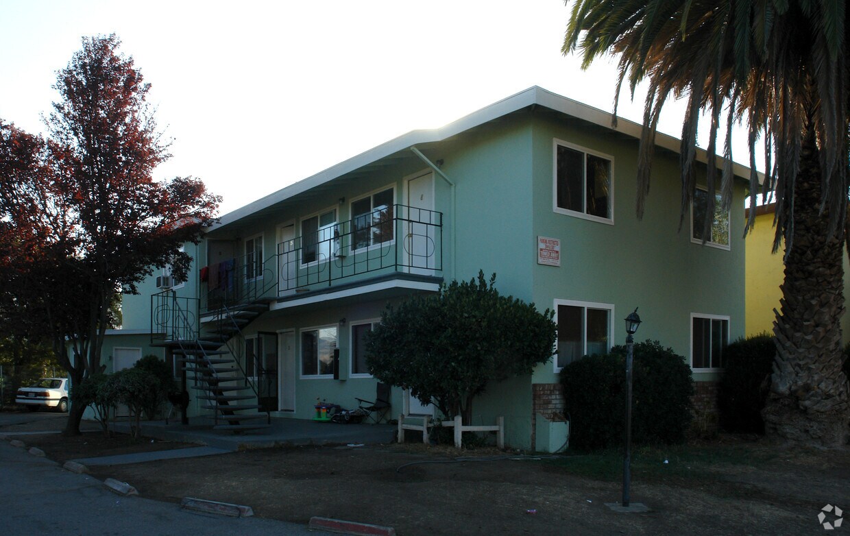
Discover your new apartment at 268 Pamela in San Jose, CA. This community can be found in San Jose on Pamela Ave in the 95116 area. Make a visit to see the current floorplan options. This community offers a variety of featured amenities. These include: convenient on-site parking options, curbside trash pick-up, and high-speed internet access. It's all waiting for you at 268 Pamela. Stop by the leasing office to talk about leasing your new apartment.
268 Pamela is an apartment community located in Santa Clara County and the 95116 ZIP Code. This area is served by the Alum Rock Union Elementary attendance zone.
Air Conditioning
High Speed Internet Access
Yard
Smoke Free
Consistently named among the best places to live in the nation, San Jose is a thriving city at the very heart of America’s tech industry. The highly-walkable downtown is a popular hangout for the entire community, featuring lush parks, exquisite restaurants, performance venues, and a vibrant nightlife scene. Over 30,000 students attend San Jose State University, and the position of the campus right downtown contributes to the college having a major impact on the local culture; the collegiate influence is amplified by the numerous smaller colleges throughout the city as well. The city layout is full of bike lanes, sidewalks, and trails, making the community very walkable and bike-friendly.
San Jose is an excellent city for sports fans, between the San Jose Sharks NHL team, the San Jose Giants baseball team (affiliate to the more famous San Francisco Giants), and the 49ers playing at Levis Stadium in neighboring Santa Clara.
Learn more about living in San Jose| Colleges & Universities | Distance | ||
|---|---|---|---|
| Colleges & Universities | Distance | ||
| Drive: | 8 min | 3.6 mi | |
| Drive: | 13 min | 7.4 mi | |
| Drive: | 12 min | 7.5 mi | |
| Drive: | 14 min | 8.1 mi |


Transportation options available in San Jose include Mckee Station, located 1.1 miles from 268 Pamela. 268 Pamela is near Norman Y Mineta San Jose International, located 6.7 miles or 12 minutes away, and Metro Oakland International, located 37.2 miles or 47 minutes away.
| Transit / Subway | Distance | ||
|---|---|---|---|
| Transit / Subway | Distance | ||
| Drive: | 2 min | 1.1 mi | |
|
|
Drive: | 3 min | 1.2 mi |
|
|
Drive: | 3 min | 1.6 mi |
| Drive: | 4 min | 2.0 mi | |
|
|
Drive: | 4 min | 2.1 mi |
| Commuter Rail | Distance | ||
|---|---|---|---|
| Commuter Rail | Distance | ||
| Drive: | 10 min | 4.9 mi | |
| Drive: | 10 min | 4.9 mi | |
| Drive: | 10 min | 6.0 mi | |
| Drive: | 10 min | 6.0 mi | |
| Drive: | 10 min | 6.0 mi |
| Airports | Distance | ||
|---|---|---|---|
| Airports | Distance | ||
|
Norman Y Mineta San Jose International
|
Drive: | 12 min | 6.7 mi |
|
Metro Oakland International
|
Drive: | 47 min | 37.2 mi |
Time and distance from 268 Pamela.
| Shopping Centers | Distance | ||
|---|---|---|---|
| Shopping Centers | Distance | ||
| Walk: | 12 min | 0.6 mi | |
| Walk: | 13 min | 0.7 mi | |
| Drive: | 3 min | 1.2 mi |
| Parks and Recreation | Distance | ||
|---|---|---|---|
| Parks and Recreation | Distance | ||
|
Emma Prusch Farm Park
|
Drive: | 6 min | 2.7 mi |
|
Penitencia Creek County Park
|
Drive: | 6 min | 3.4 mi |
|
Japanese Friendship Garden Regional Park
|
Drive: | 7 min | 3.5 mi |
|
Lake Cunningham Park
|
Drive: | 8 min | 4.0 mi |
|
Happy Hollow Park & Zoo
|
Drive: | 9 min | 4.6 mi |
| Hospitals | Distance | ||
|---|---|---|---|
| Hospitals | Distance | ||
| Walk: | 8 min | 0.4 mi | |
| Drive: | 11 min | 7.7 mi | |
| Drive: | 17 min | 12.3 mi |
| Military Bases | Distance | ||
|---|---|---|---|
| Military Bases | Distance | ||
| Drive: | 22 min | 14.6 mi |
What Are Walk Score®, Transit Score®, and Bike Score® Ratings?
Walk Score® measures the walkability of any address. Transit Score® measures access to public transit. Bike Score® measures the bikeability of any address.
What is a Sound Score Rating?
A Sound Score Rating aggregates noise caused by vehicle traffic, airplane traffic and local sources
268 Pamela Ave
San Jose, CA 95116


