$2,695
Total Monthly Price
12 Month Lease
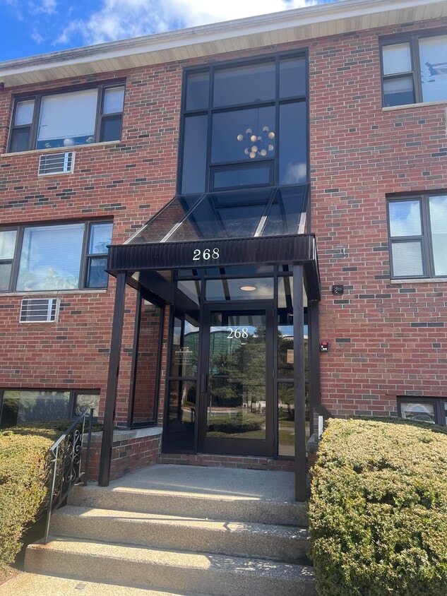
268 Grove St Unit U10
Auburndale, MA 02466
Favorites
-
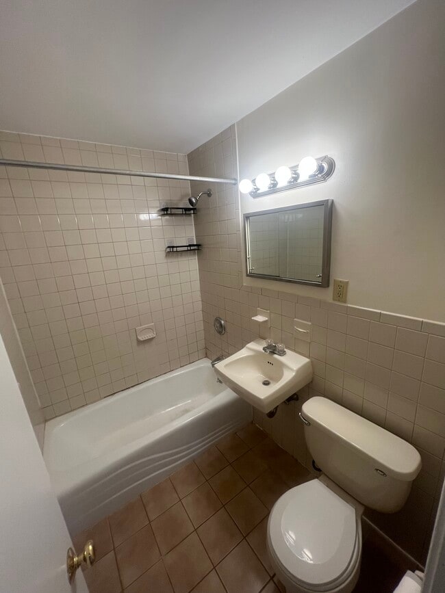
Bedrooms
2
-
Bathrooms
1
-
Square Feet
999 sq ft
-
Available
Available Aug 1
Highlights
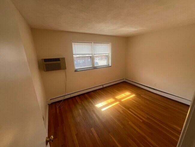
- Hardwood Floors
- Yard
268 Grove St Unit U10

Favorites
About This Home
12 Month Lease
,
Available Aug 1
Live in the heart of beautiful Newton, MA, in a neighborhood that perfectly blends suburban charm with city convenience. This location offers easy access to vibrant local shops, popular restaurants, and cozy cafes. Commuters will appreciate nearby public transportation options for a quick trip into Boston, making everyday errands and work commutes effortless. Enjoy the green spaces and parks scattered throughout the area, perfect for weekend strolls, outdoor activities, or simply soaking up the serene surroundings. With Newton’s top-rated schools, community amenities, and welcoming streets, this neighborhood provides a lifestyle that’s both convenient and enjoyable.
268 Grove St is an apartment community located in Middlesex County and the 02466 ZIP Code. This area is served by the Newton School District attendance zone.
* Price shown is total price based on community-supplied monthly required fees. Excludes user-selected optional fees and variable or usage-based fees and required charges due at or prior to move-in or at move-out. Price, availability, fees, and any applicable rent special are subject to change without notice.
* Square footage definitions vary. Displayed square footage is approximate.
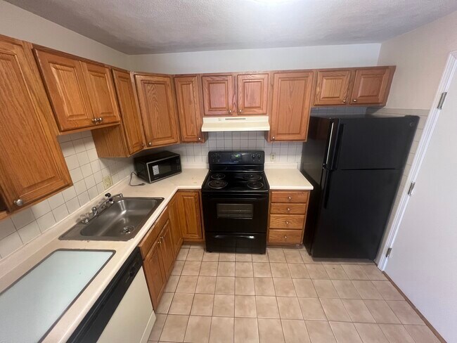
Apartment Features
Dishwasher
Hardwood Floors
Microwave
Disposal
- Dishwasher
- Disposal
- Microwave
- Instant Hot Water
- Hardwood Floors
- Laundry Facilities
- Bicycle Storage
- Yard
Fees and Policies
The fees listed below are community-provided and may exclude utilities or add-ons. All payments are made directly to the property and are non-refundable unless otherwise specified.
- Parking
-
Surface Lot--
Details
Property Information
-
2 units
Contact
- Contact
Location
Get Directions
Auburndale, affectionately referred to as “The Dale” by locals, is one of 13 villages in the City of Newton. Situated near the intersection of Interstates 90 and 95, the Dale is surrounded by the City of Waltham and the Charles River as well as three other Newton villages including West Newton, Waban, and Newton Lower Falls. Getting around from the Dale is simple with access to the MBTA commuter rail.
The western end of Auburndale is well known for containing two historic parks, Norumbega Park and the Auburndale Cove Park and Playground, which offer plenty of options for outdoor recreation. The Auburndale Historic District is comprised of about 275 properties, many of which are on the National Register of Historic Places. Treasured resources like the Auburndale Community Library and Lasell College provide learning opportunities for the community.
Learn more about living in Auburndale
Education
| Colleges & Universities | Distance | ||
|---|---|---|---|
| Colleges & Universities | Distance | ||
| Drive: | 8 min | 3.2 mi | |
| Drive: | 10 min | 4.4 mi | |
| Drive: | 11 min | 4.6 mi | |
| Drive: | 11 min | 5.5 mi |
268 Grove St Unit U10 is within 8 minutes or 3.2 miles from Brandeis University. It is also near Babson College and Bentley University.
Schools


Public Elementary School
Grades K-5
263 Students
Nearby
Public Elementary School
Grades K-5
198 Students
Attendance Zone
Public Middle School
Grades 6-8
698 Students
Attendance Zone
Public High School
Grades 9-12
1,865 Students
Attendance Zone
Private Elementary, Middle & High School
Grades K-12
146 Students
Nearby
Private Elementary School
Grades PK-5
217 Students
Nearby
School data provided by
 The GreatSchools Rating helps parents compare schools within a state based on a variety of school quality indicators and provides a helpful picture of how effectively each school serves all of its students. Ratings are on a scale of 1 (below average) to 10 (above average) and can include test scores, college readiness, academic progress, advanced courses, equity, discipline and attendance data. We also advise parents to visit schools, consider other information on school performance and programs, and consider family needs as part of the school selection process.
View GreatSchools Rating Methodology
Data provided by GreatSchools.org © 2026. All rights reserved.
View GreatSchools Rating Methodology
Data provided by GreatSchools.org © 2026. All rights reserved.
Transportation options available in Auburndale include Riverside Station, located 0.1 mile from 268 Grove St Unit U10. 268 Grove St Unit U10 is near General Edward Lawrence Logan International, located 14.5 miles or 24 minutes away, and Worcester Regional, located 38.6 miles or 55 minutes away.
| Transit / Subway | Distance | ||
|---|---|---|---|
| Transit / Subway | Distance | ||
|
|
Walk: | 2 min | 0.1 mi |
|
|
Drive: | 4 min | 1.6 mi |
|
|
Drive: | 5 min | 2.3 mi |
|
|
Drive: | 8 min | 3.4 mi |
|
|
Drive: | 8 min | 3.6 mi |
| Commuter Rail | Distance | ||
|---|---|---|---|
| Commuter Rail | Distance | ||
|
|
Drive: | 4 min | 1.8 mi |
|
|
Drive: | 5 min | 2.5 mi |
|
|
Drive: | 5 min | 2.8 mi |
|
|
Drive: | 12 min | 6.7 mi |
|
|
Drive: | 13 min | 7.5 mi |
| Airports | Distance | ||
|---|---|---|---|
| Airports | Distance | ||
|
General Edward Lawrence Logan International
|
Drive: | 24 min | 14.5 mi |
|
Worcester Regional
|
Drive: | 55 min | 38.6 mi |
Getting Around
 What do Walkability, Transit, Drivability, and Bikeability mean?
Walkability measures the walking distance to day-to-day needs.
Transit measures access to public transportation.
Drivability measures congestion, parking availability, and access to major roads.
Bikeability measures the suitability for cycling.
How It Works
What do Walkability, Transit, Drivability, and Bikeability mean?
Walkability measures the walking distance to day-to-day needs.
Transit measures access to public transportation.
Drivability measures congestion, parking availability, and access to major roads.
Bikeability measures the suitability for cycling.
How It Works
Fairly Walkable
Walkability
40
/ 100
Good Public Transit
Transit
70
/ 100
Exceptionally Drivable
Drivability
100
/ 100
Fairly Bikeable
Bikeability
50
/ 100
Scores provided by
-
Soundscore™
-
/ 100
Traffic
-Airport
-Businesses
-Scores provided by
HowLoud What is a Sound Score Rating? A Sound Score Rating aggregates noise caused by vehicle traffic, airplane traffic and local sources. How It WorksTime and distance from 268 Grove St Unit U10.
| Shopping Centers | Distance | ||
|---|---|---|---|
| Shopping Centers | Distance | ||
| Walk: | 18 min | 1.0 mi | |
| Drive: | 5 min | 2.6 mi | |
| Drive: | 6 min | 2.7 mi |
268 Grove St Unit U10 has 3 shopping centers within 2.7 miles, which is about a 6-minute drive. The miles and minutes will be for the farthest away property.
| Parks and Recreation | Distance | ||
|---|---|---|---|
| Parks and Recreation | Distance | ||
|
Land's Sake Farm
|
Drive: | 8 min | 3.7 mi |
|
Hemlock Gorge Reservation
|
Drive: | 8 min | 3.8 mi |
|
Whitin Observatory
|
Drive: | 10 min | 4.3 mi |
|
Cutler Park Reservation
|
Drive: | 8 min | 4.5 mi |
|
Hammond Pond Reservation
|
Drive: | 10 min | 5.1 mi |
268 Grove St Unit U10 has 5 parks within 5.1 miles, including Hemlock Gorge Reservation, Land's Sake Farm, and Whitin Observatory.
| Hospitals | Distance | ||
|---|---|---|---|
| Hospitals | Distance | ||
| Drive: | 3 min | 1.4 mi | |
| Drive: | 7 min | 3.0 mi | |
| Drive: | 9 min | 5.3 mi |
268 Grove St Unit U10 has 3 hospitals within 5.3 miles, the nearest is Newton - Wellesley Hospital which is 1.4 miles away and a 3 minute drive.
| Military Bases | Distance | ||
|---|---|---|---|
| Military Bases | Distance | ||
| Drive: | 14 min | 7.9 mi | |
| Drive: | 19 min | 10.3 mi | |
| Drive: | 49 min | 27.5 mi |
268 Grove St Unit U10 has 3 military bases within 27.5 miles, the nearest is US Military Reservation which is 7.9 miles away and a 14 minute drive.
Amenities
- Dishwasher
- Disposal
- Microwave
- Instant Hot Water
- Hardwood Floors
- Laundry Facilities
- Yard
- Bicycle Storage
268 Grove St Unit U10 Photos
What Are Walk Score®, Transit Score®, and Bike Score® Ratings?
Walk Score® measures the walkability of any address. Transit Score® measures access to public transit. Bike Score® measures the bikeability of any address.
What is a Sound Score Rating?
A Sound Score Rating aggregates noise caused by vehicle traffic, airplane traffic and local sources.

268 Grove St
Auburndale, MA 02466