-
Monthly Rent
$895 - $1,050
-
Bedrooms
1 bd
-
Bathrooms
1 ba
-
Square Feet
575 - 700 sq ft

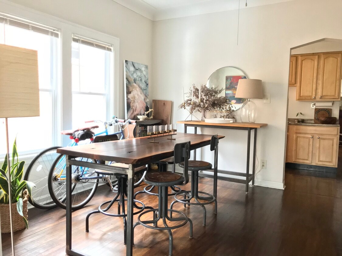
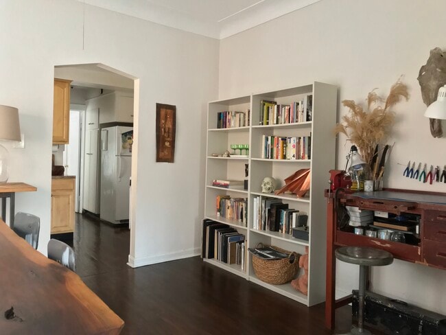
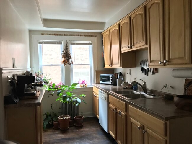
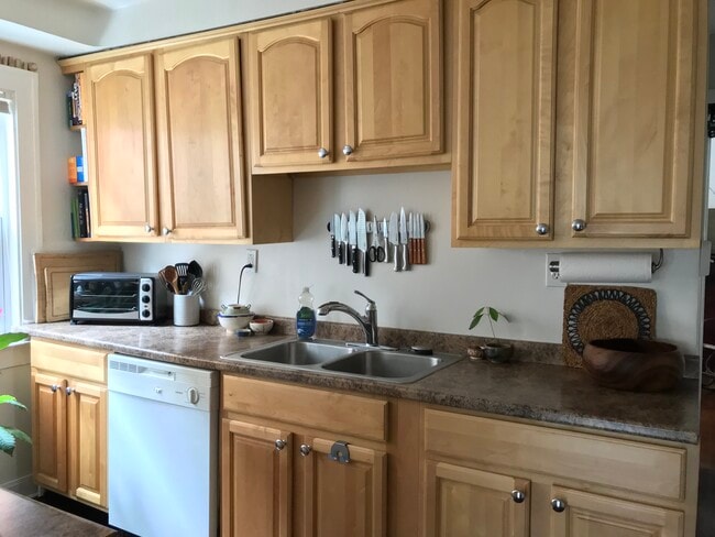
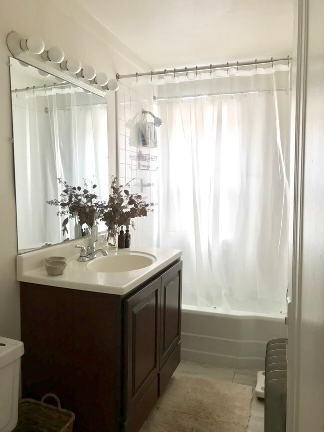
Renovated suite in walking distance to CWRU, UH, Cedar Fairmount and all the shops museums and restaurants in University Circle and Little Italy. Short drive to CCF, JCU and downtown. On RTA and CWRU shuttle lines. Updated kitchen with dishwasher Updated bath Hardwood floors Ceiling fans Blinds On site laundry Parking available (assigned space) in private lot adjacent to building Rent INCLUDES reserved parking, heat, water, and cooking gas. Tenant pays personal electric and Internet Ideal for hospital staff, young professionals and grad students
Highlights
- By-The-Bed Leasing
- Walk To Campus
- High Ceilings
- Walk-In Closets
- Controlled Access
- Hardwood Floors
Pricing & Floor Plans
-
Unit 3Aprice $895 /Personsquare feet 575availibility Now
-
Unit 3price $995 /Personsquare feet 700availibility Now
-
Unit 3Aprice $895 /Personsquare feet 575availibility Now
-
Unit 3price $995 /Personsquare feet 700availibility Now
Fees and Policies
The fees listed below are community-provided and may exclude utilities or add-ons. All payments are made directly to the property and are non-refundable unless otherwise specified.
Pet policies are negotiable.
-
Surface LotAssigned parking in private lot adjacent to building. Limited garage parking
Property Fee Disclaimer: Based on community-supplied data and independent market research. Subject to change without notice. May exclude fees for mandatory or optional services and usage-based utilities.
Details
Utilities Included
-
Gas
-
Water
-
Heat
-
Trash Removal
Property Information
-
Built in 1927
-
10 units/3 stories
About 2660 Mayfield Rd Cleveland, OH 44106
Renovated suite in walking distance to CWRU, UH, Cedar Fairmount and all the shops museums and restaurants in University Circle and Little Italy. Short drive to CCF, JCU and downtown. On RTA and CWRU shuttle lines. Updated kitchen with dishwasher Updated bath Hardwood floors Ceiling fans Blinds On site laundry Parking available (assigned space) in private lot adjacent to building Rent INCLUDES reserved parking, heat, water, and cooking gas. Tenant pays personal electric and Internet Ideal for hospital staff, young professionals and grad students
2660 Mayfield Rd is an apartment community located in Cuyahoga County and the 44106 ZIP Code. This area is served by the Cleveland Heights-University Heights City attendance zone.
Contact
Community Amenities
Laundry Facilities
Controlled Access
Shuttle To Campus
Walk To Campus
- Laundry Facilities
- Controlled Access
- Vintage Building
- Private Bathroom
- Shuttle To Campus
- Walk To Campus
Apartment Features
Dishwasher
High Speed Internet Access
Hardwood Floors
Walk-In Closets
Refrigerator
Tub/Shower
Freezer
Crown Molding
Indoor Features
- High Speed Internet Access
- Heating
- Ceiling Fans
- Smoke Free
- Cable Ready
- Tub/Shower
- Framed Mirrors
Kitchen Features & Appliances
- Dishwasher
- Kitchen
- Refrigerator
- Freezer
- Gas Range
Model Details
- Hardwood Floors
- Tile Floors
- Dining Room
- High Ceilings
- Crown Molding
- Walk-In Closets
- Linen Closet
- Double Pane Windows
- Window Coverings
Rich in personality, the Cedar-Fairmount district of Cleveland provides shopping in an environment that incorporates historic style with modern trends. Lying only six miles east of downtown, the area is convenient for commuters and those that love urban life. Investment in independent businesses, the arts and transportation has brought young professionals to the neighborhood. Residents as well as consumers gather on sidewalks to enjoy the Tudor style structures or share lunch.
Learn more about living in Cedar-FairmountCompare neighborhood and city base rent averages by bedroom.
| Cedar-Fairmount | Cleveland, OH | |
|---|---|---|
| Studio | $1,083 | $1,204 |
| 1 Bedroom | $1,151 | $1,385 |
| 2 Bedrooms | $1,330 | $1,747 |
| 3 Bedrooms | $1,574 | $2,161 |
- Laundry Facilities
- Controlled Access
- Vintage Building
- Private Bathroom
- Shuttle To Campus
- Walk To Campus
- High Speed Internet Access
- Heating
- Ceiling Fans
- Smoke Free
- Cable Ready
- Tub/Shower
- Framed Mirrors
- Dishwasher
- Kitchen
- Refrigerator
- Freezer
- Gas Range
- Hardwood Floors
- Tile Floors
- Dining Room
- High Ceilings
- Crown Molding
- Walk-In Closets
- Linen Closet
- Double Pane Windows
- Window Coverings
| Monday | 12am - 12am |
|---|---|
| Tuesday | 12am - 12am |
| Wednesday | 12am - 12am |
| Thursday | 12am - 12am |
| Friday | 12am - 12am |
| Saturday | 12am - 12am |
| Sunday | 12am - 12am |
| Colleges & Universities | Distance | ||
|---|---|---|---|
| Colleges & Universities | Distance | ||
| Drive: | 4 min | 1.5 mi | |
| Drive: | 4 min | 1.6 mi | |
| Drive: | 5 min | 2.0 mi | |
| Drive: | 12 min | 4.2 mi |


View GreatSchools Rating Methodology
Data provided by GreatSchools.org © 2026. All rights reserved.
Transportation options available in Cleveland include Cedar - University, located 1.5 miles from 2660 Mayfield Rd. 2660 Mayfield Rd is near Cleveland-Hopkins International, located 18.4 miles or 33 minutes away.
| Transit / Subway | Distance | ||
|---|---|---|---|
| Transit / Subway | Distance | ||
|
|
Drive: | 3 min | 1.5 mi |
| Drive: | 4 min | 1.6 mi | |
|
|
Drive: | 8 min | 3.1 mi |
| Commuter Rail | Distance | ||
|---|---|---|---|
| Commuter Rail | Distance | ||
|
|
Drive: | 19 min | 9.2 mi |
| Drive: | 25 min | 12.4 mi | |
| Drive: | 27 min | 14.1 mi | |
| Drive: | 35 min | 20.0 mi | |
|
Boston Mill
|
Drive: | 42 min | 25.0 mi |
| Airports | Distance | ||
|---|---|---|---|
| Airports | Distance | ||
|
Cleveland-Hopkins International
|
Drive: | 33 min | 18.4 mi |
Scores provided by
Traffic
BusyAirport
CalmBusinesses
CalmScores provided by
HowLoud What is a Sound Score Rating? A Sound Score Rating aggregates noise caused by vehicle traffic, airplane traffic and local sources. How It WorksTime and distance from 2660 Mayfield Rd.
| Shopping Centers | Distance | ||
|---|---|---|---|
| Shopping Centers | Distance | ||
| Walk: | 6 min | 0.4 mi | |
| Drive: | 5 min | 1.6 mi | |
| Drive: | 5 min | 1.6 mi |
| Parks and Recreation | Distance | ||
|---|---|---|---|
| Parks and Recreation | Distance | ||
|
Cleveland Botanical Garden
|
Drive: | 5 min | 1.9 mi |
|
Children's Museum of Cleveland
|
Drive: | 4 min | 2.0 mi |
|
Nature Center at Shaker Lakes
|
Drive: | 7 min | 2.4 mi |
|
Cleveland Museum of Natural History
|
Drive: | 6 min | 2.7 mi |
| Hospitals | Distance | ||
|---|---|---|---|
| Hospitals | Distance | ||
| Drive: | 4 min | 1.6 mi | |
| Drive: | 4 min | 1.6 mi | |
| Drive: | 6 min | 2.7 mi |
| Military Bases | Distance | ||
|---|---|---|---|
| Military Bases | Distance | ||
| Drive: | 108 min | 87.2 mi | |
| Drive: | 110 min | 88.4 mi |
2660 Mayfield Rd Photos
While 2660 Mayfield Rd does not provide in‑unit laundry, on‑site laundry facilities are available for shared resident use.
Select utilities are included in rent at 2660 Mayfield Rd, including gas, water, heat, and trash removal. Residents are responsible for any other utilities not listed.
Parking is available at 2660 Mayfield Rd. Contact this property for details.
2660 Mayfield Rd has one-bedroom available with rent ranges from $895/mo. to $1,050/mo.
2660 Mayfield Rd does not allow pets, though service animals are always welcome in accordance with applicable laws.
A good rule of thumb is to spend no more than 30% of your gross income on rent. Based on the lowest available rent of $895 for a one-bedroom, you would need to earn about $35,800 per year to qualify. Want to double-check your budget? Calculate how much rent you can afford with our Rent Affordability Calculator.
2660 Mayfield Rd is not currently offering any rent specials. Check back soon, as promotions change frequently.
While 2660 Mayfield Rd does not offer Matterport 3D tours, renters can request a tour directly through our online platform.

2660 Mayfield Rd
Cleveland, OH 44106
Property Manager Responded