
$5,890 / Month
2655 Bush St
San Francisco, CA 94115
Today
Favorites
415-933-4364
-
Bedrooms
2
-
Bathrooms
2
-
Square Feet
971 sq ft
-
Available
Available Sep 8
Highlights
- Views of San Francisco
- Fitness Center
- Rooftop Deck
- Clubhouse
- Contemporary Architecture
- Wood Flooring
2655 Bush St

Favorites
About This Home
$5,890 deposit,
Available Sep 8
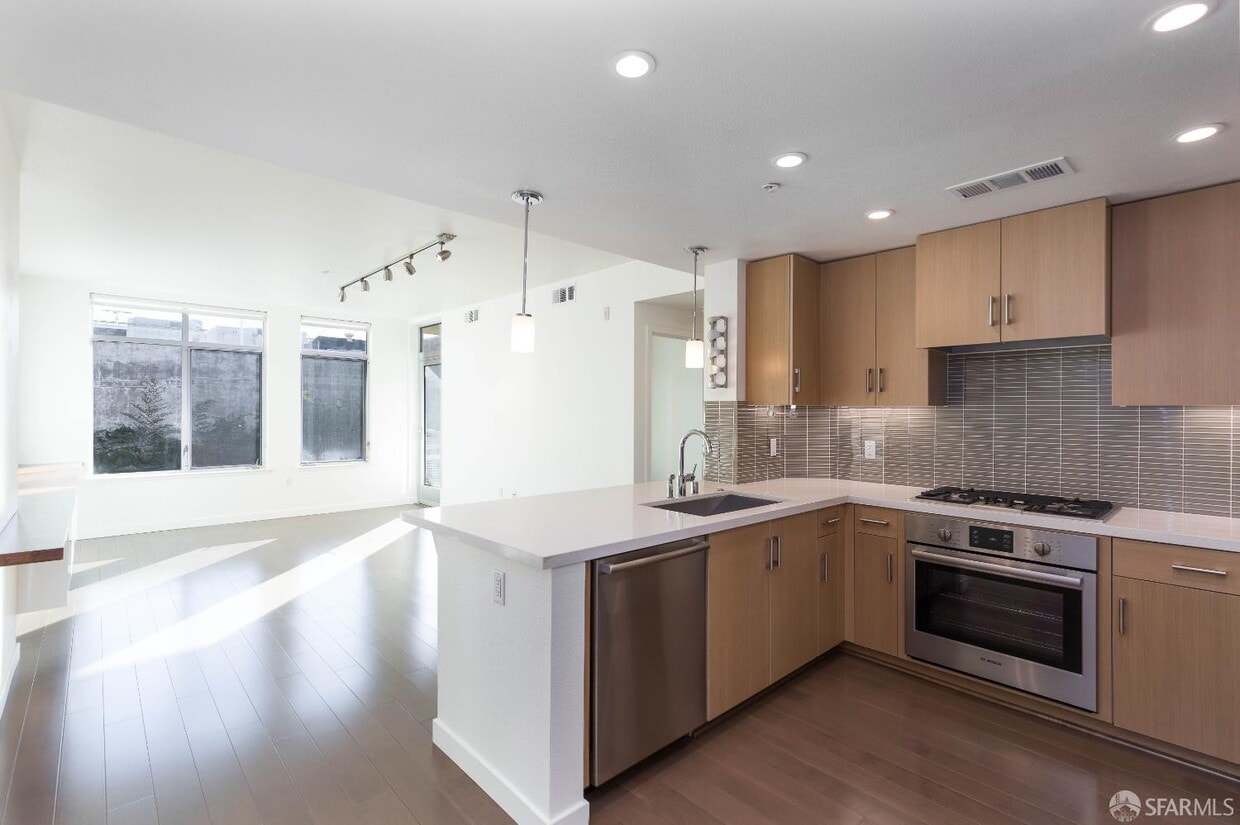
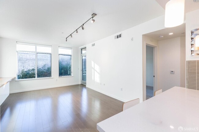
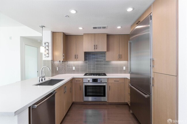
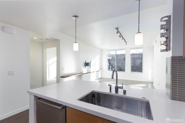
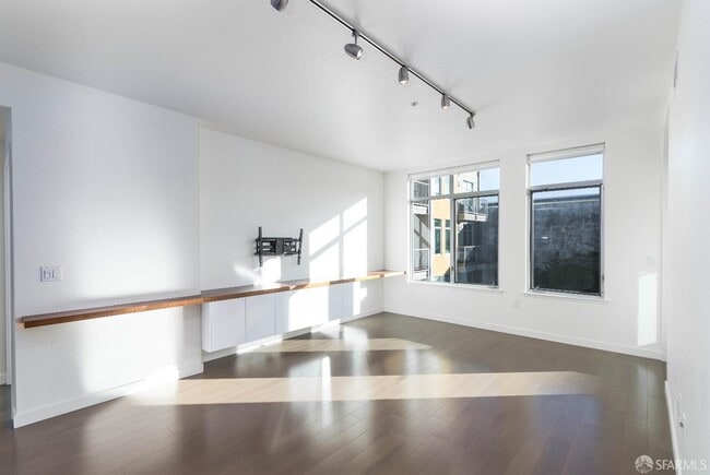
This bright and spacious home features an open floor plan and a private patio overlooking the inner courtyard. Kitchen equipped with Thermador & Bosch stainless steel appliances, Caesarstone countertops, and tasteful modern finishes. Generous-sized bedrooms feature luxurious bathrooms, and large closets. The unit is equipped with central heat, AC, Bosch Stackable Washer/Dryer in the unit, and much more.2655 Bush is a luxury six-story mid-rise condo building in Lower Pac Heights. Completed in 2016, The District features a rooftop sky terrace, fitness center, inner courtyard, pet grooming station, attended lobby, lounge, and gated garage. The location is prime. The building is within walking distance from UCSF Medical Center, Kaiser Permanente, and Cal. Pacific Medical Center. The central location offers easy access to Filmore and Divisadero restaurants, shops, and transportation. With a perfect 98 walk score, enjoy walks to the Presidio, Alta Plaza Park, the city libraries, and shops.
2655 Bush St is a condo located in San Francisco County and the 94115 ZIP Code.
* Price shown is base rent and may not include non-optional fees and utilities.
Price, availability, fees, and any applicable rent special are subject to change without notice.
* Square footage definitions vary. Displayed square footage is approximate.
Home Details
Home Type
Condominium
Year Built
Built in 2017
Bedrooms and Bathrooms
Walk-In Closet
Bathtub with Shower
2 Full Bathrooms
Dual Vanity Sinks in Primary Bathroom
Home Design
Contemporary Architecture
Interior Spaces
Wood Flooring
Combination Dining and Living Room
971 Sq Ft Home
1-Story Property
Kitchen
Quartz Countertops
Breakfast Area or Nook
Built-In Gas Oven
Built-In Gas Range
Dishwasher
Range Hood
Disposal
Laundry
Laundry closet
Stacked Washer and Dryer
Listing and Financial Details
Security Deposit $5,890
Assessor Parcel Number 1052080
Tenant pays for electricity, gas
12-Month Minimum Lease Term
Lot Details
0.77 Acre Lot
Outdoor Features
Balcony
Parking
Enclosed Parking
1 Car Attached Garage
Side by Side Parking
Assigned Parking
Parking Available
Parking Fee
$300 Parking Fee
Views
San Francisco
Garden
Community Details
Amenities
Rooftop Deck
Clubhouse
Community Barbecue Grill
Overview
Greenbelt
Mid-Rise Condominium
Recreation
Fitness Center
Fees and Policies
The fees below are based on community-supplied data and may exclude additional fees and utilities.
- Parking
-
Surface Lot--
-
Garage--
Contact
- Listed by Milan Jezdimirovic | Compass
- Phone Number
- Website View Property Website
- Contact
-
Source
San Francisco Association of Realtors
Copyright © 2025 San Francisco Association of REALTORS. All rights reserved. All information provided by the listing agent/broker is deemed reliable but is not guaranteed and should be independently verified.
Location
Get Directions
Amenities
- Air Conditioning
- Smoke Free
- Tub/Shower
- Sprinkler System
- Oven
- Range
- Breakfast Nook
- Hardwood Floors
- Carpet
- Patio
- Deck
Lower Pacific Heights is a vibrant San Francisco neighborhood situated between Pacific Heights, Japantown, the Fillmore District, and Laurel Heights. Formerly known as Upper Fillmore, Lower Pacific Heights offers residents a wide variety of apartments, condos, and houses available for rent, many of which boast scenic views due to the neighborhood’s hilly environment.
Lower Pacific Heights is regarded for its walkable layout, with many rentals situated within easy walking distance of the diverse restaurants, shops, coffeehouses, and bars that line Fillmore Street, the community’s main commercial thoroughfare. The neighborhood’s central locale is a major part of its allure, providing quick access to Union Square, the University of San Francisco, the Financial District, several prominent medical centers, tech employers, landmarks, and more.
Learn more about living in Lower Pacific Heights
Education
| Colleges & Universities | Distance | ||
|---|---|---|---|
| Colleges & Universities | Distance | ||
| Walk: | 4 min | 0.2 mi | |
| Drive: | 3 min | 1.2 mi | |
| Drive: | 5 min | 1.9 mi | |
| Drive: | 9 min | 3.2 mi |
2655 Bush St is within 4 minutes or 0.2 mile from UC San Francisco, Mount Zion. It is also near University of San Francisco and Academy of Art University.
Transportation options available in San Francisco include Van Ness And California, located 1.2 miles from 2655 Bush St. 2655 Bush St is near San Francisco International, located 15.1 miles or 25 minutes away, and Metro Oakland International, located 21.0 miles or 34 minutes away.
| Transit / Subway | Distance | ||
|---|---|---|---|
| Transit / Subway | Distance | ||
|
|
Drive: | 3 min | 1.2 mi |
|
|
Drive: | 4 min | 1.4 mi |
|
|
Drive: | 5 min | 1.4 mi |
|
|
Drive: | 4 min | 1.4 mi |
|
|
Drive: | 4 min | 1.8 mi |
| Commuter Rail | Distance | ||
|---|---|---|---|
| Commuter Rail | Distance | ||
| Drive: | 8 min | 4.2 mi | |
| Drive: | 8 min | 4.2 mi | |
| Drive: | 10 min | 5.0 mi | |
| Drive: | 10 min | 5.0 mi | |
| Drive: | 14 min | 7.2 mi |
| Airports | Distance | ||
|---|---|---|---|
| Airports | Distance | ||
|
San Francisco International
|
Drive: | 25 min | 15.1 mi |
|
Metro Oakland International
|
Drive: | 34 min | 21.0 mi |
Time and distance from 2655 Bush St.
| Shopping Centers | Distance | ||
|---|---|---|---|
| Shopping Centers | Distance | ||
| Walk: | 13 min | 0.7 mi | |
| Walk: | 14 min | 0.7 mi | |
| Drive: | 4 min | 1.3 mi |
2655 Bush St has 3 shopping centers within 1.3 miles, which is about a 4-minute walk. The miles and minutes will be for the farthest away property.
| Parks and Recreation | Distance | ||
|---|---|---|---|
| Parks and Recreation | Distance | ||
|
Buena Vista Park
|
Drive: | 5 min | 1.5 mi |
|
Exploratorium
|
Drive: | 4 min | 1.7 mi |
|
Conservatory of Flowers
|
Drive: | 4 min | 1.8 mi |
|
Randall Museum
|
Drive: | 7 min | 2.2 mi |
|
California Academy of Sciences
|
Drive: | 7 min | 2.6 mi |
2655 Bush St has 5 parks within 2.6 miles, including Exploratorium, Buena Vista Park, and Conservatory of Flowers.
| Hospitals | Distance | ||
|---|---|---|---|
| Hospitals | Distance | ||
| Walk: | 7 min | 0.4 mi | |
| Drive: | 5 min | 1.3 mi | |
| Drive: | 4 min | 1.4 mi |
2655 Bush St has 3 hospitals within 1.4 miles, the nearest is Kaiser Foundation Hospital - San Francisco which is 0.4 mile away and a 7 minute walk.
| Military Bases | Distance | ||
|---|---|---|---|
| Military Bases | Distance | ||
| Drive: | 11 min | 3.8 mi | |
| Drive: | 12 min | 4.2 mi | |
| Drive: | 17 min | 7.2 mi |
2655 Bush St has 3 military bases within 7.2 miles, the nearest is East Fort Miley which is 3.8 miles away and a 11 minute drive.
You May Also Like
Similar Rentals Nearby
-
-

-

-
 $4,6002 Beds, 2 Baths, 1,167 sq ftApartment for Rent
 -
 $7,0005 Beds, 2.5 Baths, 1,400 sq ftRoom for Rent
 -

-

-

-
 $2,1603 Beds, 1 Bath, 1,000 sq ftApartment for Rent
 -

What Are Walk Score®, Transit Score®, and Bike Score® Ratings?
Walk Score® measures the walkability of any address. Transit Score® measures access to public transit. Bike Score® measures the bikeability of any address.
What is a Sound Score Rating?
A Sound Score Rating aggregates noise caused by vehicle traffic, airplane traffic and local sources

2655 Bush St
San Francisco, CA 94115