

$1,899
/ Month
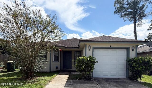
2641 Sam Houston Pl
Jacksonville, FL 32246
Today
Favorites
904-708-7745
-
Bedrooms
3
-
Bathrooms
2
-
Square Feet
1,401 sq ft
-
Available
Available Now
Highlights
- Breakfast Area or Nook
- Central Heating and Cooling System
- 1 Car Garage
- Dogs and Cats Allowed
- 1-Story Property
2641 Sam Houston Pl

Favorites
About This Home
$1,899 deposit,
Available Now
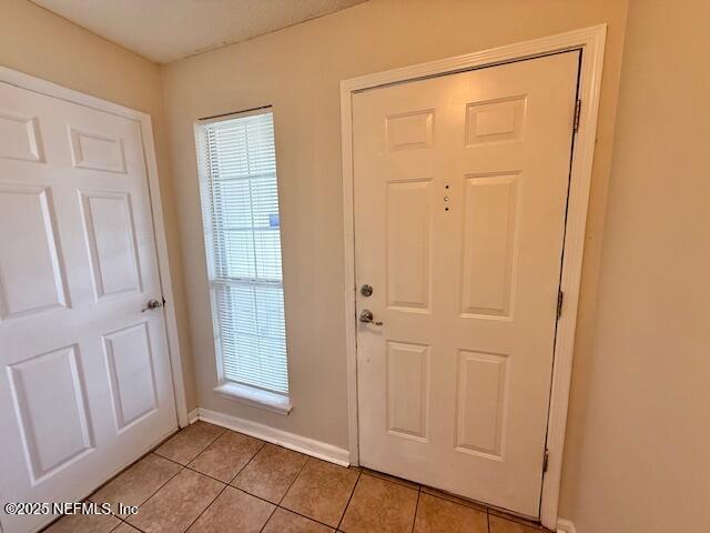
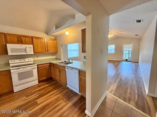
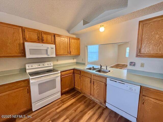
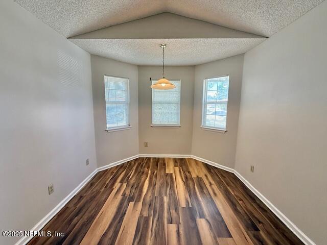
**AVAILABLE NOW** Charming 3-Bedroom,2-Bathroom Home in Southside! This lovely home offers over 1,400 sq. ft. of living space and a welcoming layout. Enjoy a spacious living room with laminate wood flooring and a well-sized kitchen complete with a cozy breakfast nook and newer appliances. The primary suite features a generous walk-in closet,while the additional bedrooms provide plenty of space and comfort.Step outside to a screened-in patio overlooking the fully fenced backyardperfect for relaxing or entertaining. Additional highlights include washer/dryer connections for your convenience. Tenant is responsible for lawncare. Pets welcome with $25 pet rent monthly.
2641 Sam Houston Pl is a house located in Duval County and the 32246 ZIP Code. This area is served by the Duval County Public Schools attendance zone.
* Price shown is base rent. Excludes user-selected optional fees and variable or usage-based fees and required charges due at or prior to move-in or at move-out. Price, availability, fees, and any applicable rent special are subject to change without notice.
* Square footage definitions vary. Displayed square footage is approximate.
Home Details
Home Type
Single Family Detached Home
Year Built
Built in 1995
Bedrooms and Bathrooms
2 Full Bathrooms
3 Bedrooms
Interior Spaces
1,401 Sq Ft Home
1-Story Property
Kitchen
Breakfast Area or Nook
Convection Oven
Microwave
Dishwasher
Laundry
Dryer
Washer
Listing and Financial Details
Other Lease Term
Assessor Parcel Number 1652900056
Lot Details
4,792 Sq Ft Lot
Parking
1 Car Garage
Utilities
Central Heating and Cooling System
Community Details
Overview
No Home Owners Association
Hardwick Pl Subdivision
Pet Policy
Dogs and Cats Allowed
Breed Restrictions
Contact
- Listed by SHERI WYATT | Nest Finders Property Management
- Phone Number
- Contact
-
Source
Northeast Florida Multiple Listing Service, Inc.
Copyright 2025 realMLS. All rights reserved. Information is deemed reliable but not guaranteed.
Location
Get Directions
Development on the Sandalwood neighborhood began in the spring of 1960. Designed to provide inhabitants with the ideal balance of work and play, Sandalwood sits approximately half way between Jacksonville city center and its nearest beach, which lies roughly six miles east of the neighborhood.
Developer Pearce-Uible's primary Sandalwood concept contained 500 houses. To give the neighborhood an exotic ambiance, Sandalwood's original streets were all named after Pacific Islands. Mindanao Drive, Hawaii Drive East, and Kusai Drive are three of those original roadways. Two more streets, Majuro Drive and Luana Drive, were added to the neighborhood in 1969.
Nearly half the houses in the modern Sandalwood neighborhood are quite new. The original 1960s properties reside in the northern half of the area, whereas newer houses extend to the southern part of the neighborhood. Several educational establishments call the area home, including Sandalwood High School, established in 1971.
Learn more about living in Sandalwood
Education
| Colleges & Universities | Distance | ||
|---|---|---|---|
| Colleges & Universities | Distance | ||
| Drive: | 9 min | 4.3 mi | |
| Drive: | 17 min | 9.1 mi | |
| Drive: | 20 min | 10.7 mi | |
| Drive: | 19 min | 10.9 mi |
2641 Sam Houston Pl is within 9 minutes or 4.3 miles from University of North Florida. It is also near Jacksonville University and Florida Coastal School of Law.
Schools


Public Elementary School
Grades PK-5
486 Students
Attendance Zone
Public Middle School
Grades 6-8
1,136 Students
Attendance Zone
Public High School
Grades 9-12
2,771 Students
Attendance Zone
Private Elementary, Middle & High School
Grades PK-12
221 Students
Nearby
Private Elementary, Middle & High School
Grades 5-12
56 Students
Nearby
School data provided by
 The GreatSchools Rating helps parents compare schools within a state based on a variety of school quality indicators and provides a helpful picture of how effectively each school serves all of its students. Ratings are on a scale of 1 (below average) to 10 (above average) and can include test scores, college readiness, academic progress, advanced courses, equity, discipline and attendance data. We also advise parents to visit schools, consider other information on school performance and programs, and consider family needs as part of the school selection process.
View GreatSchools Rating Methodology
Data provided by GreatSchools.org © 2025. All rights reserved.
View GreatSchools Rating Methodology
Data provided by GreatSchools.org © 2025. All rights reserved.
Transportation options available in Jacksonville include Kings Ave Station, located 10.1 miles from 2641 Sam Houston Pl. 2641 Sam Houston Pl is near Jacksonville International, located 20.2 miles or 31 minutes away.
| Transit / Subway | Distance | ||
|---|---|---|---|
| Transit / Subway | Distance | ||
| Drive: | 19 min | 10.1 mi | |
|
|
Drive: | 20 min | 10.2 mi |
|
|
Drive: | 19 min | 10.4 mi |
|
|
Drive: | 20 min | 10.6 mi |
|
|
Drive: | 20 min | 10.7 mi |
| Commuter Rail | Distance | ||
|---|---|---|---|
| Commuter Rail | Distance | ||
|
|
Drive: | 28 min | 16.4 mi |
| Airports | Distance | ||
|---|---|---|---|
| Airports | Distance | ||
|
Jacksonville International
|
Drive: | 31 min | 20.2 mi |
Time and distance from 2641 Sam Houston Pl.
| Shopping Centers | Distance | ||
|---|---|---|---|
| Shopping Centers | Distance | ||
| Drive: | 3 min | 1.2 mi | |
| Drive: | 5 min | 2.1 mi | |
| Drive: | 5 min | 2.2 mi |
2641 Sam Houston Pl has 3 shopping centers within 2.2 miles, which is about a 5-minute drive. The miles and minutes will be for the farthest away property.
| Parks and Recreation | Distance | ||
|---|---|---|---|
| Parks and Recreation | Distance | ||
|
Beach and Peach Park
|
Drive: | 7 min | 3.5 mi |
|
Touchton Road Park
|
Drive: | 9 min | 4.7 mi |
|
Jacksonville Arboretum and Gardens
|
Drive: | 10 min | 6.0 mi |
|
Tree Hill Nature Center
|
Drive: | 13 min | 6.6 mi |
|
Castaway Island Preserve
|
Drive: | 15 min | 7.8 mi |
2641 Sam Houston Pl has 5 parks within 7.8 miles, including Beach and Peach Park, Touchton Road Park, and Jacksonville Arboretum and Gardens.
| Hospitals | Distance | ||
|---|---|---|---|
| Hospitals | Distance | ||
| Drive: | 11 min | 5.7 mi | |
| Drive: | 12 min | 6.4 mi | |
| Drive: | 13 min | 8.0 mi |
2641 Sam Houston Pl has 3 hospitals within 8.0 miles, the nearest is River Point Behavioral Health which is 5.7 miles away and a 11 minute drive.
| Military Bases | Distance | ||
|---|---|---|---|
| Military Bases | Distance | ||
| Drive: | 22 min | 12.1 mi | |
| Drive: | 34 min | 24.8 mi |
2641 Sam Houston Pl is 12.1 miles from Mayport Naval Air Station, and is convenient to other military bases, including Jacksonville Naval Air Station.
You May Also Like
Similar Rentals Nearby
-
-

-
-
-
-
1 / 17

-
-
-
-


What Are Walk Score®, Transit Score®, and Bike Score® Ratings?
Walk Score® measures the walkability of any address. Transit Score® measures access to public transit. Bike Score® measures the bikeability of any address.
What is a Sound Score Rating?
A Sound Score Rating aggregates noise caused by vehicle traffic, airplane traffic and local sources
2641 Sam Houston Pl
Jacksonville, FL 32246